
![]()
Cat Bells (Catbells)
451m (1480ft)
The North Western Fells, The Lake District, Cumbria, England
Not familiar with this top?
   |
|---|
Vital Statistics:
| Length: | 3.75ml (6km) |
|---|---|
| Ascent: | 1,628ft (496m) |
| Time: | 3 hrs |
| Grade: |  (Moderate) (Moderate) |
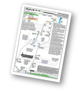
Route Summary:
Keswick - Derwent Water Launch - Nichol End Pier - Hawes End Pier - Newlands Valley - Woodford's Path - Cat Bells (Catbells) - Hawes End Pier - Derwent Water Launch - Keswick
|
|---|
Vital Statistics:
| Length: | 8.25ml (13km) |
|---|---|
| Ascent: | 2,512ft (766m) |
| Time: | 5½ hrs |
| Grade: |  (Moderate) (Moderate) |
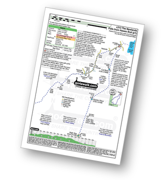
Route Summary:
Hawes End - Derwent Water - Newlands Valley - Skelgill Bank - Woodford's Path - Cat Bells (Catbells) - Maiden Moor - High Spy (North Top) - High Spy - Dalehead Tarn - Newlands Valley - Newlands Church - Little Town - Hawes End
|
|---|
Vital Statistics:
| Length: | 10mls (16km) |
|---|---|
| Ascent: | 3,349ft (1,082m) |
| Time: | 7.25hrs |
| Grade: |  (Hard) (Hard) |
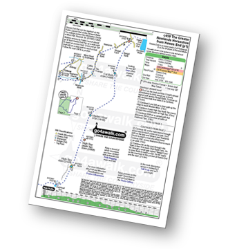
Route Summary:
Hawes End - Derwent Water - Skelgill Bank - Woodford's Path - Cat Bells (Catbells) - Maiden Moor - Narrow Moor - High Spy (North Top) - High Spy - Dale Head Tarn - Rigghead Quarries - The Allerdale Ramble - Castle Crag - River Derwent - Yewdale Knott - Manesty - Manesty Band - Hawes End - Derwent Water.
|
|---|
Vital Statistics:
| Length: | 10.25ml (16.5km) |
|---|---|
| Ascent: | 3,585ft (1,093m) |
| Time: | 7½ hrs |
| Grade: | (Hard) |
Route Summary:
Hawes End - Derwent Water - Skelgill Bank - Woodford's Path - Cat Bells (Catbells) - Maiden Moor - High Spy (North Top) - High Spy - Dalehead Tarn - Dale Head (Newlands) - Hindscarth - High Crags - Scope End - Low Snab Farm - Newlands Church - Little Town - Newlands Valley - Hawes End - Derwent Water.
|
|---|
Vital Statistics:
| Length: | 12mls (19km) |
|---|---|
| Ascent: | 4,152ft (1,266m) |
| Time: | 8½ hrs |
| Grade: |  (Hard) (Hard) |
Route Summary:
Hawes End - Derwent Water - Skelgill Bank - Woodford's Path - Cat Bells (Catbells) - Maiden Moor - High Spy (North Top) - High Spy - Dale Head Tarn - Dale Head (Newlands) - Hindscarth Edge - Hindscarth - Littledale Edge - Robinson - High Snab Bank - Newlands Church - Little Town - Hawes End - Derwent Water.
|
|---|
Vital Statistics:
| Length: | 14.5ml (23km) |
|---|---|
| Ascent: | 5,409ft (1,648m) |
| Time: | 11 hrs |
| Grade: |  (Very Hard) (Very Hard) |
Route Summary:
Hawes End - Derwent Water - Skelgill Bank - Woodford's Path - Cat Bells (Catbells) - Maiden Moor - High Spy (North Top) - High Spy - Dalehead Tarn - Dale Head (Newlands) - Hindscarth - Littledale Edge - Robinson - High Snockrigg - Moss Force - Newlands Hause - Knott Rigg - Ard Crags - Birkrigg - Keskerdale Beck - Newlands Church - Newlands Beck - Little Town - Skelgill Farm - Hawes End Derwent Water.
See Cat Bells (Catbells) and the surrounding tops on our free-to-access 'Google Style' Peak Bagging Maps:
The North Western Fells of The Lake District National Park
Less data - quicker to download
The Whole of The Lake District National Park
More data - might take a little longer to download
See Cat Bells (Catbells) and the surrounding tops on our downloadable Peak Bagging Maps in PDF format:

NB: Whether you print off a copy or download it to your phone, these PDF Peak Baggers' Maps might prove incredibly useful when your are up there on the tops and you cannot get a phone signal.
*This version is marked with the walk routes you need to follow to Walk all 214 Wainwrights in just 59 walks.
You can find Cat Bells (Catbells) & all the walks that climb it on these unique free-to-access Interactive Walk Planning Maps:
1:25,000 scale OS Explorer Map (orange/yellow covers):
1:50,000 scale OS Landranger Maps (pink/magenta covers):
 Fellow go4awalkers who have already walked, climbed, summited & bagged Cat Bells (Catbells)
Neil Walker walked up Cat Bells (Catbells) on June 1st, 1982 [from/via/route] Car Park. [with] Doddridge & Commercial St URC
Martin Woods climbed Cat Bells (Catbells) on July 30th, 2025 [from/via/route] Catbells loop over Dalehead with Crush [with] Crush [weather] Mixed with no wind.
Martin Hartshorne bagged Cat Bells (Catbells) on April 25th, 2025 [from/via/route] Chapel bridge [with] finley [weather] Started warm & sunny with a cool breeze then clouded over later
Nick Tippins hiked Cat Bells (Catbells) on January 1st, 2025 [from/via/route] Cat Bells Circular from Grange [with] Fran
Sarah Gunn summited Cat Bells (Catbells) on February 27th, 2024 [from/via/route] From Littletown [with] Martin Gunn, Dan Gunn and Shannon Worton
Claire Kirk conquered Cat Bells (Catbells) on February 16th, 2025 [from/via/route] Portinscale [with] Gareth [weather] Very cold but windy day. Clear.
Ian Ashton scaled Cat Bells (Catbells) on October 5th, 2024 [with] With JPH
David Higginbottom walked up Cat Bells (Catbells) on April 23rd, 2024 [from/via/route] C405 [with] Carolyn [weather] Good
Sarah Moore climbed Cat Bells (Catbells) on March 29th, 2024 [from/via/route] c405 Amazing day having driven up early from Derby - & then a glorious Good Friday with clear views all day. Cat Bells - Maiden Moor - High Spy - down the Riggsdale Quarries - along the river back... [with] On my own [weather] Easter warmth - little wind & clear views all the way was incredible. - Over excited parking = parking ticket... And then coming down, & thinking about 2 more days of hiking I managed to twist my knee in a way that caused so much pain it's untrue. Writing this at the end of the weekend, I'm just glad it's ok & led to other things.
Clare Tait bagged Cat Bells (Catbells) on March 24th, 2024 [from/via/route] A 3.45 get up to take advantage of the promised fair weather. Good thing we left the midlands early as we literally grabbed the last of the parking spots at the base of Catbells. Absolutely beautiful walk up & enjoyed the craggy areas. We had the summit to ourselves. Then went onward to Maiden Moor. Sadly, neither of us is fit enough for the half Newlands which we would have done a few years ago. We descended to walk back around the base & enjoyed stunning views. Fabulous view. Well worth the early start [with] Charlie [weather] Perfect walking weather with some blue sky & great visibility.
To add (or remove) your name and experiences on this page - Log On and edit your Personal Mountain Bagging Record
. . . [see more walk reports]
More Photographs & Pictures of views from, on or of Cat Bells (Catbells)
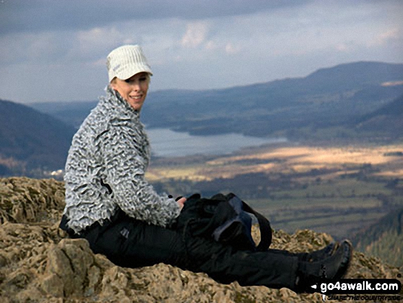
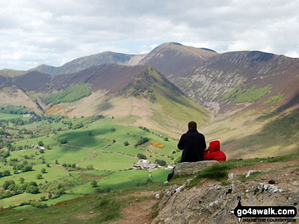
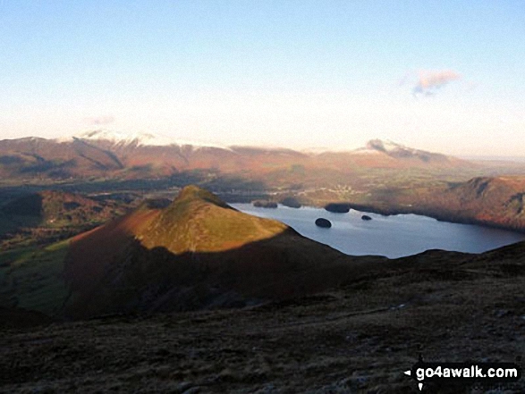
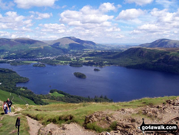
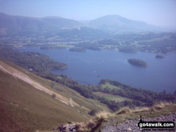
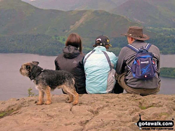
Derwent Water from Cat Bells (Catbells) with Latrigg (left) and Blencathra or Saddleback (right) beyond
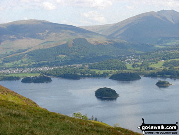
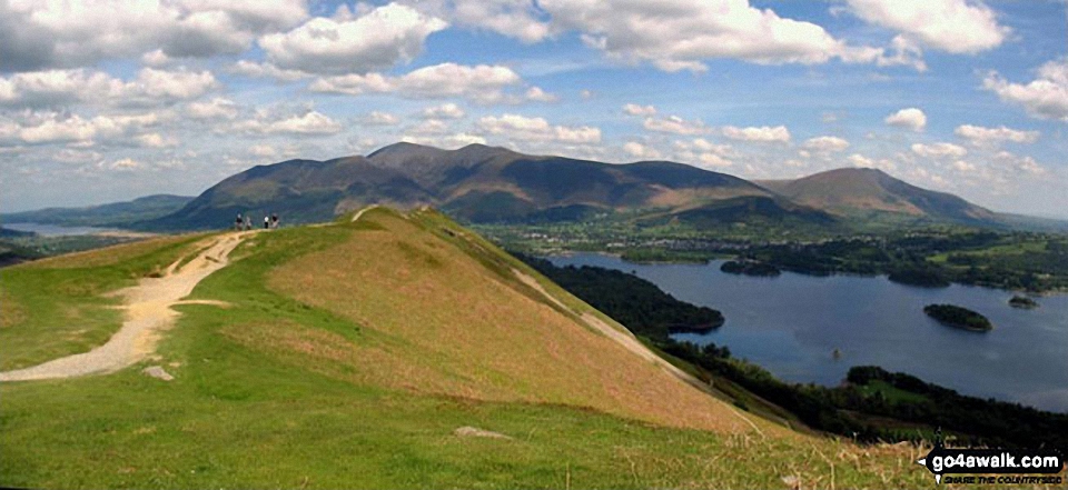
Cat Bells (Catbells) (foreground) with Skiddaw and Blencathra (distance left) and Derwent Water from Maiden Moor
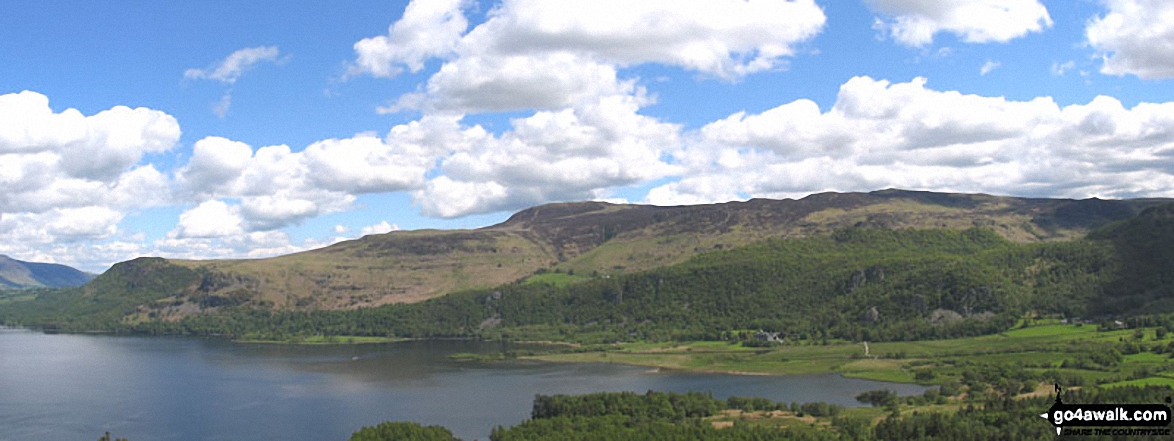
Bassenthwaite Lake (far left), Skiddaw (left), Blencathra (or Saddleback) (right), Keswick and Derwent Water from Cat Bells (Catbells)
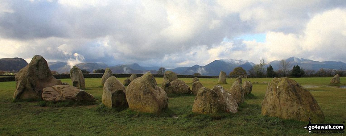
Castlerigg Stone Circle with the shoulder of Walla Crag (left), Maiden Moor, Cat Bells (Catbells), Sail, Causey Pike, Barrow and Grisedale Pike in the background
*Derwent Water, Cat Bells (Catbells) and The Newlands Fells from Castlerigg

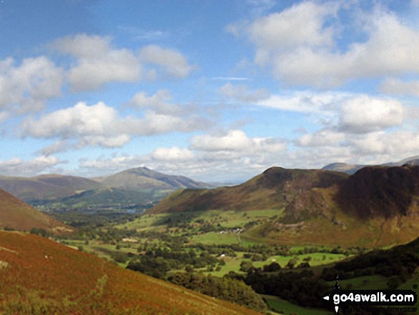
High Spy (North Top), High Spy, Maiden Moor, Hindscarth (left), Robinson, Crag Hill (Eel Crag), Causey Pike, Barrow (Newlands) (centre), Newlands, Bassenthwaite Lake, Swinside, Skiddaw, Derwent Water and Blencathra (right) beyond from Cat Bells (Catbells)
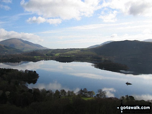
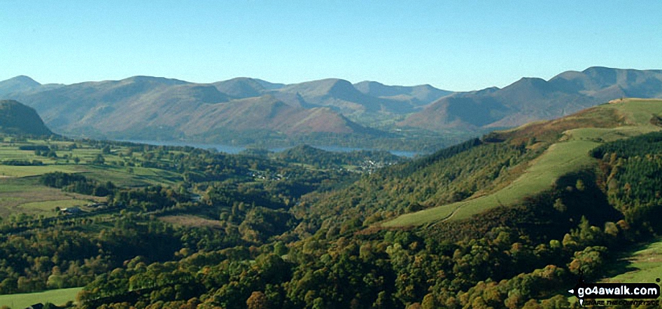
*Derwent Water with Walla Crag, Bleaberry Fell and High Seat beyond from Cat Bells (Catbells)
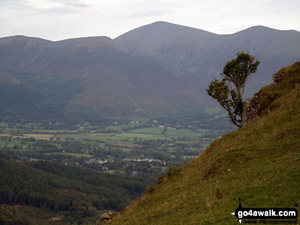
Ullock Pike, Carl Side, Skiddaw and Little Man (Skiddaw) from Cat Bells (Catbells)
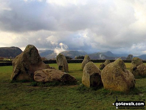
Castlerigg Stone Circle with the shoulder of Walla Crag (left), Maiden Moor and Cat Bells (Catbells) in the background
Overlooking Derwent Water to Cat Bells (Catbells) from near Walla Crag
Keswick and The Skiddaw Masiff (distance) and Cat Bells (Catbells) (right) from Blea Crags
. . . see all 61 walk photographs & pictures of views from, on or of Cat Bells (Catbells)
Send us your photographs and pictures on, of, or from Cat Bells (Catbells)
If you would like to add your walk photographs and pictures featuring views from, on or of Cat Bells (Catbells) to this page, please send them as email attachments (configured for any computer) along with your name to:
and we shall do our best to publish them.
(Guide Resolution = 300dpi. At least = 660pixels (wide) x 440 pixels (high).)

You can also submit photos via our Facebook Page.
NB. Please indicate where each photo was taken and whether you wish us to credit your photos with a Username or your First Name/Last Name.
Not familiar with this top?


