
![]()
Cadair Idris (Penygadair)
892m (2929ft)
The Cadair Idris Area, Snowdonia, Gwynedd, Wales
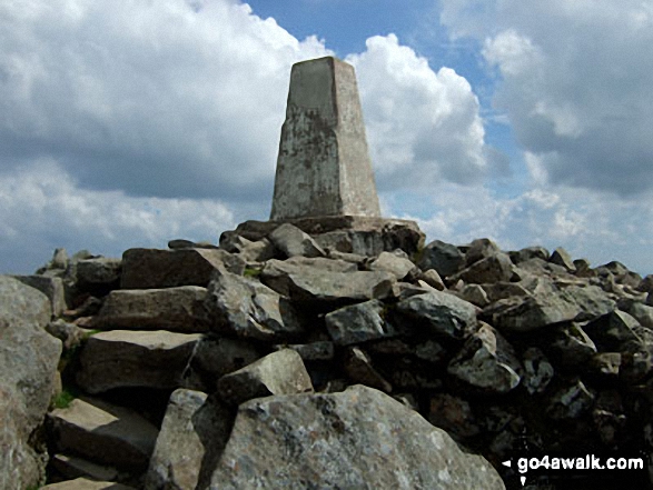
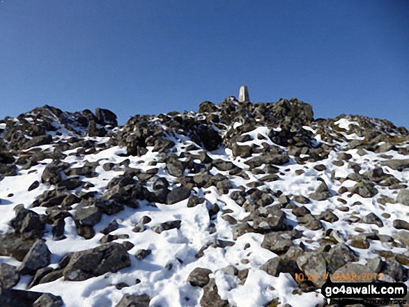
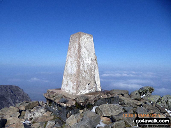
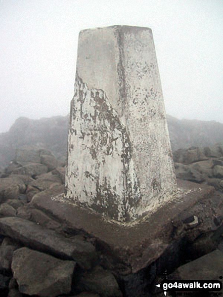
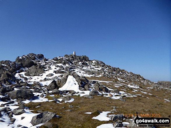
The summit of Cadair Idris (Penygadair) is marked by an Ordnance Survey Trig Point.
Not familiar with this top?
   |
|---|
Vital Statistics:
| Length: | 6ml (9.5km) |
|---|---|
| Ascent: | 3,218ft (981m) |
| Time: | 5½ hrs |
| Grade: |  (Moderate) (Moderate) |
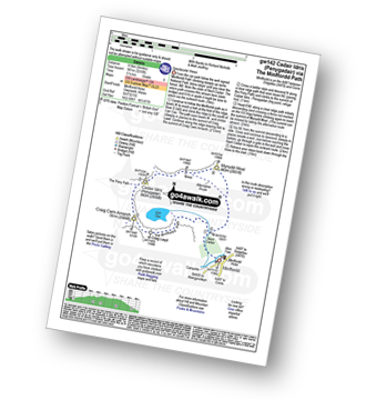
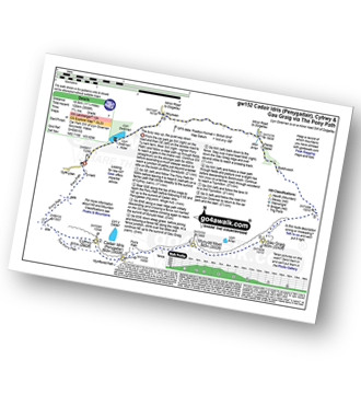
Route Summary:
Minffordd Hotel - Afon Faw - Ystrad-gwyn - Nant Cadair - The Minffordd Path - Llyn Cau - Craig Lwyd - Craig Cwm Amarch - Craig Cau - Cadair Idris (Penygadair) - Mynydd Moel - Mynydd Moel Path - Minffordd.
|
|---|
Vital Statistics:
| Length: | 6ml (9.5km) |
|---|---|
| Ascent: | 2,609ft (975m) |
| Time: | 5 hrs |
| Grade: | (Moderate) |
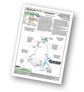
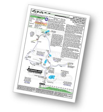
Route Summary:
Llyn Gwernan - Llyn Gafr - Llyn y Cadair - The Fox's Path - Cadair Idris (Penygadair) - The Pony Path - Cyfrwy - Rhiw Gwerdydd - Llyn Gwernan
|
|---|
Vital Statistics:
| Length: | 10.5ml (17km) |
|---|---|
| Ascent: | 3,627ft (1,105m) |
| Time: | 7½ hrs |
| Grade: |  (Hard) (Hard) |
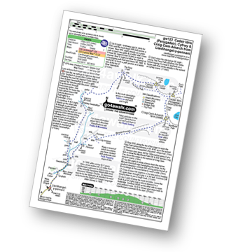
Route Summary:
Llanfihangel-y-pennant - Afon Cadair - Tynyfach - Gwastadfryn - Hafotty Gwastaffryn - Rhiw Gwerdydd - The Pony Path - Cyfrwy - Cadair Idris (Penygadair) - Craig Cau - Craig Cwm Amarch - Mynydd Pencoed - Pencoed - Llanfihangel-y-pennant
|
|---|
Vital Statistics:
| Length: | 11.25ml (18.5km) |
|---|---|
| Ascent: | 3,558ft (1,084m) |
| Time: | 7.75hrs |
| Grade: | (Hard) |
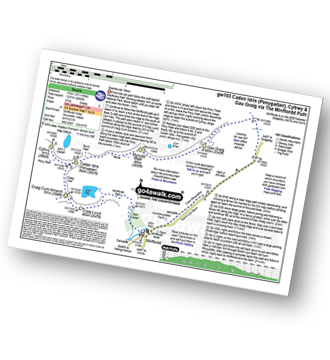
Route Summary:
Llyn Gwernan - The Pony Path - Rhiw Gwerdydd - Cyfrwy - Cadair Idris (Penygadair) - Mynydd Moel - Gau Graig - Bwlch-coch - Pandy Gader - Afon Arran - Rhydwen - Llyn Gwernan
|
|---|
Vital Statistics:
| Length: | 9.75ml (15.5km) |
|---|---|
| Ascent: | 4,247ft (1,294m) |
| Time: | 7.75hrs |
| Grade: |  (Hard) (Hard) |
Route Summary:
Llyn Gwernan - Llyn Gafr - The Fox's Path - Cadair Idris (Penygadair) - Mynydd Moel - Craig Cwm Amarch - Craig Cau - The Pony Path - Cyfrwy - Rhiw Gwerdydd - Llyn Gwernan
|
|---|
Vital Statistics:
| Length: | 10.5ml (17km) |
|---|---|
| Ascent: | 4,060ft (1,237m) |
| Time: | 8 hrs |
| Grade: | (Hard) |
Route Summary:
Minffordd Hotel - Afon Faw - Ystrad-gwyn - Nant Cadair - The Minffordd Path - Llyn Cau - Craig Lwyd - Craig Cwm Amarch - Craig Cau - Cadair Idris (Penygadair) - Cyfrwy - Cadair Idris (Penygadair) - Mynydd Moel - Gau Graig - Mynydd Gwerngraig - A487 - Nant Yr Allt-ioen - Cwm Rhwyddfor - Bwlch Llyn Bach - Minffordd.
See Cadair Idris (Penygadair) and the surrounding tops on our free-to-access 'Google Style' Peak Bagging Maps:
The Cadair Idris area of Snowdonia National Park
Less data - quicker to download
The Whole of Snowdonia National Park
More data - might take a little longer to download
See Cadair Idris (Penygadair) and the surrounding tops on our downloadable Peak Bagging Map in PDF format:

NB: Whether you print off a copy or download it to your phone, this PDF Peak Baggers' Map might prove incredibly useful when your are up there on the tops and you cannot get a phone signal.
You can find Cadair Idris (Penygadair) & all the walks that climb it on these unique free-to-access Interactive Walk Planning Maps:
1:25,000 scale OS Explorer Map (orange/yellow covers):
1:50,000 scale OS Landranger Map (pink/magenta covers):
 Fellow go4awalkers who have already walked, climbed, summited & bagged Cadair Idris (Penygadair)
Hugh Towns walked up Cadair Idris (Penygadair) on September 13th, 2023 [from/via/route] Pony Path [weather] Sunny
Sion Britton climbed Cadair Idris (Penygadair) on May 20th, 2023 [from/via/route] Rhedeg fyny yn Ras y Gader 2023. [with] Solo [weather] Braf iawn
Melfyn Parry bagged Cadair Idris (Penygadair) on October 13th, 2022 [from/via/route] Started walk from car park at SH732115 & followed well signposted path over the river & past the visitor centre before ascending through woodland up steep stone steps. Path continues steeply upwards & then forks to the right at SH721123 to Llyn Can which is well worth a visit. Retrace steps & then fork right to rejoin Minffordd path at SH720123. Path continues steeply upwards to gain the summit of Craig Cwm Amarch. From here path is well defined to head towards Cadair Idris. Turned left at SH708127 to join Pony Path which descends gradually & follows edge of cliffs to then rise slowly to summit of Cyfrwy. From here retrace steps to then continue on Pony Path to summit of Cadair Idris. From here the route to Mynydd Moel is visible & an easy walk. From here there is a steep descent before following a fence line to where it joins another fence coming from the right, cross over stile & follow path to corner of fence & pop over tp reach cairns at summit of Gau Graig. From here head in a southerly direction to reach fence at SH744138, path here is very steep in places before levelling out & path turns right at corner of fence at SH751140 & then descends almost back to A487 before turning sharp right & continues down to finish the walk at the lay by at SH753135. Approx total distance is 12.6Km & took nearly 6 hours. [with] On my own [weather] A sunny, dry day & pleasantly warm at times, got a bit chilly on the summit of Cadair Idris & warmed up again on descent. Hardly any breeze. - An really enjoyable walk with stunning views. Straight forward route, challenging ascents as path in parts are quite steep.
Stephanie Doyle hiked Cadair Idris (Penygadair) on February 27th, 2022 [from/via/route] Pony path [with] Nieces and son 14,12 and 8 [weather] Cold, clear & bursts of fog - Easy path to follow
Iain Ballard summited Cadair Idris (Penygadair) on September 2nd, 2020 [weather] windy to begin with then sunny
Tracy Lewis conquered Cadair Idris (Penygadair) on November 26th, 2020 [from/via/route] Minyffordd path [with] Hannah and Susie [weather] Cloudy & mizzle at the top
Andy Buxton scaled Cadair Idris (Penygadair) during April, 1989 [from/via/route] Mynffordd path [with] St Clements Bog-Trotters [weather] Sunny/showers - Snow on top
Angela Moroney walked up Cadair Idris (Penygadair) during 2017 [with] 3PEAKS
Dale Tyler climbed Cadair Idris (Penygadair) on August 18th, 2019 [from/via/route] After a day up Snowdon via Crib Goch, stopped at Cadair Idris on the way home. Just me, Jason & Alex left; managed to kill off Sean & Lambert the day before. Did the loop (3 tops) from the Minffordd Path [with] Jason, Alex, (Sean and Lambert left in van!) [weather] Another gusty day on the tops & ridges - Beautiful wooded section with waterfalls at the start of the walk & perhaps the best sausage rolls I've ever had at the visitor centre when we finished!
Darin Torrance bagged Cadair Idris (Penygadair) on July 21st, 2018 [from/via/route] Visitor Center Minnfford path [weather] Cloud rain - Hard days walk
Alan Pritchard hiked Cadair Idris (Penygadair) on June 18th, 2013 [with] My Wife [weather] Good - Amazing views of Dolgellau - played in the Welsh Festival there, a great day..😎🚶♂️
Bleddyn Rhys summited Cadair Idris (Penygadair) on May 27th, 2017 [from/via/route] Llwybr Minffordd o Tal y Llyn Hefyd 26 Chwefror 2019 ar ben fy hyn fel rhan o daith hir iawn ar draws y crib i gyd [with] Y teulu i gyd! - Mona Siwan Caradog a Daniel [weather] Dechrau yn braf iawn ac addawol ond cwmwl isel yn disgyn yn raddol ar ol y llyn. Yn datblygu i law trwm a gwynt cryf gyda fawr ddim visibility erbyn Penygadair. Abort mission a dod lawr ochr Dolgellau ar y Pony path. - Taxi yn ol i Dal y Llyn o'r gwesty ochr Dolgellau. Pawb yn oer ac yn wlyb ddyferyd.
David Wand conquered Cadair Idris (Penygadair) on May 29th, 1989 [with] Gayle [weather] Rained in the night but dry for the walk & a light breeze
Robert Shaw scaled Cadair Idris (Penygadair) on June 17th, 2016 [from/via/route] From the north. [with] Elaine [weather] Sunny & Clear - Fabulous walk
Peter Wroe walked up Cadair Idris (Penygadair) on April 2nd, 2017 [from/via/route] Minfford Trail [with] My Mate Andy [weather] Sunny - All those at the top got out their flasks of tea or coffee, other reached for their Energy Gels & Drinks. Andy got out the bottle of champagne & we toasted our 'old farts' success.
Mark Davidson climbed Cadair Idris (Penygadair) on June 6th, 2012 [with] Theresa, Martin, Mary, Suzie and Ernie [weather] Dry but low cloud - did get some good views though
Mike Jackson bagged Cadair Idris (Penygadair) on April 21st, 2016 [from/via/route] Minfford [with] Mike Heaton [weather] Very good..
Paul Redman hiked Cadair Idris (Penygadair) on June 19th, 2015 [from/via/route] Pony Trek [with] Solo [weather] Fair - Chillaxed day out
Rachael Tyler summited Cadair Idris (Penygadair) on August 26th, 2015 [from/via/route] Dolgellau [with] Ash, John, Natasha [weather] Cloudy, windy. Rain on descent. - Wednesday walk during Barmouth week.
Iain Cocks has conquered Cadair Idris (Penygadair) [with] pete jones [weather] misty, rain, sunny
Sam Rayn scaled Cadair Idris (Penygadair) on May 3rd, 2014 [from/via/route] minnford path [with] solo [weather] sunny turning cloudy & blustery on tops
Gerald Murphy walked up Cadair Idris (Penygadair) on March 18th, 2015 [from/via/route] Start point was car Park at foot of Minffordd Path. [with] Alone [weather] Fine, dry, light wind, pollution haze due to high pressure over recent days. - From top of woodland section took the Mynydd Moel option. From Mynydd Moel followed ridge to Penygadair. from trig point headed to Cyfrw to look at the Cyfrw arete then returned to just below Penygadair summit to rejoin Minfordd Path over Pencoed & then down to side of Llyn Cau. Lunch then return via woodland path to car park. Note: This route gets you quickly to the 800 metre plus level along a clear path. The downside is that you also gain the summits of Penygadair & Pencoed quickly. You are then faced with a seemingly endless, occasionally nasty descent. The diversion to Cyfrw is well wothwhile.
Alan Smith climbed Cadair Idris (Penygadair) on March 17th, 2015 [from/via/route] Minifford campsite [with] only Me [weather] sunny & hot start. Snow on the peak a little snow in the air
Christina Lander bagged Cadair Idris (Penygadair) on May 3rd, 2014 [from/via/route] Minffordd Circular route [with] Dick & Suzanne [weather] Gorgeous clear, sunny day - Training walk for the Welsh Three Peaks Challenge
Colin Jones hiked Cadair Idris (Penygadair) during September, 2014 [with] Self [weather] Excellent, clear calm & sunny - Did the full circular tour from the southern side car park, up through the forest. Exhausting but fantastic, & met some really nice fellow walkers at the top......and a plague of flying ants.
Pauline Styles summited Cadair Idris (Penygadair) on May 23rd, 2014 [from/via/route] Myndfford pass [with] The Benskey Walkers [weather] Mostly good. A downpour just before the summit, clearing at the top, then mist came down as we tried to find our way off.
Robert Taylor-Marriott conquered Cadair Idris (Penygadair) on November 10th, 2010 [from/via/route] Route 21: Cadair Idris - Penygadair(, Mynydd Moel, Craig Cwm Amarch (CI) Completed 10.11.10 [with] Vince Wetton & Robert Taylor-Marriott. [weather] Cloudy, sunny.
Marilyn Wadkin scaled Cadair Idris (Penygadair) on September 9th, 2012 [from/via/route] The plan was to go up the Fox Path & return via the Minffordd Path. With no compass & it being very cloudy we took the Pony Path down by mistake. Then took a wrong turn half way down that path. We ended up about 7 miles away from our car. A fella waiting to pick up kids doing the DofE very kindly gave us a lift to the Minffordd car park. [with] Rob [weather] Warm with a breeze going up but very cloudy on the summit, we couldn't see more than 5 feet in front of us.
Stephen Reader walked up Cadair Idris (Penygadair) on May 26th, 2014 [from/via/route] Minffordd track [with] Bev & Shep [weather] Cleared up as we climbed to reveal the views - Really tough trek back down from Mynydd Moel.
Samantha Kimber climbed Cadair Idris (Penygadair) during May, 1994 [with] Powys Schools and Youth Exploration Group (about 16 of us) [weather] Sunny, not terribly warm, breezy - Excellent visibility for views!
Iain Jones bagged Cadair Idris (Penygadair) on October 5th, 2013 [from/via/route] Cyfrwy Ridge [with] Graeme High
Alberto Lopes hiked Cadair Idris (Penygadair) on February 26th, 2012 [from/via/route] From Minffordd car park [with] Rachel [weather] sunny
Joanne Mcgawley summited Cadair Idris (Penygadair) on July 7th, 2013 [from/via/route] Mynfford Path [with] Rich [weather] In cloud . hot & humid. - 6.2 miles.
Keith Bezant conquered Cadair Idris (Penygadair) on May 31st, 2013 [from/via/route] The Pony Path from the National trust car park [with] A group of 13 friends [weather] Very very hot with brilliant sunshine. Great views from the summit - Walked as part of the Welsh three peaks that we undertook for the Bobath charity
Robert Logan has scaled Cadair Idris (Penygadair) [from/via/route] Minffordd [with] Judith Logan [weather] Sunny, Warm
John Tippins walked up Cadair Idris (Penygadair) on December 27th, 2012 [from/via/route] Minffordd [with] just me [weather] thick mist
Richard Penney climbed Cadair Idris (Penygadair) on February 25th, 2013 [from/via/route] Minnfford Hotel [with] Solo... how daft... first visit. [weather] Mist, low cloud, everything covered in 2" of ice. Compass out on return down east ridge. - Bit dangerous on summit, hands & knees at one point where path (solid ice) runs by cliff.
David Lane bagged Cadair Idris (Penygadair) on May 9th, 1999 [with] Kelly
Jeremy Maguire hiked Cadair Idris (Penygadair) on October 27th, 2012 [from/via/route] Minfford Path. [with] Beth. [weather] Beautiful, Sunny.
Vince Wetton summited Cadair Idris (Penygadair) on November 10th, 2010 [with] RTM
John Senior conquered Cadair Idris (Penygadair) on April 28th, 2012 [from/via/route] From Kings Youth |Hostel via Pony path up & Foxes path down [with] Julie Senior
Jackie Payne scaled Cadair Idris (Penygadair) on April 19th, 2012 [from/via/route] minfford path [with] started with peter . ended up with phil and dave [weather] cold,hail, snow above cloud line. - could not see way down, too much snow. phil good with maps & found the way. split up below cloud cover as limping like a crab with broken legs. slow painful(ankle) sideways (left leg first always)steep descent.
Bay Wan walked up Cadair Idris (Penygadair) on August 31st, 2010 [from/via/route] The bottom? [with] Brian and Kira Dog [weather] Sunny - Midges were a nightmare that day!
Stuart Mellor climbed Cadair Idris (Penygadair) on August 15th, 2011 [from/via/route] Minffordd Hotel GW142 [with] Dominic my son [weather] Hot sunny - Climbed before alone
Richard Gunner bagged Cadair Idris (Penygadair) on September 3rd, 2011 [from/via/route] Minffordd Path [with] Companion [weather] Sunny - Climbed Cadair Idris after climbing Snowdon the day before
Patrick Rogozinski, Mike Harris, Sue Bromley, Andrew Jones, Wendy Sockett, Donovan Suddell, Rich Roberts, Louis Smith, Tom Norgate, Hugh Strickland, John Cuthbert, Anthony Jackson, Linda Mckeogh, Alison Farrell, Judith Mulcahy, Louise Sandwith, Phyllis Mcgibbon, Edward Wells, Robert Maclean, Paul Booth, Trevor Williams, James Brocken, Stephen Millington, David Price, Dave Milner, Kath Edwards, Jacqueline Debbie Tonks, Paul Warren, Pete Howes, Doug Jeffries, Linda Walker and Stephen Hobdell have all walked, climbed & bagged Cadair Idris (Penygadair).
To add (or remove) your name and experiences on this page - Log On and edit your Personal Mountain Bagging Record
. . . [see less walk reports]
More Photographs & Pictures of views from, on or of Cadair Idris (Penygadair)
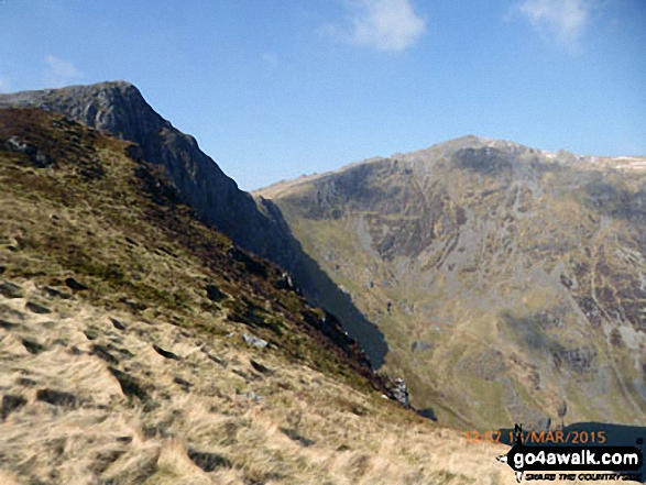
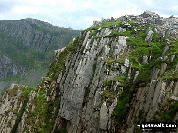
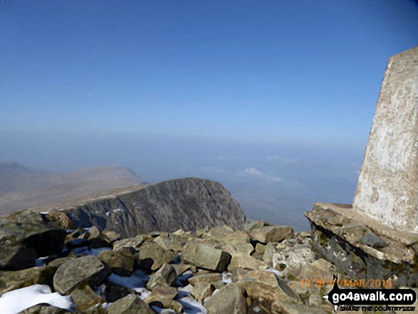
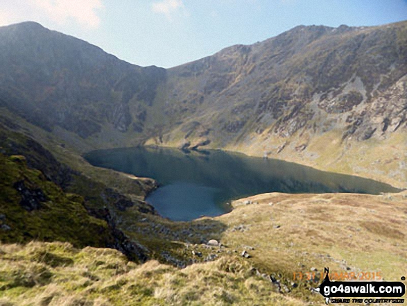
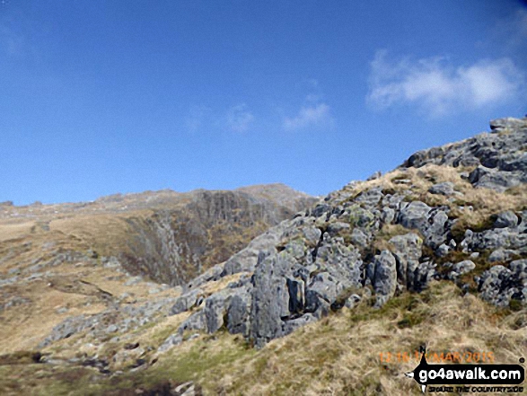
Craig Cwm Amarch and Cadair Idris (Penygadair) above Llyn Cau from the Minffordd Path near Craig Lwyd
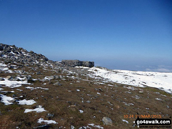
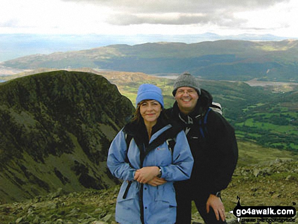
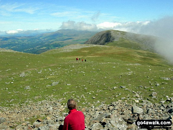
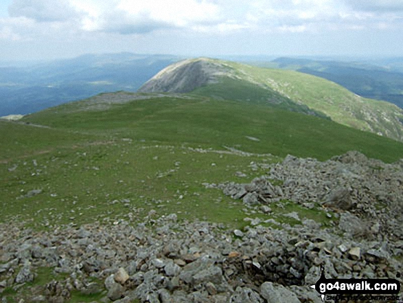
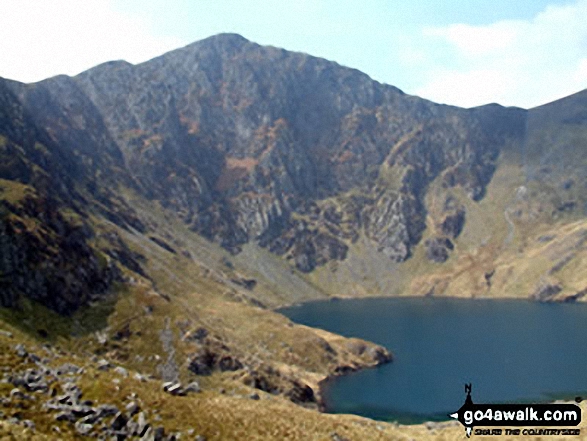
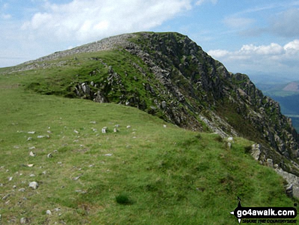
Looking west to Cadair Idris (Penygadair) from the summit of Mynydd Moel
. . . see all 84 walk photographs & pictures of views from, on or of Cadair Idris (Penygadair)
Send us your photographs and pictures on, of, or from Cadair Idris (Penygadair)
If you would like to add your walk photographs and pictures featuring views from, on or of Cadair Idris (Penygadair) to this page, please send them as email attachments (configured for any computer) along with your name to:
and we shall do our best to publish them.
(Guide Resolution = 300dpi. At least = 660pixels (wide) x 440 pixels (high).)

You can also submit photos via our Facebook Page.
NB. Please indicate where each photo was taken and whether you wish us to credit your photos with a Username or your First Name/Last Name.
Not familiar with this top?


