
![]()
Black Combe
600m (1969ft)
The South Western Marches, The Lake District, Cumbria, England
A rare location in the United Kingdom where, on a clear day, you can see five countries - England, Scotland, Wales, Northern Ireland & Southern Ireland and the self-governing British Crown dependency, The Isle of Man.
William Wordsworth claimed that the summit of Black Combe offered "the amplest range of unobstructed prospect may be seen that British ground commands."
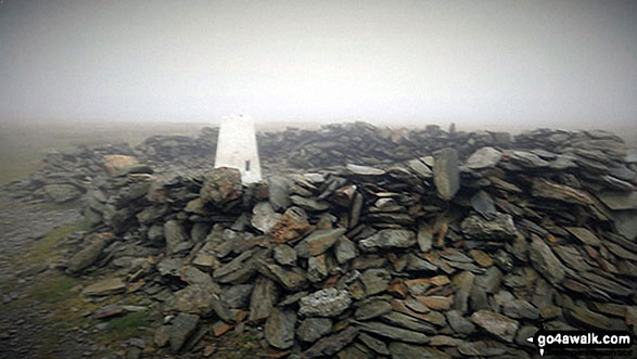
The summit of Black Combe is marked by an Ordnance Survey Trig Point.

Not familiar with this top?
   |
|---|
Vital Statistics:
| Length: | 8.5ml (13.5km) |
|---|---|
| Ascent: | 2,645ft (806m) |
| Time: | 5.75hrs |
| Grade: |  (Moderate) (Moderate) |

Route Summary:
Silecroft - Whicham Church - Kirkbank Farm - Townend Knotts - Black Combe - Blackcombe Screes - Whitcombe Screes - Stoupdale Head - White Combe - White Hall Knott - Whitecombe Beck - Parsonage Breast - Kirkbank Farm - Whicham Church.
|
|---|
Vital Statistics:
| Length: | 8.75ml (14km) |
|---|---|
| Ascent: | 2,307ft (703m) |
| Time: | 5½ hrs |
| Grade: | (Moderate) |
Route Summary:
Silecroft - Whicham Church - Kirkbank Farm - Townend Knotts - Black Combe - Blackcombe Screes - William Gill - Hentoe Hill - Butcher's Breast - Littlefell Crags - Tarn Dimples - Whitbeck Mill - Townend Hall - Whitebeck - Throstlerake Crag Fell Brow - Whicham Church - Silecroft
See Black Combe and the surrounding tops on our free-to-access 'Google Style' Peak Bagging Maps:
The South Western Marches area of The Lake District National Park
Less data - quicker to download
The Whole of The Lake District National Park
More data - might take a little longer to download
A go4awalk.com downloadable Peak Bagging Map in PDF format featuring Black Combe should be available soon.
You can find Black Combe & all the walks that climb it on these unique free-to-access Interactive Walk Planning Maps:
1:25,000 scale OS Explorer Map (orange/yellow covers):
1:50,000 scale OS Landranger Map (pink/magenta covers):
 Fellow go4awalkers who have already walked, climbed, summited & bagged Black Combe
Trevor Williams walked up Black Combe on September 6th, 2023 [from/via/route] Broughton Whicham [with] Paul Booth and Pals [weather] Very hot - Skinny dipping
David Lord climbed it on March 12th, 2017 [from/via/route] Whicham church car park. Highly recommended. [with] Debbie Lord - An excellent walk/climb that affords excellent views over the coast & inland to the Lakeland fells.
Darren Wilson bagged it on February 19th, 2020 [from/via/route] White Combe, Black Combe [with] Lone [weather] Fog above 450 metres
Mike Walker has hiked Black Combe [with] MK
Thomas Mccann summited on January 7th, 2018 [from/via/route] Whicham church. [with] myself [weather] Cold Sunny morning - Sunrise was great.
To add (or remove) your name and experiences on this page - Log On and edit your Personal Mountain Bagging Record
. . . [see more walk reports]
More Photographs & Pictures of views from, on or of Black Combe
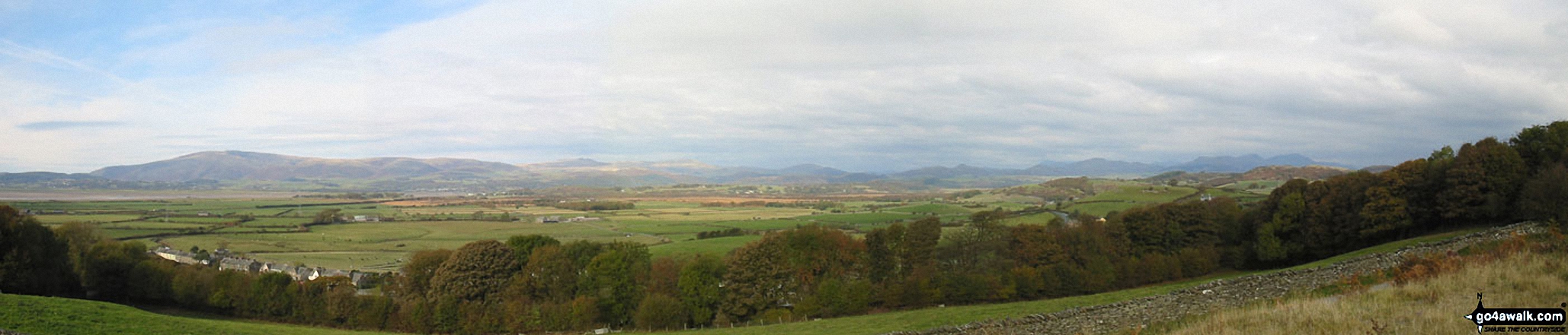
*The Southern Fells from Black Combe to The Old Man of Coniston from Kirkby-in-Furness


The Southern Fells from Black Combe to The Old Man of Coniston from Kirkby-in-Furness

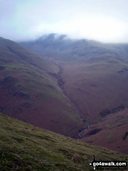
Looking back over Black Combe and Whitecombe Screes from White Combe

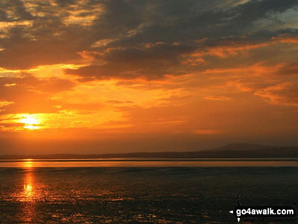
Looking back to Millom and Duddon Sands from the path up Black Combe
. . . see all 10 walk photographs & pictures of views from, on or of Black Combe
Send us your photographs and pictures on, of, or from Black Combe
If you would like to add your walk photographs and pictures to this page, please send them as email attachments (configured for any computer) along with your name to:
and we shall do our best to publish them.
(Guide Resolution = 300dpi. At least = 660pixels (wide) x 440 pixels (high).)

You can also submit photos via our Facebook Page.
NB. Please indicate where each photo was taken and whether you wish us to credit your photos with a Username or your First Name/Last Name.


