
![]()
Buachaille Etive Beag (Stob Dubh)
958m (3144ft)
The Glen Coe Mountains, Loch Leven to Connel Bridge, Strath of Orchy and Glen Lochy, Highland, Scotland
Buachaille Etive Beag (Stob Dubh) means 'Small Shepherd of Etive (Black Peak)' and is pronounced 'boo-a-chil-ya etiv baik (stop dub)'.
The summit of Buachaille Etive Beag (Stob Dubh) is marked by a cairn.

Not familiar with this top?
You can walk/hike to the top of Buachaille Etive Beag (Stob Dubh) by using any of these 4 easy‑to‑follow route maps:
Walk h153 Stob Coire Raineach (Buachaille Etive Beag) and Buachaille Etive Beag (Stob Dubh) from The Pass of Glencoe
Munros 200 and 263
   |
|---|
Vital Statistics:
| Length: | 5ml (8km) |
|---|---|
| Ascent: | 2,983ft (909m) |
| Time: | 5 hrs |
| Grade: |  (Moderate) (Moderate) |

Route Summary:
The Pass of Glencoe - Mam Buidhe - Stob Coire Raineach (Buachaille Etive Beag) - Buachaille Etive Beag (Stob Dubh) - Lairig Eilde - The Pass of Glencoe
Walk h109 Stob Coire Raineach (Buachaille Etive Beag) and Buachaille Etive Beag (Stob Dubh) via Lairig Eilde from The Pass of Glencoe
Superb ridge walk
|
|---|
Vital Statistics:
| Length: | 6.5ml (10.5km) |
|---|---|
| Ascent: | 3,318ft (1,011m) |
| Time: | 6 hrs |
| Grade: |  (Moderate) (Moderate) |

Route Summary:
The Pass of Glencoe - Mam Buidhe - Stob Coire Raineach (Buachaille Etive Beag) - Buachaille Etive Beag (Stob Dubh) - Lairig Eilde - The Pass of Glencoe
Walk h135 Stob Coire Raineach (Buachaille Etive Beag) and Buachaille Etive Beag (Stob Dubh) via Stob nan Cabar from The Pass of Glencoe
Testing scramble to a superb ridge
|
|---|
Vital Statistics:
| Length: | 7.5ml (12km) |
|---|---|
| Ascent: | 3,016ft (919m) |
| Time: | 6½ hrs |
| Grade: | (Moderate) |
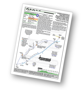
Route Summary:
The Pass of Glencoe - Stob Nan Cabar - Stob Coire Raineach (Buachaille Etive Beag) - Buachaille Etive Beag (Stob Dubh) - Lairig Gartain - The Pass of Glencoe
Walk h179 Stob Coire Raineach (Buachaille Etive Beag) and Buachaille Etive Beag (Stob Dubh) via Lairig Gartain from The Pass of Glencoe
Superb ridge walk
|
|---|
Vital Statistics:
| Length: | 8.25ml (13km) |
|---|---|
| Ascent: | 2,993ft (912m) |
| Time: | 6 hrs |
| Grade: | (Moderate) |
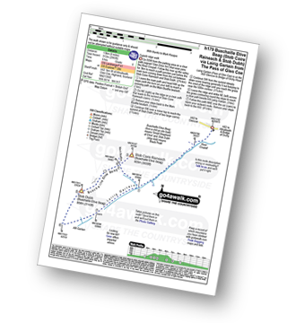
Route Summary:
The Pass of Glencoe - Stob Coire Raineach (Buachaille Etive Beag) - Buachaille Etive Beag (Stob Dubh) - Lairig Gartain - The Pass of Glencoe
See Buachaille Etive Beag (Stob Dubh) and the surrounding tops on our free-to-access 'Google Style' Peak Bagging Maps:
The Glen Coe Mountains area of Scottish Region 3: Loch Leven to Connel Bridge, Strath of Orchy and Glen Lochy
Less data - quicker to download
Scottish Region 3: Loch Leven to Connel Bridge, Strath of Orchy and Glen Lochy
Less data - quicker to download
See Buachaille Etive Beag (Stob Dubh) and the surrounding tops on our unique, downloadable, PDF Peak Bagging Map:

NB: Whether you print off a copy or download it to your phone, this PDF Peak Baggers' Map might prove incredibly useful when your are up there on the tops and you cannot get a phone signal.
You can find Buachaille Etive Beag (Stob Dubh) & all the walks that climb it on these unique free-to-access Interactive Walk Planning Maps:
1:25,000 scale OS Explorer Map (orange/yellow covers):
1:50,000 scale OS Landranger Map (pink/magenta covers):
 Fellow go4awalkers who have already walked, climbed, scaled, summited, hiked & bagged Buachaille Etive Beag (Stob Dubh)
Bay Wan walked up Buachaille Etive Beag (Stob Dubh) on October 6th, 2021 [from/via/route] Started from A82 car park (Google maps says 'Parking lot - starting point 5'- started with Stob Coire Raineach & also hit Stob Dubh [with] Cocoa dog - 10 yrs + Paul Harper [weather] Dry & sunny but quite cold - Steep ascent/descent as had to go up & come down the same way.
Angela Moroney climbed it during 2014 - Turner
Andrew Edwards bagged it on November 1st, 2015 [from/via/route] Start point the memorial [with] My wife [weather] Sunny very windy - My wife's second munro & I lost my selfie stick
Mark Davidson hiked Buachaille Etive Beag (Stob Dubh) on July 25th, 2004 [with] MK [weather] Dry & sunny - - midges on the summit though!
Grant Mclean, Mr M A Blanchard, Simon Duerden, Paul Booth, Trevor Williams, Geert Gritter, Rob Barklamb and Adam Shewry have all walked, climbed & bagged Buachaille Etive Beag (Stob Dubh).
To add (or remove) your name and experiences on this page - Log On and edit your Personal Mountain Bagging Record
More Photographs & Pictures of views from, on, or of, Buachaille Etive Beag (Stob Dubh)
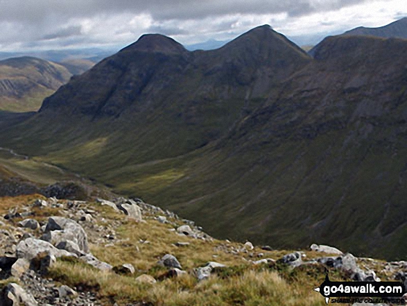
Buachaille Etive Mor (Stob Dearg) (left), Stob na Doire (Buachaille Etive Mor) and Stob Coire Altruim (Buachaille Etive Mor) from the summit of Buachaille Etive Beag (Stob Dubh)

Stob Coire Sgreamhach (left) & Beinn Fhada (Stob Coire Sgreamhach) (foreground - left) with Bidean nam Bian & Stob Coire nam Beith (in shadow behind), Stob Coire Raineach (Buachaille Etive Beag) (centre), Buachaille Etive Mor (Stob Dearg), Stob na Doire (Buachaille Etive Mor), Stob Coire Altruim (Buachaille Etive Mor) & Stob na Broige (Buachaille Etive Mor) (right) with Clach Leathad (Creise), Creise & Stob A' Ghlais Choire (Creise) behind from the summit of Buachaille Etive Beag (Stob Dubh)
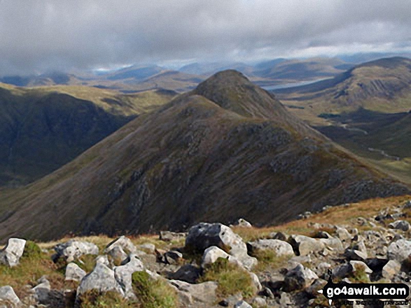
Stob Coire Raineach (Buachaille Etive Beag) from the summit of Buachaille Etive Beag (Stob Dubh)

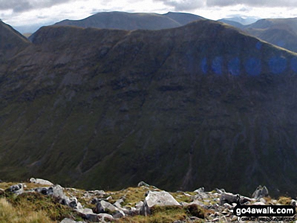
Stob Coire Sgreamhach (left) & Beinn Fhada (Stob Coire Sgreamhach) (in sunlight in the foreground) with Bidean nam Bian & Stob Coire nam Beith (in shadow behind) from the summit of Buachaille Etive Beag (Stob Dubh)
Stob Coire Altruim (Buachaille Etive Mor) & Stob na Broige (Buachaille Etive Mor) with Clach Leathad (Creise), Creise & Stob A' Ghlais Choire (Creise) beyond from the summit of Buachaille Etive Beag (Stob Dubh)

Send us your photographs and pictures on, of, or from Buachaille Etive Beag (Stob Dubh)
If you would like to add your walk photographs and pictures to this page, please send them as email attachments (configured for any computer) along with your name to:
and we shall do our best to publish them.
(Guide Resolution = 300dpi. At least = 660pixels (wide) x 440 pixels (high).)

You can also submit photos via our Facebook Page.
NB. Please indicate where each photo was taken and whether you wish us to credit your photos with a Username or your First Name/Last Name.


