
![]()
An Gearanach
982m (3223ft)
The Mamores, Fort William and Loch Linnhe to Loch Ericht, Highland, Scotland
Tap/mouse over a coloured circle (1-3 easy walks, 4-6 moderate walks, 7-9 hard walks) and click to select.
You can find An Gearanach & all the walks that climb it on these unique free-to-access Interactive Walk Planning Maps: (click/TAP to select)
1:25,000 scale OS Explorer Map (the ones with orange/yellow covers):
1:50,000 scale OS Landranger Map (the ones with pink/magenta covers):
See An Gearanach and the surrounding tops on our free-to-access 'Google Style' Peak Bagging Maps:
See An Gearanach and the surrounding tops on our downloadable PDF Peak Bagging Map:
 Fellow go4awalkers who have already walked, climbed, summited & bagged An Gearanach
Daniel Moran walked up An Gearanach on May 16th, 2024 [weather] Great day - Devils ridge
Andy Buxton climbed An Gearanach during August, 2001 [from/via/route] Glen Nevis car park via Stell Falls [with] Dan, Grace [weather] Sunny day - VERY windy
Mark Hanley bagged An Gearanach on June 8th, 2018 [from/via/route] Glen Nevis [weather] Sunny
Andrew Edwards hiked An Gearanach on October 9th, 2016 [from/via/route] Part of ring of steall [with] ALY [weather] Superb - Long day
Mr M A Blanchard, Ron Blundell, Simon Duerden, Paul Booth and Trevor Williams have all walked, climbed & bagged An Gearanach.To add (or remove) your name and experiences on this page - Log On and edit your Personal Mountain Bagging Record
More Photographs & Pictures of views from, on or of An Gearanach
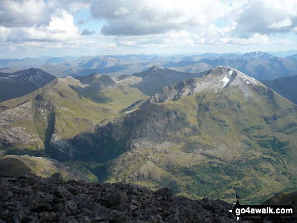
Na Gruagaichean, Na Gruagaichean (North West Top), The Ring of Steall, Stob Coire a' Chairn, Sgurr a' Mhaim, An Garbhanach (An Gearanach), Ben Nevis and Carn Mor Dear from Binnein Mor in the Eastern Mamores
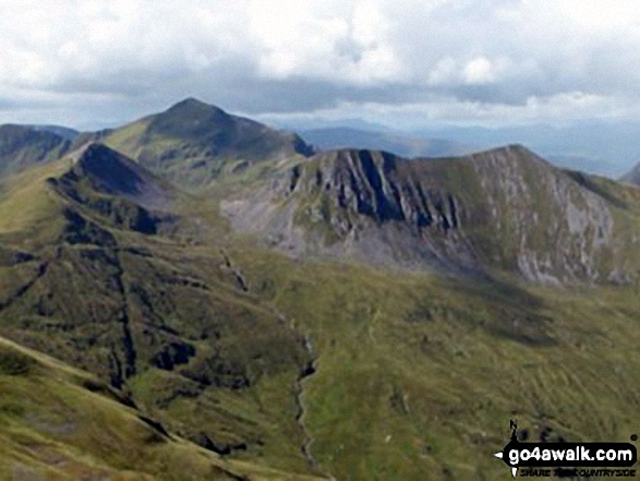
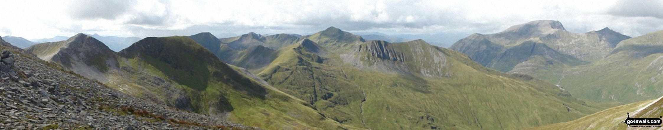
The Ring of Steall featuring Stob Coire a' Chairn (left foreground), Sgurr a' Mhaim (high peak at back) and An Garbhanach (An Gearanach) from Binnein Mor in the Eastern Mamores
Send us your photographs and pictures on, of, or from An Gearanach
If you would like to add your walk photographs and pictures featuring views from, on or of An Gearanach to this page, please send them as email attachments (configured for any computer) along with your name to:
and we shall do our best to publish them.
(Guide Resolution = 300dpi. At least = 660pixels (wide) x 440 pixels (high).)

You can also submit photos via our Facebook Page.
NB. Please indicate where each photo was taken.


