
![]()
Bleaklow Stones (Bleaklow Hill)
628m (2061ft)
The Dark Peak Area, The Peak District, Derbyshire, England
Tap/mouse over a coloured circle (1-3 easy walks, 4-6 moderate walks, 7-9 hard walks) and click to select.
You can find Bleaklow Stones (Bleaklow Hill) & all the walks that climb it on these unique free-to-access Interactive Walk Planning Maps: (click/TAP to select)
1:25,000 scale OS Explorer Map (the ones with orange/yellow covers):
1:50,000 scale OS Landranger Map (the ones with pink/magenta covers):
See Bleaklow Stones (Bleaklow Hill) and the surrounding tops on our free-to-access 'Google Style' Peak Bagging Maps:
See Bleaklow Stones (Bleaklow Hill) and the surrounding tops on our downloadable PDF Peak Bagging Map:
   |
|---|
Vital Statistics:
| Length: | 10.5ml (17km) |
|---|---|
| Ascent: | 1,975ft (602m) |
| Time: | 5.75hrs |
| Grade: |  (Moderate) (Moderate) |
Route Summary:
Woodhead Tunnel - Middle Black Clough - Bleaklow Stones (Bleaklow Hill) - Bleaklow Head (Bleaklow Hill) - The Wain Stones (or Kissing Stones) - The Pennine Way - Clough Edge - The Longdendale Trail - Crowden - Woodhead Reservoir - Woodhead Tunnel
|
|---|
Vital Statistics:
| Length: | 13.25mls (21km) |
|---|---|
| Ascent: | 2,081ft (634m) |
| Time: | 7 hrs |
| Grade: |  (Hard) (Hard) |
Route Summary:
Woodhead Tunnel - Far Black Clough - Swains Head - Swains Greave - Barrow Stones - Grinah Stones - Bleaklow Stones (Bleaklow Hill) - Bleaklow Head (Bleaklow Hill) - The Wain Stones (or Kissing Stones) - The Pennine Way - Joseph Patch - John Track Well - Torside Clough - Peaknaze Moor - Reaps Farm - The Longdendale Trail - Torside Reservoir - Woodhead Reservoir - Woodhead Tunnel
|
|---|
Vital Statistics:
| Length: | 16.5ml (26.5km) |
|---|---|
| Ascent: | 2,604ft (794m) |
| Time: | 8½ hrs |
| Grade: |  (Hard) (Hard) |
Route Summary:
Ladybower Reservoir - Fairholmes Car Park - Derwent Reservoir - Howden Reservoir - Fagney Clough - Ridgewalk Moor - Barrow Stones - Bleaklow Stones (Bleaklow Hill) - Alport Moor - West End Moor - Birchin Hat - Alport Castles - Rowlee Pasture - Lockerbrook Heights - Lockerbrook Farm - Fairholmes Car Park - Ladybower Reservoir
 Fellow go4awalkers who have already walked, climbed, summited & bagged Bleaklow Stones (Bleaklow Hill)
Neall Garrad walked up Bleaklow Stones (Bleaklow Hill) on May 9th, 2022 [from/via/route] From Snakes Pass [with] Scouts [weather] Sunny, windy on the summit
Nicola Parkinson climbed Bleaklow Stones (Bleaklow Hill) on February 22nd, 2014 [from/via/route] Woodhead Tunnels [with] Stu
Robert Logan bagged Bleaklow Stones (Bleaklow Hill) on June 4th, 2011 [from/via/route] Fairholmes, Howden Reservoir, Ridgewalk Moor, Round Hill, Barrow Stones, Grinah Stones, Bleaklow Stones, Bleaklow, The Rdge, Alport Castles, Rowlee Pasture [with] Judith Logan
Philip Wilde, Louise Sandwith, Andrew Else, Louis Smith and Mark Davidson have all walked, climbed & bagged Bleaklow Stones (Bleaklow Hill).To add (or remove) your name and experiences on this page - Log On and edit your Personal Mountain Bagging Record
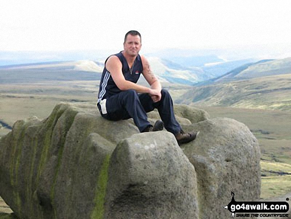
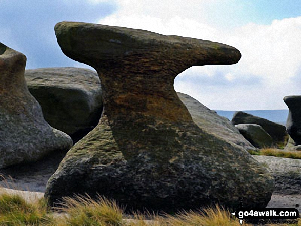
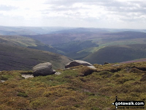
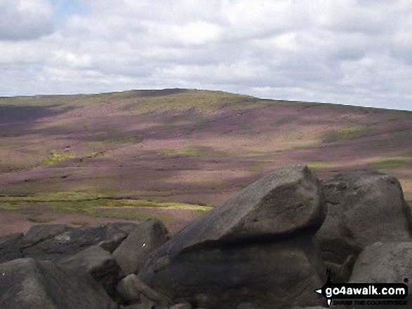
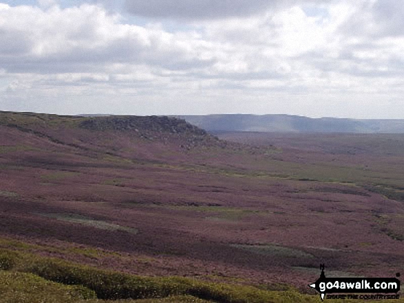
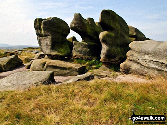
More Photographs & Pictures of views from, on or of Bleaklow Stones (Bleaklow Hill)
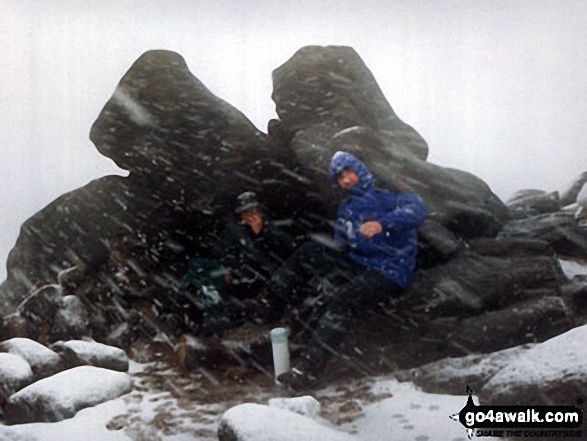
Me, Bradders and my nephew David during a snow blizzard on Bleaklow Head (Bleaklow Hill)
Send us your photographs and pictures on, of, or from Bleaklow Stones (Bleaklow Hill)
If you would like to add your walk photographs and pictures featuring views from, on or of Bleaklow Stones (Bleaklow Hill) to this page, please send them as email attachments (configured for any computer) along with your name to:
and we shall do our best to publish them.
(Guide Resolution = 300dpi. At least = 660pixels (wide) x 440 pixels (high).)

You can also submit photos via our Facebook Page.
NB. Please indicate where each photo was taken.


