
![]()
Cnicht (North Top)
688m (2257ft)
The Moelwyns, Snowdonia, Gwynedd, Wales
Not familiar with this top?
   |
|---|
Vital Statistics:
| Length: | 6.75ml (11km) |
|---|---|
| Ascent: | 2,369ft (722m) |
| Time: | 5 hrs |
| Grade: |  (Hard) (Hard) |
Route Summary:
Blaen Nanmor - Gelli-lago Nantmor Mountain Centre - Bwlch y Battel - Croesor Bach - Cnicht - Cnicht (North Top) - Llyn Yr Adar - Y Cyrniau - Llyn Llagi - Clogwyn Gottal - Carned Melyn - Llwynyrhwch - Cefn Gerynt - Gerynt - Blaen Nanmor
|
|---|
Vital Statistics:
| Length: | 7.25ml (11.5km) |
|---|---|
| Ascent: | 2,273ft (693m) |
| Time: | 5 hrs |
| Grade: | (Moderate) |
Route Summary:
Croesor - Croesor Bach - Cnicht - The Welsh Matterhorn - Cnicht (North Top) - Llyn Yr Adar - Afon Cwm-y-foel - Llyn Cwm-corsiog - Clogwyn Birth - Rhosydd Quarry - Bwlch y Rhosydd - Croesor Quarry - Cwm Croesor - Croesor
|
|---|
Vital Statistics:
| Length: | 9ml (14.5km) |
|---|---|
| Ascent: | 3,355ft (1,023m) |
| Time: | 6.75hrs |
| Grade: |  (Hard) (Hard) |
Route Summary:
Croesor - Croesor Bach - Cnicht - Cnicht (North Top) - Llyn Yr Adar - Afon Cwm-y-foel - Llyn Cwm-corsiog - Clogwyn Birth - Rhosydd Quarry - Moel-yr-hydd - Moelwyn Mawr (North Ridge Top) - Moelwyn Mawr - Croesor
|
|---|
Vital Statistics:
| Length: | 10ml (16km) |
|---|---|
| Ascent: | 3,923ft (1,196m) |
| Time: | 7½ hrs |
| Grade: | (Hard) |
Route Summary:
Croesor - Croesor Bach - Cnicht - Cnicht (North Top) - Llyn Yr Adar - Afon Cwm-y-foel - Llyn Cwm-corsiog - Clogwyn Birth - Rhosydd Quarry - Moel-yr-hydd - Moelwyn Mawr (North Ridge Top) - Moelwyn Mawr - Craigysgafn - Bwlch Stwlan - Moelwyn Bach - Croesor
See Cnicht (North Top) and the surrounding tops on our free-to-access 'Google Style' Peak Bagging Maps:
The Moelwyns area of Snowdonia National Park
Less data - quicker to download
The Whole of Snowdonia National Park
More data - might take a little longer to download
See Cnicht (North Top) and the surrounding tops on our downloadable Peak Bagging Map in PDF format:

NB: Whether you print off a copy or download it to your phone, this PDF Peak Baggers' Map might prove incredibly useful when your are up there on the tops and you cannot get a phone signal.
You can find Cnicht (North Top) & all the walks that climb it on these unique free-to-access Interactive Walk Planning Maps:
1:25,000 scale OS Explorer Map (orange/yellow covers):
1:50,000 scale OS Landranger Map (pink/magenta covers):
 Fellow go4awalkers who have already walked, climbed, summited & bagged Cnicht (North Top)
Melfyn Parry walked up Cnicht (North Top) on April 11th, 2019 [from/via/route] Start & finish at Croesor car park at SH631446. Steep tarmac road to start of the walking path. Ascent to summit of Cnicht was via well defined path. Stunning views in all directions. Descent from summit toward Llyn Adar before turning right to pass by Llynnau Dwyffos. Path a little boggy along here up to brow of hill. Descent to Rhosydd quarry & then up the old incline to stop for lunch. Ascent to ridge line & then followed fence to summit of Moelwyn Mawr. Descent back to car park via grassy slope, not too steep & then tarmac lane. [with] DS [weather] Mainly sunny & warm, occasional cold breeze.
Mark Smith climbed Cnicht (North Top) on March 13th, 2010 [weather] cold but sunny
Sion Britton bagged Cnicht (North Top) on May 30th, 2021 [from/via/route] O Croesor. [with] Rhiannon [weather] Braf
Andy Buxton hiked Cnicht (North Top) during August, 1963 [from/via/route] Nanmor (with Cnicht) [with] Dad
Christina Lander summited Cnicht (North Top) on April 18th, 2018 [from/via/route] Croesor - Cnicht - Bwlch y Rhosydd - Llyn Croesor - Moelwyn Mawr - Moelwyn Bach - Croesor [with] Dick [weather] Started off overcast, but turned into a beautiful sunny day. Windy on top of Moelwyn Mawr & Moelwyn Bach
Mark Davidson conquered Cnicht (North Top) on August 20th, 2002 [with] Alone [weather] Sunny & warm with good views
Vince Wetton scaled Cnicht (North Top) on March 9th, 2010 [from/via/route] Cnicht [with] RTM
Gerald Murphy walked up Cnicht (North Top) on May 5th, 2012 [from/via/route] See notes on Allt Fawr walk, same day.
Robert Taylor-Marriott climbed Cnicht (North Top) on February 9th, 2010 [from/via/route] Route 4: Cnicnt, Cnicnt North Top& Moel Druman (CNT) Completed 09.02.10 [with] Vince Wetton & Robert Taylor-Marriott [weather] Sunny, cold, ice
Kath Edwards bagged Cnicht (North Top) on June 26th, 2011 - Loved this walk
To add (or remove) your name and experiences on this page - Log On and edit your Personal Mountain Bagging Record
. . . [see more walk reports]
More Photographs & Pictures of views from, on or of Cnicht (North Top)
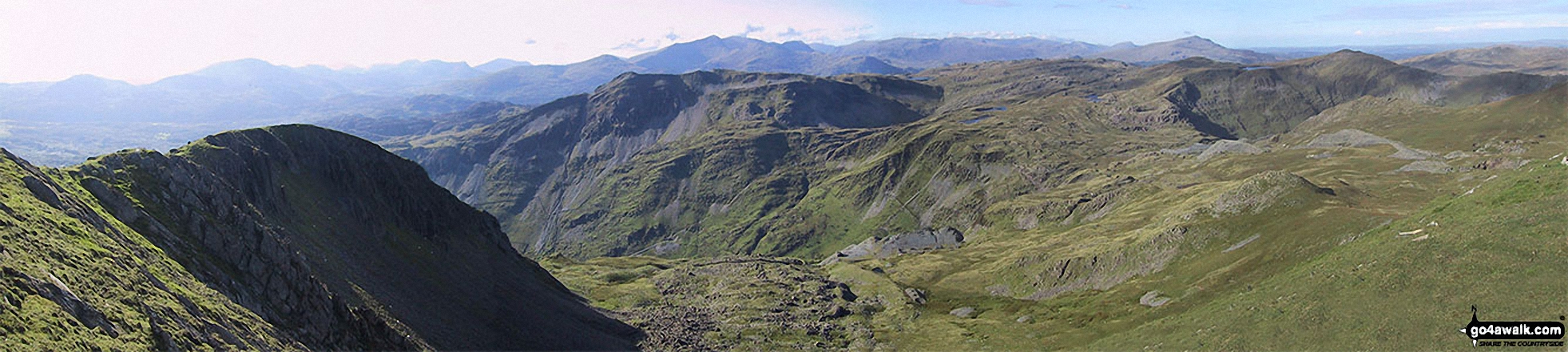
The north-west ridge of Molewyn Mawr (left) with Cnicht, Cnicht (North Top) and Ysgafell Wen (far right) across Cwm Croesor and Clogwyn Brith from the summit of Moelwyn Mawr
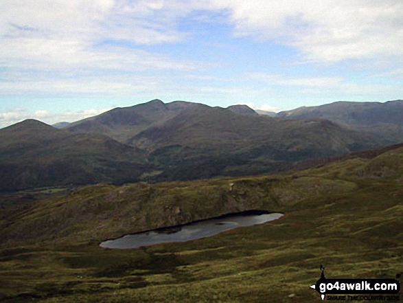
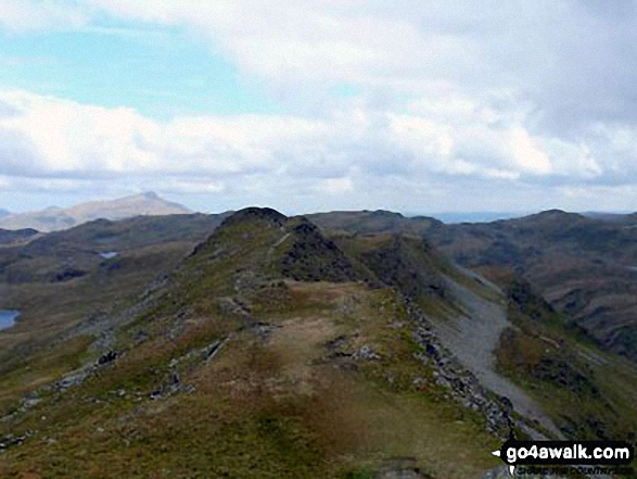
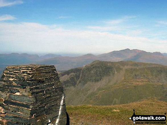
Llyn y Biswail with Snowdon (Yr Wyddfa) in the distance from the summit of Cnicht (North Top)
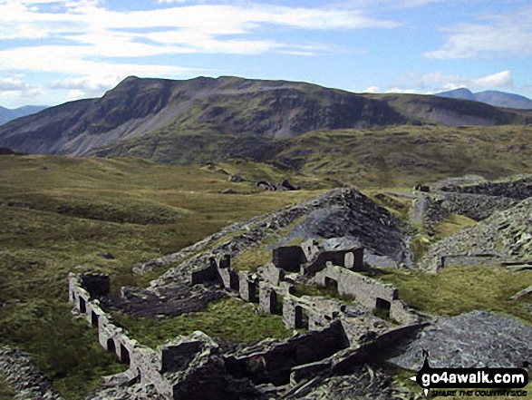
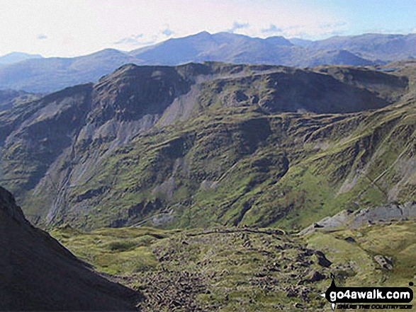
Cnicht and Cnicht (North Top) across Cwm Croesor from the summit of Moelwyn Mawr
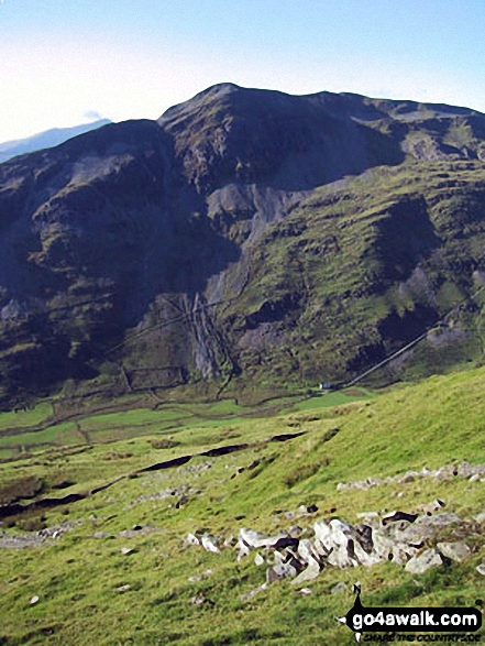
Cnicht (centre) and Cnicht (North Top) (right) from the lower slopes of Moelwyn Bach
Cnicht and Cnicht (North Top) with The Snowdon Range beyond from Moelwyn Mawr
Send us your photographs and pictures on, of, or from Cnicht (North Top)
If you would like to add your walk photographs and pictures featuring views from, on or of Cnicht (North Top) to this page, please send them as email attachments (configured for any computer) along with your name to:
and we shall do our best to publish them.
(Guide Resolution = 300dpi. At least = 660pixels (wide) x 440 pixels (high).)

You can also submit photos via our Facebook Page.
NB. Please indicate where each photo was taken and whether you wish us to credit your photos with a Username or your First Name/Last Name.
Not familiar with this top?


