
![]()
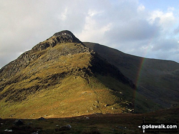
Craigysgafn
689m (2263ft)
The Moelwyns, Snowdonia, Gwynedd, Wales
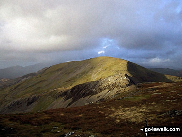
Craigysgafn means 'Pile of Rocks' in Welsh.
Not familiar with this top?
   |
|---|
Vital Statistics:
| Length: | 6.20ml (10.5km) |
|---|---|
| Ascent: | 2,691ft (820m) |
| Time: | 5 hrs |
| Grade: |  (Moderate) (Moderate) |
Route Summary:
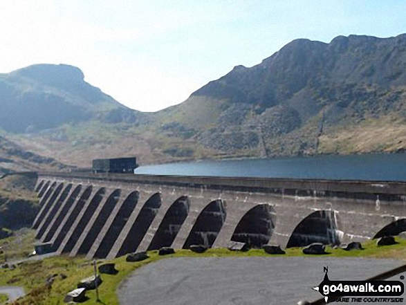
Tanygrisiau - Moel-yr-hydd - Rhosydd Quarry - Moelwyn Mawr (North Ridge Top) - Moelwyn Mawr - Craigysgafn - Bwlch Stwlan - Moelwyn Bach - Llyn Stwlan - Stwlan Dam - Tanygrisiau
|
|---|
Vital Statistics:
| Length: | 8.25ml (13km) |
|---|---|
| Ascent: | 3,037ft (926m) |
| Time: | 6 hrs |
| Grade: | (Moderate) |
Route Summary:
Croesor - Rhosydd Quarry - Bwlch y Rhosydd - Clogwyn Brith - Moel-yr-hydd - Moelwyn Mawr (North Ridge Top) - Moelwyn Mawr - Craigysgafn - Bwlch Stwlan - Moelwyn Bach - Croesor
|
|---|
Vital Statistics:
| Length: | 10ml (16km) |
|---|---|
| Ascent: | 3,923ft (1,196m) |
| Time: | 7½ hrs |
| Grade: |  (Hard) (Hard) |
Route Summary:
Croesor - Croesor Bach - Cnicht - Cnicht (North Top) - Llyn Yr Adar - Afon Cwm-y-foel - Llyn Cwm-corsiog - Clogwyn Birth - Rhosydd Quarry - Moel-yr-hydd - Moelwyn Mawr (North Ridge Top) - Moelwyn Mawr - Craigysgafn - Bwlch Stwlan - Moelwyn Bach - Croesor
See Craigysgafn and the surrounding tops on our free-to-access 'Google Style' Peak Bagging Maps:
The Moelwyns area of Snowdonia National Park
Less data - quicker to download
The Whole of Snowdonia National Park
More data - might take a little longer to download
See Craigysgafn and the surrounding tops on our downloadable Peak Bagging Map in PDF format:

NB: Whether you print off a copy or download it to your phone, this PDF Peak Baggers' Map might prove incredibly useful when your are up there on the tops and you cannot get a phone signal.
You can find Craigysgafn & all the walks that climb it on these unique free-to-access Interactive Walk Planning Maps:
1:25,000 scale OS Explorer Map (orange/yellow covers):
1:50,000 scale OS Landranger Map (pink/magenta covers):
 Fellow go4awalkers who have already walked, climbed, summited & bagged Craigysgafn
Stephanie Doyle walked up Craigysgafn on June 21st, 2025 [from/via/route] Stwlan dam [with] Friend [weather] Fine - Great views
Christina Lander climbed Craigysgafn on April 18th, 2018 [from/via/route] Croesor - Cnicht - Moelwyn Mawr - Craigysgafn - Moelwyn Bach - Croesor [with] Dick [weather] Sunny day
Melfyn Parry bagged Craigysgafn on April 17th, 2022 [from/via/route] Started from the car park in Tanygrisiau, walked up to Llyn Cwmorthin before working our way through the old quarry workings at Rhosydd. Followed well defined path to summit of Moelwyn Mawr, then retraced route back a little before dropping down path to then ascend Craig Ysgafn. Lunch at this spot overlooking the Stwlan reservoir before continuing up to summit of Moelwyn Bach. Retraces steps to saddle & then dropped to path to walk along contour of Moelwyn Mawr before ascending path to Moel yr Hudd. Dropped from here to tarmac path & returned to car park. [with] PRC [weather] Bright sunny day, mostly warm. Slightly cooler at altitude.
Andy Buxton hiked Craigysgafn during August, 1965 [from/via/route] Croesor circuit with Moelwyns [with] Dad
Mark Davidson summited Craigysgafn on August 20th, 2002 [with] Alone [weather] Sunny & warm with good views
Vince Wetton conquered Craigysgafn on May 8th, 2013 [from/via/route] Moel-yr-hydd [with] RTM
Robert Taylor-Marriott scaled Craigysgafn on May 8th, 2013 [from/via/route] Route 51: Moel yr Hydd. Moelwyn Mawr NRT.Moelwyn Mawr. Craigysgafn. Moelwyn Bach (MMMB) Completed 08.05.13 [with] Vince Wetton & Robert Taylor-Marriott [weather] Very Fair.
Kath Edwards walked up Craigysgafn on March 10th, 2012 [weather] very poor visability.
Gerald Murphy climbed Craigysgafn on March 29th, 2012 [from/via/route] See walk to Moelwyn Mawr & Moelwyn Bach [with] alone - The views across the Stwlan Dam are beautiful. The descent into Bwlch Stwlan is quite steep but it gives a clear view across to the diagonal scree path you need to follow up Moelwyn Bach.
Paul Booth and Trevor Williams have both walked, climbed & bagged Craigysgafn.
To add (or remove) your name and experiences on this page - Log On and edit your Personal Mountain Bagging Record
More Photographs & Pictures of views from, on or of Craigysgafn
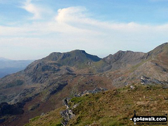
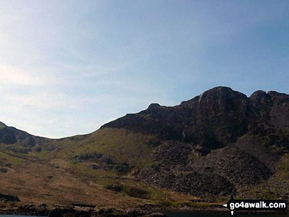
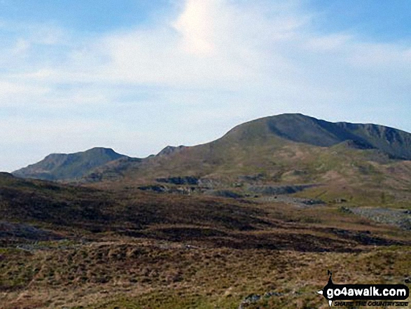
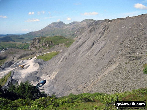
Moelwyn Bach, Bwlch Stwlan, Craigysgafn and Moelwyn Mawr from near Rhosydd Quarry
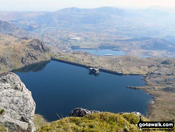
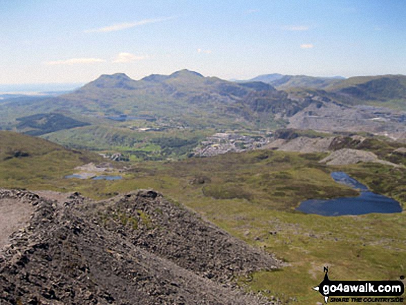
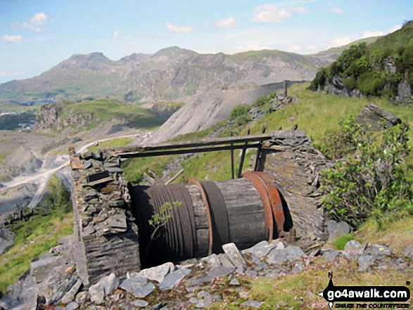
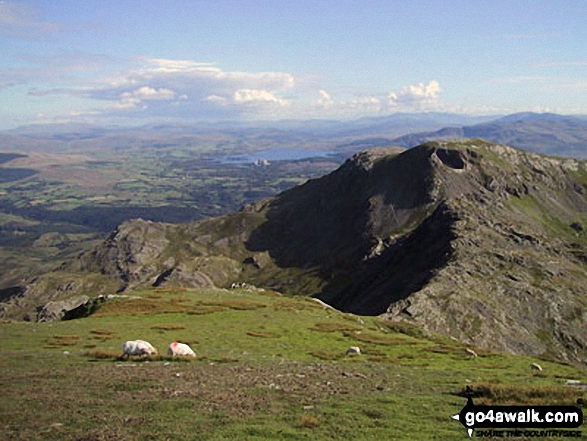
Moel-yr-hydd, Llyn Stwlan, Tanygisiau Dam and Blaenau Ffestiniog from Craigysgafn
Moelwyn Bach, Craigysgafn and Moelwyn Mawr beyond the water leat on Moel Bowydd
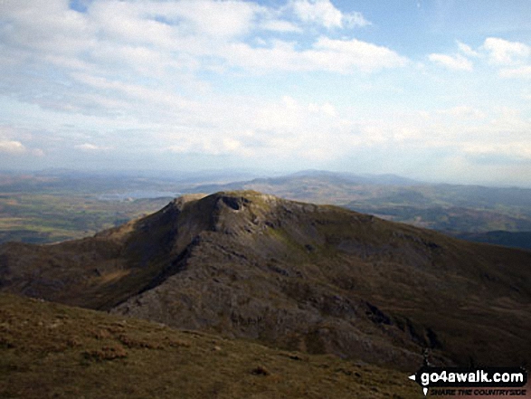
Moelwyn Bach, Craigysgafn, Moelwyn Mawr, Allt-fawr and Moel Druman from Manod Mawr (North Top) summit
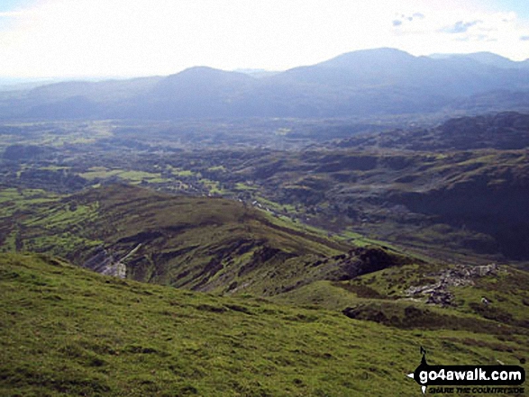
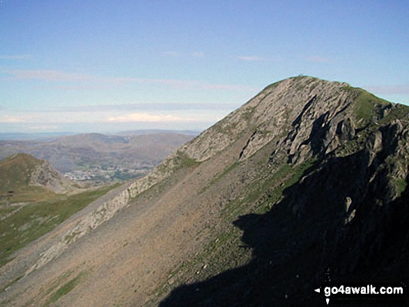
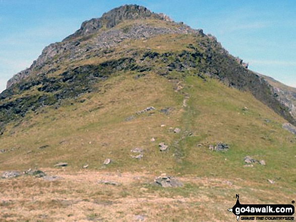
Croseor with The Moel Hebog mountains beyond from the summit of Craigysgafn
The Moelwyns - Moelwyn Bach, Craigysgafn & Moelwyn Mawr, Allt-fawr, Moel Druman & Ysgafell Wen from Moel Penamnen
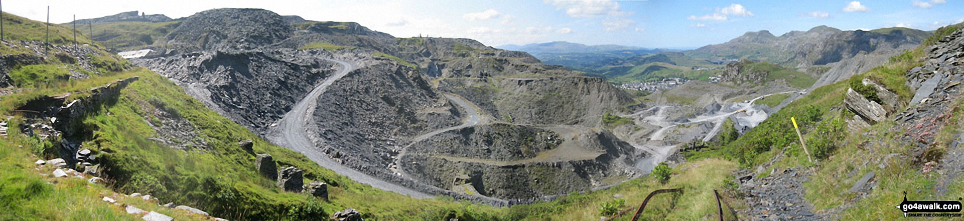
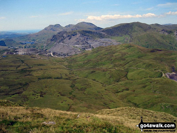
Maen-offeren Quarry from Drum House at the top of a disused incline with Arenig Fawr & Arenig Fach (on the horizon) and Moelwyn Bach, Craigysgafn and Moelwyn Mawr (mid-distance right)
Moelwyn Bach, Craigysgafn and Moelwyn Mawr from Drum House at the top of a disused incline in Maen-offeren Quarry
Moelwyn Bach, Bwlch Stwlan, Craigysgafn, Moelwyn Mawr and Moelwyn Mawr (North Ridge Top) (far right) from the col below Moel-yr-hydd
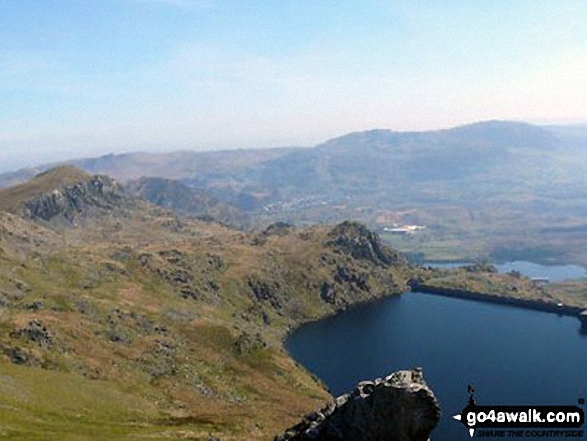
Moel-yr-hydd, Llyn Stwlan, Tanygisiau Dam and Blaenau Ffestiniog from Craigysgafn
Moelwyn Bach, Craigysgafn and Moelwyn Mawr from Maen-offeren Quarry, Blaenau Ffestiniog

360 degree view from Moel Penamnen summit featuring (from left to right): The Moelwyns - Moelwyn Bach, Craigysgafn & Moelwyn Mawr, Allt-fawr, Moel Druman & Ysgafell Wen, Moel Farlwyd (foreground above/left of blue lake), Yr Aran (pointed peak above Moel Farlwyd), Mount Snowdon (Yr Wyddfa) & Y Lliwedd, The Glyderau - Glyder Fach, Glyder Fawr & Tryfan, Carnedd Moel Siabod, Y Ro Wen, Foel-fras (Moelwyns), Manod Mawr (above two light blue lakes) and The Arenigs - Arenig Fawr & Arenig Fach.
. . . see all 22 walk photographs & pictures of views from, on or of Craigysgafn
Send us your photographs and pictures on, of, or from Craigysgafn
If you would like to add your walk photographs and pictures featuring views from, on or of Craigysgafn to this page, please send them as email attachments (configured for any computer) along with your name to:
and we shall do our best to publish them.
(Guide Resolution = 300dpi. At least = 660pixels (wide) x 440 pixels (high).)

You can also submit photos via our Facebook Page.
NB. Please indicate where each photo was taken and whether you wish us to credit your photos with a Username or your First Name/Last Name.
Not familiar with this top?


