
![]()
Rhinog Fach
712m (2337ft)
The Rhinogs, Snowdonia, Gwynedd, Wales
Rhinog Fach was promoted to Marilyn status in August, 2021
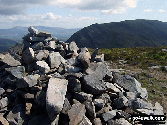
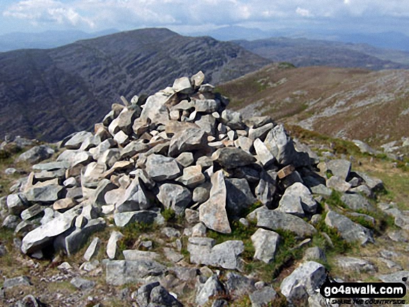
The summit of Rhinog Fach is marked by a cairn..
Not familiar with this top?
   |
|---|
Vital Statistics:
| Length: | 12mls (19km) |
|---|---|
| Ascent: | 4,723ft (1,439m) |
| Time: | 9.25hrs |
| Grade: |  (Hard) (Hard) |
Route Summary:
Maes-y-garnedd - Nantcol - Rhinog Fawr - Bwlch Drws-Ardudwy - Rhinog Fach - Llyn Hywel - Y Llethr - Crib-y-rhiw - Diffwys - Diffwys (West Top) - Llyn Bodlyn - Cil-cychwyn - Pont Cerrig - Afon Cwmnantcol - Cwm Nantcol - Maes-y-garnedd
See Rhinog Fach and the surrounding tops on our free-to-access 'Google Style' Peak Bagging Maps:
The Rhinogs of Snowdonia National Park
Less data - quicker to download
The Whole of Snowdonia National Park
More data - might take a little longer to download
See Rhinog Fach and the surrounding tops on our downloadable Peak Bagging Map in PDF format:

NB: Whether you print off a copy or download it to your phone, this PDF Peak Baggers' Map might prove incredibly useful when your are up there on the tops and you cannot get a phone signal.
You can find Rhinog Fach & all the walks that climb it on these unique free-to-access Interactive Walk Planning Maps:
1:25,000 scale OS Explorer Map (orange/yellow covers):
1:50,000 scale OS Landranger Map (pink/magenta covers):
 Fellow go4awalkers who have already walked, climbed, summited & bagged Rhinog Fach
Christina Lander walked up Rhinog Fach on June 3rd, 2023 [from/via/route] Maes-y-Garnedd, Cwm Nantcol - Bwlch Drws Ardudwy - Rhinog Fawr - Bwlch Drws Ardudwy - Rhinog Fach - Llyn Hywel - Maes-y-Garnedd [with] Dick, Suzie & Peggy [weather] Hot & sunny
Melfyn Parry climbed Rhinog Fach on May 17th, 2023 [from/via/route] Started walk from the car park at Maes y Garnedd at 08:45 & followed the route as described on GW159. Notes were generally very good. Path was not easy to follow down from Rhinog Fawr but eventually reached Bwlch Drws Ardudwy & struggled again to find the start of the path up Rhinog Fach, once found it was easy to follow to the summit although it was a hard slog. Once at the top navigation was straightforward to Llyn Hywel albeit quite slow progress due to the nature of the path. Another slog up to Llethr but easy path to follow. From Llethr the grassy path was much easier to make quicker progress & the next three tops (Crib y Rhiw, Diffwys & Diffwys West Top) were reached without difficulty. I decided to go down to Port Scethin & take the bridle path back but this was a mistake as the bridle path as shown on the OS didn't exist. It was hard going through reed beds, boggy land & clumps of heather & bilberry bushes to get back to the path leading back to the carpark, only seeing the bridle path for the final 400m or so. [with] On my own [weather] Sunny spells & quite warm at times especially on uphill sections when in lea of the breeze. On the tops the breeze was chilly. - Stunning views in all directions. Well worth the effort but the ascents are quite hard work, not for the faint hearted.
Mark Davidson bagged Rhinog Fach on June 2nd, 2010 [from/via/route] Walk gw159 Rhinog Fawr, Rhinog Fach, Y Llethr & Diffwys from Cwm Nantcol [with] Alone [weather] Bright & sunny - perfect walking conditions
Donovan Suddell hiked Rhinog Fach on April 16th, 2021 [from/via/route] BontDdu [with] alone [weather] Sunny & clear.
Andy Buxton summited Rhinog Fach on June 20th, 1968 [from/via/route] Roman Steps [with] BVGS [weather] Sunny/showers - Training for 14 Peaks (we reckoned that the 14 Peaks were good training for the Rhinogs!)
Patrick Rogozinski, Mike Harris, Linda Mckeogh, Paul Booth and Trevor Williams have all walked, climbed & bagged Rhinog Fach.
To add (or remove) your name and experiences on this page - Log On and edit your Personal Mountain Bagging Record
More Photographs & Pictures of views from, on or of Rhinog Fach
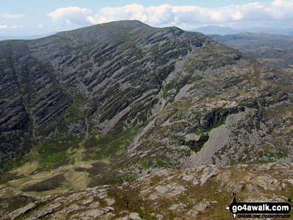
Rhinog Fach and Y Llethr with Bwlch Drws-Ardudwy below from Rhinog Fawr
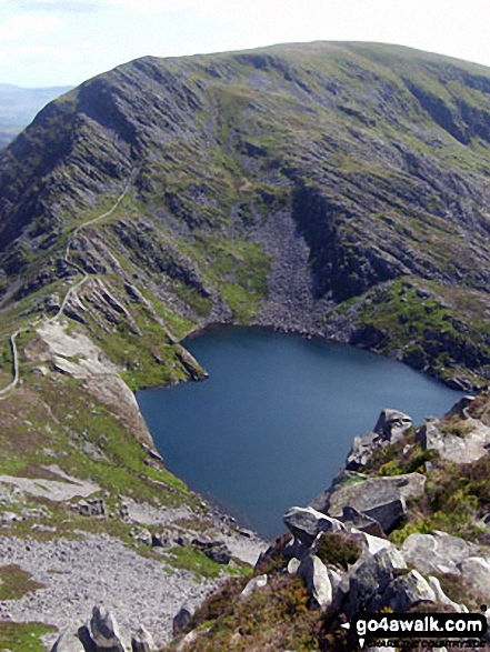
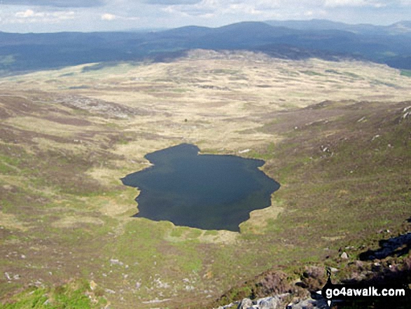
Llyn Hywel below Y Llethr with Cadair Idris (in the distance centre left), Moelfre (Rhinogs) (in the distance centre right) and Cwm Nantcol from the summit of Rhinog Fach

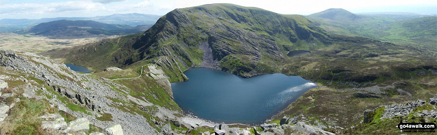
360 panorama from the summit of Rhinog Fach featuring: Rhinog Fach. Cadair Idris (in the distance), Y Llethr, Moelfre (Rhinogs), Cwm Nantcol and Rhinog Fach
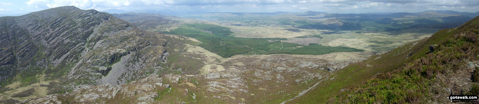
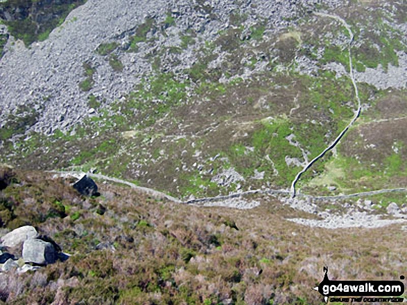
Rhinog Fawr and Northern Snowdonia from the cairn on the north end of the Rhinog Fach ridge
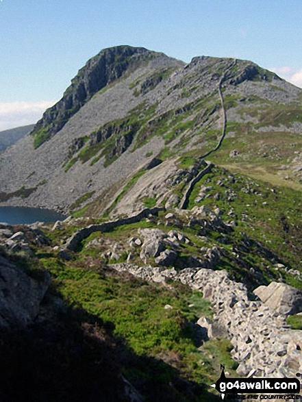
Rhinog Fawr towers above Bwlch Drws-Ardudwy from the cairn on the North end of the Rhinog Fach ridge
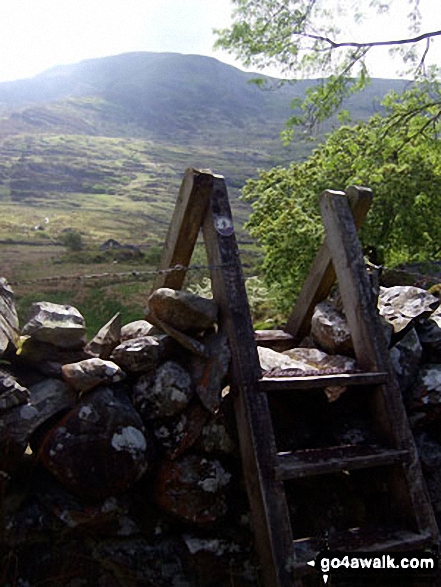
Looking down to Bwlch Drws-Ardudwy after the very steep section on the North Face of Rhinog Fach
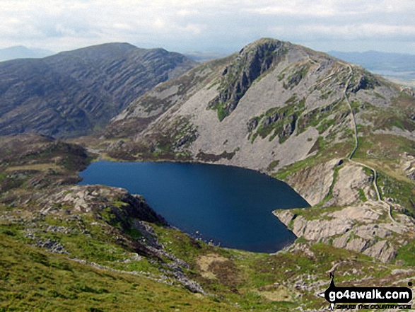
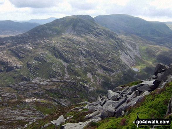
Rhinog Fawr (centre left) and Rhinog Fach (centre right) and Llyn Hywel from Y Llethr
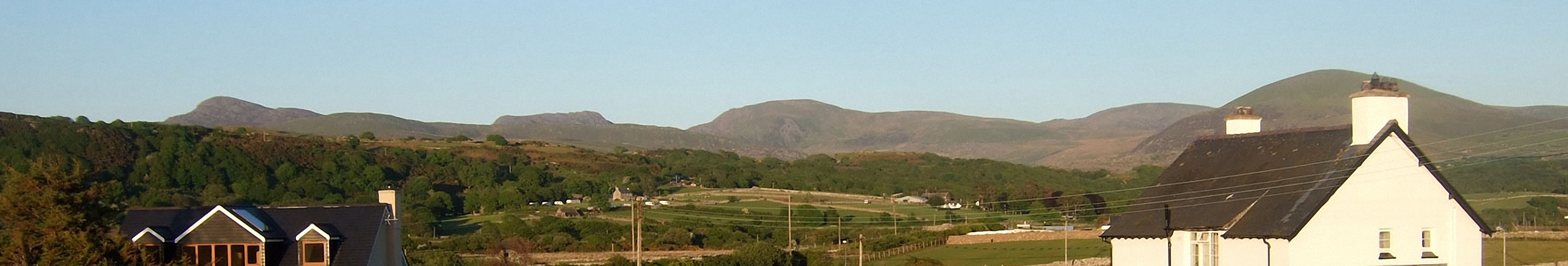
The Rhinogs featuring (left to right): Rhinog Fawr, Rhinog Fach, Y Llethr, Diffwys and Moelfre (Rhinogs) (behind the house) from Llandanwg
Send us your photographs and pictures on, of, or from Rhinog Fach
If you would like to add your walk photographs and pictures featuring views from, on or of Rhinog Fach to this page, please send them as email attachments (configured for any computer) along with your name to:
and we shall do our best to publish them.
(Guide Resolution = 300dpi. At least = 660pixels (wide) x 440 pixels (high).)

You can also submit photos via our Facebook Page.
NB. Please indicate where each photo was taken and whether you wish us to credit your photos with a Username or your First Name/Last Name.
Not familiar with this top?


