
![]()
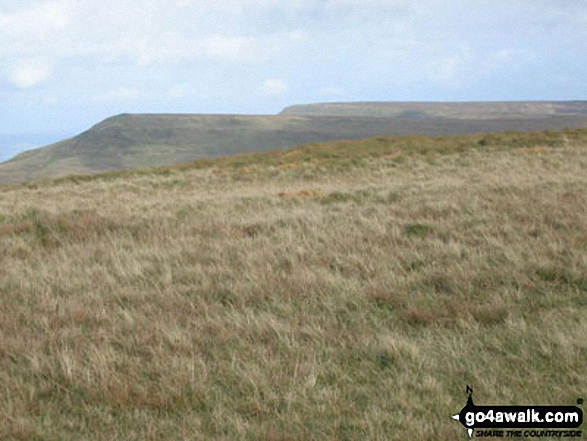
Rhos Dirion
713m (2340ft)
The Black Mountains, The Brecon Beacons, Powys, Wales
Rhos Dirion means 'Gentle Moor' in Welsh and is pronounced 'ross deer-ree-on'.
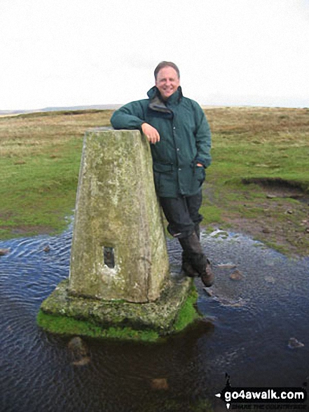
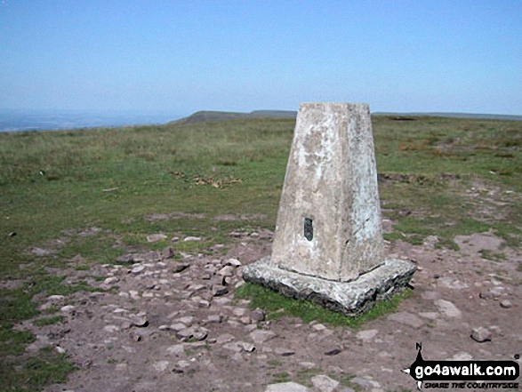
The summit of Rhos Dirion is marked by an Ordnance Survey Trig Point.
Not familiar with this top?
   |
|---|
Vital Statistics:
| Length: | 7.75ml (12.5km) |
|---|---|
| Ascent: | 1,942ft (592m) |
| Time: | 4.75hrs |
| Grade: |  (Moderate) (Moderate) |
Route Summary:
Pen y Beacon Stone Circle - The Offa's Dyke Path - Hay Bluff - Fynnon y Parc - Gospel Pass - Twmpa (Lord Hereford's Knob) - Rhiw y Fan - Rhos Dirion - Rhiw Wen - Caemarchog - Three Rivers Ride - Pen y Beacon Stone Circle
|
|---|
Vital Statistics:
| Length: | 10.25ml (16.5km) |
|---|---|
| Ascent: | 2,093ft (638m) |
| Time: | 5.75hrs |
| Grade: |  (Moderate) (Moderate) |
Route Summary:
Capel-y-ffin - Chwarel y Fan - Blacksmith's Anvil (stone) Twyn Talycefn - Rhos Dirion - Rhiw y Fan - Twmpa (Lord Hereford's Knob) - Darren Lwyd - Capel-y-ffin
|
|---|
Vital Statistics:
| Length: | 14ml (22.5km) |
|---|---|
| Ascent: | 2,808ft (856m) |
| Time: | 8 hrs |
| Grade: |  (Hard) (Hard) |
Route Summary:
Capel-y-ffin - The Offa's Dyke Path - Black Mountain (South Top) - Black Mountain - Hay Bluff - Gospel Pass - Twmpa (Lord Hereford's Knob) - Rhiw y Fan - Rhos Dirion - Twyn Talycefn - Blacksmith's Anvil - Chwarel y Fan - Capel-y-ffin
See Rhos Dirion and the surrounding tops on our free-to-access 'Google Style' Peak Bagging Maps:
The Black Mountains Area of Bannau Brycheiniog (The Brecon Beacons National Park)
Less data - quicker to download
The Whole of Bannau Brycheiniog (The Brecon Beacons National Park)
More data - might take a little longer to download
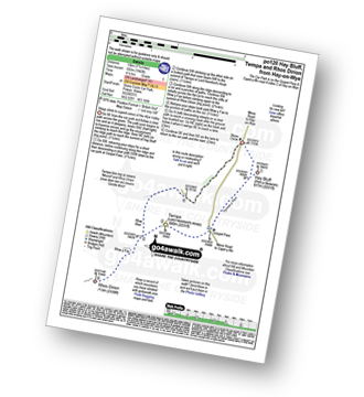
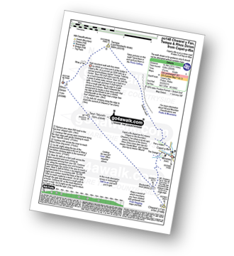
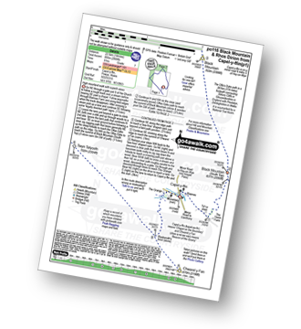
See Rhos Dirion and the surrounding tops on our downloadable Peak Bagging Map in PDF format:

NB: Whether you print off a copy or download it to your phone, this PDF Peak Baggers' Map might prove incredibly useful when your are up there on the tops and you cannot get a phone signal.
You can find Rhos Dirion & all the walks that climb it on these unique free-to-access Interactive Walk Planning Maps:
1:25,000 scale OS Explorer Map (orange/yellow covers):
1:50,000 scale OS Landranger Map (pink/magenta covers):
 Fellow go4awalkers who have already walked, climbed, summited & bagged Rhos Dirion
Craig Barrell walked up Rhos Dirion on August 25th, 2025 [with] solo [weather] sunny
Melfyn Parry climbed Rhos Dirion on April 9th, 2025 [from/via/route] Started walk from minor road at Capel y Ffin, followed route as described on PO116 Routs ascends to summit of Black Mountain (south top) which is also on the Offa's Dyke Path, then continues to Black Mountain. Path drops down before gently climbing to Hay Bluff & then a lovely walk along the ridge to drop down to Gospel Pass. Cross the road & continue on to Twmpa (here by lunchtime). Easy walking over to Rhos Dirion before turning sharp left to walk a long way to Chwarel y Fan. [with] On my own [weather] It was a lovely day. Breezy & cool at times & mostly sunny. - Excellent views in all directions. Lots of people around Hay Bluff & Twmpa but otherwise had the hills to myself.
Paul Roddam bagged Rhos Dirion on January 14th, 2024 [from/via/route] Hay Bluff car park [with] Mig [weather] Sunny!
Mark Davidson hiked Rhos Dirion on July 14th, 2003 [from/via/route] Walk po116 Black Mountain & Rhos Dirion from Capel-y-ffin [with] Theresa [weather] Warm & sunny - really good walking weather
Sion Britton summited Rhos Dirion on December 19th, 2021 [from/via/route] O Maes Parcio Gospel Pass. [with] Solo [weather] Clir/ Oer
Chris Hughes conquered Rhos Dirion on May 1st, 2021 [from/via/route] Gospel pass [weather] Sunny
Tom Bond scaled Rhos Dirion on April 30th, 2021 [from/via/route] Circular route from Blaen-y-Cwm car park. [with] Scott Gibbons - First wild camp & maiden voyage of MSR Elixir 2. Camped north west of Grwyne Fawr reservoir, next to the stream, after summiting Rhos Dirion.
Robert Shaw walked up Rhos Dirion on May 13th, 2017 [from/via/route] From Llanthony whilst doing the Black Mountain Challenge. [with] Alcester Gents Sports Club [weather] Wet & misty
Christina Lander climbed Rhos Dirion on March 18th, 2015 [from/via/route] Capel-y-ffin - Black Mountain (South Top) - Black Mountain - Hay Bluff - Gospel Pass - Twmpa - Rhos Dirion - Twyn Talycefn - Chwarel y Fan - Capel-y-ffin [with] Dick [weather] Dry with sunny spells
David Price bagged Rhos Dirion on November 5th, 2013 [from/via/route] Grwyne Fawr Reservoir [with] Solo
Vince Wetton hiked Rhos Dirion on October 10th, 2014 [from/via/route] Po116 [with] RTM [weather] Sunny with showers - Long but satisfying walk
Robert Taylor-Marriott summited Rhos Dirion on October 10th, 2014 [from/via/route] Route 63: South Top, Black Mountain, Twmpa, Rhos Dirion, Chwarel y Fan (CB). [with] Vince Wetton and Robert Taylor-Marriott. [weather] Sunny, cloudy & light rain.
Tim Buckley conquered Rhos Dirion on September 14th, 2013 [from/via/route] po116 Black Mountain & Rhos Dirion circular walk. [with] Solo walk. [weather] Sunny spells & cold wind. - Arrived at 10.38 having set off from Gospel Pass at 9.45am via Twmpa.
David Lane scaled Rhos Dirion on August 14th, 2008 [with] Kelly
Steve Gilmore walked up Rhos Dirion on November 17th, 2012 [from/via/route] from Cappel y ffin via Chwarel Y fan [with] Mark Gilmour & Steve Taylor
Elen Newcombe-ling, Jonathan Morris, Michael Rygol, Paul Booth, Trevor Williams, Matthew Thomas, Richard Penney and Ray O'hara have all walked, climbed & bagged Rhos Dirion.
To add (or remove) your name and experiences on this page - Log On and edit your Personal Mountain Bagging Record
. . . [see less walk reports]
More Photographs & Pictures of views from, on or of Rhos Dirion
Send us your photographs and pictures on, of, or from Rhos Dirion
If you would like to add your walk photographs and pictures featuring views from, on or of Rhos Dirion to this page, please send them as email attachments (configured for any computer) along with your name to:
and we shall do our best to publish them.
(Guide Resolution = 300dpi. At least = 660pixels (wide) x 440 pixels (high).)

You can also submit photos via our Facebook Page.
NB. Please indicate where each photo was taken and whether you wish us to credit your photos with a Username or your First Name/Last Name.
Not familiar with this top?


