
![]()
Langcliffe
440m (1444ft)
The Southern Dales Area, The Yorkshire Dales, North Yorkshire, England
Tap/mouse over a coloured circle (1-3 easy walks, 4-6 moderate walks, 7-9 hard walks) and click to select.
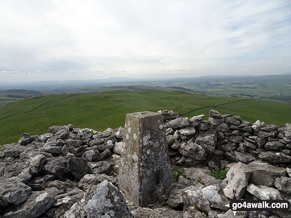
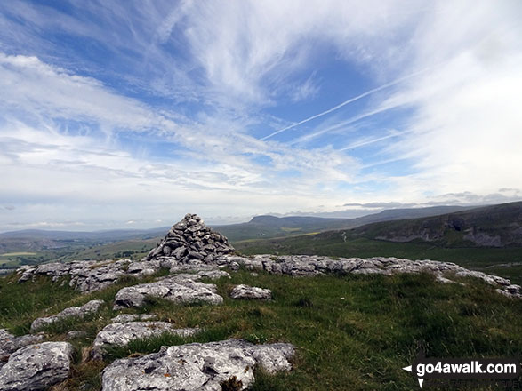
The summit of Langcliffe is marked by an Ordnance Survey Trig Point.
Not familiar with this top?
   |
|---|
Vital Statistics:
| Length: | 8.25ml (13km) |
|---|---|
| Ascent: | 1,279ft (390m) |
| Time: | 4.25hrs |
| Grade: |  (Moderate) (Moderate) |
Route Summary:
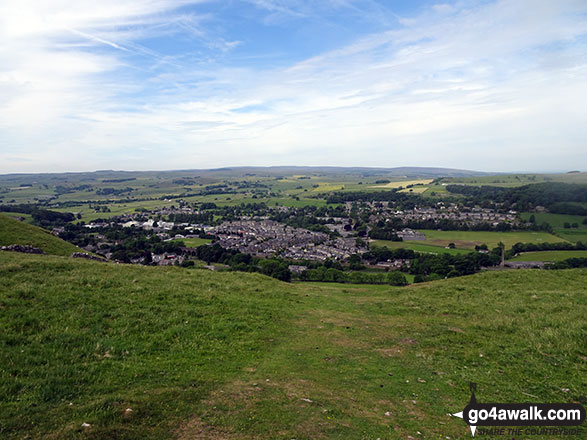
Settle - Constitution Hill - Attermire - Attermire Scar - Victoria Cave - Clay Pits Plantation - Upper Winskill - Catrigg Force (waterfall) - Stainforth - Langcliffe - Settle
See Langcliffe and the surrounding tops on our free-to-access 'Google Style' Peak Bagging Maps:
The Southern Dales Area of The Yorkshire Dales National Park
Less data - quicker to download
The Whole of The Yorkshire Dales National Park
More data - might take a little longer to download
See Langcliffe and the surrounding tops on our downloadable Peak Bagging Map in PDF format:

NB: Whether you print off a copy or download it to your phone, this PDF Peak Baggers' Map might prove incredibly useful when your are up there on the tops and you cannot get a phone signal.
You can find Langcliffe & all the walks that climb it on these unique free-to-access Interactive Walk Planning Maps:
1:25,000 scale OS Explorer Map (orange/yellow covers):
1:50,000 scale OS Landranger Map (pink/magenta covers):
 Fellow go4awalkers who have already walked, climbed, summited & bagged Langcliffe
Christine Shepherd walked up Langcliffe on June 22nd, 2018 [from/via/route] Walked from Settle using walk ny165 [with] On my own [weather] Glorious sunshine with the occasional breeze. - A lovely walk with tremendous views from the summit. Loved the variety on this walk; a summit, caves, a waterfall & a walk through the history of Craven Lime Works.
Patrick Rogozinski has walked, climbed & bagged Langcliffe.
To add (or remove) your name and experiences on this page - Log On and edit your Personal Mountain Bagging Record
More Photographs & Pictures of views from, on or of Langcliffe
Send us your photographs and pictures on, of, or from Langcliffe
If you would like to add your walk photographs and pictures featuring views from, on or of Langcliffe to this page, please send them as email attachments (configured for any computer) along with your name to:
and we shall do our best to publish them.
(Guide Resolution = 300dpi. At least = 660pixels (wide) x 440 pixels (high).)

You can also submit photos via our Facebook Page.
NB. Please indicate where each photo was taken and whether you wish us to credit your photos with a Username or your First Name/Last Name.
Not familiar with this top?


