
![]()
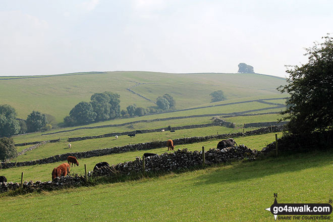
Gratton Moor (Gratton Moor)
304m (997ft)
The White Peak Area, The Peak District, Derbyshire, England
Tap/mouse over a coloured circle (1-3 easy walks, 4-6 moderate walks, 7-9 hard walks) and click to select.
Not familiar with this top?
See Gratton Moor (Gratton Moor) and the surrounding tops on our free-to-access 'Google Style' Peak Bagging Maps:
The White Peak Area of The Peak District National Park
Less data - quicker to download
See Gratton Moor (Gratton Moor) and the surrounding tops on our downloadable Peak Bagging Map in PDF format:

NB: Whether you print off a copy or download it to your phone, this PDF Peak Baggers' Map might prove incredibly useful when your are up there on the tops and you cannot get a phone signal.
You can find Gratton Moor (Gratton Moor) & all the walks that climb it on these unique free-to-access Interactive Walk Planning Maps:
1:25,000 scale OS Explorer Map (orange/yellow covers):
1:50,000 scale OS Landranger Map (pink/magenta covers):
There are no walk reports for Gratton Moor (Gratton Moor) because it is on private land and not accessible to the public
Send us your photographs and pictures on, of, or from Gratton Moor (Gratton Moor)
If you would like to add your walk photographs and pictures featuring views from, on or of Gratton Moor (Gratton Moor) to this page, please send them as email attachments (configured for any computer) along with your name to:
and we shall do our best to publish them.
(Guide Resolution = 300dpi. At least = 660pixels (wide) x 440 pixels (high).)

You can also submit photos via our Facebook Page.
NB. Please indicate where each photo was taken and whether you wish us to credit your photos with a Username or your First Name/Last Name.
Not familiar with this top?


