
![]()
Mynydd Tal-y-mignedd
653m (2143ft)
The Moel Hebog Area, Snowdonia, Gwynedd, Wales
Tap/mouse over a coloured circle (1-3 easy walks, 4-6 moderate walks, 7-9 hard walks) and click to select.
Mynydd Tal-y-mignedd means 'Mountain at the End of the Bog' in Welsh and is pronounced 'minith tal-ee-meeg-neth'.
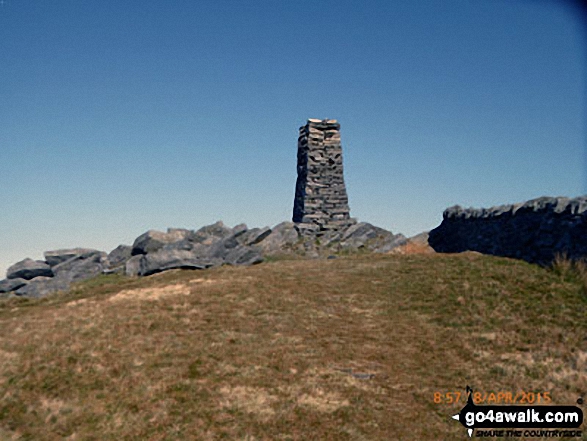
The summit of Mynydd Tal-y-mignedd is marked by a tall stone tower.

Not familiar with this top?
   |
|---|
Vital Statistics:
| Length: | 9.5mls (15.5km) |
|---|---|
| Ascent: | 4,017ft (1,224m) |
| Time: | 7.75hrs |
| Grade: |  (Hard) (Hard) |
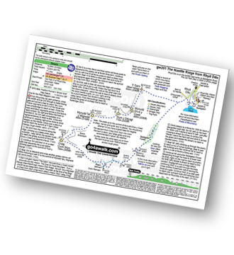
Route Summary:
Rhyd-Ddu - Y Garn (Moel Hebog) - The Nantlle Ridge - Mynydd Drws-y-coed - Trum y Ddysgl - The Hiatus - Mynydd Tal-y-mignedd - Bwlch Dros-bern - Craig Cwm Silyn - Cwm Pennant - Bwlch y Ddwy Elor - Beddgelert Forest - Cwm Marchnad - Llyn-y-Gader - Rhyd-Ddu
|
|---|
Vital Statistics:
| Length: | 11.5ml (18.5km) |
|---|---|
| Ascent: | 4,496ft (1,370m) |
| Time: | 8.75hrs |
| Grade: |  (Hard) (Hard) |
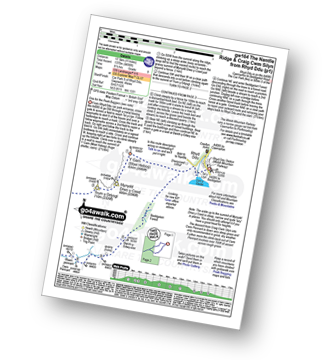
Route Summary:
Rhyd-Ddu - Y Garn (Moel Hebog) - The Nantlle Ridge - Mynydd Drws-y-coed - Trum y Ddysgl - The Hiatus - Mynydd Tal-y-mignedd - Bwlch Dros-bern - Craig Cwm Silyn - Garnedd-goch - Craig Cwm Silyn - Cwm Pennant - Bwlch y Ddwy Elor - Beddgelert Forest - Cwm Marchnad - Llyn-y-Gader - Rhyd-Ddu
See Mynydd Tal-y-mignedd and the surrounding tops on our free-to-access 'Google Style' Peak Bagging Maps:
The Moel Hebog area of Snowdonia National Park
Less data - quicker to download
The Whole of Snowdonia National Park
More data - might take a little longer to download
See Mynydd Tal-y-mignedd and the surrounding tops on our downloadable Peak Bagging Map in PDF format:

NB: Whether you print off a copy or download it to your phone, this PDF Peak Baggers' Map might prove incredibly useful when your are up there on the tops and you cannot get a phone signal.
You can find Mynydd Tal-y-mignedd & all the walks that climb it on these unique free-to-access Interactive Walk Planning Maps:
1:25,000 scale OS Explorer Map (orange/yellow covers):
1:50,000 scale OS Landranger Map (pink/magenta covers):
 Fellow go4awalkers who have already walked, climbed, summited & bagged Mynydd Tal-y-mignedd
Donovan Suddell walked up Mynydd Tal-y-mignedd on May 27th, 2023 [from/via/route] Rhyd Ddu [with] Wife [weather] Beautiful sunny day
Mark Davidson climbed Mynydd Tal-y-mignedd on August 5th, 2003 [from/via/route] Walk gw164 The full Nantlle Ridge & Craig Cwm Silyn from Rhyd-Ddu [with] Alone [weather] Nice & sunny - perfect conditions for top ridge walks in the UK
Melfyn Parry bagged Mynydd Tal-y-mignedd on March 20th, 2019 [from/via/route] Start & finish in lay-by at Rhyd Ddu 566526. Very steep incline to summit of Y Garn, low cloud until above 600m & then came out into sunshine. Great views over to Snowdon to the east & Nantlle & Anglesey to west & north west. Continued on ridge to scramble up Mynydd Drws y Coed, quite challenging in one or two sections. Walking in low cloud again, very wet, with limited visibility. Continued along Trym y Ddysgl & on up to the obelisk on Mynydd Tal y Mignedd. Had lunch in the shelter of a dry stone wall. Descent from here was quite a steep grassy bank crossing over streams & disused inclines. At 540502 the path was not evident & we through bogland & forest to find the forest track at 544498. From there easy route back to start. [with] ChW & CW [weather] Mostly cloudy, short spell of sunshine on Y Garn
Sion Britton hiked Mynydd Tal-y-mignedd on August 2nd, 2020 [from/via/route] Nantlle Ridge Walk. Cerdded o Rhyd-Ddu. [with] Rhiannon [weather] Sunny
Andy Buxton summited Mynydd Tal-y-mignedd during August, 1964 [from/via/route] Nantlle Ridge from Rhyd-Ddu to Nantlle [with] Dad - Amazing cairn!!!
Bleddyn Rhys conquered Mynydd Tal-y-mignedd on August 29th, 2011 [from/via/route] O'r pub yn rhyd ddu i Garn [with] AR ben fy hyn bach [weather] Amrywiol, cymylog a gwlyb weithiau - Wedi gwneud y ridge yma sawl gwaith, gan gynwys un tro gyda Kev ar ol cysgu yn Rhyd Ddu yn 2013 neu 2014 on doedd gennai ddim camera!
Chris Newham scaled Mynydd Tal-y-mignedd on February 18th, 2017 [from/via/route] gw201 [with] Craig [weather] Low cloud - Very steep decent at end the ladder style has gone & a new barbed wire fence installed as a result we had to go all the way down the very steep slope & climb a padlocked gate to get back on track then you have to walk across very boggy ground on a footpath not often used. However despite this a very good walk.
Christina Lander walked up Mynydd Tal-y-mignedd on August 16th, 2016 [from/via/route] Nantlle Ridge Rhyd-Ddu - Y Garth - Mynydd Drws Y Coed - Trum Y Ddysgl - Mynydd Tal Y Mignedd - Craig Cwm Silyn - Garnedd Goch - Mynydd Craig Goch - Llyn Cwm Dulyn - Nebo [with] Dick [weather] Perfect sunny day
Gerald Murphy climbed Mynydd Tal-y-mignedd on April 18th, 2015 [from/via/route] See notes on Craig Cwm Silyn
Stephen Lewis bagged Mynydd Tal-y-mignedd on June 9th, 2013 [from/via/route] Rhyd-Ddu [with] Team Trail [weather] Hot & sunny
Craig Hewison has hiked Mynydd Tal-y-mignedd [from/via/route] From Rhyd-Ddu [with] Annujal Walk [weather] Perfect
Daniel Graham, Louis Smith, Math Llwyd, Linda Mckeogh, Paul Booth, Trevor Williams, Steve Lockett, Andrew Greenhill and Kath Edwards have all walked, climbed & bagged Mynydd Tal-y-mignedd.
To add (or remove) your name and experiences on this page - Log On and edit your Personal Mountain Bagging Record
. . . [see less walk reports]
More Photographs & Pictures of views from, on or of Mynydd Tal-y-mignedd
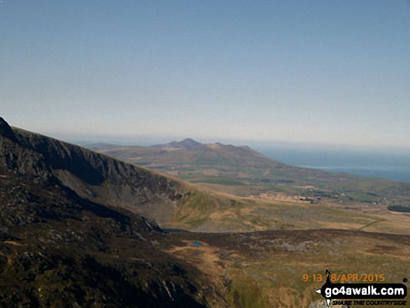
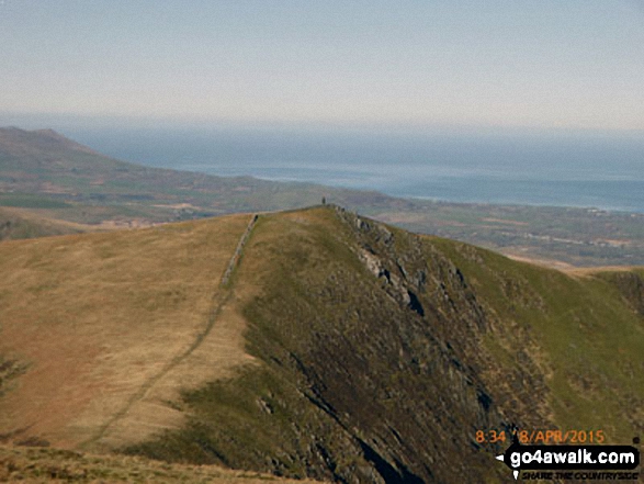
Yr Eifl (The Rivals) on The Llyn peninsula from the summit of Mynydd Tal-y-mignedd
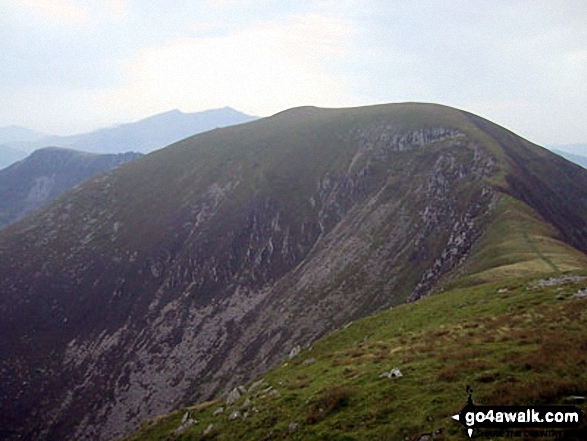
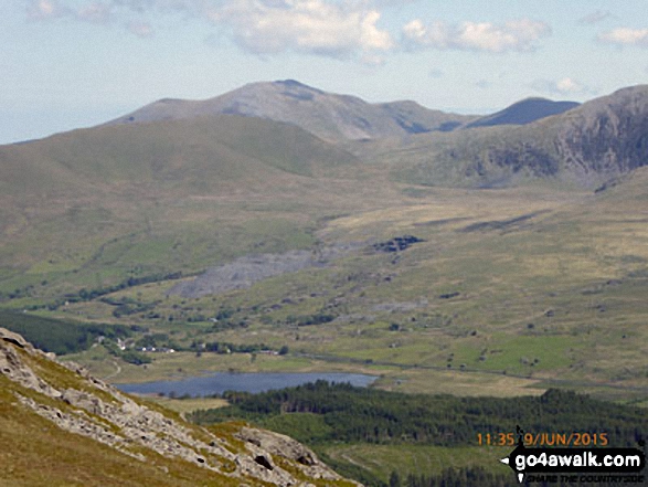
The Nantle Ridge - Mynydd Tal-y-mignedd (front left), The Hiatus (front right), Trum y Ddysgl (right) and Y Garn (Moel Hebog) (centre) from the summit of Craig Cwm Silyn
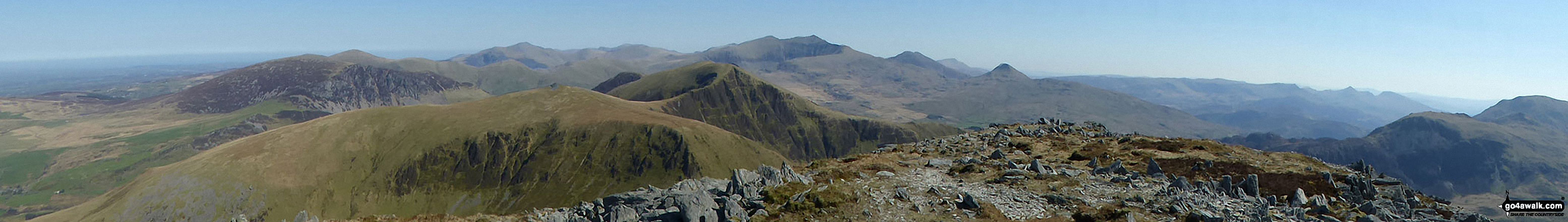
Mynydd Mawr (Llyn Celyn), Craig y Bera, Mynydd Tal-y-mignedd and Mynydd Drws-y-coed from the summit of Craig Cwm Silyn with Garnedd Ugain (Crib y Ddysgl), Snowdon (Yr Wyddfa), Y Lliwedd & Yr Aran on the horizon (centre) and Moel Lefn, Moel yr Ogof & Moel Hebog on the far left
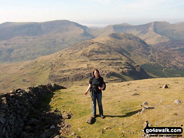
Look! Its me ;-) on Moel Hebog last April with Craig Cwm Silyn (left), Mynydd Tal-y-mignedd (centre right), Trum y Ddysgl (right) on the horizon and Moel Lefn and Moel yr Ogof in the mid-distance

The Nantlle Ridge - Garnedd-goch, Craig Cwm Silyn, Mynydd Tal-y-mignedd, Bwlch Dros-bern, Trum y Ddysgl and Mynydd Drws-y-coed - from Moel Lefn
Mynydd Tal-y-mignedd (centre left) and Craig Cwm Silyn (centre right) from Craig y Bera on Mynydd Mawr (Llyn Cwellyn)
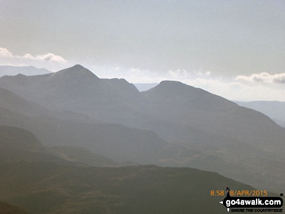
Mynydd Tal-y-mignedd (left) and Mynydd Drws-y-coed with Moel Eilio (right, in the distance) from the cairn on the summit of Moel Yr Ogof
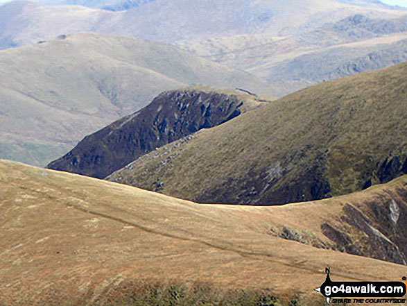
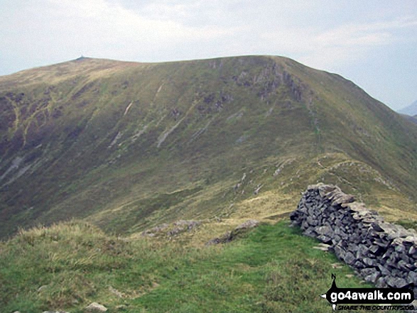
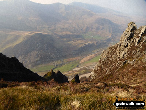
Bwlch Dros-bern and Craig Cwm Silyn - with Gyrn Goch, Bwlch Mawr & Gyrn Ddu (far right) from the summit of Mynydd Tal-y-mignedd
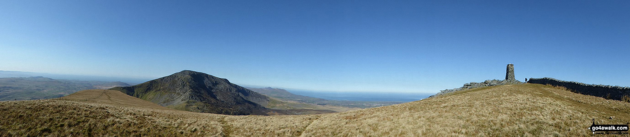
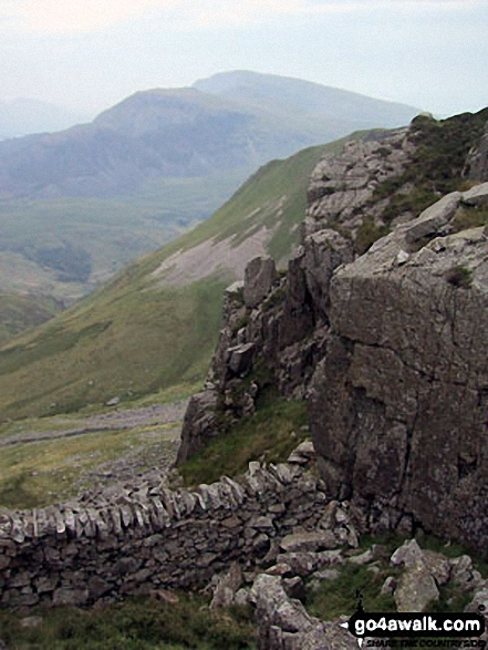
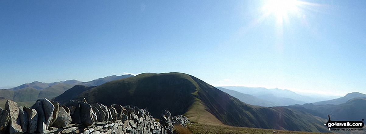
Craig Cwm Silyn (mid-ground) and Yr Eifl (The Rivals) on The Llyn peninsula (in the distance) and The Jubilee Monument Obelisk on the summit of Mynydd Tal-y-mignedd
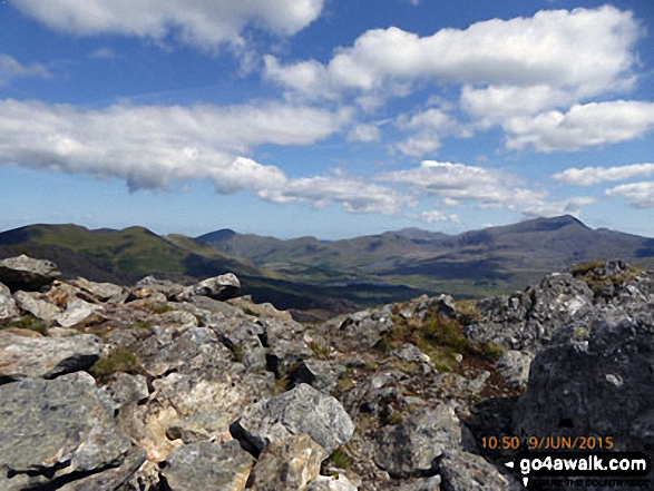
Mynydd Tal-y-mignedd and Mynydd Drws-y-coed (left) with Moel Eilio (in shadow), Foel Gron, Moel Cynghorion and Snowdon (Yr Wyddfa) from the cairn on the summit of Moel Yr Ogof
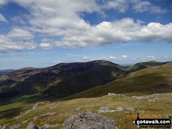
The Nantlle Ridge - Garnedd-goch, Craig Cwm Silyn, Mynydd Tal-y-mignedd, Bwlch Dros-bern and Mynydd Drws-y-coed - from Moel Yr Ogof
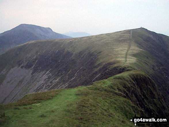
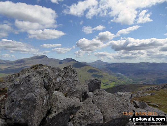
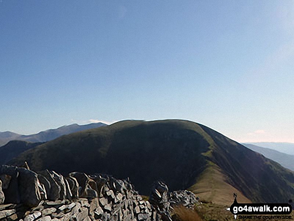
The Moelwyns - Cnicht (left) and Moelwyn Mawr (right) - from Mynydd Tal-y-mignedd
. . . see all 24 walk photographs & pictures of views from, on or of Mynydd Tal-y-mignedd
Send us your photographs and pictures on, of, or from Mynydd Tal-y-mignedd
If you would like to add your walk photographs and pictures featuring views from, on or of Mynydd Tal-y-mignedd to this page, please send them as email attachments (configured for any computer) along with your name to:
and we shall do our best to publish them.
(Guide Resolution = 300dpi. At least = 660pixels (wide) x 440 pixels (high).)

You can also submit photos via our Facebook Page.
NB. Please indicate where each photo was taken and whether you wish us to credit your photos with a Username or your First Name/Last Name.
Not familiar with this top?


