
![]()
Fan Fawr
734m (2409ft)
The Brecon Beacons Area, The Brecon Beacons, Powys, Wales
Tap/mouse over a coloured circle (1-3 easy walks, 4-6 moderate walks, 7-9 hard walks) and click to select.
Fan Fawr means 'Large Beacon' in Welsh and is pronounced 'van-vowr'.
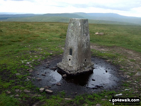
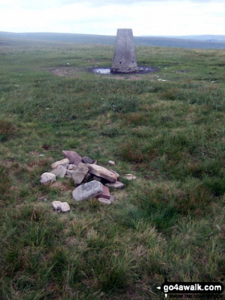
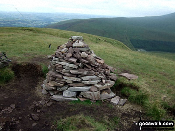
The summit of Fan Fawr is marked by a cairn. Fan Fawr's Ordnance Survey Trig Point lies some 500m SE of the summit.
Not familiar with this top?
   |
|---|
Vital Statistics:
| Length: | 8.25ml (13km) |
|---|---|
| Ascent: | 2,009ft (612m) |
| Time: | 5 hrs |
| Grade: |  (Moderate) (Moderate) |
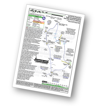
Route Summary:
A470 Nr Llwyn-y-celyn Youth Hostel - Libanus - Twyn Dylluan-ddu - Fan Frynych - Craig Cerrig-gleisiad - Rhos Dringarth - Gorllwn - Fan Fawr - Bryn Du - The Storey Arms Outdoor Centre - The Taff Trail - A470.
|
|---|
Vital Statistics:
| Length: | 9.75ml (15.5km) |
|---|---|
| Ascent: | 2,402ft (732m) |
| Time: | 6 hrs |
| Grade: | (Moderate) |
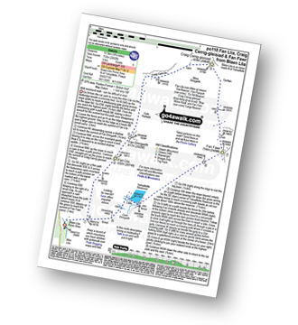
Route Summary:
Blaen Llia Picnic Area - Fan Llia - Fan Dringarth - Cefn Perfedd - Craig Cwm-du - Rhos Dringarth - Craig Cerrig-gleisiad - Gorllwn - Fan Fawr - Ystradfellte Reservoir - Cwm Dringarth - Blaen Llia.
See Fan Fawr and the surrounding tops on our free-to-access 'Google Style' Peak Bagging Maps:
The Brecon Beacons Area of Bannau Brycheiniog (The Brecon Beacons National Park)
Less data - quicker to download
The Whole of Bannau Brycheiniog (The Brecon Beacons National Park)
More data - might take a little longer to download
See Fan Fawr and the surrounding tops on our downloadable Peak Bagging Map in PDF format:

NB: Whether you print off a copy or download it to your phone, this PDF Peak Baggers' Map might prove incredibly useful when your are up there on the tops and you cannot get a phone signal.
You can find Fan Fawr & all the walks that climb it on these unique free-to-access Interactive Walk Planning Maps:
1:25,000 scale OS Explorer Map (orange/yellow covers):
1:50,000 scale OS Landranger Map (pink/magenta covers):
 Fellow go4awalkers who have already walked, climbed, summited & bagged Fan Fawr
Melfyn Parry walked up Fan Fawr on September 12th, 2025 [from/via/route] Followed route PO112 & then rather than tab down the Taffs Trail I headed up to Y Gyrn (to bag another Nuttall) & then rejoined the Taffs Trail lower down to finish the route this extended the walk to 10 miles. [with] On my own [weather] Only one spell of heavy rain otherwise a dry, breezy day.
Alan Smith climbed Fan Fawr on September 24th, 2024 [from/via/route] With Kev from the storey arms. [with] kev [weather] Clear day. Some light rain
Donovan Suddell bagged Fan Fawr on August 27th, 2024 [from/via/route] Libanus [with] solo [weather] Dry, high cloud, clear summits, Gusty
Paul Roddam hiked Fan Fawr on January 21st, 2023 [from/via/route] Pen Y Fan Car Park [with] Solo [weather] Cold, sunny
Helen Howarth summited Fan Fawr on May 31st, 2021 [from/via/route] From Storey Arms [with] Leila x [weather] Warm - Early morning walk
Sion Britton conquered Fan Fawr on November 22nd, 2020 [from/via/route] Fan Llia to Fan Fawr Horseshoe. [weather] Dry, cold & boggy.
Toby Norman scaled Fan Fawr on August 31st, 2020 [with] Woots, Jay, Odette, Sarah, Steve
Iwan Williams walked up Fan Fawr on August 13th, 2019 [from/via/route] Storey Arms
Iain Jones climbed Fan Fawr on July 13th, 2018 [from/via/route] The Storey Arms [with] Stuart Jones & others as part of UFC Survival Weekend - Day 1
Mark Phillips bagged Fan Fawr on January 29th, 2016 [from/via/route] Storey Arms [weather] Pouring rain
To add (or remove) your name and experiences on this page - Log On and edit your Personal Mountain Bagging Record
. . . [see more walk reports]
More Photographs & Pictures of views from, on or of Fan Fawr
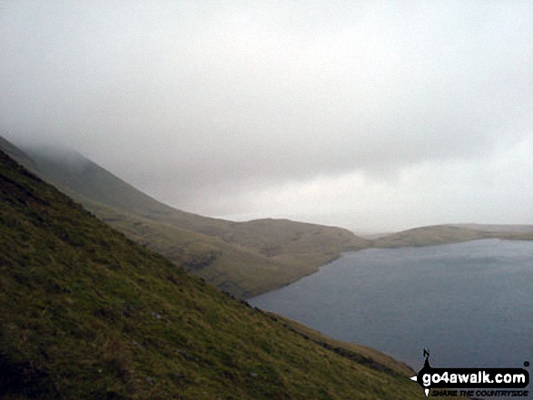
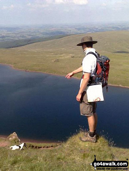
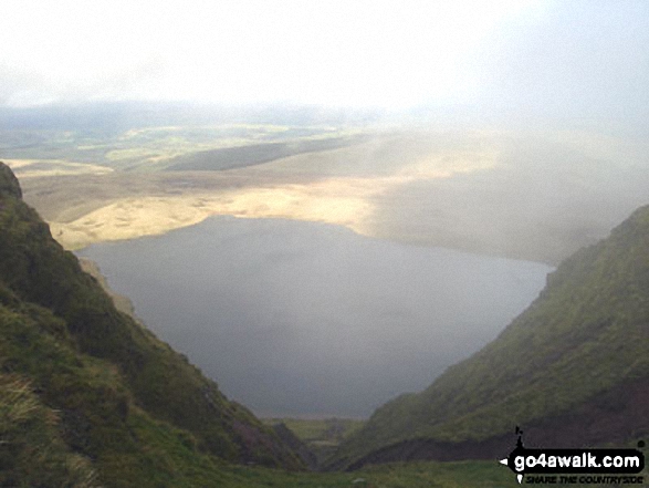
Ralph and our dog Switch enjoying the view of Llyn Y Fan Fawr from Fan Brycheiniog
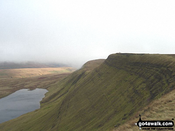
On the Beacons Way above Glyn Tarell near Craig y Fro on the lower slopes of Fan Fawr
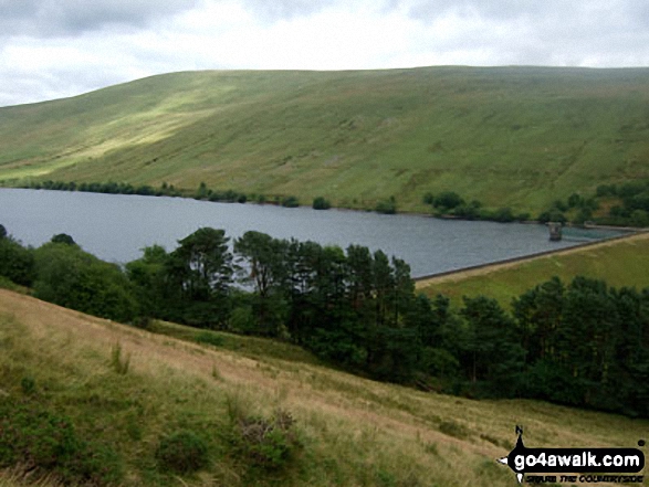
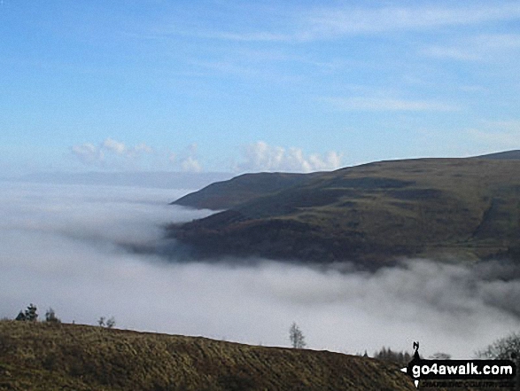
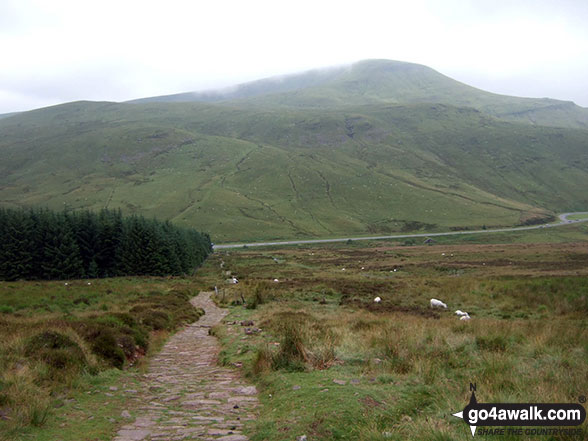
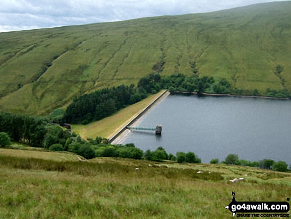
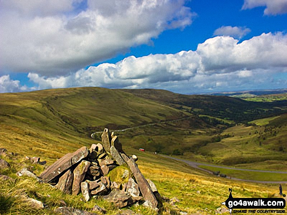
Fan Fawr and Ystradfellte Reservoir from the upper slopes of Cwm Dringarth
Send us your photographs and pictures on, of, or from Fan Fawr
If you would like to add your walk photographs and pictures featuring views from, on or of Fan Fawr to this page, please send them as email attachments (configured for any computer) along with your name to:
and we shall do our best to publish them.
(Guide Resolution = 300dpi. At least = 660pixels (wide) x 440 pixels (high).)

You can also submit photos via our Facebook Page.
NB. Please indicate where each photo was taken and whether you wish us to credit your photos with a Username or your First Name/Last Name.
Not familiar with this top?


