A Google Peak Bagging Map of The Cruachan and Glen Lochy Hills area of Scottish Region 3: Loch Leven to Connel Bridge, Strath of Orchy and Glen Lochy
The Cruachan and Glen Lochy Hills area of Scottish Region 3: Loch Leven to Connel Bridge, Strath of Orchy and Glen Lochy is the area enclosed by an imaginary line connecting:
- Loch Etive to Loch Tulla via Glen Kinglass, Loch Dochard & Abhainn Shira to Loch Tulla to the North
- Loch Tulla to Tyndrum via the A82 to the East
- Tyndrum to Taynuilt via the A85 through Glen Lochy, Dalmally, Loch Awe, The River Awe and The Pass of Brander to the South
- Taynuilt to Glen Kinglass via Loch Etive to the West
If you count only the Grahams there are 5 tops to climb, bag & conquer and the highest point is Meall Garbh (Glen Kinglass) at 701m (2,301ft).
To see these Mountains, Peaks, Tops and Hills displayed in different ways - see the options in the left-hand column and towards the bottom of this page.
![]() Your Personal Bagging Record for The Cruachan and Glen Lochy Hills area of Scottish Region 3: Loch Leven to Connel Bridge, Strath of Orchy and Glen Lochy
Your Personal Bagging Record for The Cruachan and Glen Lochy Hills area of Scottish Region 3: Loch Leven to Connel Bridge, Strath of Orchy and Glen Lochy
LOG ON and RELOAD this page to show which Mountains, Peaks, Tops and Hills you have already climbed, bagged & conquered [. . . more details]
NB. If a Google Map does not appear below, or the icons do not respond, click here to refresh the page. If that doesn't work, try deleting your browser's cache.
Tap/click on each name below (in blue) to locate it's position on the map above.
Mountain, Peak, Top or Hill:
Bagged

![]()
1. Meall Garbh (Glen Kinglass)
701m (2,301ft)
Graham
See more details, photos, trip reports and easy-to-follow walks up Meall Garbh (Glen Kinglass)
![]()
2. Beinn Suidhe
676m (2,219ft)
Graham
See more details, photos, trip reports and easy-to-follow walks up Beinn Suidhe
![]()
3. Meall Tairbh
665m (2,183ft)
Graham
See more details, photos, trip reports and easy-to-follow walks up Meall Tairbh
![]()
4. Beinn Donachain
650m (2,133ft)
Graham
See more details, photos, trip reports and easy-to-follow walks up Beinn Donachain
![]()
5. Beinn na Sroine
636m (2,087ft)
Graham
See more details, photos, trip reports and easy-to-follow walks up Beinn na Sroine
View these 5 Mountains, Peaks, Tops and Hills:
- On a Downloadable PDF you can Print or Save to your Phone#
- On an Interactive Google Map (loads faster)
- On an Interactive Google Map with a list of tops below it.
(makes it easier to locate a particular top) - On a Detailed List in:
Alphabetical Order | Height Order - On one page with 'yet-to-be-bagged' listed 1st & then 'already-bagged' tops listed 2nd in:
Alphabetical Order | Height Order - On one page with 'already-bagged' tops listed 1st & then 'yet-to-be-bagged' tops listed 2nd in:
Alphabetical Order | Height Order
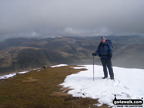 The summit of Ben Cruachan in Loch Leven to Connel Bridge, Strath of Orchy and Glen Lochy
Photo: Clint Trigg
Is there a Mountain, Peak, Top or Hill missing from the above google map or list?
Let us know an we will add it to our database.

To contribute to go4awalk.com or to contact us about anything at all - see Talk To Us.
For help see Help.
go4awalk.com and go4awalk.co.uk are registered trademarks of TMDH Limited.
Copyright © 2000-2025 TMDH Limited. All rights reserved.
Copyright Terms & Conditions Privacy Statement
A - Z Walks Home Log On/Accounts Photo Gallery Walk Ideas and Collections Fell Facts Hill Skills Walking Questions and Answers Your Stories News Competitions Product Reviews/Gear Tests Walking Gear Guides Peaks and Mountains Peak Bagging Find New Walking Friends Camping GPS Waypoints for Walking Contents Walk Search Talk To Us go4awalk.com Help Free Example Walks Newsletter


