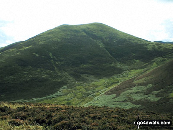
The Moorfoot Hills area of Scottish Region 27: The Scottish Borders - a fully detailed list of all the Mountains, Peaks, Tops and Hills
The Moorfoot Hills area of Scottish Region 27: The Scottish Borders region is the area enclosed by an imaginary line connecting:
- Blyth Bridge to Musselburgh via the A701, Leadburn and Lasswade to the North West
- Musselburgh to Selkirk via the A7, Gorebridge, Stow and Galashiels to the North East
- Selkirk to Blyth Bridge via the River Tweed, A72, Innerleithen and Peebles to the South
If you count only the Marilyns there are 9 tops to climb, bag & conquer and the highest point is Windlestraw Law at 659m (2,163ft).
To see these Mountains, Peaks, Tops and Hills displayed in different ways - see the options in the left-hand column and towards the bottom of this page.
LOG ON and RELOAD this page to show which Mountains, Peaks, Tops and Hills you have already climbed, bagged & conquered [. . . more details]
See this list in: Alphabetical Order
| Height Order‡
To reverse the order select the link again.
Mountain, Peak, Top or Hill:
Bagged
1. Meigle Hill
423m (1,388ft)
Meigle Hill is on interactive maps:
A downloadable go4awalk.com PDF Peak Bagging Map featuring Meigle Hill will be available soon. |
2. Broomy Law
426m (1,398ft)
Broomy Law is on interactive maps:
A downloadable go4awalk.com PDF Peak Bagging Map featuring Broomy Law will be available soon. |
3. White Meldon
427m (1,401ft)
White Meldon is on interactive maps:
A downloadable go4awalk.com PDF Peak Bagging Map featuring White Meldon will be available soon. |
4. Wether Law (Cloich Hills)
479m (1,572ft)
Send it in and we'll publish it here.
Wether Law (Cloich Hills) is on interactive maps:
A downloadable go4awalk.com PDF Peak Bagging Map featuring Wether Law (Cloich Hills) will be available soon. |
5. Penvalla
537m (1,762ft)
Penvalla is on interactive maps:
A downloadable go4awalk.com PDF Peak Bagging Map featuring Penvalla will be available soon. |
6. Trahenna Hill
549m (1,802ft)
Trahenna Hill is on interactive maps:
A downloadable go4awalk.com PDF Peak Bagging Map featuring Trahenna Hill will be available soon. |
7. Pyked Stane Hill (Broughton Heights)
571m (1,873ft)
Send it in and we'll publish it here.
Pyked Stane Hill (Broughton Heights) is on interactive maps:
A downloadable go4awalk.com PDF Peak Bagging Map featuring Pyked Stane Hill (Broughton Heights) will be available soon. |
8. Blackhope Scar
651m (2,137ft)
Blackhope Scar is on interactive maps:
A downloadable go4awalk.com PDF Peak Bagging Map featuring Blackhope Scar will be available soon. |
9. Windlestraw Law
659m (2,163ft)
Windlestraw Law is on interactive maps:
A downloadable go4awalk.com PDF Peak Bagging Map featuring Windlestraw Law will be available soon. |
View these 9 Mountains, Peaks, Tops and Hills:
- On an Interactive Google Map (loads faster)
- On an Interactive Google Map with a list of tops below it.
(makes it easier to locate a particular top) - On a Detailed List in:
Alphabetical Order | Height Order - On one page with 'yet-to-be-bagged' listed 1st & then 'already-bagged' tops listed 2nd in:
Alphabetical Order | Height Order - On one page with 'already-bagged' tops listed 1st & then 'yet-to-be-bagged' tops listed 2nd in:
Alphabetical Order | Height Order
Is there a Mountain, Peak, Top or Hill missing from the above google map or list?
Let us know an we will add it to our database.


