Scottish Region 27: The Scottish Borders- - a fully detailed list of all the Mountains, Peaks, Tops and Hills (Page 1 of 3)
Scottish Region 27: The Scottish Borders region is the area enclosed by an imaginary line connecting:
- Glasgow to North Berwick via the Forth and Clyde Canal and the Firth of Forth, Queensferry and Edinburgh to the North;
- North Berwick to Berwick-upon-Tweed via the North Sea to the North East
- Berwick-upon-Tweed to Gretna Green via the border between Scotland & England to the South East
- Gretna Green to Glasgow via the A74(M) past Lockerbie, Moffat, Douglas and Hamilton to the South West
If you count only the Marilyns there are 62 tops to climb, bag & conquer and the highest point is Broad Law at 840m (2,757ft).
To see these Mountains, Peaks, Tops and Hills displayed in different ways - see the options in the left-hand column and towards the bottom of this page.
![]() Your Personal Bagging Record for Scottish Region 27: The Scottish Borders
Your Personal Bagging Record for Scottish Region 27: The Scottish Borders
LOG ON and RELOAD this page to show which Mountains, Peaks, Tops and Hills you have already climbed, bagged & conquered [. . . more details]
See this list in: Alphabetical Order
| Height Order‡
To reverse the order select the link again.
Mountain, Peak, Top or Hill:
Bagged

![]()
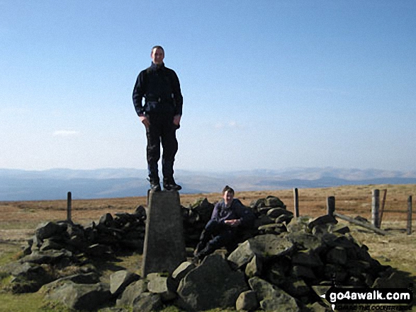
1. Broad Law
840m (2,757ft)
Broad Law is on interactive maps:
A downloadable go4awalk.com PDF Peak Bagging Map featuring Broad Law will be available soon. |
![]()
2. White Coomb
821m (2,695ft)
White Coomb is on interactive maps:
A downloadable go4awalk.com PDF Peak Bagging Map featuring White Coomb will be available soon. |
![]()
3. Hart Fell (Moffat)
808m (2,652ft)
Hart Fell (Moffat) is on interactive maps:
A downloadable go4awalk.com PDF Peak Bagging Map featuring Hart Fell (Moffat) will be available soon. |
![]()
4. Culter Fell
748m (2,455ft)
Culter Fell is on interactive maps:
A downloadable go4awalk.com PDF Peak Bagging Map featuring Culter Fell will be available soon. |
![]()
5. Dun Rig
744m (2,442ft)
Dun Rig is on interactive maps:
A downloadable go4awalk.com PDF Peak Bagging Map featuring Dun Rig will be available soon. |
![]()
6. Tinto
711m (2,333ft)
Tinto is on interactive maps:
A downloadable go4awalk.com PDF Peak Bagging Map featuring Tinto will be available soon. |
![]()
7. Ettrick Pen
692m (2,271ft)
Ettrick Pen is on interactive maps:
A downloadable go4awalk.com PDF Peak Bagging Map featuring Ettrick Pen will be available soon. |
![]()
8. Gathersnow Hill
688m (2,258ft)
Gathersnow Hill is on interactive maps:
A downloadable go4awalk.com PDF Peak Bagging Map featuring Gathersnow Hill will be available soon. |
![]()
9. Capel Fell
678m (2,225ft)
Capel Fell is on interactive maps:
A downloadable go4awalk.com PDF Peak Bagging Map featuring Capel Fell will be available soon. |
![]()
10. Andrewhinney Hill
677m (2,222ft)
Andrewhinney Hill is on interactive maps:
A downloadable go4awalk.com PDF Peak Bagging Map featuring Andrewhinney Hill will be available soon. |
![]()
11. Windlestraw Law
659m (2,163ft)
Windlestraw Law is on interactive maps:
A downloadable go4awalk.com PDF Peak Bagging Map featuring Windlestraw Law will be available soon. |
![]()
12. Blackhope Scar
651m (2,137ft)
Blackhope Scar is on interactive maps:
A downloadable go4awalk.com PDF Peak Bagging Map featuring Blackhope Scar will be available soon. |
![]()
13. Croft Head
637m (2,091ft)
Croft Head is on interactive maps:
A downloadable go4awalk.com PDF Peak Bagging Map featuring Croft Head will be available soon. |
![]()
14. Cauldcleuch Head
619m (2,032ft)
Cauldcleuch Head is on interactive maps:
A downloadable go4awalk.com PDF Peak Bagging Map featuring Cauldcleuch Head will be available soon. |
![]()
15. Greatmoor Hill (Starcleuch Edge)
599m (1,966ft)
Send it in and we'll publish it here.
Greatmoor Hill (Starcleuch Edge) is on interactive maps:
A downloadable go4awalk.com PDF Peak Bagging Map featuring Greatmoor Hill (Starcleuch Edge) will be available soon. |
![]()
16. Ward Law
595m (1,953ft)
Ward Law is on interactive maps:
A downloadable go4awalk.com PDF Peak Bagging Map featuring Ward Law will be available soon. |
![]()
17. Wisp Hill (Teviothead)
595m (1,953ft)
Wisp Hill (Teviothead) is on interactive maps:
A downloadable go4awalk.com PDF Peak Bagging Map featuring Wisp Hill (Teviothead) will be available soon. |
![]()
18. The Wiss
589m (1,933ft)
The Wiss is on interactive maps:
A downloadable go4awalk.com PDF Peak Bagging Map featuring The Wiss will be available soon. |
![]()
19. Scald Law
579m (1,900ft)
Scald Law is on interactive maps:
A downloadable go4awalk.com PDF Peak Bagging Map featuring Scald Law will be available soon. |
![]()
20. Pyked Stane Hill (Broughton Heights)
571m (1,873ft)
Send it in and we'll publish it here.
Pyked Stane Hill (Broughton Heights) is on interactive maps:
A downloadable go4awalk.com PDF Peak Bagging Map featuring Pyked Stane Hill (Broughton Heights) will be available soon. |
![]()
21. Roan Fell
568m (1,864ft)
Roan Fell is on interactive maps:
A downloadable go4awalk.com PDF Peak Bagging Map featuring Roan Fell will be available soon. |
![]()
22. East Cairn Hill
567m (1,861ft)
East Cairn Hill is on interactive maps:
A downloadable go4awalk.com PDF Peak Bagging Map featuring East Cairn Hill will be available soon. |
![]()
23. Minch Moor
567m (1,861ft)
Minch Moor is on interactive maps:
A downloadable go4awalk.com PDF Peak Bagging Map featuring Minch Moor will be available soon. |
![]()
24. Pikethaw Hill
564m (1,851ft)
Pikethaw Hill is on interactive maps:
A downloadable go4awalk.com PDF Peak Bagging Map featuring Pikethaw Hill will be available soon. |
![]()
25. Turner Cleuch Law
551m (1,808ft)
Turner Cleuch Law is on interactive maps:
A downloadable go4awalk.com PDF Peak Bagging Map featuring Turner Cleuch Law will be available soon. |
![]()
26. Trahenna Hill
549m (1,802ft)
Trahenna Hill is on interactive maps:
A downloadable go4awalk.com PDF Peak Bagging Map featuring Trahenna Hill will be available soon. |
![]()
27. Scaw'd Fell
549m (1,801ft)
Scaw'd Fell is on interactive maps:
A downloadable go4awalk.com PDF Peak Bagging Map featuring Scaw'd Fell will be available soon. |
![]()
28. Deuchar Law
543m (1,782ft)
Deuchar Law is on interactive maps:
A downloadable go4awalk.com PDF Peak Bagging Map featuring Deuchar Law will be available soon. |
![]()
29. Ellson Fell
537m (1,762ft)
Ellson Fell is on interactive maps:
A downloadable go4awalk.com PDF Peak Bagging Map featuring Ellson Fell will be available soon. |
![]()
30. Penvalla
537m (1,762ft)
Penvalla is on interactive maps:
A downloadable go4awalk.com PDF Peak Bagging Map featuring Penvalla will be available soon. |
View these 62 Mountains, Peaks, Tops and Hills:
- On an Interactive Google Map (loads faster)
- On an Interactive Google Map with a list of tops below it.
(makes it easier to locate a particular top) - On a Detailed List in:
Alphabetical Order | Height Order - On one page with 'yet-to-be-bagged' listed 1st & then 'already-bagged' tops listed 2nd in:
Alphabetical Order | Height Order - On one page with 'already-bagged' tops listed 1st & then 'yet-to-be-bagged' tops listed 2nd in:
Alphabetical Order | Height Order
Is there a Mountain, Peak, Top or Hill missing from the above google map or list?
Let us know an we will add it to our database.

To contribute to go4awalk.com or to contact us about anything at all - see Talk To Us.
For help see Help.
go4awalk.com and go4awalk.co.uk are registered trademarks of TMDH Limited.
Copyright © 2000-2025 TMDH Limited. All rights reserved.
Copyright Terms & Conditions Privacy Statement
A - Z Walks Home Log On/Accounts Photo Gallery Walk Ideas and Collections Fell Facts Hill Skills Walking Questions and Answers Your Stories News Competitions Product Reviews/Gear Tests Walking Gear Guides Peaks and Mountains Peak Bagging Find New Walking Friends Camping GPS Waypoints for Walking Contents Walk Search Talk To Us go4awalk.com Help Free Example Walks Newsletter


