Scottish Region 21: Buchan, Formartine and Strathbogie - a fully detailed list of all the Mountains, Peaks, Tops and Hills (Page 1 of 2)
Scottish Region 21: Buchan, Formartine and Strathbogie region is the area enclosed by an imaginary line connecting:
- Spey Bay to Fraserburgh via the Moray Firth, Cullen, Banff and Rosehearty to the North
- Fraserburgh to Aberdeen via the North Sea and Peterhead to the East
- Aberdeen to Ballater via the A93 through Peterculter, Banchory and Aboyne to the South
- Ballater to Grantown-on-Spey via the A939 to the South West
- Grantown-on-Spey to Spey Bay via the River Spey, Belleheiglash, Charlestown of Aberlour and Rothes to the West
If you count only the Marilyns there are 36 tops to climb, bag & conquer and the highest point is Morven (Cairngorms) at 871m (2,859ft).
To see these Mountains, Peaks, Tops and Hills displayed in different ways - see the options in the left-hand column and towards the bottom of this page.
![]() Your Personal Bagging Record for Scottish Region 21: Buchan, Formartine and Strathbogie
Your Personal Bagging Record for Scottish Region 21: Buchan, Formartine and Strathbogie
When logged on, you can mark each Mountain, Peak, Top or Hill as 'bagged' by either:
- if you opt to display the tops in this area using a google map, click or tap on its symbol on the map below. This will open a text window. Click or tap on the 'Record [mountain name] as Bagged, Climbed & Conquered' link towards the bottom of the text window, or
- if you opt to display the tops in this area as a list, click or tap on the red 'not yet' symbol to the right of the name of each 'top'
Either method will open a new page where you can complete all your details such as:
- when you bagged the Mountain, Peak, Top or Hill;
- which route you took
- who you went with
- what the weather was like
- any other comment that will remind you of the day
Once you have completed your details and click or tap the submit button, you will automatically return to this page and the top you bagged will show with a green tick.
NB. None of the above fields are 'mandatory' - you can leave them blank if you wish.
NNB. You also have the option whether to display your peak bagging exploits to other users of this site or keep them private so only you can see them when you are logged on.
Furthermore, since you can also access your Personal Mountain & Hill Bagging Record via go4awalk Mobile you can quickly & easily record, edit and view your achievements - whether you are at home/work on your desktop computer or in the pub/at the top of a mountain with your Mobile Phone. (You can even download your Personal Mountain & Hill Bagging Record as a .csv file for importing into and saving with spreadsheet software like Excel or NeoOffice!)
This facility costs one credit to initially access your personal bagging record. Once accessed, all other interactions, such as recording other Mountains, Peaks, Tops and Hills as 'bagged' or altering an existing bagging record, are free.
Click REGISTER to register and purchase credits.
LOG ON and RELOAD this page to show which Mountains, Peaks, Tops and Hills you have already climbed, bagged & conquered. [ . . . remove this text]
Page 1 of 2 Go to page: 1 2 |
See this list in: Alphabetical Order
| Height Order‡
To reverse the order select the link again.
Mountain, Peak, Top or Hill:
Bagged

![]()
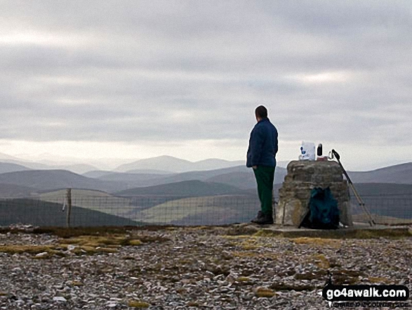
1. Morven (Cairngorms)
871m (2,859ft)
Send it in and we'll publish it here.
Morven (Cairngorms) is on interactive maps:
A downloadable go4awalk.com PDF Peak Bagging Map featuring Morven (Cairngorms) will be available soon. |
![]()
2. Ben Rinnes
841m (2,759ft)
Ben Rinnes is on interactive maps:
A downloadable go4awalk.com PDF Peak Bagging Map featuring Ben Rinnes will be available soon. |
![]()
3. Carn Mor (Ladder Hills)
804m (2,639ft)
Send it in and we'll publish it here.
Carn Mor (Ladder Hills) is on interactive maps:
A downloadable go4awalk.com PDF Peak Bagging Map featuring Carn Mor (Ladder Hills) will be available soon. |
![]()
4. Corryhabbie Hill
781m (2,563ft)
Corryhabbie Hill is on interactive maps:
A downloadable go4awalk.com PDF Peak Bagging Map featuring Corryhabbie Hill will be available soon. |
![]()
5. Cook's Cairn
755m (2,478ft)
Cook's Cairn is on interactive maps:
A downloadable go4awalk.com PDF Peak Bagging Map featuring Cook's Cairn will be available soon. |
![]()
6. Mona Gowan
749m (2,458ft)
Mona Gowan is on interactive maps:
A downloadable go4awalk.com PDF Peak Bagging Map featuring Mona Gowan will be available soon. |
![]()
7. Creagan a' Chaise
722m (2,370ft)
Creagan a' Chaise is on interactive maps:
A downloadable go4awalk.com PDF Peak Bagging Map featuring Creagan a' Chaise will be available soon. |
![]()
8. The Buck (Strathbogie)
721m (2,366ft)
Send it in and we'll publish it here.
The Buck (Strathbogie) is on interactive maps:
A downloadable go4awalk.com PDF Peak Bagging Map featuring The Buck (Strathbogie) will be available soon. |
![]()
9. Carn a Ghille Chearr (Cromdale)
710m (2,330ft)
Send it in and we'll publish it here.
Carn a Ghille Chearr (Cromdale) is on interactive maps:
A downloadable go4awalk.com PDF Peak Bagging Map featuring Carn a Ghille Chearr (Cromdale) will be available soon. |
![]()
10. Pressendye
619m (2,031ft)
Pressendye is on interactive maps:
A downloadable go4awalk.com PDF Peak Bagging Map featuring Pressendye will be available soon. |
![]()
11. Ladylea Hill
609m (1,998ft)
Ladylea Hill is on interactive maps:
A downloadable go4awalk.com PDF Peak Bagging Map featuring Ladylea Hill will be available soon. |
![]()
12. Meikle Conval
571m (1,874ft)
Meikle Conval is on interactive maps:
A downloadable go4awalk.com PDF Peak Bagging Map featuring Meikle Conval will be available soon. |
![]()
13. Carn Daimh
570m (1,871ft)
Carn Daimh is on interactive maps:
A downloadable go4awalk.com PDF Peak Bagging Map featuring Carn Daimh will be available soon. |
![]()
14. Ben Newe
565m (1,854ft)
Ben Newe is on interactive maps:
A downloadable go4awalk.com PDF Peak Bagging Map featuring Ben Newe will be available soon. |
![]()
15. Tap o' Noth
563m (1,848ft)
Tap o' Noth is on interactive maps:
A downloadable go4awalk.com PDF Peak Bagging Map featuring Tap o' Noth will be available soon. |
![]()
16. Little Conval
552m (1,814ft)
Little Conval is on interactive maps:
A downloadable go4awalk.com PDF Peak Bagging Map featuring Little Conval will be available soon. |
![]()
17. Coiliochbhar Hill
533m (1,749ft)
Coiliochbhar Hill is on interactive maps:
A downloadable go4awalk.com PDF Peak Bagging Map featuring Coiliochbhar Hill will be available soon. |
![]()
18. Oxen Craig (Bennachie)
529m (1,736ft)
Send it in and we'll publish it here.
Oxen Craig (Bennachie) is on interactive maps:
A downloadable go4awalk.com PDF Peak Bagging Map featuring Oxen Craig (Bennachie) will be available soon. |
![]()
19. Lord Arthur's Hill
518m (1,700ft)
Lord Arthur's Hill is on interactive maps:
A downloadable go4awalk.com PDF Peak Bagging Map featuring Lord Arthur's Hill will be available soon. |
![]()
20. Benaquhallie
494m (1,621ft)
Benaquhallie is on interactive maps:
A downloadable go4awalk.com PDF Peak Bagging Map featuring Benaquhallie will be available soon. |
![]()
21. The Bochel
491m (1,611ft)
The Bochel is on interactive maps:
A downloadable go4awalk.com PDF Peak Bagging Map featuring The Bochel will be available soon. |
![]()
22. Craiglich
476m (1,562ft)
Craiglich is on interactive maps:
A downloadable go4awalk.com PDF Peak Bagging Map featuring Craiglich will be available soon. |
![]()
23. Ben Aigan
471m (1,546ft)
Ben Aigan is on interactive maps:
A downloadable go4awalk.com PDF Peak Bagging Map featuring Ben Aigan will be available soon. |
![]()
24. Hill of Fare
471m (1,546ft)
Hill of Fare is on interactive maps:
A downloadable go4awalk.com PDF Peak Bagging Map featuring Hill of Fare will be available soon. |
![]()
25. Hill of Foudland
467m (1,533ft)
Hill of Foudland is on interactive maps:
A downloadable go4awalk.com PDF Peak Bagging Map featuring Hill of Foudland will be available soon. |
![]()
26. Cairn William
448m (1,470ft)
Cairn William is on interactive maps:
A downloadable go4awalk.com PDF Peak Bagging Map featuring Cairn William will be available soon. |
![]()
27. Knock Hill
430m (1,411ft)
Knock Hill is on interactive maps:
A downloadable go4awalk.com PDF Peak Bagging Map featuring Knock Hill will be available soon. |
![]()
28. Millstone Hill
409m (1,342ft)
Millstone Hill is on interactive maps:
A downloadable go4awalk.com PDF Peak Bagging Map featuring Millstone Hill will be available soon. |
![]()
29. Craigendarroch
402m (1,319ft)
Craigendarroch is on interactive maps:
A downloadable go4awalk.com PDF Peak Bagging Map featuring Craigendarroch will be available soon. |
![]()
30. Hill of Tillymorgan
381m (1,250ft)
Send it in and we'll publish it here.
Hill of Tillymorgan is on interactive maps:
A downloadable go4awalk.com PDF Peak Bagging Map featuring Hill of Tillymorgan will be available soon. |
Page 1 of 2 Go to page: 1 2 |
View these 36 Mountains, Peaks, Tops and Hills:
- On an Interactive Google Map (loads faster)
- On an Interactive Google Map with a list of tops below it.
(makes it easier to locate a particular top) - On a Detailed List in:
Alphabetical Order | Height Order - On one page with 'yet-to-be-bagged' listed 1st & then 'already-bagged' tops listed 2nd in:
Alphabetical Order | Height Order - On one page with 'already-bagged' tops listed 1st & then 'yet-to-be-bagged' tops listed 2nd in:
Alphabetical Order | Height Order
Is there a Mountain, Peak, Top or Hill missing from the above google map or list?
Let us know an we will add it to our database.

To contribute to go4awalk.com or to contact us about anything at all - see Talk To Us.
For help see Help.
go4awalk.com and go4awalk.co.uk are registered trademarks of TMDH Limited.
Copyright © 2000-2025 TMDH Limited. All rights reserved.
Copyright Terms & Conditions Privacy Statement
A - Z Walks Home Log On/Accounts Photo Gallery Walk Ideas and Collections Fell Facts Hill Skills Walking Questions and Answers Your Stories News Competitions Product Reviews/Gear Tests Walking Gear Guides Peaks and Mountains Peak Bagging Find New Walking Friends Camping GPS Waypoints for Walking Contents Walk Search Talk To Us go4awalk.com Help Free Example Walks Newsletter


