Scottish Region 13: The Achnashellach and Torridon Hills - a fully detailed list of all the Mountains, Peaks, Tops and Hills (Page 1 of 2)
Scottish Region 13: The Achnashellach and Torridon Hills region is the area enclosed by an imaginary line connecting:
- Loch Ewe to Achnasheen via Loch Maree, Taagan, Kinlochewe and Loch a' Chroisg to the North East
- Achnasheen to Kyle of Lochalsh via the A890. Achnashellach Station, Glen Carron, Strathcarron, Loch Carron and Inner Sound to the South East
- Kyle of Lochalsh to Loch Ewe via Inner Sound the West
If you count only the Marilyns there are 38 tops to climb, bag & conquer and the highest point is Spidean a' Choire Leith (Liathach) at 1,055m (3,463ft).
To see these Mountains, Peaks, Tops and Hills displayed in different ways - see the options in the left-hand column and towards the bottom of this page.
LOG ON and RELOAD this page to show which Mountains, Peaks, Tops and Hills you have already climbed, bagged & conquered [. . . more details]
Page 1 of 2 Go to page: 1 2 |
See this list in: Alphabetical Order‡
| Height Order
To reverse the order select the link again.
Mountain, Peak, Top or Hill:
Bagged
1. An Cuaidh
296m (971ft)
An Cuaidh is on interactive maps:
A downloadable go4awalk.com PDF Peak Bagging Map featuring An Cuaidh will be available soon. |
2. An Ruadh-mheallan
672m (2,206ft)
An Ruadh-mheallan is on interactive maps:
A downloadable go4awalk.com PDF Peak Bagging Map featuring An Ruadh-mheallan will be available soon. |
3. An Ruadh-stac
890m (2,921ft)
An Ruadh-stac is on interactive maps:
A downloadable go4awalk.com PDF Peak Bagging Map featuring An Ruadh-stac will be available soon. |
4. An Sgurr (Loch Kishorn)
392m (1,287ft)
Send it in and we'll publish it here.
An Sgurr (Loch Kishorn) is on interactive maps:
A downloadable go4awalk.com PDF Peak Bagging Map featuring An Sgurr (Loch Kishorn) will be available soon. |
5. An Staonach
516m (1,693ft)
An Staonach is on interactive maps:
A downloadable go4awalk.com PDF Peak Bagging Map featuring An Staonach will be available soon. |
6. Bad a' Chreamha
395m (1,296ft)
Bad a' Chreamha is on interactive maps:
A downloadable go4awalk.com PDF Peak Bagging Map featuring Bad a' Chreamha will be available soon. |
7. Baosbheinn
875m (2,872ft)
Baosbheinn is on interactive maps:
A downloadable go4awalk.com PDF Peak Bagging Map featuring Baosbheinn will be available soon. |
8. Beinn a' Chearcaill
725m (2,379ft)
Send it in and we'll publish it here.
Beinn a' Chearcaill is on interactive maps:
A downloadable go4awalk.com PDF Peak Bagging Map featuring Beinn a' Chearcaill will be available soon. |
9. Beinn a' Chlachain (Meall an Doireachain)
626m (2,055ft)
Send it in and we'll publish it here.
Beinn a' Chlachain (Meall an Doireachain) is on interactive maps:
A downloadable go4awalk.com PDF Peak Bagging Map featuring Beinn a' Chlachain (Meall an Doireachain) will be available soon. |
10. Beinn an Eoin (Flowerdale Forest)
855m (2,806ft)
Beinn an Eoin (Flowerdale Forest) is on interactive maps:
A downloadable go4awalk.com PDF Peak Bagging Map featuring Beinn an Eoin (Flowerdale Forest) will be available soon. |
11. Beinn Bhan (Loch Kishorn)
896m (2,941ft)
Send it in and we'll publish it here.
Beinn Bhan (Loch Kishorn) is on interactive maps:
A downloadable go4awalk.com PDF Peak Bagging Map featuring Beinn Bhan (Loch Kishorn) will be available soon. |
12. Beinn Damh
903m (2,963ft)
Beinn Damh is on interactive maps:
A downloadable go4awalk.com PDF Peak Bagging Map featuring Beinn Damh will be available soon. |
13. Beinn Dearg (Torridon)
914m (2,998ft)
Beinn Dearg (Torridon) is on interactive maps:
A downloadable go4awalk.com PDF Peak Bagging Map featuring Beinn Dearg (Torridon) will be available soon. |
14. Beinn Liath Mhor
926m (3,039ft)
Beinn Liath Mhor is on interactive maps:
A downloadable go4awalk.com PDF Peak Bagging Map featuring Beinn Liath Mhor will be available soon. |
15. Beinn na Feusaige
627m (2,056ft)
Beinn na Feusaige is on interactive maps:
A downloadable go4awalk.com PDF Peak Bagging Map featuring Beinn na Feusaige will be available soon. |
16. Beinn na h-Eaglaise (Ben-Damph Forest)
736m (2,416ft)
Beinn na h-Eaglaise (Ben-Damph Forest) is on interactive maps:
A downloadable go4awalk.com PDF Peak Bagging Map featuring Beinn na h-Eaglaise (Ben-Damph Forest) will be available soon. |
17. Ben Shieldaig
534m (1,752ft)
Ben Shieldaig is on interactive maps:
A downloadable go4awalk.com PDF Peak Bagging Map featuring Ben Shieldaig will be available soon. |
18. Bidein Clann Raonaild
466m (1,529ft)
Send it in and we'll publish it here.
Bidein Clann Raonaild is on interactive maps:
A downloadable go4awalk.com PDF Peak Bagging Map featuring Bidein Clann Raonaild will be available soon. |
19. Carn Breac
678m (2,225ft)
Carn Breac is on interactive maps:
A downloadable go4awalk.com PDF Peak Bagging Map featuring Carn Breac will be available soon. |
20. Fuar Tholl
907m (2,976ft)
Fuar Tholl is on interactive maps:
A downloadable go4awalk.com PDF Peak Bagging Map featuring Fuar Tholl will be available soon. |
21. Maol Chean-dearg
933m (3,062ft)
Maol Chean-dearg is on interactive maps:
A downloadable go4awalk.com PDF Peak Bagging Map featuring Maol Chean-dearg will be available soon. |
22. Meall a' Ghiubhais
887m (2,911ft)
Meall a' Ghiubhais is on interactive maps:
A downloadable go4awalk.com PDF Peak Bagging Map featuring Meall a' Ghiubhais will be available soon. |
23. Meall an Doirein
420m (1,378ft)
Meall an Doirein is on interactive maps:
A downloadable go4awalk.com PDF Peak Bagging Map featuring Meall an Doirein will be available soon. |
24. Meall Lochan a' Chleirich
403m (1,323ft)
Send it in and we'll publish it here.
Meall Lochan a' Chleirich is on interactive maps:
A downloadable go4awalk.com PDF Peak Bagging Map featuring Meall Lochan a' Chleirich will be available soon. |
25. Mullach an Rathain (Liathach)
1,023m (3,357ft)
Mullach an Rathain (Liathach) is on interactive maps:
A downloadable go4awalk.com PDF Peak Bagging Map featuring Mullach an Rathain (Liathach) will be available soon. |
26. Ruadh-stac Beag (Beinn Eighe)
896m (2,941ft)
Send it in and we'll publish it here.
Ruadh-stac Beag (Beinn Eighe) is on interactive maps:
A downloadable go4awalk.com PDF Peak Bagging Map featuring Ruadh-stac Beag (Beinn Eighe) will be available soon. |
27. Ruadh-stac Mor (Beinn Eighe)
1,010m (3,315ft)
Ruadh-stac Mor (Beinn Eighe) is on interactive maps:
A downloadable go4awalk.com PDF Peak Bagging Map featuring Ruadh-stac Mor (Beinn Eighe) will be available soon. |
28. Seana Mheallan
437m (1,434ft)
Seana Mheallan is on interactive maps:
A downloadable go4awalk.com PDF Peak Bagging Map featuring Seana Mheallan will be available soon. |
29. Sgorr nan Lochan Uaine
871m (2,859ft)
Send it in and we'll publish it here.
Sgorr nan Lochan Uaine is on interactive maps:
A downloadable go4awalk.com PDF Peak Bagging Map featuring Sgorr nan Lochan Uaine will be available soon. |
30. Sgorr Ruadh
962m (3,157ft)
Sgorr Ruadh is on interactive maps:
A downloadable go4awalk.com PDF Peak Bagging Map featuring Sgorr Ruadh will be available soon. |
Page 1 of 2 Go to page: 1 2 |
View these 38 Mountains, Peaks, Tops and Hills:
- On an Interactive Google Map (loads faster)
- On an Interactive Google Map with a list of tops below it.
(makes it easier to locate a particular top) - On a Detailed List in:
Alphabetical Order | Height Order - On one page with 'yet-to-be-bagged' listed 1st & then 'already-bagged' tops listed 2nd in:
Alphabetical Order | Height Order - On one page with 'already-bagged' tops listed 1st & then 'yet-to-be-bagged' tops listed 2nd in:
Alphabetical Order | Height Order
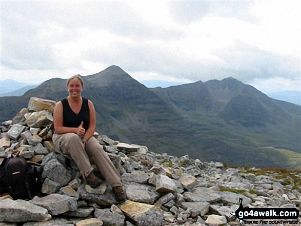
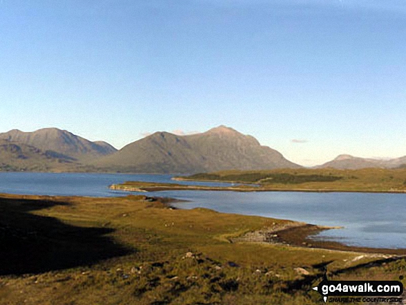 Spidean a' Choire Leith (Liathach) in The Achnashellach and Torridon Hills
Photo: Lovat Fraser
Is there a Mountain, Peak, Top or Hill missing from the above google map or list?
Let us know an we will add it to our database.

