All the Mountains, Peaks, Tops and Hills in Mynyddoedd Cambria (The Cambrian Mountains) displayed as a detailed list
Mynyddoedd Cambria (The Cambrian Mountains) is located in Central Wales covering parts of Ceredigion, Powys and Carmarthenshire.
If you include the Marilyns, the Bridgets (Hills) and all the Mountains, Tops, Peaks and Hills with a Trig Point on them there are 141 tops to climb, bag & conquer and the highest point is Pen Pumlumon Fawr (Plynlimon) at 752m (2,468ft).
![]() Your Personal Bagging Record for Mynyddoedd Cambria (The Cambrian Mountains)
Your Personal Bagging Record for Mynyddoedd Cambria (The Cambrian Mountains)
LOG ON and RELOAD this page to show which Mountains, Peaks, Tops and Hills you have already climbed, bagged & conquered [. . . more details]
See this list in: Alphabetical Order
| Height Order‡
To reverse the order select the link again.
Mountain, Peak, Top or Hill:
Bagged

![]()
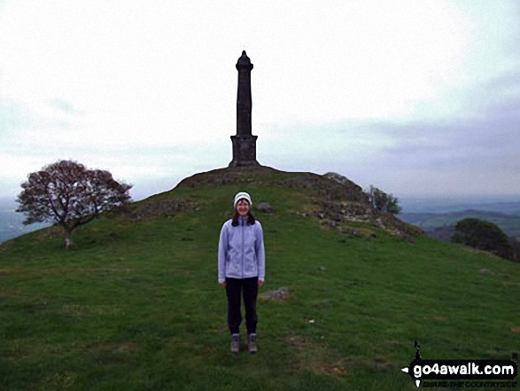
91. Rodney's Pillar (Breidden Hill)
365m (1,197ft)
Rodney's Pillar (Breidden Hill) is on interactive maps:
A downloadable go4awalk.com PDF Peak Bagging Map featuring Rodney's Pillar (Breidden Hill) will be available soon. |

![]()
92. Hafod Ithel
361m (1,185ft)
Hafod Ithel is on interactive maps:
A downloadable go4awalk.com PDF Peak Bagging Map featuring Hafod Ithel will be available soon. |

![]()
93. Coed y Gaer
360m (1,181ft)
Coed y Gaer is on interactive maps:
A downloadable go4awalk.com PDF Peak Bagging Map featuring Coed y Gaer will be available soon. |
![]()
94. Stingwern Hill
358m (1,174ft)
Stingwern Hill is on interactive maps:
A downloadable go4awalk.com PDF Peak Bagging Map featuring Stingwern Hill will be available soon. |
![]()
95. Allt y Main
356m (1,168ft)
Allt y Main is on interactive maps:
A downloadable go4awalk.com PDF Peak Bagging Map featuring Allt y Main will be available soon. |

![]()
96. Caeliber Isaf
355m (1,165ft)
Caeliber Isaf is on interactive maps:
A downloadable go4awalk.com PDF Peak Bagging Map featuring Caeliber Isaf will be available soon. |
![]()
97. Upper Park (Crown Wood)
352m (1,155ft)
Send it in and we'll publish it here.
Upper Park (Crown Wood) is on interactive maps:
A downloadable go4awalk.com PDF Peak Bagging Map featuring Upper Park (Crown Wood) will be available soon. |
![]()
98. Stanner Hill
349m (1,145ft)
Stanner Hill is on interactive maps:
A downloadable go4awalk.com PDF Peak Bagging Map featuring Stanner Hill will be available soon. |
![]()
99. Mynydd Llansadwrn
345m (1,132ft)
Mynydd Llansadwrn is on interactive maps:
|
![]()
100. Allt yr Hebog
342m (1,122ft)
Allt yr Hebog is on interactive maps:
A downloadable go4awalk.com PDF Peak Bagging Map featuring Allt yr Hebog will be available soon. |
![]()
101. Cefn Blewog
341m (1,119ft)
Cefn Blewog is on interactive maps:
A downloadable go4awalk.com PDF Peak Bagging Map featuring Cefn Blewog will be available soon. |
![]()
102. Fforest
341m (1,119ft)
Fforest is on interactive maps:
A downloadable go4awalk.com PDF Peak Bagging Map featuring Fforest will be available soon. |
![]()
103. Y Golfa (Castle Caereinion)
341m (1,119ft)
Send it in and we'll publish it here.
Y Golfa (Castle Caereinion) is on interactive maps:
A downloadable go4awalk.com PDF Peak Bagging Map featuring Y Golfa (Castle Caereinion) will be available soon. |
![]()
104. Moel Bentyrch
338m (1,109ft)
Moel Bentyrch is on interactive maps:
A downloadable go4awalk.com PDF Peak Bagging Map featuring Moel Bentyrch will be available soon. |
![]()
105. Mynydd y Bryn
335m (1,099ft)
Mynydd y Bryn is on interactive maps:
A downloadable go4awalk.com PDF Peak Bagging Map featuring Mynydd y Bryn will be available soon. |
![]()
106. Allt y Gader
334m (1,096ft)
Allt y Gader is on interactive maps:
A downloadable go4awalk.com PDF Peak Bagging Map featuring Allt y Gader will be available soon. |
![]()
107. Yr Allt (Pen-yr-allt)
333m (1,092ft)
Send it in and we'll publish it here.
Yr Allt (Pen-yr-allt) is on interactive maps:
A downloadable go4awalk.com PDF Peak Bagging Map featuring Yr Allt (Pen-yr-allt) will be available soon. |
![]()
108. Banc y Garreg
332m (1,089ft)
Banc y Garreg is on interactive maps:
A downloadable go4awalk.com PDF Peak Bagging Map featuring Banc y Garreg will be available soon. |
![]()
109. Dinas (Llyn Brianne)
331m (1,086ft)
Send it in and we'll publish it here.
Dinas (Llyn Brianne) is on interactive maps:
A downloadable go4awalk.com PDF Peak Bagging Map featuring Dinas (Llyn Brianne) will be available soon. |
![]()
110. Mynydd Cynros
329m (1,080ft)
Mynydd Cynros is on interactive maps:
A downloadable go4awalk.com PDF Peak Bagging Map featuring Mynydd Cynros will be available soon. |
![]()
111. Lan Ddu Cilwenau
328m (1,076ft)
Lan Ddu Cilwenau is on interactive maps:
|
![]()
112. Mynydd Figyn
328m (1,076ft)
Mynydd Figyn is on interactive maps:
A downloadable go4awalk.com PDF Peak Bagging Map featuring Mynydd Figyn will be available soon. |
![]()
113. Mynydd Figyn
328m (1,076ft)
Mynydd Figyn is on interactive maps:
|
![]()
114. Rhos Ymryson
327m (1,073ft)
Rhos Ymryson is on interactive maps:
A downloadable go4awalk.com PDF Peak Bagging Map featuring Rhos Ymryson will be available soon. |
![]()
115. Pen-crug-melyn (Lan)
326m (1,070ft)
Send it in and we'll publish it here.
Pen-crug-melyn (Lan) is on interactive maps:
A downloadable go4awalk.com PDF Peak Bagging Map featuring Pen-crug-melyn (Lan) will be available soon. |
![]()
116. Gallt y Goedhwch
326m (1,069ft)
Gallt y Goedhwch is on interactive maps:
A downloadable go4awalk.com PDF Peak Bagging Map featuring Gallt y Goedhwch will be available soon. |
![]()
117. Pen yr Allt-fawr
316m (1,037ft)
Pen yr Allt-fawr is on interactive maps:
A downloadable go4awalk.com PDF Peak Bagging Map featuring Pen yr Allt-fawr will be available soon. |
![]()
118. Burfa Bank
313m (1,027ft)
Burfa Bank is on interactive maps:
A downloadable go4awalk.com PDF Peak Bagging Map featuring Burfa Bank will be available soon. |
![]()
119. Banc Mynyddgorddu
311m (1,020ft)
Banc Mynyddgorddu is on interactive maps:
A downloadable go4awalk.com PDF Peak Bagging Map featuring Banc Mynyddgorddu will be available soon. |
![]()
120. Banc Cwm-coed-ifor
309m (1,014ft)
Banc Cwm-coed-ifor is on interactive maps:
A downloadable go4awalk.com PDF Peak Bagging Map featuring Banc Cwm-coed-ifor will be available soon. |
Is there a Mountain, Peak, Top or Hill missing from the above google map or list?
Let us know an we will add it to our database.

To contribute to go4awalk.com or to contact us about anything at all - see Talk To Us.
For help see Help.
go4awalk.com and go4awalk.co.uk are registered trademarks of TMDH Limited.
Copyright © 2000-2025 TMDH Limited. All rights reserved.
Copyright Terms & Conditions Privacy Statement
A - Z Walks Home Log On/Accounts Photo Gallery Walk Ideas and Collections Fell Facts Hill Skills Walking Questions and Answers Your Stories News Competitions Product Reviews/Gear Tests Walking Gear Guides Peaks and Mountains Peak Bagging Find New Walking Friends Camping GPS Waypoints for Walking Contents Walk Search Talk To Us go4awalk.com Help Free Example Walks Newsletter


