All the Mountains, Peaks, Tops and Hills in Mynyddoedd Cambria (The Cambrian Mountains) displayed as a detailed list

Mynyddoedd Cambria (The Cambrian Mountains) is located in Central Wales covering parts of Ceredigion, Powys and Carmarthenshire.

If you count only the Deweys there are 82 tops to climb, bag & conquer and the highest point is Y Gamriw at 604m (1,982ft).

Wainwright
0/0
Wainwrights

Hewitt
10/0
Welsh
Mountains

Dewey
78/0
Welsh
Deweys

nuttall
11/0
Welsh
Nuttalls

Wainwright Outlying Fell
0/0
Wainwright
Outlying Fells

marilyn
29/0
Welsh
Marilyns

Bridget
70/0
Welsh
Bridgets

Trig Point
60/0
Trig
Points


To see all Mountains, Peaks, Tops and Hills displayed in different ways - see the options in the left-hand column and towards the bottom of this page.


LOG ON and RELOAD this page to show which Mountains, Peaks, Tops and Hills you have already climbed, bagged & conquered [. . . more]


Page 1 of 3    Go to page: 1 2 3


See this list in: Alphabetical Order | Height Order
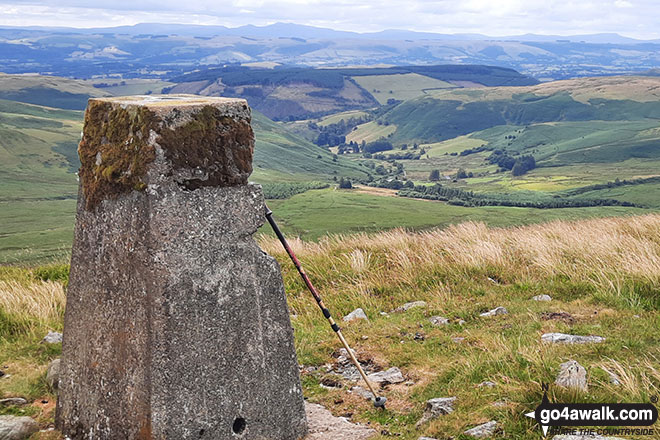
To reverse the order select the link again.


Mountain, Peak, Top or Hill:

Bagged


1. Y Gamriw

604m (1,982ft)

  • Dewey (8th in Wales, 13th in England & Wales)
  • OS Trig Point

  • We hope to have walks that climb & bag Y Gamriw very soon

    Google Maps Icon
    See the location of Y Gamriw and walks up it on a google Map

    Y Gamriw is on interactive maps:

  • OS Explorer (Orange Covers): 200
  • OS Landranger (Pink Covers): 147

  • Y Gamriw is on Peak Bagging Map and Hill Tick List:


    2. Whimble

    599m (1,965ft)

  • Dewey (15th in Wales, 27th in England & Wales)

  • We hope to have walks that climb & bag Whimble very soon

    Google Maps Icon
    See the location of Whimble and walks up it on a google Map

    Whimble is on interactive maps:

  • OS Explorer (Orange Covers): 201
  • OS Landranger (Pink Covers): 137 and 148

  • A go4awalk.com Peak Bagging Map and Hill Tick List featuring Whimble will be available soon.


    3. Llan Ddu Fawr (Waun Claerddu)

    594m (1,949ft)

  • Dewey (22nd in Wales, 38th in England & Wales)
  • Marilyn (58th in Wales, 779th in GB)
  • OS Trig Point

  • We hope to have walks that climb & bag Llan Ddu Fawr (Waun Claerddu) very soon

    Google Maps Icon
    See the location of Llan Ddu Fawr (Waun Claerddu) and walks up it on a google Map

    Llan Ddu Fawr (Waun Claerddu) is on interactive maps:

  • OS Explorer (Orange Covers): 213
  • OS Landranger (Pink Covers): 135 and 147

  • A go4awalk.com Peak Bagging Map and Hill Tick List featuring Llan Ddu Fawr (Waun Claerddu) will be available soon.


    4. Pegwn Mawr

    586m (1,923ft)

  • Dewey (35th in Wales, 57th in England & Wales)
  • Marilyn (60th in Wales, 792nd in GB)
  • OS Trig Point

  • We hope to have walks that climb & bag Pegwn Mawr very soon

    Google Maps Icon
    See the location of Pegwn Mawr and walks up it on a google Map

    Pegwn Mawr is on interactive maps:

  • OS Explorer (Orange Covers): 214
  • OS Landranger (Pink Covers): 136

  • A go4awalk.com Peak Bagging Map and Hill Tick List featuring Pegwn Mawr will be available soon.


    5. Clipyn Du (Siambr Trawsfynydd)

    582m (1,910ft)

  • Dewey (39th in Wales, 67th in England & Wales)

  • We hope to have walks that climb & bag Clipyn Du (Siambr Trawsfynydd) very soon

    Google Maps Icon
    See the location of Clipyn Du (Siambr Trawsfynydd) and walks up it on a google Map

    Clipyn Du (Siambr Trawsfynydd) is on interactive maps:

  • OS Explorer (Orange Covers): 215
  • OS Landranger (Pink Covers): 135

  • A go4awalk.com Peak Bagging Map and Hill Tick List featuring Clipyn Du (Siambr Trawsfynydd) will be available soon.


    6. Draws Drum (Y Glog)

    574m (1,883ft)

  • Dewey (45th in Wales, 81st in England & Wales)

  • We hope to have walks that climb & bag Draws Drum (Y Glog) very soon

    Google Maps Icon
    See the location of Draws Drum (Y Glog) and walks up it on a google Map

    Draws Drum (Y Glog) is on interactive maps:

  • OS Explorer (Orange Covers): 213
  • OS Landranger (Pink Covers): 135

  • A go4awalk.com Peak Bagging Map and Hill Tick List featuring Draws Drum (Y Glog) will be available soon.


    7. Cefn Croes

    573m (1,880ft)

  • Dewey (47th in Wales, 86th in England & Wales)

  • We hope to have walks that climb & bag Cefn Croes very soon

    Google Maps Icon
    See the location of Cefn Croes and walks up it on a google Map

    Cefn Croes is on interactive maps:

  • OS Explorer (Orange Covers): 213 and 214
  • OS Landranger (Pink Covers): 135 and 136 and 147

  • A go4awalk.com Peak Bagging Map and Hill Tick List featuring Cefn Croes will be available soon.


    8. Geifas

    572m (1,877ft)

  • Dewey (48th in Wales, 87th in England & Wales)

  • We hope to have walks that climb & bag Geifas very soon

    Google Maps Icon
    See the location of Geifas and walks up it on a google Map

    Geifas is on interactive maps:

  • OS Explorer (Orange Covers): 200
  • OS Landranger (Pink Covers): 135 and 136 and 147

  • A go4awalk.com Peak Bagging Map and Hill Tick List featuring Geifas will be available soon.


    9. Crugyn Llwyd

    571m (1,874ft)

  • Dewey (50th in Wales, 90th in England & Wales)

  • We hope to have walks that climb & bag Crugyn Llwyd very soon

    Google Maps Icon
    See the location of Crugyn Llwyd and walks up it on a google Map

    Crugyn Llwyd is on interactive maps:

  • OS Explorer (Orange Covers): 214
  • OS Landranger (Pink Covers): 136 and 147

  • A go4awalk.com Peak Bagging Map and Hill Tick List featuring Crugyn Llwyd will be available soon.


    10. Mynydd Coch

    569m (1,867ft)

  • Dewey (52nd in Wales, 95th in England & Wales)
  • OS Trig Point

  • We hope to have walks that climb & bag Mynydd Coch very soon

    Google Maps Icon
    See the location of Mynydd Coch and walks up it on a google Map

    Mynydd Coch is on interactive maps:

  • OS Explorer (Orange Covers): OL23
  • OS Landranger (Pink Covers): 125

  • A go4awalk.com Peak Bagging Map and Hill Tick List featuring Mynydd Coch will be available soon.


    11. Carn Gwilym (Carn Hyddgen)

    566m (1,858ft)

  • Dewey (56th in Wales, 101st in England & Wales)

  • We hope to have walks that climb & bag Carn Gwilym (Carn Hyddgen) very soon

    Google Maps Icon
    See the location of Carn Gwilym (Carn Hyddgen) and walks up it on a google Map

    Carn Gwilym (Carn Hyddgen) is on interactive maps:

  • OS Explorer (Orange Covers): 215
  • OS Landranger (Pink Covers): 135

  • A go4awalk.com Peak Bagging Map and Hill Tick List featuring Carn Gwilym (Carn Hyddgen) will be available soon.


    12. Drybedd

    566m (1,857ft)

  • Dewey (57th in Wales, 103rd in England & Wales)

  • We hope to have walks that climb & bag Drybedd very soon

    Google Maps Icon
    See the location of Drybedd and walks up it on a google Map

    Drybedd is on interactive maps:

  • OS Explorer (Orange Covers): 213
  • OS Landranger (Pink Covers): 135

  • A go4awalk.com Peak Bagging Map and Hill Tick List featuring Drybedd will be available soon.


    13. Foel Uchaf (Cambrian Mountains)

    565m (1,854ft)

  • Dewey (60th in Wales, 108th in England & Wales)

  • We hope to have walks that climb & bag Foel Uchaf (Cambrian Mountains) very soon

    Google Maps Icon
    See the location of Foel Uchaf (Cambrian Mountains) and walks up it on a google Map

    Foel Uchaf (Cambrian Mountains) is on interactive maps:

  • OS Explorer (Orange Covers): 214 and 215
  • OS Landranger (Pink Covers): 135 and 136

  • A go4awalk.com Peak Bagging Map and Hill Tick List featuring Foel Uchaf (Cambrian Mountains) will be available soon.


    14. Foel Fadian

    564m (1,851ft)

  • Dewey (63rd in Wales, 111th in England & Wales)
  • OS Trig Point

  • We hope to have walks that climb & bag Foel Fadian very soon

    Google Maps Icon
    See the location of Foel Fadian and walks up it on a google Map

    Foel Fadian is on interactive maps:

  • OS Explorer (Orange Covers): 215
  • OS Landranger (Pink Covers): 135 and 136

  • A go4awalk.com Peak Bagging Map and Hill Tick List featuring Foel Fadian will be available soon.


    15. Bryn Du (Esgair Ychion)

    562m (1,845ft)

  • Dewey (65th in Wales, 116th in England & Wales)

  • We hope to have walks that climb & bag Bryn Du (Esgair Ychion) very soon

    Google Maps Icon
    See the location of Bryn Du (Esgair Ychion) and walks up it on a google Map

    Bryn Du (Esgair Ychion) is on interactive maps:

  • OS Explorer (Orange Covers): 214
  • OS Landranger (Pink Covers): 135 and 136

  • A go4awalk.com Peak Bagging Map and Hill Tick List featuring Bryn Du (Esgair Ychion) will be available soon.


    16. Banc Llechwedd-mawr

    560m (1,837ft)

  • Dewey (69th in Wales, 123rd in England & Wales)
  • Marilyn (65th in Wales, 847th in GB)

  • We hope to have walks that climb & bag Banc Llechwedd-mawr very soon

    Google Maps Icon
    See the location of Banc Llechwedd-mawr and walks up it on a google Map

    Banc Llechwedd-mawr is on interactive maps:

  • OS Explorer (Orange Covers): 213
  • OS Landranger (Pink Covers): 135

  • A go4awalk.com Peak Bagging Map and Hill Tick List featuring Banc Llechwedd-mawr will be available soon.


    17. Llechwedd Ddu (Carnbwlchcloddiau)

    559m (1,834ft)

  • Dewey (71st in Wales, 126th in England & Wales)
  • OS Trig Point

  • We hope to have walks that climb & bag Llechwedd Ddu (Carnbwlchcloddiau) very soon

    Google Maps Icon
    See the location of Llechwedd Ddu (Carnbwlchcloddiau) and walks up it on a google Map

    Llechwedd Ddu (Carnbwlchcloddiau) is on interactive maps:

  • OS Explorer (Orange Covers): 214
  • OS Landranger (Pink Covers): 135 and 136 and 147

  • A go4awalk.com Peak Bagging Map and Hill Tick List featuring Llechwedd Ddu (Carnbwlchcloddiau) will be available soon.


    18. Domen Milwyn

    555m (1,821ft)

  • Dewey (81st in Wales, 143rd in England & Wales)

  • We hope to have walks that climb & bag Domen Milwyn very soon

    Google Maps Icon
    See the location of Domen Milwyn and walks up it on a google Map

    Domen Milwyn is on interactive maps:

  • OS Explorer (Orange Covers): 200 and 213
  • OS Landranger (Pink Covers): 135 and 136

  • A go4awalk.com Peak Bagging Map and Hill Tick List featuring Domen Milwyn will be available soon.


    19. Banc Bugeilyn

    551m (1,808ft)

  • Dewey (89th in Wales, 158th in England & Wales)

  • We hope to have walks that climb & bag Banc Bugeilyn very soon

    Google Maps Icon
    See the location of Banc Bugeilyn and walks up it on a google Map

    Banc Bugeilyn is on interactive maps:

  • OS Explorer (Orange Covers): 215
  • OS Landranger (Pink Covers): 135

  • A go4awalk.com Peak Bagging Map and Hill Tick List featuring Banc Bugeilyn will be available soon.


    20. Drosgol (Pumlumon)

    550m (1,805ft)

  • Dewey (91st in Wales, 163rd in England & Wales)
  • Marilyn (69th in Wales, 874th in GB)

  • We hope to have walks that climb & bag Drosgol (Pumlumon) very soon

    Google Maps Icon
    See the location of Drosgol (Pumlumon) and walks up it on a google Map

    Drosgol (Pumlumon) is on interactive maps:

  • OS Explorer (Orange Covers): 213
  • OS Landranger (Pink Covers): 135

  • A go4awalk.com Peak Bagging Map and Hill Tick List featuring Drosgol (Pumlumon) will be available soon.


    21. Pant-llwyd

    549m (1,801ft)

  • Dewey (97th in Wales, 171st in England & Wales)

  • We hope to have walks that climb & bag Pant-llwyd very soon

    Google Maps Icon
    See the location of Pant-llwyd and walks up it on a google Map

    Pant-llwyd is on interactive maps:

  • OS Explorer (Orange Covers): 214
  • OS Landranger (Pink Covers): 135 and 136 and 147

  • A go4awalk.com Peak Bagging Map and Hill Tick List featuring Pant-llwyd will be available soon.


    22. Llyn Du (Mynydd Tywi)

    548m (1,798ft)

  • Dewey (100th in Wales, 175th in England & Wales)
  • OS Trig Point

  • We hope to have walks that climb & bag Llyn Du (Mynydd Tywi) very soon

    Google Maps Icon
    See the location of Llyn Du (Mynydd Tywi) and walks up it on a google Map

    Llyn Du (Mynydd Tywi) is on interactive maps:

  • OS Explorer (Orange Covers): 187
  • OS Landranger (Pink Covers): 146 and 147

  • A go4awalk.com Peak Bagging Map and Hill Tick List featuring Llyn Du (Mynydd Tywi) will be available soon.


    23. Beacon Hill (Beguildy Beacon)

    547m (1,795ft)

  • Dewey (101st in Wales, 176th in England & Wales)
  • Marilyn (71st in Wales, 886th in GB)
  • OS Trig Point

  • We hope to have walks that climb & bag Beacon Hill (Beguildy Beacon) very soon

    Google Maps Icon
    See the location of Beacon Hill (Beguildy Beacon) and walks up it on a google Map

    Beacon Hill (Beguildy Beacon) is on interactive maps:

  • OS Explorer (Orange Covers): 214
  • OS Landranger (Pink Covers): 136 and 148

  • A go4awalk.com Peak Bagging Map and Hill Tick List featuring Beacon Hill (Beguildy Beacon) will be available soon.


    24. Blaen Rhestr

    547m (1,795ft)

  • Dewey (102nd in Wales, 179th in England & Wales)

  • We hope to have walks that climb & bag Blaen Rhestr very soon

    Google Maps Icon
    See the location of Blaen Rhestr and walks up it on a google Map

    Blaen Rhestr is on interactive maps:

  • OS Explorer (Orange Covers): 200
  • OS Landranger (Pink Covers): 135 and 136 and 147

  • A go4awalk.com Peak Bagging Map and Hill Tick List featuring Blaen Rhestr will be available soon.


    25. Fron-wen

    546m (1,791ft)

  • Dewey (105th in Wales, 187th in England & Wales)

  • We hope to have walks that climb & bag Fron-wen very soon

    Google Maps Icon
    See the location of Fron-wen and walks up it on a google Map

    Fron-wen is on interactive maps:

  • OS Explorer (Orange Covers): 200
  • OS Landranger (Pink Covers): 136 and 148

  • A go4awalk.com Peak Bagging Map and Hill Tick List featuring Fron-wen will be available soon.


    26. Y Foel (Pant Mawr)

    546m (1,791ft)

  • Dewey (106th in Wales, 188th in England & Wales)

  • We hope to have walks that climb & bag Y Foel (Pant Mawr) very soon

    Google Maps Icon
    See the location of Y Foel (Pant Mawr) and walks up it on a google Map

    Y Foel (Pant Mawr) is on interactive maps:

  • OS Explorer (Orange Covers): 214
  • OS Landranger (Pink Covers): 135 and 136

  • A go4awalk.com Peak Bagging Map and Hill Tick List featuring Y Foel (Pant Mawr) will be available soon.


    27. Llyn Du (Mynydd Tywi) (East Top)

    545m (1,788ft)

  • Dewey (110th in Wales, 194th in England & Wales)

  • We hope to have walks that climb & bag Llyn Du (Mynydd Tywi) (East Top) very soon

    Google Maps Icon
    See the location of Llyn Du (Mynydd Tywi) (East Top) and walks up it on a google Map

    Llyn Du (Mynydd Tywi) (East Top) is on interactive maps:

  • OS Explorer (Orange Covers): 187
  • OS Landranger (Pink Covers): 146 and 147

  • A go4awalk.com Peak Bagging Map and Hill Tick List featuring Llyn Du (Mynydd Tywi) (East Top) will be available soon.


    28. Bryn y Fedwen

    544m (1,785ft)

  • Dewey (111th in Wales, 199th in England & Wales)

  • We hope to have walks that climb & bag Bryn y Fedwen very soon

    Google Maps Icon
    See the location of Bryn y Fedwen and walks up it on a google Map

    Bryn y Fedwen is on interactive maps:

  • OS Explorer (Orange Covers): 215
  • OS Landranger (Pink Covers): 135 and 136

  • A go4awalk.com Peak Bagging Map and Hill Tick List featuring Bryn y Fedwen will be available soon.


    29. Gwaunceste Hill (Gwaun-Ceste Hill)

    542m (1,778ft)

  • Dewey (114th in Wales, 205th in England & Wales)
  • Marilyn (72nd in Wales, 894th in GB)
  • OS Trig Point

  • We hope to have walks that climb & bag Gwaunceste Hill (Gwaun-Ceste Hill) very soon

    Google Maps Icon
    See the location of Gwaunceste Hill (Gwaun-Ceste Hill) and walks up it on a google Map

    Gwaunceste Hill (Gwaun-Ceste Hill) is on interactive maps:

  • OS Explorer (Orange Covers): 200
  • OS Landranger (Pink Covers): 148

  • A go4awalk.com Peak Bagging Map and Hill Tick List featuring Gwaunceste Hill (Gwaun-Ceste Hill) will be available soon.


    30. Garn Gron

    541m (1,775ft)

  • Dewey (117th in Wales, 210th in England & Wales)
  • OS Trig Point

  • We hope to have walks that climb & bag Garn Gron very soon

    Google Maps Icon
    See the location of Garn Gron and walks up it on a google Map

    Garn Gron is on interactive maps:

  • OS Explorer (Orange Covers): 187
  • OS Landranger (Pink Covers): 146 and 147

  • A go4awalk.com Peak Bagging Map and Hill Tick List featuring Garn Gron will be available soon.


    Page 1 of 3    Go to page: 1 2 3


    View all 204 Mountains, Peaks, Tops and Hills in Mynyddoedd Cambria (The Cambrian Mountains):


    Is there a Mountain, Peak, Top or Hill missing from the above google map or list?

    Let us know an we will add it to our database.


    Do not miss our pick of the Best Walks in Britain


    Follow go4awalk.com on Twitter Follow go4awalk.com on Facebook


    Home


    Find new Friends to go walking with

    Walk all 214 Wainwrights in just 59 Walks. Download GPS Waypoints - Great Walks you must not miss!

    Walk The Yorkshire Three Peaks Challenge Walk - All the Latest Route Information, GPS Waypoints and Split Times to keep you on Schedule

    Walk The British Three Peaks Challenge Walk - All the Latest Route Information and GPS Waypoints

    See our pick of The Best Walks in The Lake District - Great Walks you must not miss!

    Walk our pick of the Best Lake District Ridge Walks - Great Walks you must not miss!

    Walk our pick of the Best Lake District Walks to do in the rain - Great Walks you must not miss!

    Walk our pick of The Best Walks in Snowdonia - Great Walks you must not miss!

    Walk our pick of The Best Ridge Walks in Wales - Walks you must not miss!

    Walk our pick of The Best Walks in The Brecon Beacons - Great Walks you must not miss!

    Walk our pick of The Best Walks in The Yorkshire Dales - Walks you must not miss!

    Walk our pick of The Best Walks in The Peak District - Walks you must not miss!

    Walk our pick of The Best Walks in The Forest of Bowland - Walks you must not miss!

    Walk our pick of The Best Walks in Shropshire - Walks you must not miss!

    Walk our pick of The Best Walks in Cheshire - Walks you must not miss!

    Walk our pick of The Best Walks in Lancashire - Walks you must not miss!

    Not sure where to walk next? Try Peak Bagging - Great Walks you must not miss!

    Not sure where to walk next? Walk part of a National Trail - Great Walks you must not miss!

    Walks with Downloadable and Uploadable GPS Waypoint Data

    Walking Kit and Gear Tested by Walkers

    Full Site Search