All the Mountains, Peaks, Tops and Hills in The South Eastern Area of Mynyddoedd Cambria (The Cambrian Mountains) with all the tops you are yet to climb first & then the ones you have already bagged second
The South Eastern Area of The South Eastern Area of Mynyddoedd Cambria (The Cambrian Mountains), Carmarthenshire and Powys is the area enclosed by:
- the A44 from Rhayder to the country border between Wales and England at Old Radnor to the North;
- the country border from Old Radnor to Hay-on Wye to the East; the Brecon Beacons National Park boundary from Hay-on-Wye to Llandovery to the South;
- the A489 from Llandovery to Builth Wells and then the A470 from Builth Wells to Rhayader to the West
If you include just the Mountains (Hewitts) and the Nuttalls there are 3 tops to climb, bag & conquer and the highest point is Great Rhos at 660m (2,166ft).
To see these Mountains, Peaks, Tops and Hills displayed in different ways - see the options in the left-hand column and towards the bottom of this page.
![]() Your Personal Bagging Record for The South Eastern Area of The South Eastern Area of Mynyddoedd Cambria (The Cambrian Mountains)
Your Personal Bagging Record for The South Eastern Area of The South Eastern Area of Mynyddoedd Cambria (The Cambrian Mountains)
LOG ON and RELOAD this page to show which Mountains, Peaks, Tops and Hills you have already climbed, bagged & conquered [. . . more details]
Scroll down this list of mountains, peaks, tops & hills below and tap/click on each name (in blue) to locate it on the map above.
See this list in: Alphabetical Order‡ | Height Order
To reverse the order select the link again.
Top yet to be climbed, bagged & conquered:
Bagged

![]()
1. Bache Hill
610m (2002ft)
Mountain (Hewitt) and Nuttall
See more details, photos, trip reports and easy-to-follow walks up Bache Hill
![]()
2. Black Mixen
650m (2133ft)
Mountain (Hewitt) and Nuttall
See more details, photos, trip reports and easy-to-follow walks up Black Mixen
![]()
3. Great Rhos
660m (2166ft)
Mountain (Hewitt) and Nuttall
See more details, photos, trip reports and easy-to-follow walks up Great Rhos
Mountain, Peak, Top or Hill already bagged:
Bagged
![]() Your Personal Bagging Record for The South Eastern Area of The South Eastern Area of Mynyddoedd Cambria (The Cambrian Mountains)
Your Personal Bagging Record for The South Eastern Area of The South Eastern Area of Mynyddoedd Cambria (The Cambrian Mountains)
LOG ON and RELOAD this page to show which Mountains, Peaks, Tops and Hills you have already climbed, bagged & conquered [. . . more details]
View these 3 Mountains, Peaks, Tops and Hills:
- On an Interactive Google Map (loads faster)
- On an Interactive Google Map with a list of tops below it.
(makes it easier to locate a particular top) - On a Detailed List in:
Alphabetical Order | Height Order - On one page with 'yet-to-be-bagged' listed 1st & then 'already-bagged' tops listed 2nd in:
Alphabetical Order | Height Order - On one page with 'already-bagged' tops listed 1st & then 'yet-to-be-bagged' tops listed 2nd in:
Alphabetical Order | Height Order
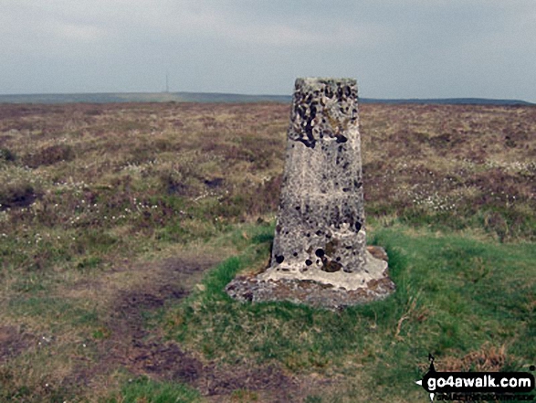 The summit of Great Rhos in The South Eastern Area of Mynyddoedd Cambria (The Cambrian Mountains)
Photo: Bryn Owens
Is there a Mountain, Peak, Top or Hill missing from the above google map or list?


