The Mountains, Peaks, Tops and Hills in Scotland as a detailed list

If you count only the Munros there are 282 tops to climb, bag & conquer and the highest point is Ben Nevis at 1,344m (4,411ft).

munro
282/0
Munros

corbett
222/0
Corbetts

graham
219/0
Grahams

donald
89/0
Donalds

murdo
442/0
Murdos

marilyn
1557/0
Scottish
Marilyns

Bridget
0/0
Scottish
Bridgets

Trig Point
1398/0
Trig
Points


To see all Mountains, Peaks, Tops and Hills displayed in different ways - see the options in the left-hand column and towards the bottom of this page.


LOG ON and RELOAD this page to show which Mountains, Peaks, Tops and Hills you have already climbed, bagged & conquered [. . . more]


Page 9 of 10    Go to page: 1 2 3 4 5 6 7 8 9 10 Next Last


See this list in: Alphabetical Order | Height Order
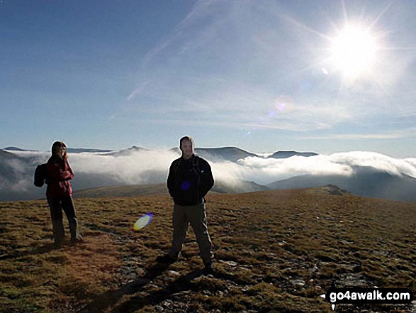
To reverse the order select the link again.


Mountain, Peak, Top or Hill:

Bagged


241. Beinn na Lap

935m (3,069ft)

  • Munro (No. 241)
  • Murdo (367th)
  • Marilyn (178th in Scotland, 184th in GB)

  • We hope to have walks that climb & bag Beinn na Lap very soon

    Google Maps Icon
    See the location of Beinn na Lap and walks up it on a google Map

    Beinn na Lap is on interactive maps:

  • OS Explorer (Orange Covers): OL50 and 385
  • OS Landranger (Pink Covers): 41

  • A go4awalk.com Peak Bagging Map and Hill Tick List featuring Beinn na Lap will be available soon.


    242. Am Basteir

    934m (3,065ft)

  • Munro (No. 242)
  • Murdo (370th)

  • We hope to have walks that climb & bag Am Basteir very soon

    Google Maps Icon
    See the location of Am Basteir and walks up it on a google Map

    Am Basteir is on interactive maps:

  • OS Explorer (Orange Covers): 411
  • OS Landranger (Pink Covers): 32

  • A go4awalk.com Peak Bagging Map and Hill Tick List featuring Am Basteir will be available soon.


    243. Meall a' Chrasgaidh

    934m (3,065ft)

  • Munro (No. 243)
  • Murdo (371st)

  • We hope to have walks that climb & bag Meall a' Chrasgaidh very soon

    Google Maps Icon
    See the location of Meall a' Chrasgaidh and walks up it on a google Map

    Meall a' Chrasgaidh is on interactive maps:

  • OS Explorer (Orange Covers): 436
  • OS Landranger (Pink Covers): 20

  • A go4awalk.com Peak Bagging Map and Hill Tick List featuring Meall a' Chrasgaidh will be available soon.


    244. Fionn Bheinn

    933m (3,062ft)

  • Munro (No. 245)
  • Murdo (374th)
  • Marilyn (179th in Scotland, 185th in GB)
  • OS Trig Point

  • We hope to have walks that climb & bag Fionn Bheinn very soon

    Google Maps Icon
    See the location of Fionn Bheinn and walks up it on a google Map

    Fionn Bheinn is on interactive maps:

  • OS Explorer (Orange Covers): 435
  • OS Landranger (Pink Covers): 20

  • A go4awalk.com Peak Bagging Map and Hill Tick List featuring Fionn Bheinn will be available soon.


    245. Maol Chean-dearg

    933m (3,062ft)

  • Munro (No. 244)
  • Murdo (373rd)
  • Marilyn (180th in Scotland, 186th in GB)

  • We hope to have walks that climb & bag Maol Chean-dearg very soon

    Google Maps Icon
    See the location of Maol Chean-dearg and walks up it on a google Map

    Maol Chean-dearg is on interactive maps:

  • OS Explorer (Orange Covers): 429
  • OS Landranger (Pink Covers): 25

  • A go4awalk.com Peak Bagging Map and Hill Tick List featuring Maol Chean-dearg will be available soon.


    246. The Cairnwell

    933m (3,062ft)

  • Munro (No. 246)
  • Murdo (375th)

  • To walk, climb & bag The Cairnwell use this easy to follow walk:

    Google Maps Icon
    See the location of The Cairnwell and walks up it on a google Map

    The Cairnwell is on interactive maps:

  • OS Explorer (Orange Covers): OL52
  • OS Landranger (Pink Covers): 43

  • A go4awalk.com Peak Bagging Map and Hill Tick List featuring The Cairnwell will be available soon.


    247. Meall Buidhe (Glen Lyon)

    932m (3,059ft)

  • Munro (No. 247)
  • Murdo (376th)
  • Marilyn (181st in Scotland, 187th in GB)

  • We hope to have walks that climb & bag Meall Buidhe (Glen Lyon) very soon

    Google Maps Icon
    See the location of Meall Buidhe (Glen Lyon) and walks up it on a google Map

    Meall Buidhe (Glen Lyon) is on interactive maps:

  • OS Explorer (Orange Covers): OL48
  • OS Landranger (Pink Covers): 51

  • A go4awalk.com Peak Bagging Map and Hill Tick List featuring Meall Buidhe (Glen Lyon) will be available soon.


    248. Beinn Chabhair

    932m (3,058ft)

  • Munro (No. 248)
  • Murdo (377th)
  • Marilyn (182nd in Scotland, 188th in GB)

  • We hope to have walks that climb & bag Beinn Chabhair very soon

    Google Maps Icon
    See the location of Beinn Chabhair and walks up it on a google Map

    Beinn Chabhair is on interactive maps:

  • OS Explorer (Orange Covers): OL39
  • OS Landranger (Pink Covers): 50 and 56

  • A go4awalk.com Peak Bagging Map and Hill Tick List featuring Beinn Chabhair will be available soon.


    249. Beinn Bhreac (Glen Derry)

    931m (3,056ft)

  • Munro (No. 249)
  • Murdo (378th)

  • We hope to have walks that climb & bag Beinn Bhreac (Glen Derry) very soon

    Google Maps Icon
    See the location of Beinn Bhreac (Glen Derry) and walks up it on a google Map

    Beinn Bhreac (Glen Derry) is on interactive maps:

  • OS Explorer (Orange Covers): OL57 and OL58
  • OS Landranger (Pink Covers): 43

  • A go4awalk.com Peak Bagging Map and Hill Tick List featuring Beinn Bhreac (Glen Derry) will be available soon.


    250. Ben Chonzie

    931m (3,055ft)

  • Munro (No. 250)
  • Murdo (380th)
  • Marilyn (183rd in Scotland, 190th in GB)

  • We hope to have walks that climb & bag Ben Chonzie very soon

    Google Maps Icon
    See the location of Ben Chonzie and walks up it on a google Map

    Ben Chonzie is on interactive maps:

  • OS Explorer (Orange Covers): OL47 and 379
  • OS Landranger (Pink Covers): 51 and 52

  • A go4awalk.com Peak Bagging Map and Hill Tick List featuring Ben Chonzie will be available soon.


    251. A' Chailleach (Monadhliath Mountains)

    930m (3,052ft)

  • Munro (No. 251)
  • Murdo (381st)

  • We hope to have walks that climb & bag A' Chailleach (Monadhliath Mountains) very soon

    Google Maps Icon
    See the location of A' Chailleach (Monadhliath Mountains) and walks up it on a google Map

    A' Chailleach (Monadhliath Mountains) is on interactive maps:

  • OS Explorer (Orange Covers): OL56
  • OS Landranger (Pink Covers): 35

  • A go4awalk.com Peak Bagging Map and Hill Tick List featuring A' Chailleach (Monadhliath Mountains) will be available soon.


    252. Bla Bheinn (Blaven)

    928m (3,046ft)

  • Munro (No. 254)
  • Murdo (388th)
  • Marilyn (184th in Scotland, 191st in GB)
  • OS Trig Point

  • We hope to have walks that climb & bag Bla Bheinn (Blaven) very soon

    Google Maps Icon
    See the location of Bla Bheinn (Blaven) and walks up it on a google Map

    Bla Bheinn (Blaven) is on interactive maps:

  • OS Explorer (Orange Covers): 411
  • OS Landranger (Pink Covers): 32

  • A go4awalk.com Peak Bagging Map and Hill Tick List featuring Bla Bheinn (Blaven) will be available soon.


    253. Mayar

    928m (3,046ft)

  • Munro (No. 255)
  • Murdo (389th)

  • We hope to have walks that climb & bag Mayar very soon

    Google Maps Icon
    See the location of Mayar and walks up it on a google Map

    Mayar is on interactive maps:

  • OS Explorer (Orange Covers): OL53
  • OS Landranger (Pink Covers): 44

  • A go4awalk.com Peak Bagging Map and Hill Tick List featuring Mayar will be available soon.


    254. Meall nan Eun (Lorn)

    928m (3,046ft)

  • Munro (No. 253)
  • Murdo (387th)
  • Marilyn (185th in Scotland, 192nd in GB)

  • We hope to have walks that climb & bag Meall nan Eun (Lorn) very soon

    Google Maps Icon
    See the location of Meall nan Eun (Lorn) and walks up it on a google Map

    Meall nan Eun (Lorn) is on interactive maps:

  • OS Explorer (Orange Covers): 377
  • OS Landranger (Pink Covers): 50

  • A go4awalk.com Peak Bagging Map and Hill Tick List featuring Meall nan Eun (Lorn) will be available soon.


    255. Moruisg

    928m (3,046ft)

  • Munro (No. 252)
  • Murdo (386th)
  • Marilyn (186th in Scotland, 193rd in GB)

  • We hope to have walks that climb & bag Moruisg very soon

    Google Maps Icon
    See the location of Moruisg and walks up it on a google Map

    Moruisg is on interactive maps:

  • OS Explorer (Orange Covers): 429 and 430
  • OS Landranger (Pink Covers): 25

  • A go4awalk.com Peak Bagging Map and Hill Tick List featuring Moruisg will be available soon.


    256. Ben Hope

    927m (3,042ft)

  • Munro (No. 256)
  • Murdo (392nd)
  • Marilyn (187th in Scotland, 194th in GB)
  • OS Trig Point

  • To walk, climb & bag Ben Hope use this easy to follow walk:

    Google Maps Icon
    See the location of Ben Hope and walks up it on a google Map

    Ben Hope is on interactive maps:

  • OS Explorer (Orange Covers): 447
  • OS Landranger (Pink Covers): 9

  • A go4awalk.com Peak Bagging Map and Hill Tick List featuring Ben Hope will be available soon.


    257. Eididh nan Clach Geala

    927m (3,042ft)

  • Munro (No. 257)
  • Murdo (393rd)
  • Marilyn (188th in Scotland, 195th in GB)

  • We hope to have walks that climb & bag Eididh nan Clach Geala very soon

    Google Maps Icon
    See the location of Eididh nan Clach Geala and walks up it on a google Map

    Eididh nan Clach Geala is on interactive maps:

  • OS Explorer (Orange Covers): 436
  • OS Landranger (Pink Covers): 20

  • A go4awalk.com Peak Bagging Map and Hill Tick List featuring Eididh nan Clach Geala will be available soon.


    258. Beinn Narnain

    927m (3,041ft)

  • Munro (No. 258)
  • Murdo (396th)
  • Marilyn (189th in Scotland, 196th in GB)
  • OS Trig Point

  • To walk, climb & bag Beinn Narnain use this easy to follow walk:

    Google Maps Icon
    See the location of Beinn Narnain and walks up it on a google Map

    Beinn Narnain is on interactive maps:

  • OS Explorer (Orange Covers): OL39
  • OS Landranger (Pink Covers): 56

  • A go4awalk.com Peak Bagging Map and Hill Tick List featuring Beinn Narnain will be available soon.


    259. Beinn Liath Mhor

    926m (3,039ft)

  • Munro (No. 259)
  • Murdo (397th)
  • Marilyn (190th in Scotland, 197th in GB)

  • We hope to have walks that climb & bag Beinn Liath Mhor very soon

    Google Maps Icon
    See the location of Beinn Liath Mhor and walks up it on a google Map

    Beinn Liath Mhor is on interactive maps:

  • OS Explorer (Orange Covers): 429
  • OS Landranger (Pink Covers): 25

  • A go4awalk.com Peak Bagging Map and Hill Tick List featuring Beinn Liath Mhor will be available soon.


    260. Geal Charn (Glen Markie)

    926m (3,039ft)

  • Munro (No. 262)
  • Murdo (400th)

  • We hope to have walks that climb & bag Geal Charn (Glen Markie) very soon

    Google Maps Icon
    See the location of Geal Charn (Glen Markie) and walks up it on a google Map

    Geal Charn (Glen Markie) is on interactive maps:

  • OS Explorer (Orange Covers): OL55
  • OS Landranger (Pink Covers): 35

  • A go4awalk.com Peak Bagging Map and Hill Tick List featuring Geal Charn (Glen Markie) will be available soon.


    261. Meall a' Choire Leith

    926m (3,039ft)

  • Munro (No. 260)
  • Murdo (398th)
  • Marilyn (191st in Scotland, 198th in GB)

  • We hope to have walks that climb & bag Meall a' Choire Leith very soon

    Google Maps Icon
    See the location of Meall a' Choire Leith and walks up it on a google Map

    Meall a' Choire Leith is on interactive maps:

  • OS Explorer (Orange Covers): OL48
  • OS Landranger (Pink Covers): 51

  • A go4awalk.com Peak Bagging Map and Hill Tick List featuring Meall a' Choire Leith will be available soon.


    262. Seana Bhraigh

    926m (3,039ft)

  • Munro (No. 261)
  • Murdo (399th)
  • Marilyn (192nd in Scotland, 199th in GB)
  • OS Trig Point

  • We hope to have walks that climb & bag Seana Bhraigh very soon

    Google Maps Icon
    See the location of Seana Bhraigh and walks up it on a google Map

    Seana Bhraigh is on interactive maps:

  • OS Explorer (Orange Covers): 436
  • OS Landranger (Pink Covers): 20

  • A go4awalk.com Peak Bagging Map and Hill Tick List featuring Seana Bhraigh will be available soon.


    263. Stob Coire Raineach (Buachaille Etive Beag)

    925m (3,036ft)

  • Munro (No. 263)
  • Murdo (403rd)
  • Marilyn (193rd in Scotland, 200th in GB)

  • To walk, climb & bag Stob Coire Raineach (Buachaille Etive Beag) use any of these easy to follow walks:

    Google Maps Icon
    See the location of Stob Coire Raineach (Buachaille Etive Beag) and walks up it on a google Map

    Stob Coire Raineach (Buachaille Etive Beag) is on interactive maps:

  • OS Explorer (Orange Covers): 384
  • OS Landranger (Pink Covers): 41

  • A go4awalk.com Peak Bagging Map and Hill Tick List featuring Stob Coire Raineach (Buachaille Etive Beag) will be available soon.


    264. Creag Pitridh

    924m (3,033ft)

  • Munro (No. 264)
  • Murdo (404th)

  • We hope to have walks that climb & bag Creag Pitridh very soon

    Google Maps Icon
    See the location of Creag Pitridh and walks up it on a google Map

    Creag Pitridh is on interactive maps:

  • OS Explorer (Orange Covers): OL50 and OL55
  • OS Landranger (Pink Covers): 34 and 42

  • A go4awalk.com Peak Bagging Map and Hill Tick List featuring Creag Pitridh will be available soon.


    265. Sgurr nan Eag

    924m (3,033ft)

  • Munro (No. 265)
  • Murdo (405th)

  • We hope to have walks that climb & bag Sgurr nan Eag very soon

    Google Maps Icon
    See the location of Sgurr nan Eag and walks up it on a google Map

    Sgurr nan Eag is on interactive maps:

  • OS Explorer (Orange Covers): 411
  • OS Landranger (Pink Covers): 32

  • A go4awalk.com Peak Bagging Map and Hill Tick List featuring Sgurr nan Eag will be available soon.


    266. An Coileachan

    923m (3,029ft)

  • Munro (No. 266)
  • Murdo (407th)

  • We hope to have walks that climb & bag An Coileachan very soon

    Google Maps Icon
    See the location of An Coileachan and walks up it on a google Map

    An Coileachan is on interactive maps:

  • OS Explorer (Orange Covers): 436
  • OS Landranger (Pink Covers): 20

  • A go4awalk.com Peak Bagging Map and Hill Tick List featuring An Coileachan will be available soon.


    267. Sgurr nan Each

    923m (3,029ft)

  • Munro (No. 267)
  • Murdo (408th)

  • We hope to have walks that climb & bag Sgurr nan Each very soon

    Google Maps Icon
    See the location of Sgurr nan Each and walks up it on a google Map

    Sgurr nan Each is on interactive maps:

  • OS Explorer (Orange Covers): 436
  • OS Landranger (Pink Covers): 20

  • A go4awalk.com Peak Bagging Map and Hill Tick List featuring Sgurr nan Each will be available soon.


    268. Tom na Gruagaich (Beinn Alligin)

    922m (3,026ft)

  • Munro (No. 268)
  • Murdo (411th)
  • Marilyn (194th in Scotland, 202nd in GB)
  • OS Trig Point

  • We hope to have walks that climb & bag Tom na Gruagaich (Beinn Alligin) very soon

    Google Maps Icon
    See the location of Tom na Gruagaich (Beinn Alligin) and walks up it on a google Map

    Tom na Gruagaich (Beinn Alligin) is on interactive maps:

  • OS Explorer (Orange Covers): 433
  • OS Landranger (Pink Covers): 19 and 24

  • A go4awalk.com Peak Bagging Map and Hill Tick List featuring Tom na Gruagaich (Beinn Alligin) will be available soon.


    269. An Socach (Glen Affric)

    921m (3,023ft)

  • Munro (No. 269)
  • Murdo (414th)

  • We hope to have walks that climb & bag An Socach (Glen Affric) very soon

    Google Maps Icon
    See the location of An Socach (Glen Affric) and walks up it on a google Map

    An Socach (Glen Affric) is on interactive maps:

  • OS Explorer (Orange Covers): 414
  • OS Landranger (Pink Covers): 25

  • A go4awalk.com Peak Bagging Map and Hill Tick List featuring An Socach (Glen Affric) will be available soon.


    270. Sgiath Chuil

    921m (3,022ft)

  • Munro (No. 270)
  • Murdo (415th)
  • Marilyn (195th in Scotland, 203rd in GB)

  • We hope to have walks that climb & bag Sgiath Chuil very soon

    Google Maps Icon
    See the location of Sgiath Chuil and walks up it on a google Map

    Sgiath Chuil is on interactive maps:

  • OS Explorer (Orange Covers): OL48
  • OS Landranger (Pink Covers): 51

  • A go4awalk.com Peak Bagging Map and Hill Tick List featuring Sgiath Chuil will be available soon.


    Page 9 of 10    Go to page: 1 2 3 4 5 6 7 8 9 10 Next Last


    View all 1674 Mountains, Peaks, Tops and Hills in Glen Coe Scottish Region : The River Tay to Rannoch Moor:


    Is there a Mountain, Peak, Top or Hill missing from the above google map or list?

    Let us know an we will add it to our database.


    Follow go4awalk.com on Twitter Follow go4awalk.com on Facebook


    Home


    Find new Friends to go walking with

    Walk all 214 Wainwrights in just 59 Walks. Download GPS Waypoints - Great Walks you must not miss!

    Walk The Yorkshire Three Peaks Challenge Walk - All the Latest Route Information, GPS Waypoints and Split Times to keep you on Schedule

    Walk The British Three Peaks Challenge Walk - All the Latest Route Information and GPS Waypoints

    See our pick of The Best Walks in The Lake District - Great Walks you must not miss!

    Walk our pick of the Best Lake District Ridge Walks - Great Walks you must not miss!

    Walk our pick of the Best Lake District Walks to do in the rain - Great Walks you must not miss!

    Walk our pick of The Best Walks in Snowdonia - Great Walks you must not miss!

    Walk our pick of The Best Ridge Walks in Wales - Walks you must not miss!

    Walk our pick of The Best Walks in The Brecon Beacons - Great Walks you must not miss!

    Walk our pick of The Best Walks in The Yorkshire Dales - Walks you must not miss!

    Walk our pick of The Best Walks in The Peak District - Walks you must not miss!

    Walk our pick of The Best Walks in The Forest of Bowland - Walks you must not miss!

    Walk our pick of The Best Walks in Shropshire - Walks you must not miss!

    Walk our pick of The Best Walks in Cheshire - Walks you must not miss!

    Walk our pick of The Best Walks in Lancashire - Walks you must not miss!

    Not sure where to walk next? Try Peak Bagging - Great Walks you must not miss!

    Not sure where to walk next? Walk part of a National Trail - Great Walks you must not miss!

    Walks with Downloadable and Uploadable GPS Waypoint Data

    Walking Kit and Gear Tested by Walkers

    Full Site Search