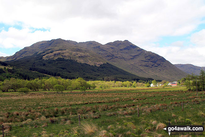
Scotland - a fully detailed list of all the Mountains, Peaks, Tops and Hills (Page 9 of 41)
If you count only the Marilyns there are 1218 tops to climb, bag & conquer and the highest point is Ben Nevis at 1,344m (4,411ft).
To see these Mountains, Peaks, Tops and Hills displayed in different ways - see the options in the left-hand column and towards the bottom of this page.
LOG ON and RELOAD this page to show which Mountains, Peaks, Tops and Hills you have already climbed, bagged & conquered [. . . more details]
See this list in: Alphabetical Order
| Height Order‡
To reverse the order select the link again.
Mountain, Peak, Top or Hill:
Bagged
241. Ben Aden
887m (2,911ft)
Ben Aden is on interactive maps:
A downloadable go4awalk.com PDF Peak Bagging Map featuring Ben Aden will be available soon. |
242. Meall a' Ghiubhais
887m (2,911ft)
Meall a' Ghiubhais is on interactive maps:
A downloadable go4awalk.com PDF Peak Bagging Map featuring Meall a' Ghiubhais will be available soon. |
243. Beinn a' Chaisteil (Loch Lyon)
886m (2,908ft)
Send it in and we'll publish it here.
Beinn a' Chaisteil (Loch Lyon) is on interactive maps:
A downloadable go4awalk.com PDF Peak Bagging Map featuring Beinn a' Chaisteil (Loch Lyon) will be available soon. |
244. Buidhe Bheinn
885m (2,905ft)
Buidhe Bheinn is on interactive maps:
A downloadable go4awalk.com PDF Peak Bagging Map featuring Buidhe Bheinn will be available soon. |
245. Garbh Bheinn (Glen Tarbert)
885m (2,904ft)
Send it in and we'll publish it here.
Garbh Bheinn (Glen Tarbert) is on interactive maps:
A downloadable go4awalk.com PDF Peak Bagging Map featuring Garbh Bheinn (Glen Tarbert) will be available soon. |
246. Cam Chreag (Glen Lochay)
884m (2,901ft)
Send it in and we'll publish it here.
Cam Chreag (Glen Lochay) is on interactive maps:
A downloadable go4awalk.com PDF Peak Bagging Map featuring Cam Chreag (Glen Lochay) will be available soon. |
247. The Cobbler (Ben Arthur)
884m (2,901ft)
See the location of The Cobbler (Ben Arthur) and walks up it on a google Map The Cobbler (Ben Arthur) is on interactive maps:
A downloadable go4awalk.com PDF Peak Bagging Map featuring The Cobbler (Ben Arthur) will be available soon. |
248. Stob Dubh (Glen Etive)
883m (2,898ft)
Stob Dubh (Glen Etive) is on interactive maps:
A downloadable go4awalk.com PDF Peak Bagging Map featuring Stob Dubh (Glen Etive) will be available soon. |
249. Beinn Odhar Bheag
882m (2,894ft)
Beinn Odhar Bheag is on interactive maps:
A downloadable go4awalk.com PDF Peak Bagging Map featuring Beinn Odhar Bheag will be available soon. |
250. Rois-Bheinn
882m (2,894ft)
Rois-Bheinn is on interactive maps:
A downloadable go4awalk.com PDF Peak Bagging Map featuring Rois-Bheinn will be available soon. |
251. Beinn Chuirn
880m (2,888ft)
Beinn Chuirn is on interactive maps:
A downloadable go4awalk.com PDF Peak Bagging Map featuring Beinn Chuirn will be available soon. |
252. Sgurr Mhurlagain
880m (2,888ft)
Sgurr Mhurlagain is on interactive maps:
A downloadable go4awalk.com PDF Peak Bagging Map featuring Sgurr Mhurlagain will be available soon. |
253. Fraochaidh
879m (2,885ft)
Fraochaidh is on interactive maps:
A downloadable go4awalk.com PDF Peak Bagging Map featuring Fraochaidh will be available soon. |
254. Sguman Coinntich
879m (2,885ft)
Sguman Coinntich is on interactive maps:
A downloadable go4awalk.com PDF Peak Bagging Map featuring Sguman Coinntich will be available soon. |
255. Ben Ledi
879m (2,884ft)
See the location of Ben Ledi and walks up it on a google Map Ben Ledi is on interactive maps:
A downloadable go4awalk.com PDF Peak Bagging Map featuring Ben Ledi will be available soon. |
256. Creag Uchdag
879m (2,884ft)
Creag Uchdag is on interactive maps:
A downloadable go4awalk.com PDF Peak Bagging Map featuring Creag Uchdag will be available soon. |
257. Sgurr a' Mhuilinn
879m (2,884ft)
Sgurr a' Mhuilinn is on interactive maps:
A downloadable go4awalk.com PDF Peak Bagging Map featuring Sgurr a' Mhuilinn will be available soon. |
258. Carn an Fhreiceadain
878m (2,882ft)
Send it in and we'll publish it here.
Carn an Fhreiceadain is on interactive maps:
A downloadable go4awalk.com PDF Peak Bagging Map featuring Carn an Fhreiceadain will be available soon. |
259. A' Chaoirnich (Creag an Loch)
875m (2,872ft)
Send it in and we'll publish it here.
A' Chaoirnich (Creag an Loch) is on interactive maps:
A downloadable go4awalk.com PDF Peak Bagging Map featuring A' Chaoirnich (Creag an Loch) will be available soon. |
260. Baosbheinn
875m (2,872ft)
Baosbheinn is on interactive maps:
A downloadable go4awalk.com PDF Peak Bagging Map featuring Baosbheinn will be available soon. |
261. Goatfell (Goat Fell)
874m (2,868ft)
Goatfell (Goat Fell) is on interactive maps:
A downloadable go4awalk.com PDF Peak Bagging Map featuring Goatfell (Goat Fell) will be available soon. |
262. Sgurr na Ba Glaise
874m (2,868ft)
Sgurr na Ba Glaise is on interactive maps:
A downloadable go4awalk.com PDF Peak Bagging Map featuring Sgurr na Ba Glaise will be available soon. |
263. Ben Hee (Sutherland)
873m (2,865ft)
Send it in and we'll publish it here.
Ben Hee (Sutherland) is on interactive maps:
A downloadable go4awalk.com PDF Peak Bagging Map featuring Ben Hee (Sutherland) will be available soon. |
264. Morven (Cairngorms)
871m (2,859ft)
Send it in and we'll publish it here.
Morven (Cairngorms) is on interactive maps:
A downloadable go4awalk.com PDF Peak Bagging Map featuring Morven (Cairngorms) will be available soon. |
265. Sgorr nan Lochan Uaine
871m (2,859ft)
Send it in and we'll publish it here.
Sgorr nan Lochan Uaine is on interactive maps:
A downloadable go4awalk.com PDF Peak Bagging Map featuring Sgorr nan Lochan Uaine will be available soon. |
266. Stob a' Choin
869m (2,852ft)
Stob a' Choin is on interactive maps:
A downloadable go4awalk.com PDF Peak Bagging Map featuring Stob a' Choin will be available soon. |
267. Faochaig
868m (2,849ft)
Faochaig is on interactive maps:
A downloadable go4awalk.com PDF Peak Bagging Map featuring Faochaig will be available soon. |
268. Meall na Meoig (Beinn Pharlagain)
868m (2,849ft)
Send it in and we'll publish it here.
Meall na Meoig (Beinn Pharlagain) is on interactive maps:
A downloadable go4awalk.com PDF Peak Bagging Map featuring Meall na Meoig (Beinn Pharlagain) will be available soon. |
269. Bidein a' Chabair
867m (2,845ft)
Bidein a' Chabair is on interactive maps:
A downloadable go4awalk.com PDF Peak Bagging Map featuring Bidein a' Chabair will be available soon. |
270. Garbh Bheinn (Loch Leven)
867m (2,845ft)
Send it in and we'll publish it here.
Garbh Bheinn (Loch Leven) is on interactive maps:
A downloadable go4awalk.com PDF Peak Bagging Map featuring Garbh Bheinn (Loch Leven) will be available soon. |
View these 1218 Mountains, Peaks, Tops and Hills:
- On an Interactive Google Map (loads faster)
- On an Interactive Google Map with a list of tops below it.
(makes it easier to locate a particular top) - On a Detailed List in:
Alphabetical Order | Height Order - On one page with 'yet-to-be-bagged' listed 1st & then 'already-bagged' tops listed 2nd in:
Alphabetical Order | Height Order - On one page with 'already-bagged' tops listed 1st & then 'yet-to-be-bagged' tops listed 2nd in:
Alphabetical Order | Height Order
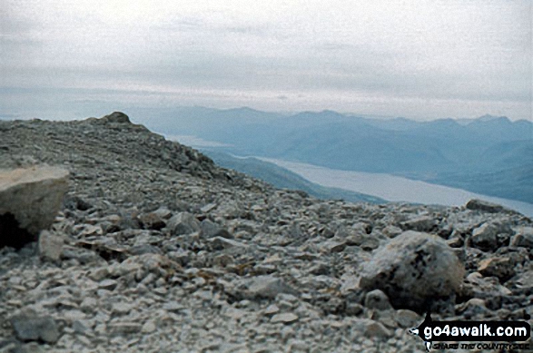 The summit of Ben Nevis in Loch Leven to Connel Bridge, Strath of Orchy and Glen LochyScotland
Photo: John Reed
Is there a Mountain, Peak, Top or Hill missing from the above google map or list?
Let us know an we will add it to our database.

