
![]()
Ben Ledi
879m (2884ft)
The Crianlarich Hills, Loch Lomond and The Trossachs to Loch Tay, Loch Lomond and The Trossochs, Stirlingshire, Scotland
Ben Ledi means 'Hill of the Gentle Slope - or God's Hill' .
The summit of Ben Ledi is marked by an Ordnance Survey Trig Point.

Not familiar with this top?
You can walk/hike to the top of Ben Ledi by using this easy‑to‑follow route map:
Walk st136 Ben Ledi from Pass of Leny
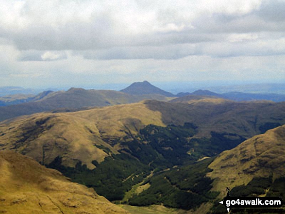
Fine views to the North and South
   |
|---|
Vital Statistics:
| Length: | 6.25ml (9.5km) |
|---|---|
| Ascent: | 2,681ft (817m) |
| Time: | 5 hrs |
| Grade: |  (Moderate) (Moderate) |

Route Summary:
Falls of Leny - Car Park NW of Falls of Leny - The Rob Roy Way - Garbh Uisge - Coireachchrombie - Stank - Stank Glen - Bealach Nan Corp - Coire na Fuaire - Gualainn Buidhe - Mullach Buidhem - Ben Ledi - Meal Odher - Creag Ghornm Car Park - Falls of Leny
See Ben Ledi and the surrounding tops on our free-to-access 'Google Style' Peak Bagging Maps:
The Crianlarich Hills area of Scottish Region 1: The Firth of Clyde to Strath Tay
Less data - quicker to download
Scottish Region 1: Loch Lomond and The Trossachs to Loch Tay
Less data - quicker to download
A go4awalk.com downloadable Peak Bagging Map in PDF format featuring Ben Ledi should be available soon.
You can find Ben Ledi & all the walks that climb it on these unique free-to-access Interactive Walk Planning Maps:
1:25,000 scale OS Explorer Map (orange/yellow covers):
1:50,000 scale OS Landranger Map (pink/magenta covers):
 Fellow go4awalkers who have already walked, climbed, scaled, summited, hiked & bagged Ben Ledi
Mark Davidson walked up Ben Ledi on May 8th, 2007 [with] Theresa [weather] Nice summer's day - Not a soul up there
Trevor Williams has walked, climbed & bagged Ben Ledi.
To add (or remove) your name and experiences on this page - Log On and edit your Personal Mountain Bagging Record
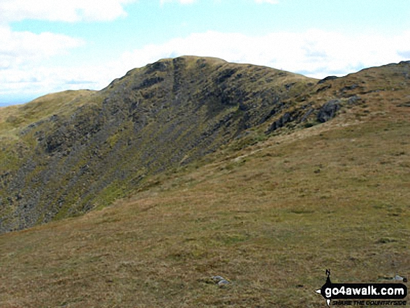
More Photographs & Pictures of views from, on, or of, Ben Ledi

Snow scultured by the wind with the The Lawers range in the distance from Ben Ledi


Send us your photographs and pictures on, of, or from Ben Ledi
If you would like to add your walk photographs and pictures to this page, please send them as email attachments (configured for any computer) along with your name to:
and we shall do our best to publish them.
(Guide Resolution = 300dpi. At least = 660pixels (wide) x 440 pixels (high).)

You can also submit photos via our Facebook Page.
NB. Please indicate where each photo was taken and whether you wish us to credit your photos with a Username or your First Name/Last Name.


