The Mountains, Peaks, Tops and Hills in Scotland as a detailed list

If you count only the Grahams there are 219 tops to climb, bag & conquer and the highest point is Sgurr a' Chaorainn at 761m (2,498ft).

munro
282/0
Munros

corbett
222/0
Corbetts

graham
219/0
Grahams

donald
89/0
Donalds

murdo
442/0
Murdos

marilyn
1557/0
Scottish
Marilyns

Bridget
0/0
Scottish
Bridgets

Trig Point
1398/0
Trig
Points


To see all Mountains, Peaks, Tops and Hills displayed in different ways - see the options in the left-hand column and towards the bottom of this page.


LOG ON and RELOAD this page to show which Mountains, Peaks, Tops and Hills you have already climbed, bagged & conquered [. . . more]


Page 1 of 8    Go to page: 1 2 3 4 5 6 7 8


See this list in: Alphabetical Order | Height Order
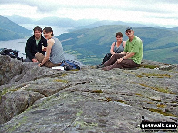
To reverse the order select the link again.


Mountain, Peak, Top or Hill:

Bagged


1. Beinn Talaidh

761m (2,498ft)

  • Graham (1st)
  • Marilyn (427th in Scotland, 468th in GB)
  • OS Trig Point

  • We hope to have walks that climb & bag Beinn Talaidh very soon

    Google Maps Icon
    See the location of Beinn Talaidh and walks up it on a google Map

    Beinn Talaidh is on interactive maps:

  • OS Explorer (Orange Covers): 375
  • OS Landranger (Pink Covers): 49

  • A go4awalk.com Peak Bagging Map and Hill Tick List featuring Beinn Talaidh will be available soon.


    2. Sgurr a' Chaorainn

    761m (2,498ft)

  • Graham (2nd)
  • Marilyn (428th in Scotland, 469th in GB)

  • We hope to have walks that climb & bag Sgurr a' Chaorainn very soon

    Google Maps Icon
    See the location of Sgurr a' Chaorainn and walks up it on a google Map

    Sgurr a' Chaorainn is on interactive maps:

  • OS Explorer (Orange Covers): 391
  • OS Landranger (Pink Covers): 40

  • A go4awalk.com Peak Bagging Map and Hill Tick List featuring Sgurr a' Chaorainn will be available soon.


    3. Beinn a' Chapuill

    759m (2,491ft)

  • Graham (3rd)
  • Marilyn (429th in Scotland, 470th in GB)

  • We hope to have walks that climb & bag Beinn a' Chapuill very soon

    Google Maps Icon
    See the location of Beinn a' Chapuill and walks up it on a google Map

    Beinn a' Chapuill is on interactive maps:

  • OS Explorer (Orange Covers): 413
  • OS Landranger (Pink Covers): 33

  • A go4awalk.com Peak Bagging Map and Hill Tick List featuring Beinn a' Chapuill will be available soon.


    4. Shee of Ardtalnaig (Ciste Buide a' Claidheimh)

    759m (2,491ft)

  • Graham (4th)
  • Marilyn (430th in Scotland, 471st in GB)

  • We hope to have walks that climb & bag Shee of Ardtalnaig (Ciste Buide a' Claidheimh) very soon

    Google Maps Icon
    See the location of Shee of Ardtalnaig (Ciste Buide a' Claidheimh) and walks up it on a google Map

    Shee of Ardtalnaig (Ciste Buide a' Claidheimh) is on interactive maps:

  • OS Explorer (Orange Covers): OL48
  • OS Landranger (Pink Covers): 51 and 52

  • A go4awalk.com Peak Bagging Map and Hill Tick List featuring Shee of Ardtalnaig (Ciste Buide a' Claidheimh) will be available soon.


    5. Carn an Tionail

    759m (2,489ft)

  • Graham (5th)
  • Marilyn (431st in Scotland, 472nd in GB)

  • We hope to have walks that climb & bag Carn an Tionail very soon

    Google Maps Icon
    See the location of Carn an Tionail and walks up it on a google Map

    Carn an Tionail is on interactive maps:

  • OS Explorer (Orange Covers): 447
  • OS Landranger (Pink Covers): 16

  • A go4awalk.com Peak Bagging Map and Hill Tick List featuring Carn an Tionail will be available soon.


    6. Beinn Shiantaidh

    757m (2,484ft)

  • Graham (6th)
  • Marilyn (432nd in Scotland, 473rd in GB)

  • We hope to have walks that climb & bag Beinn Shiantaidh very soon

    Google Maps Icon
    See the location of Beinn Shiantaidh and walks up it on a google Map

    Beinn Shiantaidh is on interactive maps:

  • OS Explorer (Orange Covers): 355
  • OS Landranger (Pink Covers): 61

  • A go4awalk.com Peak Bagging Map and Hill Tick List featuring Beinn Shiantaidh will be available soon.


    7. Creag Dhubh (Kingussie)

    756m (2,481ft)

  • Graham (7th)
  • Marilyn (433rd in Scotland, 474th in GB)

  • We hope to have walks that climb & bag Creag Dhubh (Kingussie) very soon

    Google Maps Icon
    See the location of Creag Dhubh (Kingussie) and walks up it on a google Map

    Creag Dhubh (Kingussie) is on interactive maps:

  • OS Explorer (Orange Covers): OL56
  • OS Landranger (Pink Covers): 35

  • A go4awalk.com Peak Bagging Map and Hill Tick List featuring Creag Dhubh (Kingussie) will be available soon.


    8. Cook's Cairn

    755m (2,478ft)

  • Graham (8th)
  • Marilyn (434th in Scotland, 476th in GB)

  • We hope to have walks that climb & bag Cook's Cairn very soon

    Google Maps Icon
    See the location of Cook's Cairn and walks up it on a google Map

    Cook's Cairn is on interactive maps:

  • OS Explorer (Orange Covers): OL62
  • OS Landranger (Pink Covers): 37

  • A go4awalk.com Peak Bagging Map and Hill Tick List featuring Cook's Cairn will be available soon.


    9. The Stob (Meall na Frean)

    753m (2,471ft)

  • Graham (9th)
  • Marilyn (435th in Scotland, 478th in GB)

  • We hope to have walks that climb & bag The Stob (Meall na Frean) very soon

    Google Maps Icon
    See the location of The Stob (Meall na Frean) and walks up it on a google Map

    The Stob (Meall na Frean) is on interactive maps:

  • OS Explorer (Orange Covers): OL46
  • OS Landranger (Pink Covers): 51

  • A go4awalk.com Peak Bagging Map and Hill Tick List featuring The Stob (Meall na Frean) will be available soon.


    10. Meallan a' Chuail

    750m (2,462ft)

  • Graham (10th)
  • Marilyn (436th in Scotland, 481st in GB)

  • We hope to have walks that climb & bag Meallan a' Chuail very soon

    Google Maps Icon
    See the location of Meallan a' Chuail and walks up it on a google Map

    Meallan a' Chuail is on interactive maps:

  • OS Explorer (Orange Covers): 440 and 442
  • OS Landranger (Pink Covers): 15

  • A go4awalk.com Peak Bagging Map and Hill Tick List featuring Meallan a' Chuail will be available soon.


    11. Groban

    749m (2,458ft)

  • Graham (12th)
  • Marilyn (437th in Scotland, 482nd in GB)

  • We hope to have walks that climb & bag Groban very soon

    Google Maps Icon
    See the location of Groban and walks up it on a google Map

    Groban is on interactive maps:

  • OS Explorer (Orange Covers): 435
  • OS Landranger (Pink Covers): 19

  • A go4awalk.com Peak Bagging Map and Hill Tick List featuring Groban will be available soon.


    12. Mona Gowan

    749m (2,458ft)

  • Graham (13th)
  • Marilyn (438th in Scotland, 483rd in GB)

  • We hope to have walks that climb & bag Mona Gowan very soon

    Google Maps Icon
    See the location of Mona Gowan and walks up it on a google Map

    Mona Gowan is on interactive maps:

  • OS Explorer (Orange Covers): OL59
  • OS Landranger (Pink Covers): 37

  • A go4awalk.com Peak Bagging Map and Hill Tick List featuring Mona Gowan will be available soon.


    13. Sgurr Choinich

    749m (2,458ft)

  • Graham (11th)
  • Marilyn (439th in Scotland, 484th in GB)

  • We hope to have walks that climb & bag Sgurr Choinich very soon

    Google Maps Icon
    See the location of Sgurr Choinich and walks up it on a google Map

    Sgurr Choinich is on interactive maps:

  • OS Explorer (Orange Covers): 399
  • OS Landranger (Pink Covers): 34

  • A go4awalk.com Peak Bagging Map and Hill Tick List featuring Sgurr Choinich will be available soon.


    14. Culter Fell

    748m (2,455ft)

  • Graham (14th)
  • Donald (15th)
  • Marilyn (440th in Scotland, 485th in GB)
  • OS Trig Point

  • We hope to have walks that climb & bag Culter Fell very soon

    Google Maps Icon
    See the location of Culter Fell and walks up it on a google Map

    Culter Fell is on interactive maps:

  • OS Explorer (Orange Covers): 336
  • OS Landranger (Pink Covers): 72

  • A go4awalk.com Peak Bagging Map and Hill Tick List featuring Culter Fell will be available soon.


    15. Binnein Shuas

    747m (2,452ft)

  • Graham (16th)
  • Marilyn (441st in Scotland, 486th in GB)

  • We hope to have walks that climb & bag Binnein Shuas very soon

    Google Maps Icon
    See the location of Binnein Shuas and walks up it on a google Map

    Binnein Shuas is on interactive maps:

  • OS Explorer (Orange Covers): OL50 and OL55
  • OS Landranger (Pink Covers): 34 and 42

  • A go4awalk.com Peak Bagging Map and Hill Tick List featuring Binnein Shuas will be available soon.


    16. Meall Mor (Strath Gartney)

    747m (2,452ft)

  • Graham (15th)
  • Marilyn (442nd in Scotland, 488th in GB)

  • We hope to have walks that climb & bag Meall Mor (Strath Gartney) very soon

    Google Maps Icon
    See the location of Meall Mor (Strath Gartney) and walks up it on a google Map

    Meall Mor (Strath Gartney) is on interactive maps:

  • OS Explorer (Orange Covers): OL39
  • OS Landranger (Pink Covers): 50 and 56

  • A go4awalk.com Peak Bagging Map and Hill Tick List featuring Meall Mor (Strath Gartney) will be available soon.


    17. Meall a' Mhuic

    745m (2,445ft)

  • Graham (17th)
  • Marilyn (443rd in Scotland, 490th in GB)

  • We hope to have walks that climb & bag Meall a' Mhuic very soon

    Google Maps Icon
    See the location of Meall a' Mhuic and walks up it on a google Map

    Meall a' Mhuic is on interactive maps:

  • OS Explorer (Orange Covers): OL48 and 385
  • OS Landranger (Pink Covers): 42 and 51

  • A go4awalk.com Peak Bagging Map and Hill Tick List featuring Meall a' Mhuic will be available soon.


    18. Druim Fada (Stob a' Ghrianain)

    744m (2,442ft)

  • Graham (19th)
  • Marilyn (444th in Scotland, 491st in GB)

  • We hope to have walks that climb & bag Druim Fada (Stob a' Ghrianain) very soon

    Google Maps Icon
    See the location of Druim Fada (Stob a' Ghrianain) and walks up it on a google Map

    Druim Fada (Stob a' Ghrianain) is on interactive maps:

  • OS Explorer (Orange Covers): 392 and 398
  • OS Landranger (Pink Covers): 41

  • A go4awalk.com Peak Bagging Map and Hill Tick List featuring Druim Fada (Stob a' Ghrianain) will be available soon.


    19. Dun Rig

    744m (2,442ft)

  • Graham (20th)
  • Donald (17th)
  • Marilyn (445th in Scotland, 492nd in GB)
  • OS Trig Point

  • We hope to have walks that climb & bag Dun Rig very soon

    Google Maps Icon
    See the location of Dun Rig and walks up it on a google Map

    Dun Rig is on interactive maps:

  • OS Explorer (Orange Covers):
  • OS Landranger (Pink Covers): 73

  • A go4awalk.com Peak Bagging Map and Hill Tick List featuring Dun Rig will be available soon.


    20. Mount Blair

    744m (2,442ft)

  • Graham (18th)
  • Marilyn (446th in Scotland, 493rd in GB)
  • OS Trig Point

  • We hope to have walks that climb & bag Mount Blair very soon

    Google Maps Icon
    See the location of Mount Blair and walks up it on a google Map

    Mount Blair is on interactive maps:

  • OS Explorer (Orange Covers): OL52
  • OS Landranger (Pink Covers): 43

  • A go4awalk.com Peak Bagging Map and Hill Tick List featuring Mount Blair will be available soon.


    21. Meall nan Gabhar

    744m (2,441ft)

  • Graham (21st)
  • Marilyn (447th in Scotland, 494th in GB)

  • We hope to have walks that climb & bag Meall nan Gabhar very soon

    Google Maps Icon
    See the location of Meall nan Gabhar and walks up it on a google Map

    Meall nan Gabhar is on interactive maps:

  • OS Explorer (Orange Covers): OL39
  • OS Landranger (Pink Covers): 50

  • A go4awalk.com Peak Bagging Map and Hill Tick List featuring Meall nan Gabhar will be available soon.


    22. Beinn nan Eun (Kildermorie Forest)

    743m (2,439ft)

  • Graham (23rd)
  • Marilyn (448th in Scotland, 495th in GB)

  • We hope to have walks that climb & bag Beinn nan Eun (Kildermorie Forest) very soon

    Google Maps Icon
    See the location of Beinn nan Eun (Kildermorie Forest) and walks up it on a google Map

    Beinn nan Eun (Kildermorie Forest) is on interactive maps:

  • OS Explorer (Orange Covers): 437
  • OS Landranger (Pink Covers): 20

  • A go4awalk.com Peak Bagging Map and Hill Tick List featuring Beinn nan Eun (Kildermorie Forest) will be available soon.


    23. Ben Mor Coigach

    743m (2,439ft)

  • Graham (24th)
  • Marilyn (449th in Scotland, 496th in GB)
  • OS Trig Point

  • We hope to have walks that climb & bag Ben Mor Coigach very soon

    Google Maps Icon
    See the location of Ben Mor Coigach and walks up it on a google Map

    Ben Mor Coigach is on interactive maps:

  • OS Explorer (Orange Covers): 439
  • OS Landranger (Pink Covers): 15

  • A go4awalk.com Peak Bagging Map and Hill Tick List featuring Ben Mor Coigach will be available soon.


    24. Creag Liath (Newtonmore)

    743m (2,439ft)

  • Graham (25th)
  • Marilyn (450th in Scotland, 497th in GB)

  • We hope to have walks that climb & bag Creag Liath (Newtonmore) very soon

    Google Maps Icon
    See the location of Creag Liath (Newtonmore) and walks up it on a google Map

    Creag Liath (Newtonmore) is on interactive maps:

  • OS Explorer (Orange Covers): OL56
  • OS Landranger (Pink Covers): 35

  • A go4awalk.com Peak Bagging Map and Hill Tick List featuring Creag Liath (Newtonmore) will be available soon.


    25. Geallaig Hill

    743m (2,439ft)

  • Graham (22nd)
  • Marilyn (451st in Scotland, 498th in GB)
  • OS Trig Point

  • We hope to have walks that climb & bag Geallaig Hill very soon

    Google Maps Icon
    See the location of Geallaig Hill and walks up it on a google Map

    Geallaig Hill is on interactive maps:

  • OS Explorer (Orange Covers): OL59
  • OS Landranger (Pink Covers): 37 and 44

  • A go4awalk.com Peak Bagging Map and Hill Tick List featuring Geallaig Hill will be available soon.


    26. Cnap Cruinn

    742m (2,435ft)

  • Graham (26th)
  • Marilyn (452nd in Scotland, 499th in GB)

  • We hope to have walks that climb & bag Cnap Cruinn very soon

    Google Maps Icon
    See the location of Cnap Cruinn and walks up it on a google Map

    Cnap Cruinn is on interactive maps:

  • OS Explorer (Orange Covers): 392
  • OS Landranger (Pink Covers): 41

  • A go4awalk.com Peak Bagging Map and Hill Tick List featuring Cnap Cruinn will be available soon.


    27. Sgorr na Ciche (Pap of Glencoe)

    742m (2,435ft)

  • Graham (27th)
  • Marilyn (453rd in Scotland, 500th in GB)

  • To walk, climb & bag Sgorr na Ciche (Pap of Glencoe) use either of these easy to follow walks:

    Google Maps Icon
    See the location of Sgorr na Ciche (Pap of Glencoe) and walks up it on a google Map

    Sgorr na Ciche (Pap of Glencoe) is on interactive maps:

  • OS Explorer (Orange Covers): 384
  • OS Landranger (Pink Covers): 41

  • A go4awalk.com Peak Bagging Map and Hill Tick List featuring Sgorr na Ciche (Pap of Glencoe) will be available soon.


    28. Beinn Mhor (Loch Eck)

    741m (2,432ft)

  • Graham (28th)
  • Marilyn (454th in Scotland, 501st in GB)
  • OS Trig Point

  • We hope to have walks that climb & bag Beinn Mhor (Loch Eck) very soon

    Google Maps Icon
    See the location of Beinn Mhor (Loch Eck) and walks up it on a google Map

    Beinn Mhor (Loch Eck) is on interactive maps:

  • OS Explorer (Orange Covers): OL37
  • OS Landranger (Pink Covers): 56

  • A go4awalk.com Peak Bagging Map and Hill Tick List featuring Beinn Mhor (Loch Eck) will be available soon.


    29. Sgurr Dearg (Mull)

    741m (2,432ft)

  • Graham (29th)
  • Marilyn (455th in Scotland, 502nd in GB)

  • We hope to have walks that climb & bag Sgurr Dearg (Mull) very soon

    Google Maps Icon
    See the location of Sgurr Dearg (Mull) and walks up it on a google Map

    Sgurr Dearg (Mull) is on interactive maps:

  • OS Explorer (Orange Covers): 375
  • OS Landranger (Pink Covers): 49

  • A go4awalk.com Peak Bagging Map and Hill Tick List featuring Sgurr Dearg (Mull) will be available soon.


    30. Badandun Hill

    740m (2,429ft)

  • Graham (30th)
  • Marilyn (456th in Scotland, 503rd in GB)
  • OS Trig Point

  • We hope to have walks that climb & bag Badandun Hill very soon

    Google Maps Icon
    See the location of Badandun Hill and walks up it on a google Map

    Badandun Hill is on interactive maps:

  • OS Explorer (Orange Covers): OL53
  • OS Landranger (Pink Covers): 44

  • A go4awalk.com Peak Bagging Map and Hill Tick List featuring Badandun Hill will be available soon.


    Page 1 of 8    Go to page: 1 2 3 4 5 6 7 8


    View all 1674 Mountains, Peaks, Tops and Hills in Scottish Region : The East Mounth - Glen Shee and Mount Keen to Montrose:


    Is there a Mountain, Peak, Top or Hill missing from the above google map or list?

    Let us know an we will add it to our database.


    Follow go4awalk.com on Twitter Follow go4awalk.com on Facebook


    Home


    Find new Friends to go walking with

    Walk all 214 Wainwrights in just 59 Walks. Download GPS Waypoints - Great Walks you must not miss!

    Walk The Yorkshire Three Peaks Challenge Walk - All the Latest Route Information, GPS Waypoints and Split Times to keep you on Schedule

    Walk The British Three Peaks Challenge Walk - All the Latest Route Information and GPS Waypoints

    See our pick of The Best Walks in The Lake District - Great Walks you must not miss!

    Walk our pick of the Best Lake District Ridge Walks - Great Walks you must not miss!

    Walk our pick of the Best Lake District Walks to do in the rain - Great Walks you must not miss!

    Walk our pick of The Best Walks in Snowdonia - Great Walks you must not miss!

    Walk our pick of The Best Ridge Walks in Wales - Walks you must not miss!

    Walk our pick of The Best Walks in The Brecon Beacons - Great Walks you must not miss!

    Walk our pick of The Best Walks in The Yorkshire Dales - Walks you must not miss!

    Walk our pick of The Best Walks in The Peak District - Walks you must not miss!

    Walk our pick of The Best Walks in The Forest of Bowland - Walks you must not miss!

    Walk our pick of The Best Walks in Shropshire - Walks you must not miss!

    Walk our pick of The Best Walks in Cheshire - Walks you must not miss!

    Walk our pick of The Best Walks in Lancashire - Walks you must not miss!

    Not sure where to walk next? Try Peak Bagging - Great Walks you must not miss!

    Not sure where to walk next? Walk part of a National Trail - Great Walks you must not miss!

    Walks with Downloadable and Uploadable GPS Waypoint Data

    Walking Kit and Gear Tested by Walkers

    Full Site Search