   |
Vital Statistics:
| Length: | 6mls (9.5km) |
| Ascent: | 1,194ft (364m) |
| Time: | 3¼hrs |
| Grade: |  |
Route outline for walk ce101:
The Arch - Coed Yr Arch - Coed y Cwm - Bryn-llwyd - Coed y Ceuleth - Truman - Rhos Peiran - Craig U Ceffyl - Pen Y Garn (Bryn Garw) - Banc Myheryn - Rhos Nantperfedd - Glemast Farm - Rhos y Cwm - The Arch
Peaks, Summits and Tops reached on this walk:
 1 Welsh Mountain |
 0 Wainwrights |
 1 Welsh Nuttall |
 0 Welsh Deweys |
 0 Wainwright Outlying Fells |
 1 Welsh Marilyn |
 0 Bridgets |
Peak Bagging Statistics for this walk:
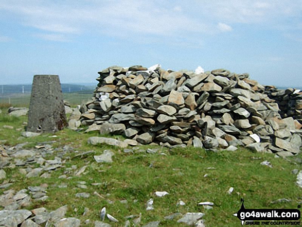
The highest point of this walk is Pen y Garn (Bryn Garw) at 611m (2002ft). Pen y Garn (Bryn Garw) is classified as a Welsh Mountain (Hewitt) (134th highest in Wales, 314th highest in England & Wales)
Pen y Garn (Bryn Garw) is also known as a Welsh Nuttall (186th highest in Wales, 436th highest in England & Wales) and a Welsh Marilyn (53rd highest in Wales, 750th highest in the UK).
The summit of Pen y Garn (Bryn Garw) is marked by an Ordnance Survey Trig Point.
Free-to-access Interactive Walk Planning Maps:
1:25,000 scale OS Explorer Map (orange/yellow covers):
An Interactive Walk Planning Map for OS Explorer 213 Aberystwyth & Cwm Rheidol is not currently available
1:50,000 scale OS Landranger Map (pink/magenta covers):
An Interactive Walk Planning Map for OS Landranger 135 Aberystwyth & Machynlleth is not currently available
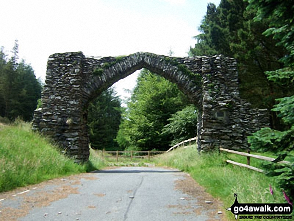
Some Photos and Pictures from Walk ce101 Pen y Garn (Bryn Garw) from The Arch
In no particular order . . .
Send us your photographs and pictures from your walks and hikes
We would love to see your photographs and pictures from walk ce101 Pen y Garn (Bryn Garw) from The Arch. Send them in to us as email attachments (configured for any computer) along with your name and where the picture was taken to:
and we shall do our best to publish them.
(Guide Resolution = 300dpi. At least = 660 pixels (wide) x 440 pixels (high).)

You can also submit photos from walk ce101 Pen y Garn (Bryn Garw) from The Arch via our Facebook Page.
NB. Please indicate where each photo was taken.


