UK Postcode SR4 - The 30 nearest easy-to-follow, circular walk route maps to you
The thirty nearest easy-to-follow, circular walk route maps to you in UK Postcode SR4 in Walk Grade Order
The UK cities, towns and villages in Tyne and Wear, England that have SR4 in their UK Postcode include:
• South Hylton •
Tap/mouse over a coloured circle (1-3 easy walks, 4-6 moderate walks, 7-9 hard walks) and click to select.
Scroll down the list of walks below & click on each walk title (in blue) to locate it on the map above.
   |
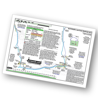
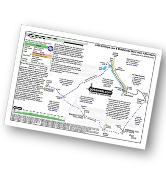
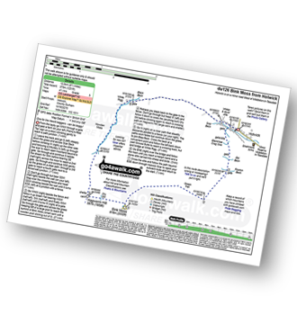
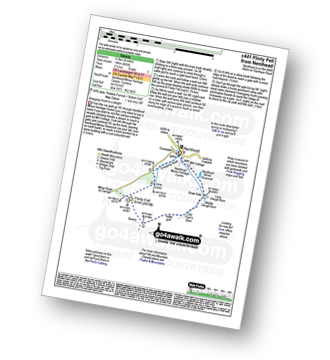
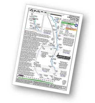
Vital Statistics:
| Length: | 5.5 miles (8.5 km) |
| Ascent: | 46ft (14m) |
| Time: | 2 hrs |
| Grade: |  |
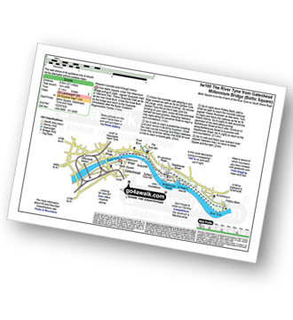
Route Summary:
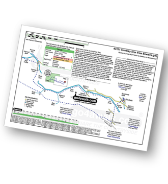
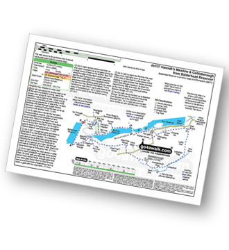
Baltic Square - Gateshead - Millennium Bridge - Newcastle - Quayside Walk - The Hadrian's Way - The Hadrian's Wall Path - Byker Ouseburn Regeneration Centre - Ouse Burn - Spillars Tyne Mill - Hadrian's Cycle Way - St Anthony's - Pottery Bank - St Peters Marina - Quayside Walk - Newcastle - Millennium Bridge - Gateshead.
|
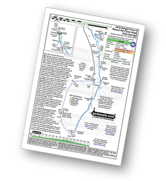
Vital Statistics:
| Length: | 8.5 miles (13.5 km) |
| Ascent: | 1,093ft (333m) |
| Time: | 4.25hrs |
| Grade: |  |
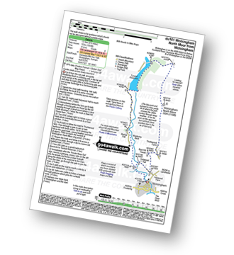
Route Summary:
Wolsingham - Waskerley Beck - Holywood House - Bael Hill House - Thistlewood Farm - Wolsingham North Moor - Tunstall Reservoir - Bishop Oak - Wolsingham
|
Vital Statistics:
| Length: | 10.5 miles (17 km) |
| Ascent: | 853ft (260m) |
| Time: | 4½ hrs |
| Grade: | |
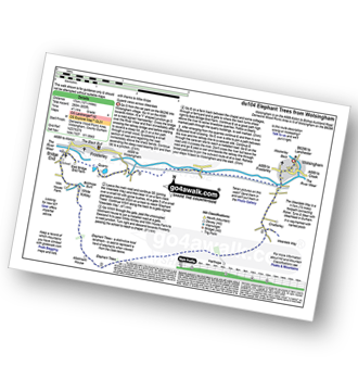
Route Summary:
Wolsingham - River Wear - Weardale - The Weardale Way - Ashes House - Towdy Potts - Spence Hill - Harthope - Sunnyside Edge - Elephant Trees - Pikestone Fell - Allotment House - Folly Plantation - Harehope Farm - White Kirkley Farm - Bolihope Burn - Lower Bishopley Farm - Miln House Farm - Bridge End - Frosterley - Weardale - Wolsingham
|
Vital Statistics:
| Length: | 11 miles (17 km) |
| Ascent: | 1,246ft (380m) |
| Time: | 5.25hrs |
| Grade: |  |
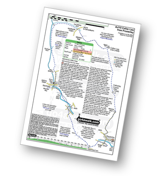
Route Summary:
Frosterley - Wireless Mast - Fatherley Currick - Collier Law - Weatherhill Engine - Heathery Burn - Stanhope Burn - Stanhope - River Wear - Stepping Stones - Weardale - The Weardale Way - Dryburnside Farm - Frosterley
|
Vital Statistics:
| Length: | 14.5 miles (23 km) |
| Ascent: | 1,805ft (550m) |
| Time: | 7.25hrs |
| Grade: |  |
Route Summary:
Stanhope - River Wear - Weardale - The Weardale Way - River Wear - Eastgate - Rookhope Burn - Rookhope - C2C Cycle Route - Longlaw End - Bolt's Law (Hunstanworth) - Weatherhill Engine - East Whitely Beck - Stanhope Burn - Stanhope
|
Vital Statistics:
| Length: | 14 miles (22.5 km) |
| Ascent: | 1,979ft (603m) |
| Time: | 7 hrs |
| Grade: |  |
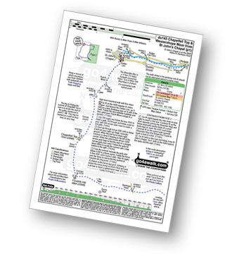
Route Summary:
St John's Chapel - Thatch Mires - Chapelfell Top - Fendrith Hill - Swinhope Moor - Dora's Seat - Swinhope Head - Westernhope Moor - Black Hill (Westernhope Moor) - Littlewood Farm - Brotherlee - Shield - River Wear - Weardale - The Weardale Way - Westgate - Daddry - St John's Chapel
|
Vital Statistics:
| Length: | 9 miles (14.5 km) |
| Ascent: | 1,651ft (503m) |
| Time: | 5 hrs |
| Grade: | |
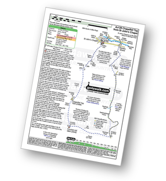
Route Summary:
St John's Chapel - Thatch Mires - Chapelfell Top - Fendrith Hill - Swinhope Moor - Dora's Seat - Swinhope Head - Swinside House - Daddry Shield - River Wear - Weardale - The Weardale Way - St John's Chapel
|
Vital Statistics:
| Length: | 12.75 miles (20.5 km) |
| Ascent: | 1,759ft (536m) |
| Time: | 6½ hrs |
| Grade: | |
Route Summary:
Allenheads - Dirt Pots - The Weardale Way - Killhope Law - Shivery Hill - Carshield Moor - Scum Hill - Hartley Moor - Nan Davison's Cleugh - Philipson's Fold - Knockshield Moor - Black Way (Track) - Swinhope Shield - High Knock Shield - Knock Shield - Knockburn Farm - River East Allen - Low Sipton Shield - Sipton Terrace - Teedham Green - Corn Mill - Low Huntwell - Dirt Pots - Allenheads
|
Vital Statistics:
| Length: | 9.5 miles (15 km) |
| Ascent: | 1,378ft (420m) |
| Time: | 4.75hrs |
| Grade: | |
Route Summary:
Allenheads - Dirt Pots - The Weardale Way - Killhope Law - Stangend Currick - Middlehope Moor - Shorngate Cross - Allenheads
|
Vital Statistics:
| Length: | 9 miles (14.5 km) |
| Ascent: | 1,730ft (527m) |
| Time: | 5 hrs |
| Grade: | |
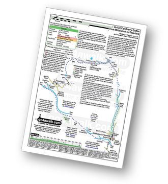
Route Summary:
Middleton-in-Teesdale - Hudeshope Beck - Skears Lime Kilns - Club Gill Farm - Coldberry Mine - Coldberry Gutter - Hardberry Hill - Stable Edge - Newbiggin - Newbiggin Bridge - The Pennine Way - Park End Wood - Knott Hill - Middle Crossthwaite - The River Tees - Middleton-in-Teesdale
|
Vital Statistics:
| Length: | 8.25 miles (13 km) |
| Ascent: | 1,172ft (357m) |
| Time: | 4.25hrs |
| Grade: | |
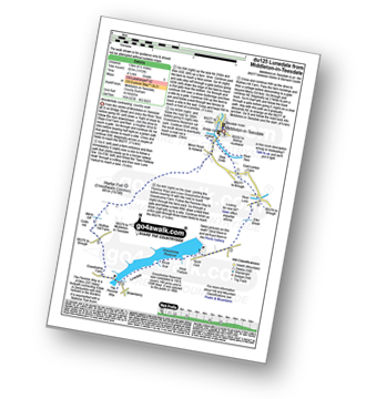
Route Summary:
Middleton-in-Teesdale - River Tees - River Lune - Eller Brook - Grassholme Reservoir - Lunedale - The Pennine Way - Crossthwaite Common - Harter Fell (Crossthwaite Common) - River Tees - Middleton-in-Teesdale
|
Vital Statistics:
| Length: | 17.5 miles (28 km) |
| Ascent: | 1,591ft (485m) |
| Time: | 7.75hrs |
| Grade: | |
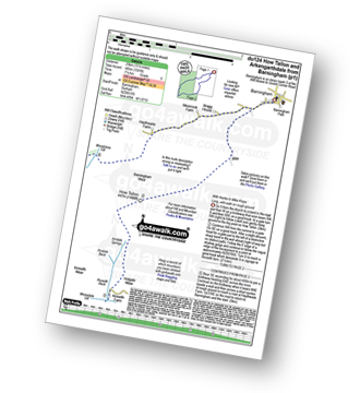
Route Summary:
Barningham - Birk Hills Farm - Brown Hill - Cathaw Stoop - Carter Allotment - Badger Way - Badger Way Stoop - How Tallon - How Tallon Gate - How Tallon Ridge - High Moor - Arndale Springs - Frankinshaw How - Holgate Moor - Arndale hole - Kexwith Beck - Kexwith Farm - Moresdale Gill - Moresdale - Moresdale Road - Fair Seat Hill - Moresdale Ridge - Stony Man (St Andrew's Cross) - Booze Moor - Low Moor - Windeg Vein - Little Windeg - Dry Gill Bottom - Shaw Farm - Stang Side - Stang House - Freestone Ridge - Stang Top - Hope Moor - The Stang - Woodcote Gill - Black Hill Gate - Haythwaite Farm - Moorcock Farm - Bragg House - Barningham
|
Vital Statistics:
| Length: | 12.5 miles (20 km) |
| Ascent: | 1,279ft (390m) |
| Time: | 5.75hrs |
| Grade: | |
Route Summary:
Bowlees - Wynch Bridge - River Tees - Holwick - Low Currick Rigg - Blea Beck - Whiteholm Bank - Dry Beck - Skyer Beck - Birk Rigg - Thistle Green - White Well Green - River Tees - Fox Earths - Raven Scar - Cronkley Scar - Green Hill - Cronkley Pasture - High House - The Pennine Way - Cronkley Farm - Bracken Rigg - Bleabeck Force - High Force - Saur Hill Bridge - Low Force - Wynch Bridge - Bowlees
|
Vital Statistics:
| Length: | 7.5 miles (12 km) |
| Ascent: | 1,287ft (392m) |
| Time: | 4 hrs |
| Grade: | |
Route Summary:
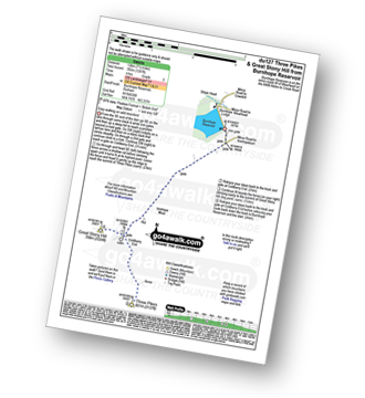
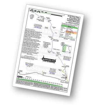
Burnhope Reservoir - Ireshope Moor - Coldberry End - Three Pikes - Coldberry End - Great Stony Hill - Coldberry End - Ireshope Moor - Burnhope Reservoir
|
Vital Statistics:
| Length: | 14 miles (22.5 km) |
| Ascent: | 1,904ft (580m) |
| Time: | 7 hrs |
| Grade: | |
Route Summary:
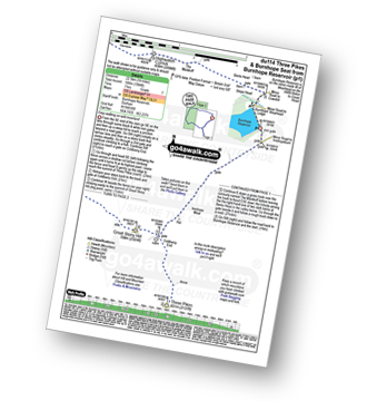
Burnhope Reservoir - Ireshope Moor - Coldberry End - Three Pikes - Coldberry End - Great Stony Hill - Scaud Hill - Redgleam (Harwood Common) - Burnhope Seat - Dead Stones - White Edge (Burnhope Reservoir) - Lamb's Head - Highwatch Currick - The Malakoff - Bents Head - Stripe End - Burnhope Reservoir
|
Vital Statistics:
| Length: | 11.5 miles (18.5 km) |
| Ascent: | 1,631ft (497m) |
| Time: | 5.75hrs |
| Grade: | |
Route Summary:
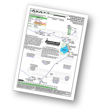
Burnhope Reservoir - Ireshope Moor - Coldberry End - Great Stony Hill - Scaud Hill - Redgleam (Harwood Common) - Burnhope Seat - Dead Stones - White Edge (Burnhope Reservoir) - Lamb's Head - Highwatch Currick - The Malakoff - Bents Head - Stripe End - Burnhope Reservoir
|
Vital Statistics:
| Length: | 8.5 miles (13.5 km) |
| Ascent: | 1,231ft (375m) |
| Time: | 4½ hrs |
| Grade: | |
Route Summary:
Holwick - Holwick Scars - Rowton Beck - Green Fell - Bink Moss - Dry Gill - Hagworm Hill - Howden Moss - Black Beck - White Rigg - Holwick
|
Vital Statistics:
| Length: | 8.5 miles (13.5 km) |
| Ascent: | 1,450ft (442m) |
| Time: | 4.75hrs |
| Grade: | |
Route Summary:
Rothbury - The St Oswald's Way - Whitton - Whittondean Farm - Garleigh Moor - Lordenshaws Car Park - The Beacon - Dove Crag - Old stell Crag - Simonside - Bob Pyle's Studdie - Joe's Wood - Great Tosson - The Old Pumphouse - River Coquet - Anton's Letch - Rothbury
|
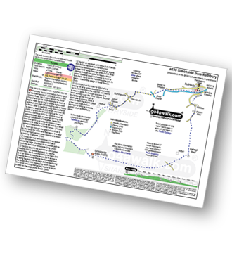
Vital Statistics:
| Length: | 5 miles (8 km) |
| Ascent: | 1,030ft (314m) |
| Time: | 3 hrs |
| Grade: | |
Route Summary:
Rothbury - Blaeberry Hill - Telecommncations Mast - Ship Crag - Brae Head - Target Plantation - Glitteringstone - Rothbury Terrace - Primrose Cottage - Debdon Burn - Debdon Plantation - Tumbleton House - Debden Lake - Tumbleton Lake - Addycombe Farm - Hillside Road - Rothbury
|
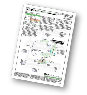
Vital Statistics:
| Length: | 4.5 miles (7 km) |
| Ascent: | 387ft (118m) |
| Time: | 2 hrs |
| Grade: |  |
Route Summary:
Alnmouth - Beach - The St Oswald's Way - River Aln - Lesbury - Foxton Hall - Marden Rocks - Alnmouth Golf Club - Alnmouth
|
Vital Statistics:
| Length: | 14 miles (22.5 km) |
| Ascent: | 1,743ft (531m) |
| Time: | 7 hrs |
| Grade: | |
Route Summary:
Langdon Beck - Tarn Hole - Tarn Hole Edge - Three Pikes - Grasshill Common - Causeway Hill - Coldberry Edge - Great Stony Hill - Scaud Hill - Redgleam (Harwood Common) - Swallow Hole - Holdenhurth Band - Herdship Fell - Viewing Hill - Backside Fell Bothy - West Common - Touting Hill - Cow Green Reservoir - Widdybank Fell - Langdon Beck
|
Vital Statistics:
| Length: | 7.75 miles (12.5 km) |
| Ascent: | 988ft (301m) |
| Time: | 4 hrs |
| Grade: | |
Route Summary:
Balderhead Reservoir - High Birk Hat Farm - The Pennine Way - Hannah's Meadow - Birk Hat Farm - Blackton Reservoir - Baldsersdale - Willoughby Hall - Scoon Bank - West Brisco - Coproal Hill - East Brisco - How Beck - Lathe Haw - Lathehaw Rigg - Goldsborough Rigg - Goldsborough - East Friar House - Mawmon Sike - Balckton Grange - Balderhead Reservoir
|
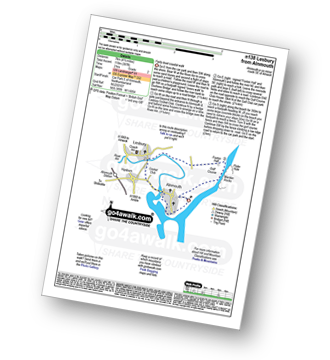
Vital Statistics:
| Length: | 6.25 miles (10 km) |
| Ascent: | 821ft (250m) |
| Time: | 3.25hrs |
| Grade: |  |
Route Summary:
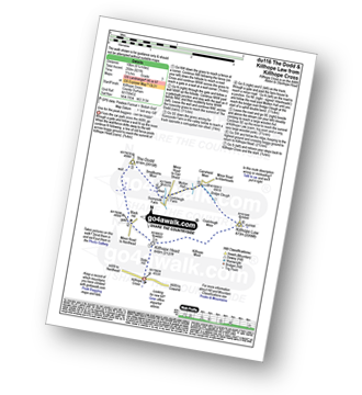
Killhope Cross - Killhope Head - Black Hill - The Dodd - Smallburns Moor - Sunnyside Farm - Coalcleugh Farm - Mufton Hall - Carrshield Moor - Bridge Cleugh - Killhope Law - Killhope Head - Killhope Cross
|
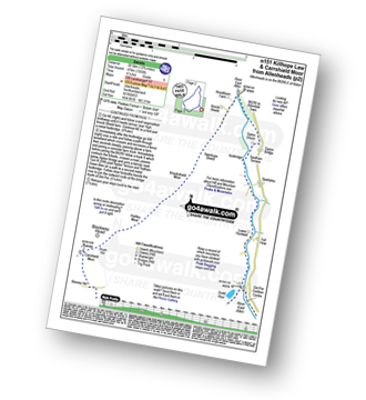
Vital Statistics:
| Length: | 8.25 miles (13 km) |
| Ascent: | 1,460ft (445m) |
| Time: | 4½ hrs |
| Grade: | |
Route Summary:
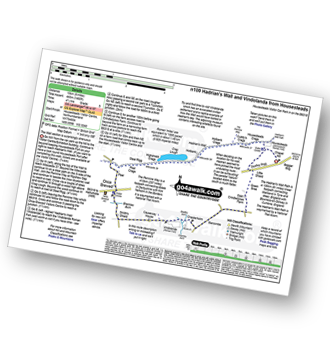
Housteads Visitor Centre - Chapel Hill - Housesteads - Vercovicium Fort - The Hadrian's Wall Path - Housesteads Crags - Cuddy's Crag - The Pennine Way - Hotbank Crags - Hotbank - Crag Lough - Highshield Crags - Steel Rigg - Peel Crags - Peel - Once Brewed - Brackies Burn - Smith's Shield - Causeway House - Vindolanda Roman Fort - Chesterholm - Barcombe - East Crindledykes Farm - Green Brae - Little Shield - Deafley Rigg - Housteads Visitor Centre
|
Vital Statistics:
| Length: | 4 miles (6.5 km) |
| Ascent: | 643ft (196m) |
| Time: | 2.25hrs |
| Grade: | |
Route Summary:
Nenthead - Nenthead Mines Heritage Centre - Shaw Side - Old Carr's Burn - Flinty Fell - Dowgang Hush - Nenthead
|
Vital Statistics:
| Length: | 7.75 miles (12.5 km) |
| Ascent: | 1,250ft (381m) |
| Time: | 4 hrs |
| Grade: | |
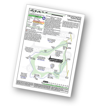
Route Summary:
Thrunton Wood - Callaly Crag - Hard Nab - Long Crag - Coe Crags - Coe Burn - Thrunton Wood
|
Vital Statistics:
| Length: | 15.75 miles (23.5 km) |
| Ascent: | 1,835ft (559m) |
| Time: | 7.25hrs |
| Grade: | |
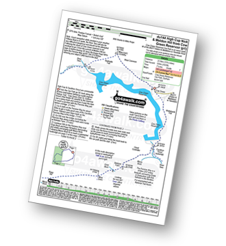
Route Summary:
Cow Green Reservoir - Widdybank Fell - Cauldron Snout - The Pennine Way - Birkdale Farm - Grain Beck - Rasp Hill - Maize Beck - High Cup - High Cup Nick - Stake Beck - Meldon Hill (Dufton Fell) - Force Burn - River Tees - Backside Fell Bothy - Cow Green Reservoir
|
Vital Statistics:
| Length: | 10 miles (16 km) |
| Ascent: | 1,359ft (414m) |
| Time: | 4 hrs |
| Grade: | |
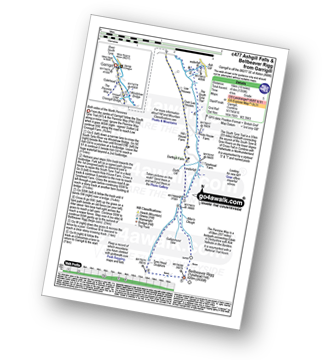
Route Summary:
Garrigill - The Pennine Way - The South Tyne Trail - Low Crossgill - Ash Gill - Ashgill Force - Waterfall - Hole House Farm - Tynehead Farm - Allan's Clough - Bellbeaver Rigg (Tynehead Fell) - Tyne Head - Garrigill
|
Vital Statistics:
| Length: | 11 miles (17.5 km) |
| Ascent: | 1,766ft (538m) |
| Time: | 5.75hrs |
| Grade: | |
Route Summary:
Garrigill - The Pennine Way - The South Tyne Trail - Low Crossgill - Ash Gill - Ashgill Force - Waterfall - Hole House Farm - Tynehead Farm - Allan's Clough - Bellbeaver Rigg (Tynehead Fell) - Tyne Head - Round Hill (Tyne Head) - Noonstones Hill - Dorthgill Farm - Hill House Farm - Lee Houses - Garrigill
|
Vital Statistics:
| Length: | 10.25 miles (16.5 km) |
| Ascent: | 1,408ft (429m) |
| Time: | 5.25hrs |
| Grade: | |
Route Summary:
Garrigill - The Pennine Way - The South Tyne Trail - Low Crossgill - Ash Gill - Ashgill Force - Waterfall - Hole House Farm - Tynehead Farm - Tyne Head - Round Hill (Tyne Head) - Noonstones Hill - Dorthgill Farm - Hill House Farm - Lee Houses - Garrigill


