Two easy to follow pub walks from The Dukes Head, Brockham, Surrey, England
To reach The Dukes Head, Brockham, in-car SatNav users should select the Latitude/Longitude (Lat Lon) screen and enter:
Lat = N51.23306 and Lon = W 0.28589
Tap/mouse over a coloured circle (1-3 easy walks, 4-6 moderate walks, 7-9 hard walks) and click to select.
Tap/mouse over a coloured circle (1-3 easy walks, 4-6 moderate walks, 7-9 hard walks) and click to select.
Two easy to follow pub walks from The Dukes Head, Brockham, Surrey, England
Scroll down the list of walks below & click on each walk title (in blue) to locate it on the map above.
   |
Vital Statistics:
| Length: | 2.75 miles (4.5 km) |
| Ascent: | 151ft (46m) |
| Time: | 1.25hrs |
| Grade: |  |
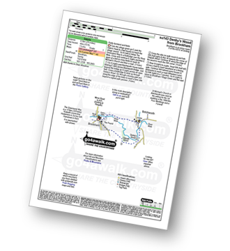
Route Summary:
Brockham - The Greensand Way - The River Mole - St Michael's Church - Betchworth - Denby's Wood - Oldpark Wood - Brockham
|
Vital Statistics:
| Length: | 7 miles (11 km) |
| Ascent: | 962ft (293m) |
| Time: | 3½ hrs |
| Grade: |  |
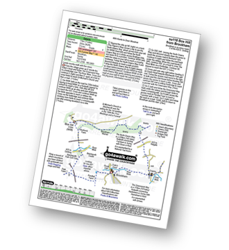
Route Summary:
Brockham - The Greensand Way - St Michael's Church - Betchworth - The North Downs Way - Brockham Warren - Box Hill - Betchworth Park Golf Club - Park Farm - Pondtail Farm - Brockham


