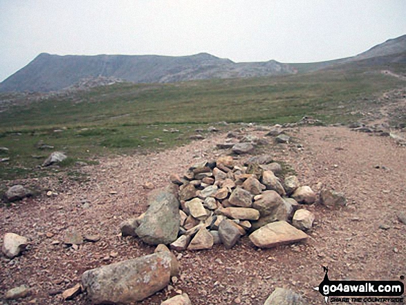
Scafell Pike (far left), Ill Crag and the shoulder of Great End (far right) from Esk Hause
The Southern Fells,
The Lake District National Park,
Cumbria, England
See views like this by using any of these 11 easy-to-follow circular walk route maps:
   |
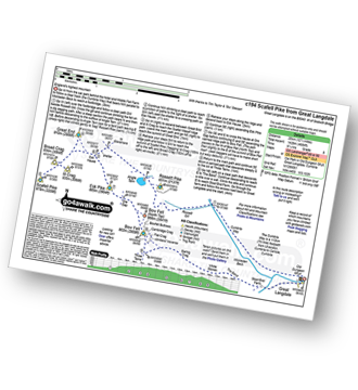
Vital Statistics:
| Length: | 9.5 miles (15 km) |
| Ascent: | 3,477ft (1,060m) |
| Time: | 7 hrs |
| Grade: |  |
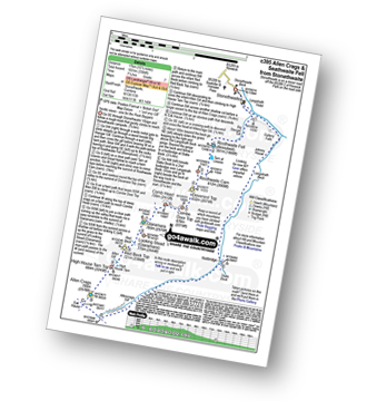
Route Summary:
Seathwaite (Borrowdale) - Grains Gill - Styhead Gill - Styhead Tarn - Corridor Route - Scafell Pike - Broad Crag - Ill Crag - Great End - Esk Hause - Grains Gill - Seathwaite (Borrowdale)
|
Vital Statistics:
| Length: | 9.75 miles (15.5 km) |
| Ascent: | 3,046ft (928m) |
| Time: | 6½ hrs |
| Grade: | |
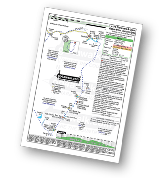
Route Summary:
Seatoller - Strands Bridge - Borrowdale - The Combe - Thornythwaite Fell - Comb Head - Glaramara - Looking Steads (Glaramara) - Red Beck - Red Beck Top - Allen Gill - High House Tarn - High House Tarn Top - Allen Crags - Esk Hause - Ruddy Gill - Sprinkling Tarn - Sty Head - Sty Head Tarn - Sty Head Gill - Stockley Bridge - Grains Gill - Seathwaite (Borrowdale) - The Allerdale Ramble - Seatoller
|
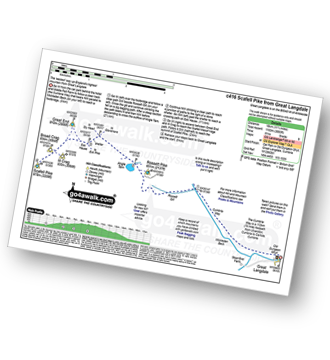
Vital Statistics:
| Length: | 9 miles (14.5 km) |
| Ascent: | 3,459ft (1,054m) |
| Time: | 6.75hrs |
| Grade: | |
Route Summary:
Great Langdale - Old Dungeon Ghyll - The Cumbria Way - Mickleden Beck - Mickleden (Langdale) - Rossett Beck - Rossett Pike - Angle Tarn (Langdale) - Esk Hause - Esk Pike - Ore Gap - Bow Fell (Bowfell) (North Top) - Bow Fell (Bowfell) - Bowfell Buttress - Cambridge Crag - Flat Crag - Climbers' Traverse (optional) - Three Tarns - Earing Crag - White Stones - The Band - Oxendale - Stool End Farm - The Old Dungeon Ghyll - Great Langdale
|
Vital Statistics:
| Length: | 10.5 miles (17 km) |
| Ascent: | 3,384ft (1,031m) |
| Time: | 7.25hrs |
| Grade: | |
Route Summary:
Stonethwaite - Big Stanger Gill - Hanging Haystack Crag - Alisongrass Crag - Rosthwaite Fell (Bessyboot) - Tarn At Leaves - Rosthwaite Cam (Rosthwaite Fell) - Dovenest Top - Combe Door Top - Combe Head - Glaramara - Looking Steads (Glaramara) - Red Beck Top - High House Tarn Top - Allen Crags - Esk Hause - Allencrags Gill - Langstrath - Stonethwaite
|
Vital Statistics:
| Length: | 8.5 miles (13.5 km) |
| Ascent: | 3,289ft (1,020m) |
| Time: | 6½ hrs |
| Grade: | |
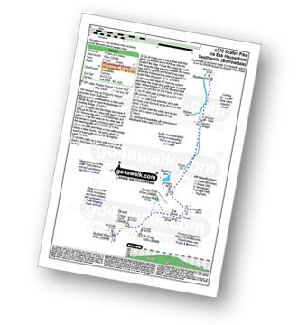
Route Summary:
Seathwaite (Borrowdale) - Stockley Bridge - Grains Gill - Ruddy Gill - Sprinkling Tarn - Esk Hause - Scafell Pike - Esk Hause - Grains Gill - Stockley Bridge - Seathwaite (Borrowdale)
|
Vital Statistics:
| Length: | 9 miles (14.5 km) |
| Ascent: | 3,696ft (1,126m) |
| Time: | 7 hrs |
| Grade: | |
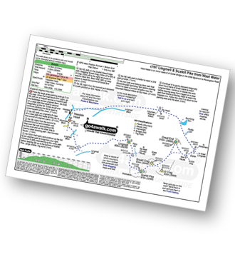
Route Summary:
Wasdale Head - Wast Water - Lingmell - Lingmell Col - Scafell Pike - Broad Crag - Ill Crag - Great End - Esk Hause - Sty Head - Lingmell Beck - Gable Beck Bridge - Wasdale Head - Wast Water.
|
Vital Statistics:
| Length: | 10.5 miles (17 km) |
| Ascent: | 4,693ft (1,430m) |
| Time: | 8½ hrs |
| Grade: |  |
Route Summary:
Seatoller - Strands Bridge - Borrowdale - The Combe - Thornythwaite Fell - Comb Head - Glaramara - Looking Steads (Glaramara) - Red Beck - Red Beck Top - Allen Gill - High House Tarn - High House Tarn Top - Allen Crags - Esk Hause - Ruddy Gill - Sprinkling Tarn - Sty Head - Great Gable - Westmorland Cairn - Windy Gap - Green Gable - Gillercomb Head - Brandreth - Grey Knotts - Honister Hause - Honister Pass - Wainwright's Coast to Coast Walk - Seatoller
|
Vital Statistics:
| Length: | 12.5 miles (20 km) |
| Ascent: | 4,684ft (1,428m) |
| Time: | 9.25hrs |
| Grade: | |
Route Summary:
Great Langdale - The Old Dungeon Ghyll - The Cumbria Way - Mickleden Beck - Mickleden - Rossett Beck - Rossett Pike - Angle Tarn (Langdale) - Esk Hause - Great End - Ill Crag - Broad Crag - Scafell Pike - Esk Hause - Esk Pike - Ore Gap - Bow Fell (Bowfell) (North Top) - Bow Fell (Bowfell) - Bowfell Buttress - Cambridge Crag - Flat Crag - Climbers' Traverse (optional) - Three Tarns - The Band - Oxendale - Stool End Farm - The Old Dungeon Ghyll - Great Langdale
|
Vital Statistics:
| Length: | 11.25 miles (18 km) |
| Ascent: | 3,883ft (1,183m) |
| Time: | 8 hrs |
| Grade: | |
Route Summary:
Great Langdale - The Old Dungeon Ghyll - The Cumbria Way - Mickleden Beck - Rossett Gill - Rossett Pike - Angle Tarn (Langdale) - Esk Hause - Scafell Pike - Ill Crag - Broad Crag - Great End - Esk Hause - Angle Tarn - Rossett Gill - Mickleden - Mickleden Beck - The Cumbria Way - The Old Dungeon Ghyll - Great Langdale
|
Vital Statistics:
| Length: | 14 miles (22.5 km) |
| Ascent: | 6,009ft (1,832m) |
| Time: | 9 hrs |
| Grade: |  |
Route Summary:
Eskdale - Wha House Farm - Hare Crag - Quagrigg Moss - Slight Side - Sca Fell - Symonds Knott - Mickledore - Scafell Pike - Broad Crag - Ill Crag - Great End - Esk Hause - Esk Pike - Ore Gap - Bow Fell (Bowfell) (North Top) - Bow Fell (Bowfell) - Bowfell Buttress - Cambridge Crag - Flat Crag - Climbers' Traverse (optional) - Three Tarns - Great Moss - Brotherikeld - Eskdale
|
Vital Statistics:
| Length: | 13.75 miles (22 km) |
| Ascent: | 4,982ft (1,519m) |
| Time: | 10 hrs |
| Grade: | |

Route Summary:
Eskdale - Wha House Farm - Hare Crag - Quagrigg Moss - Slight Side - Sca Fell - Symonds Knott - Scafell Pike - Broad Crag - Ill Crag - Great End - Esk Hause - Lingcove Bridge - Great Moss - Eskdale
Send us your photographs and pictures of walks and hikes in the British countryside
If you would like to see your digital photographs as part of this collection, please send them as email attachments (configured for any computer) along with your name to:
and we shall do our best to publish them.
(Guide Resolution = 300dpi. At least = 587 pixels (wide) x 440 pixels (high).)

You can also submit photos via our Facebook Page.
NB. Please indicate where each photo was taken.
NB. To see photographs and pictures from a particular walk choose your walk from Walks or use our Walk Search facility.
To see photographs and pictures on, of or from a particular Mountain, Peak, Top or Hill select from Peaks & Mountains' or enter the Mountain, Peak, Top or Hill Name into our 'Photo Search facility.