
![]()
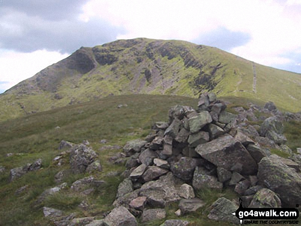
Middle Dodd
654m (2146ft)
The Eastern Fells, The Lake District, Cumbria, England
Not familiar with this top?
   |
|---|
Vital Statistics:
| Length: | 7ml (11km) |
|---|---|
| Ascent: | 2,373ft (723m) |
| Time: | 5 hrs |
| Grade: |  (Moderate) (Moderate) |
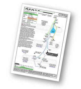
Route Summary:
Cow Bridge - Brothers Water - Hartsop Hall - Kirkstone Beck - Caiston Beck - Middle Dodd - Red Screes - Scandale Pass - Caiston Beck - Brothers Water.
|
|---|
Vital Statistics:
| Length: | 7ml (11km) |
|---|---|
| Ascent: | 2,737ft (834m) |
| Time: | 5.25hrs |
| Grade: |  (Moderate) (Moderate) |
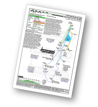
Route Summary:
Cow Bridge - Brothers Water - Hartsop Hall - Kirkstone Beck - Caiston Beck - Middle Dodd - Red Screes - Scandale Pass - Little Hart Crag - High Hartsop Dodd - Caiston Beck - Cow Bridge - Brothers Water.
|
|---|
Vital Statistics:
| Length: | 9.75ml (15.5km) |
|---|---|
| Ascent: | 3,699ft (1,127m) |
| Time: | 7.25hrs |
| Grade: |  (Hard) (Hard) |
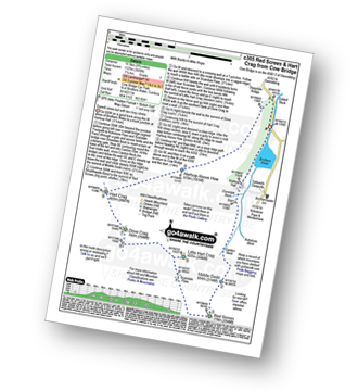
Route Summary:
Cow Bridge Car Park - Brothers Water - Hartsop Hall - Kirkstone Beck - Caiston Beck - Middle Dodd - Red Screes - Scandale Pass - Little Hart Crag - Dove Crag - Hart Crag - Blake Brow - Hartsop Above How - Hoggill Brow - Gale Crag - Bleaberry Knott - Cockley How - Cow Bridge
|
|---|
Vital Statistics:
| Length: | 13.75ml (22km) |
|---|---|
| Ascent: | 5,501ft (1,676m) |
| Time: | 10½ hrs |
| Grade: |  (Very Hard) (Very Hard) |
Route Summary:
Cow Bridge Car Park - Brothers Water - Hartsop - Hartsop Dodd - Caudale Moor - Stony Cove Pike (Caudale Moor) - Caudale Head - Pike How - St Raven's Edge - The Kirkstone Pass - Red Screes - Smallthwaite Band - Middle Dodd - Scandale Pass - Little Hart Crag - High Hartsop Dodd - Little Hart Crag - Scandale Head - Dove Crag - Hart Crag - Blake Brow - Hartsop Above How - Hoggill Brow - Gale Crag - Bleaberry Knott - Cockley How - Cow Bridge
See Middle Dodd and the surrounding tops on our free-to-access 'Google Style' Peak Bagging Maps:
The Eastern Fells of The Lake District National Park
Less data - quicker to download
The Whole of The Lake District National Park
More data - might take a little longer to download
See Middle Dodd and the surrounding tops on our downloadable Peak Bagging Maps in PDF format:

NB: Whether you print off a copy or download it to your phone, these PDF Peak Baggers' Maps might prove incredibly useful when your are up there on the tops and you cannot get a phone signal.
*This version is marked with the walk routes you need to follow to Walk all 214 Wainwrights in just 59 walks.
You can find Middle Dodd & all the walks that climb it on these unique free-to-access Interactive Walk Planning Maps:
1:25,000 scale OS Explorer Maps (orange/yellow covers):
1:50,000 scale OS Landranger Map (pink/magenta covers):
 Fellow go4awalkers who have already walked, climbed, summited & bagged Middle Dodd
Sarah Moore walked up Middle Dodd on December 30th, 2025 [from/via/route] c351 route - but started at Sykeside as staying in the bunkhouse. East start & don't feel like I've missed anything! [with] A day on my own - not done that in a while. [weather] Great winter conditions. Clear to start until I got to Red Screes but the cloud came in & I even felt a touch of snow! Perfect but very cold & essential to be wrapped up properly. - Loved it - it felt slow; particularly going up Middle Dodd, but this was never about racing & it was so icy & slippery in places. I did NOT expect the view as I hit the Red Screes trig - & to be able to see to the coast... just wow. Not many people out - didn't see anyone for an hour & a half, & only 5 groups all the way round - perfect.
Simon Myerscough climbed Middle Dodd on November 26th, 2025 [from/via/route] Started from Sykeside Camp site, paid £5 for parking & used toilets there. Beautiful day, cold sunny some ice on tops but not much. [with] Joanne [weather] No wind & cold & very sunny - gorgeous
Jason Aspinall bagged Middle Dodd on May 1st, 2025 [from/via/route] Brothers Water [weather] Sunny
Andrew Gayne hiked Middle Dodd on April 30th, 2025 [from/via/route] From Brothers Water Car Park [with] Becky [weather] Really sunny & very hot, hottest day of the year - In the lakes for 2 days. Stayed in Ambleside overnight & drove to Brothers Water. A long lovely walk to the start of the climb up Middle Dodd but got lost & missed the path & had a tortuous climb up a mossy steep slope that made for a difficult & long walk. Went on to Red Screes, then Little Hart Crag & finally High Hartsop Dodd
David Higginbottom summited Middle Dodd on April 30th, 2025 [from/via/route] Walk 351 very nice walk but tough at start [with] Carolyn [weather] Clear & nice & sunny
Mr M A Blanchard conquered Middle Dodd on March 23rd, 2025 [with] The mutts - My 300th UK mountain
Caroline Winter scaled Middle Dodd on October 21st, 2024 [from/via/route] Patterdale roadside, Middle Dodd, Red screes, [with] Becky [weather] Cold - Ground wet under foot, set off late in day & almost benighted.
Richard Fulcher walked up Middle Dodd on October 31st, 2024 [from/via/route] Parked in a layby near Caudale Bridge on the Kirkstone Pass. Walked down to the footbridge over Kirkstone Beck & then began the relentlessly steep ascent to the top of Middle Dodd. From there we followed an extremely boggy route across to the Red Screes-Scandale Pass path. We ascended the path on the opposite side of the Scandale Pass up to the tarn near Little Hart Crag, then followed another boggy path to the summit of Little Hart Crag. From there we descended to High Hartsop Dodd & then down the other side to the barn at the base of the fell. We then followed the path across the boulder strewn fields to Hartsop Hall & back to the car via Sykeside. [with] Jen [weather] Most of the walk over 1000 feet was in low cloud. This dispersed around 3pm to give a wonderful show of swirling clouds flowing over the fells, backlit be the sun. We even had 'Glory' & 'Brocken Spectre' - due the low sun piercing through the low cloud! The temperature varied between 14C at low levels to single figures on the tops … the wind also varied tremendously, at times blowing 30mph on the exposed sections for a while .. but still at ground level. - Great views when the low cloud dispersed.
Ian Ashton climbed Middle Dodd on April 2nd, 2022 [with] Solo - Done 2nd time 29/09/24 with jph
James Hughes bagged Middle Dodd on June 2nd, 2024 [from/via/route] Red Screes & Little Hart Crag from Cow Bridge c351 - From Brotherswater Inn [weather] Clear - Post walk pint in Brotherswater Inn... stiff climb up Middle Dodd, meander down to Little Hart Crag passing group of older walkers.
To add (or remove) your name and experiences on this page - Log On and edit your Personal Mountain Bagging Record
. . . [see more walk reports]
More Photographs & Pictures of views from, on or of Middle Dodd
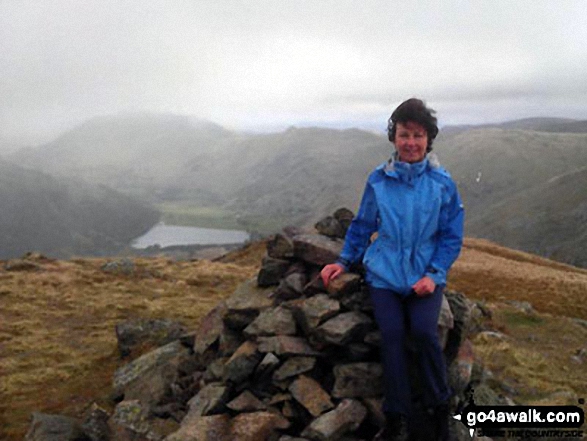
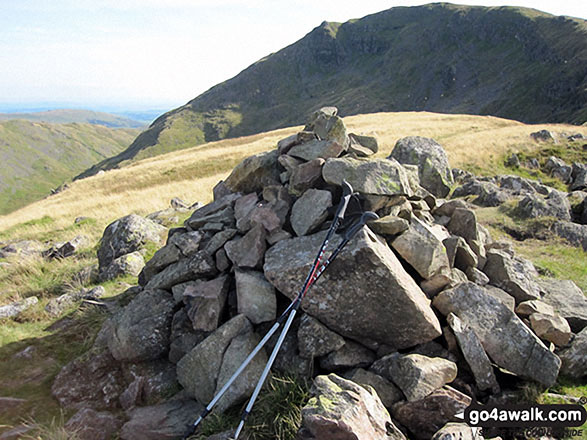
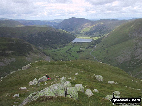
Me, Wainwright bagging, at the top of Middle Dodd with Brothers Water and Place Fell in the distance
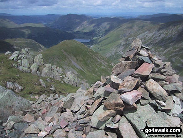
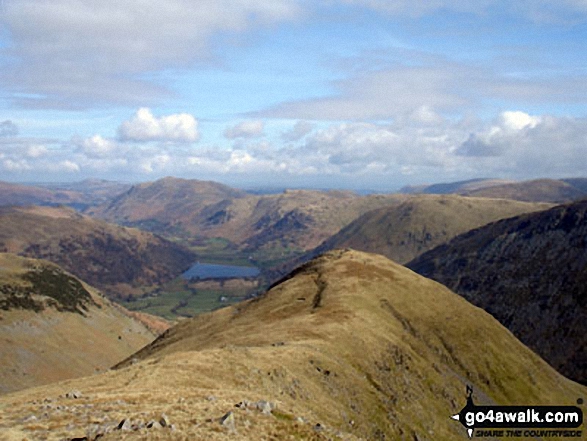
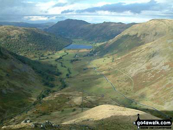
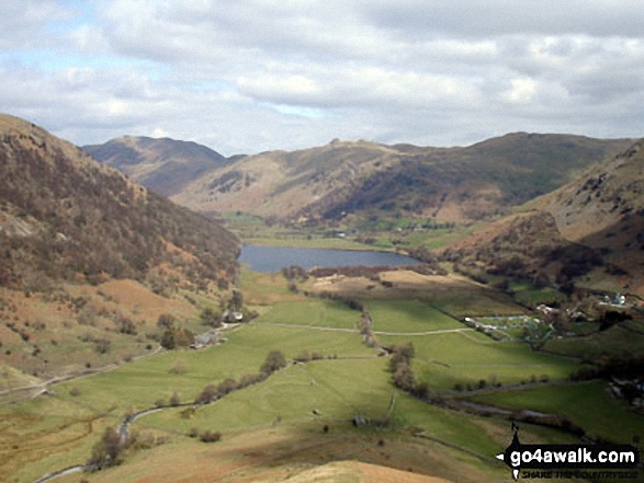
Middle Dodd with Place Fell, Angletarn Peaks and Hartsop Dodd beyond Brothers Water in the valley below from Red Screes
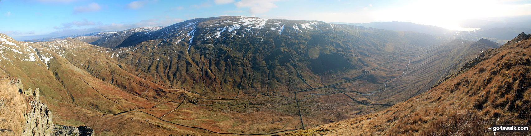
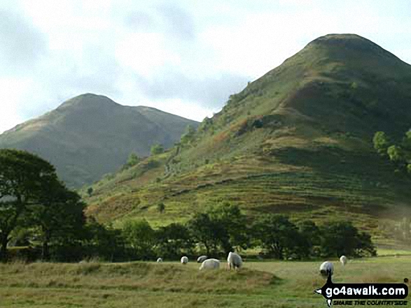
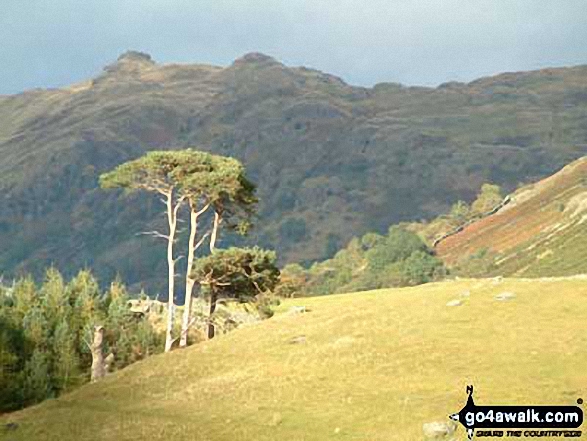
Middle Dodd, Red Screes, Snarker Pike, the Scandale Valley and Lake Windermere from High Pike (Scandale)
Send us your photographs and pictures on, of, or from Middle Dodd
If you would like to add your walk photographs and pictures featuring views from, on or of Middle Dodd to this page, please send them as email attachments (configured for any computer) along with your name to:
and we shall do our best to publish them.
(Guide Resolution = 300dpi. At least = 660pixels (wide) x 440 pixels (high).)

You can also submit photos via our Facebook Page.
NB. Please indicate where each photo was taken and whether you wish us to credit your photos with a Username or your First Name/Last Name.
Not familiar with this top?


