
![]()
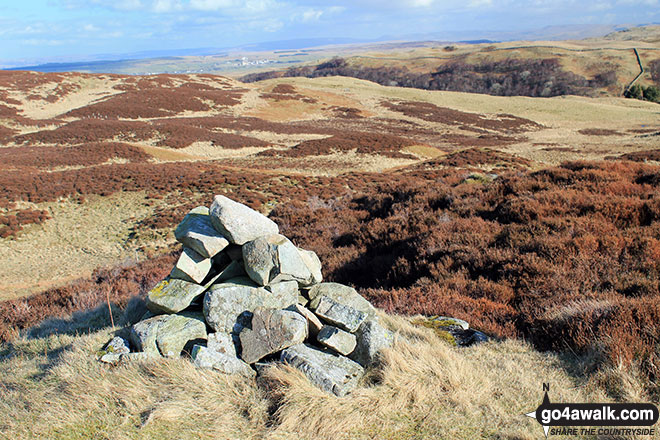
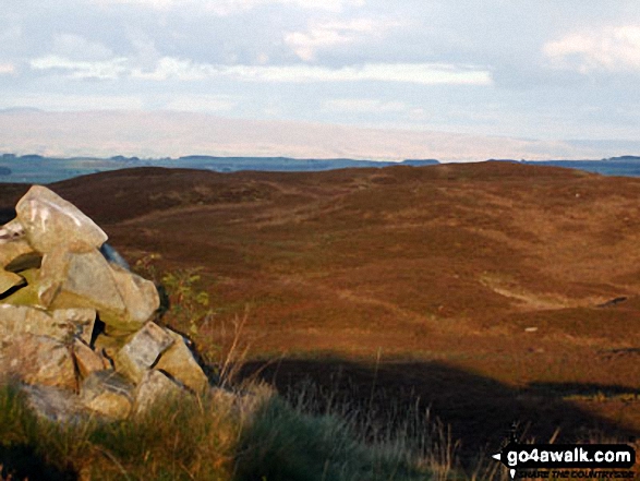
Wallow Crag (Naddle Forest)
428m (1404ft)
The Far Eastern Fells, The Lake District, Cumbria, England
Not familiar with this top?
   |
|---|
Vital Statistics:
| Length: | 7.75mls (12.5km) |
|---|---|
| Ascent: | 1,483ft (452m) |
| Time: | 4½ hrs |
| Grade: |  (Moderate) (Moderate) |
Route Summary:
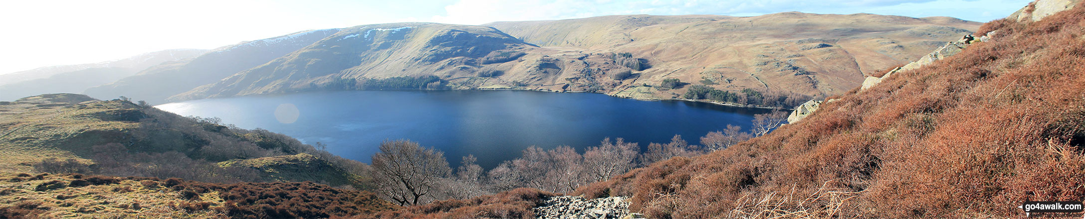
Hazel Shaw Parking Area - Rosgill Moor - Scalebarrow Knott - Harper Hills - Low Goat Gill - Long Rigg - Powley's Hill - Hare Shaw - Woodhowe Moss - Kit Crag (Naddle Forest) - Wallow Crag (Naddle Forest) - Hugh's Laithes Pike - Hugh's Laithes Pike (North East Top) - Highfield Crag - Naddle Farm - Naddle Beck - Mirkside Wood - Scalebarrow Knott - Hazel Shaw Parking Area
See Wallow Crag (Naddle Forest) and the surrounding tops on our free-to-access 'Google Style' Peak Bagging Maps:
The Far Eastern Fells of The Lake District National Park
Less data - quicker to download
The Whole of The Lake District National Park
More data - might take a little longer to download
See Wallow Crag (Naddle Forest) and the surrounding tops on our downloadable Peak Bagging Maps in PDF format:

NB: Whether you print off a copy or download it to your phone, these PDF Peak Baggers' Maps might prove incredibly useful when your are up there on the tops and you cannot get a phone signal.
*This version is marked with the walk routes you need to follow to Walk all 214 Wainwrights in just 59 walks.
You can find Wallow Crag (Naddle Forest) & all the walks that climb it on these unique free-to-access Interactive Walk Planning Maps:
1:25,000 scale OS Explorer Map (orange/yellow covers):
1:50,000 scale OS Landranger Map (pink/magenta covers):
 Fellow go4awalkers who have already walked, climbed, summited & bagged Wallow Crag (Naddle Forest)
Trevor Williams walked up Wallow Crag (Naddle Forest) on November 18th, 2021 [from/via/route] Bampton Grange [with] paul [weather] overcast & windy
Angela Haworth climbed Wallow Crag (Naddle Forest) on October 14th, 2020 [from/via/route] Circular from Haweswater Hotel [with] companion [weather] Dry
Christine Shepherd bagged Wallow Crag (Naddle Forest) on May 30th, 2016 [from/via/route] Walked from the top of the Swindale road [with] On my own [weather] Sunny & warm
Mark Davidson hiked Wallow Crag (Naddle Forest) on March 10th, 2015 [with] Alone [weather] Bright & sunny but quite cold with a cold wind
Ray O'hara summited Wallow Crag (Naddle Forest) on February 23rd, 2012 [weather] Dry - The whole Naddle Horseshoe walk is a very pleasant stroll.
Paul Booth, Peter Thwaites, Louise Sandwith and David Preston have all walked, climbed & bagged Wallow Crag (Naddle Forest).
To add (or remove) your name and experiences on this page - Log On and edit your Personal Mountain Bagging Record
More Photographs & Pictures of views from, on or of Wallow Crag (Naddle Forest)
Send us your photographs and pictures on, of, or from Wallow Crag (Naddle Forest)
If you would like to add your walk photographs and pictures featuring views from, on or of Wallow Crag (Naddle Forest) to this page, please send them as email attachments (configured for any computer) along with your name to:
and we shall do our best to publish them.
(Guide Resolution = 300dpi. At least = 660pixels (wide) x 440 pixels (high).)

You can also submit photos via our Facebook Page.
NB. Please indicate where each photo was taken and whether you wish us to credit your photos with a Username or your First Name/Last Name.
Not familiar with this top?


