
![]()
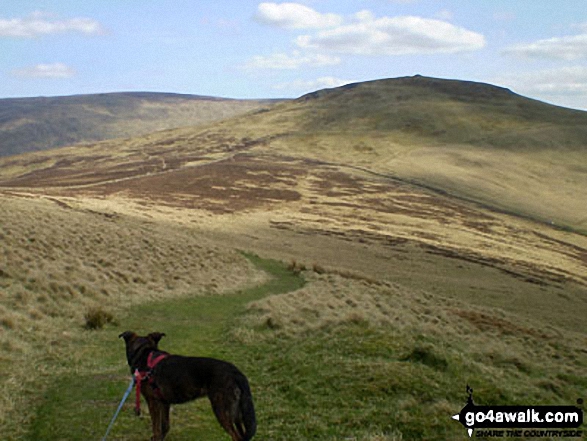
Black Hag (Hethpool)
549m (1801ft)
Northumberland National Park, Northumberland, England /Scotland
Tap/mouse over a coloured circle (1-3 easy walks, 4-6 moderate walks, 7-9 hard walks) and click to select.
You can find Black Hag (Hethpool) & all the walks that climb it on these unique free-to-access Interactive Walk Planning Maps: (click/TAP to select)
1:25,000 scale OS Explorer Map (the ones with orange/yellow covers):
1:50,000 scale OS Landranger Map (the ones with pink/magenta covers):
See Black Hag (Hethpool) and the surrounding tops on our free-to-access 'Google Style' Peak Bagging Maps:
   |
|---|
Vital Statistics:
| Length: | 13.75ml (22km) |
|---|---|
| Ascent: | 2,665ft (812m) |
| Time: | 7.75hrs |
| Grade: |  (Hard) (Hard) |
Route Summary:
Hethpool - The St Cuthbert's Way - Elsdon Burn - Elsdonburn Farm - Shank's Sike - Scaldhill Shank - Tom's Knowe - Tuppie's Sike - Eccles Cairn - England / Scotland Border - The Pennine Way - White Law - Steel Rig - Black Hag (Hethpool) - The Schil - Birnie Brae - Red Cribs - Mounthooly - Fleehope - Whitehall - College Valley - Hethpool
 Fellow go4awalkers who have already walked, climbed, summited & bagged Black Hag (Hethpool)
Ginny Tyler walked up Black Hag (Hethpool) on July 5th, 2021 [from/via/route] KIRK YETHOLM [with] Enzo [weather] Pleasant - LIGHT RAIN AT THE END - MAJOR CRAMP FEST
Hilary Hardwick climbed Black Hag (Hethpool) on May 11th, 2017 [from/via/route] walked from Kirk Yetholm along St Cuthberts Way & along valley, joined higher Pennine Way back to Kirk Yetholm [with] Husband [weather] beautiful sunny day, not a cloud in the sky again & really hot. - Beautiful walk, so peaceful, only saw 3 other walkers all day
Patrick Rogozinski and Louise Sandwith have both walked, climbed & bagged Black Hag (Hethpool).To add (or remove) your name and experiences on this page - Log On and edit your Personal Mountain Bagging Record
Send us your photographs and pictures on, of, or from Black Hag (Hethpool)
If you would like to add your walk photographs and pictures featuring views from, on or of Black Hag (Hethpool) to this page, please send them as email attachments (configured for any computer) along with your name to:
and we shall do our best to publish them.
(Guide Resolution = 300dpi. At least = 660pixels (wide) x 440 pixels (high).)

You can also submit photos via our Facebook Page.
NB. Please indicate where each photo was taken.


