
![]()
Cir Mhor
798m (2618ft)
The Isle of Arran, The South Western Isles, North Ayrshire, Scotland
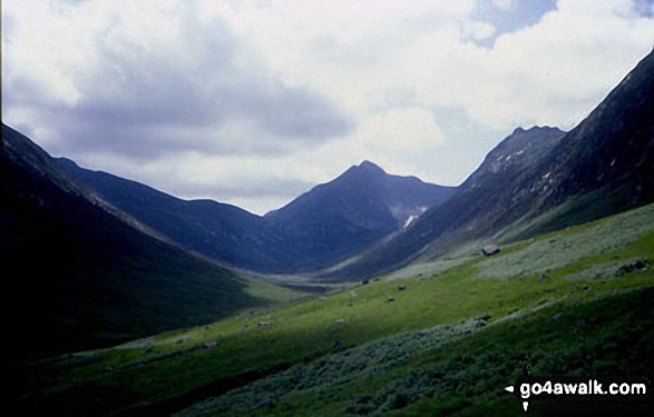
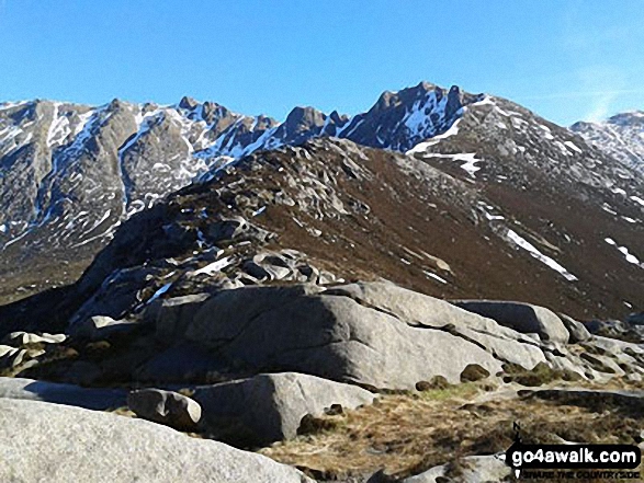
Cir Mhor (centre right) and Caisteal Abhail (right) from Glen Sannox, Isle of Arran
Not familiar with this top?
See Cir Mhor and the surrounding tops on our free-to-access 'Google Style' Peak Bagging Maps:
The Isle of Arran area of Scottish Region 20: The South Western Isles
Less data - quicker to download
Scottish Region 20: The South Western Isles
Less data - quicker to download
A go4awalk.com downloadable Peak Bagging Map in PDF format featuring Cir Mhor should be available soon.
Free-to-access Interactive Walk Planning Maps:
1:25,000 scale OS Explorer Map (orange/yellow covers):
An Interactive Walk Planning Map for OS Explorer 361 Isle of Arran is not currently available
1:50,000 scale OS Landranger Maps (pink/magenta covers):
An Interactive Walk Planning Map for OS Landranger 62 North Kintyre & Tarbert is not currently available
An Interactive Walk Planning Map for OS Landranger 69 Isle of Arran is not currently available
 Fellow go4awalkers who have already walked, climbed, summited & bagged Cir Mhor
Trevor Williams has walked, climbed & bagged Cir Mhor.
To add (or remove) your name and experiences on this page - Log On and edit your Personal Mountain Bagging Record
More Photographs & Pictures of views from, on or of Cir Mhor
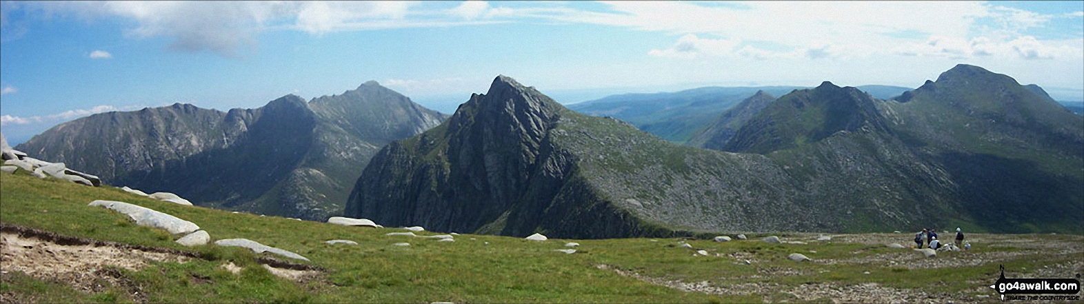
Looking back towards North Goatfell while approaching Goatfell summit this summer with Cir Mhor and The Saddle (mid-ground left) and Casteal Abhail and Ceum na Caillich (Witche's Step) visible beyond
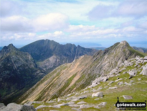
Cir Mhor (left) and Caisteal Abhail (right) from Goatfell (Goat Fell), The Isle fo Arran
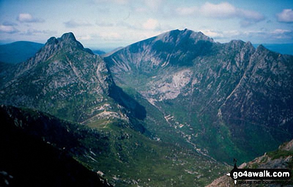
Heading up to North Goatfell and Goatfell from The Saddle, Cir Mhor at the head of Glen Sannox, Isle of Arran
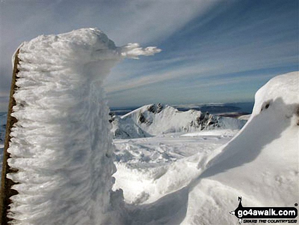
Cir Mhor from a snow and ice clad trig point on Goatfell (Goat Fell), The Isle of Arran
Send us your photographs and pictures on, of, or from Cir Mhor
If you would like to add your walk photographs and pictures featuring views from, on or of Cir Mhor to this page, please send them as email attachments (configured for any computer) along with your name to:
and we shall do our best to publish them.
(Guide Resolution = 300dpi. At least = 660pixels (wide) x 440 pixels (high).)

You can also submit photos via our Facebook Page.
NB. Please indicate where each photo was taken and whether you wish us to credit your photos with a Username or your First Name/Last Name.
Not familiar with this top?


