
![]()
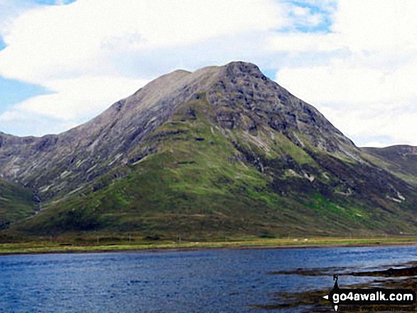
Garbh-bheinn (Skye)
808m (2652ft)
Isle of Skye, The Inner Hebrides (Western Isles), Highland, Scotland
Not familiar with this top?
See Garbh-bheinn (Skye) and the surrounding tops on our free-to-access 'Google Style' Peak Bagging Maps:
The Isle of Skye area of Scottish Region 17: The Inner Hebrides (Western Isles)
Less data - quicker to download
Scottish Region 17: The Inner Hebrides (Western Isles)
Less data - quicker to download
A go4awalk.com downloadable Peak Bagging Map in PDF format featuring Garbh-bheinn (Skye) should be available soon.
Free-to-access Interactive Walk Planning Maps:
1:25,000 scale OS Explorer Map (orange/yellow covers):
An Interactive Walk Planning Map for OS Explorer 411 Skye - Cuillin Hills is not currently available
1:50,000 scale OS Landranger Map (pink/magenta covers):
An Interactive Walk Planning Map for OS Landranger 32 South Skye & Cuillin Hills is not currently available
 Fellow go4awalkers who have already walked, climbed, summited & bagged Garbh-bheinn (Skye)
Trevor Williams has walked, climbed & bagged Garbh-bheinn (Skye).
To add (or remove) your name and experiences on this page - Log On and edit your Personal Mountain Bagging Record
More Photographs & Pictures of views from, on or of Garbh-bheinn (Skye)
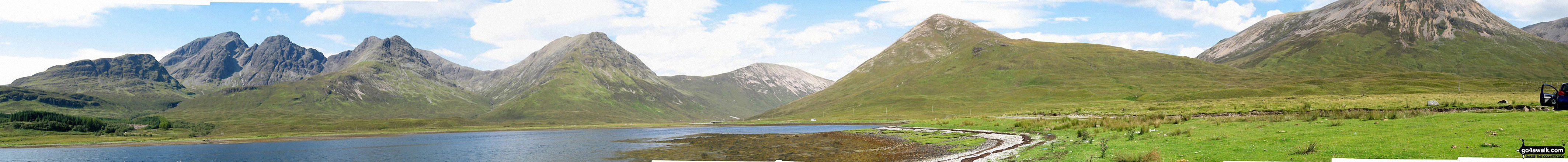
*Slat Bheinn, Bla Bheinn (Blaven) (South West Top), Bla Bheinn (Blaven), Garbh-bheinn (Skye), Belig (centre), Glas Bheinn Mhor (Skye), Beinn na Cro and Beinn Dearg from Loch Slapin near Torrin
Send us your photographs and pictures on, of, or from Garbh-bheinn (Skye)
If you would like to add your walk photographs and pictures featuring views from, on or of Garbh-bheinn (Skye) to this page, please send them as email attachments (configured for any computer) along with your name to:
and we shall do our best to publish them.
(Guide Resolution = 300dpi. At least = 660pixels (wide) x 440 pixels (high).)

You can also submit photos via our Facebook Page.
NB. Please indicate where each photo was taken and whether you wish us to credit your photos with a Username or your First Name/Last Name.
Not familiar with this top?


