
![]()
Ben More (Mull)
966m (3170ft)
Isle of Mull, The Inner Hebrides (Western Isles), Argyll and Bute, Scotland
The summit of Ben More (Mull) is marked by an Ordnance Survey Trig Point.
Not familiar with this top?
See Ben More (Mull) and the surrounding tops on our free-to-access 'Google Style' Peak Bagging Maps:
The Isle of Mull area of Scottish Region 17: The Inner Hebrides (Western Isles)
Less data - quicker to download
Scottish Region 17: The Inner Hebrides (Western Isles)
Less data - quicker to download
A go4awalk.com downloadable Peak Bagging Map in PDF format featuring Ben More (Mull) should be available soon.
Free-to-access Interactive Walk Planning Maps:
1:25,000 scale OS Explorer Map (orange/yellow covers):
An Interactive Walk Planning Map for OS Explorer 375 Isle of Mull East is not currently available
1:50,000 scale OS Landranger Maps (pink/magenta covers):
An Interactive Walk Planning Map for OS Landranger 47 Tobermory & North Mull is not currently available
An Interactive Walk Planning Map for OS Landranger 48 Iona & West Mull, Ulva is not currently available
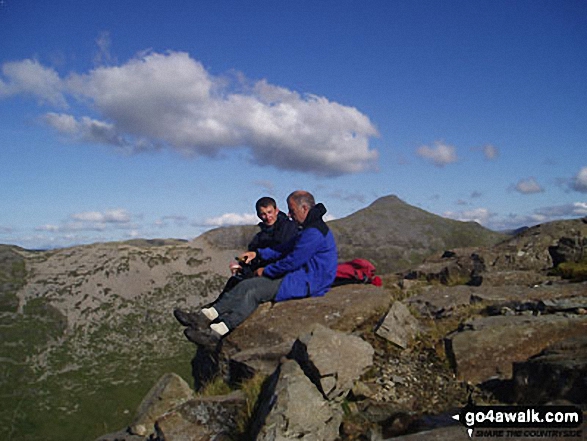
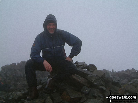
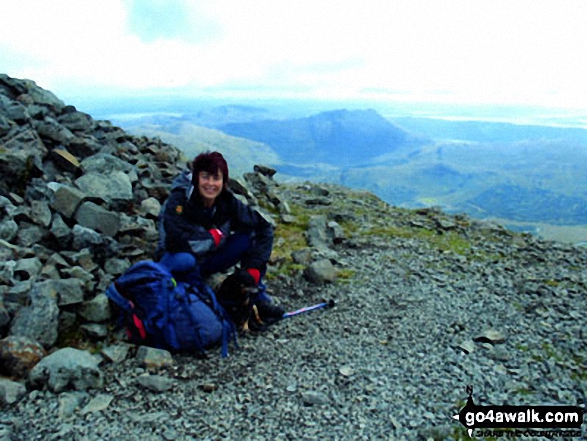
 Fellow go4awalkers who have already walked, climbed, summited & bagged Ben More (Mull)
Daniel Moran walked up Ben More (Mull) on May 16th, 2024 [weather] Great day - Devils ridge
Dale Verrall climbed Ben More (Mull) on September 9th, 2011 [with] Amber - Summit to ourselves with a golden eagle for company
Colin Egan bagged Ben More (Mull) on June 12th, 2010 [with] Wife & daughter [weather] Fair & clear
Leona Skelton hiked Ben More (Mull) during August, 2000 [with] Dad, sister and brother [weather] Pleasant - Beautiful view
Adam Shewry summited Ben More (Mull) on June 25th, 2004 - My first Munro - aged 4 - walked all way to top & back.....not carried!
Linda Mckeogh, Simon Duerden, Paul Booth, Trevor Williams and Chris Turner have all walked, climbed & bagged Ben More (Mull).
To add (or remove) your name and experiences on this page - Log On and edit your Personal Mountain Bagging Record
More Photographs & Pictures of views from, on or of Ben More (Mull)
Send us your photographs and pictures on, of, or from Ben More (Mull)
If you would like to add your walk photographs and pictures featuring views from, on or of Ben More (Mull) to this page, please send them as email attachments (configured for any computer) along with your name to:
and we shall do our best to publish them.
(Guide Resolution = 300dpi. At least = 660pixels (wide) x 440 pixels (high).)

You can also submit photos via our Facebook Page.
NB. Please indicate where each photo was taken and whether you wish us to credit your photos with a Username or your First Name/Last Name.
Not familiar with this top?


