
![]()
Beinn Ime
1011m (3318ft)
The Arrochar Alps, Loch Lomond and The Trossachs to Loch Tay, Loch Lomond and The Trossochs, Argyll and Bute, Scotland
Beinn Ime means 'Hill of Butter' .
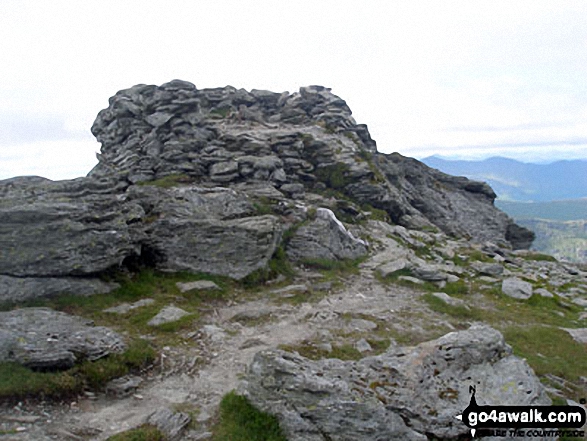
The summit of Beinn Ime is marked by an Ordnance Survey Trig Point.
Not familiar with this top?
   |
|---|
Vital Statistics:
| Length: | 8.75ml (14km) |
|---|---|
| Ascent: | 3,499ft (1,051m) |
| Time: | 6.75hrs |
| Grade: |  (Hard) (Hard) |
Route Summary:
Arrochar - Loch Long - Ardgarten Forest - Allt a' Bhalachain - Narnain Boulders - Core a' Bhalachain - Lochan a' Chlaidheimh - Bealach A Mhaim - Beinn Ime - Bealach A Mhaim - Lochan a' Chlaidheimh - Core a' Bhalachain - Narnain Boulders - Allt a' Bhalachain - Ardgarten Forest - Arrochar
See Beinn Ime and the surrounding tops on our free-to-access 'Google Style' Peak Bagging Maps:
The Arrochar Alps area of Scottish Region 1: The Firth of Clyde to Strath Tay
Less data - quicker to download
Scottish Region 1: Loch Lomond and The Trossachs to Loch Tay
Less data - quicker to download
A go4awalk.com downloadable Peak Bagging Map in PDF format featuring Beinn Ime should be available soon.
You can find Beinn Ime & all the walks that climb it on these unique free-to-access Interactive Walk Planning Maps:
1:25,000 scale OS Explorer Map (orange/yellow covers):
1:50,000 scale OS Landranger Map (pink/magenta covers):
 Fellow go4awalkers who have already walked, climbed, summited & bagged Beinn Ime
David Peebles walked up Beinn Ime on July 27th, 2024 [from/via/route] Layby just round from Succoth [with] Solo walk [weather] Mixed.Mostly sunny.
David Fee has climbed Beinn Ime [from/via/route] Via Beinn Narnain [weather] Cold, bright April day & night. - Bivvied near summit.
Mr M A Blanchard bagged Beinn Ime on November 24th, 2019 [with] The dogs [weather] Low vis, mist
Julie Buckley hiked Beinn Ime during May, 2015 [from/via/route] Arrochar [with] Husband [weather] Cloudy, some snow
Andrew Edwards summited Beinn Ime on August 25th, 2015 [from/via/route] Came from ben vane climbed up ridge on SE side [with] Myself [weather] Sunny cloudy on summit - My first munro over 1000m
Mark Davidson conquered Beinn Ime on June 25th, 2007 [with] Alone [weather] Dry & sunny - but pretty windy - Theresa came part of the way up Ben Vane but didn't fancy the wind - so headed back down & drove the car round to the car park at Butterbridge so I could complete a linear walk (bless!)
Grant Mclean, Paul Booth, Ron Blundell, Simon Duerden, Ceri Murray, Stephen Hobdell, Trevor Williams, Geert Gritter and Adam Shewry have all walked, climbed & bagged Beinn Ime.
To add (or remove) your name and experiences on this page - Log On and edit your Personal Mountain Bagging Record
More Photographs & Pictures of views from, on or of Beinn Ime
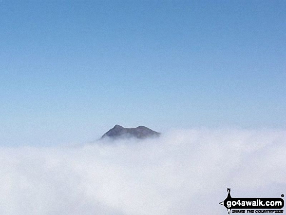
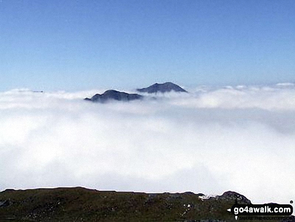
The summits of Ben Vane (left) and Beinn Ime poking up through the clouds during a temperature inversion seen from Ben Vorlich (The Arrochar Alps)
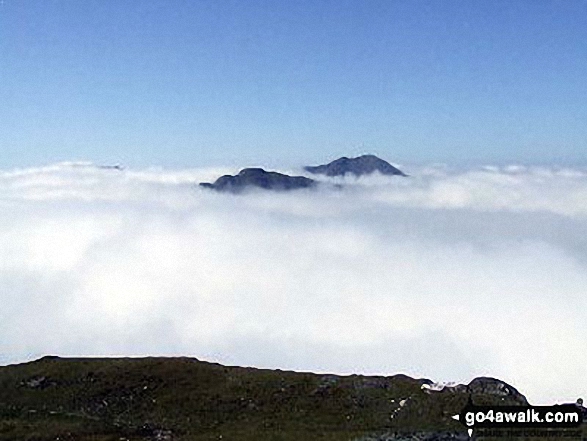
The summits of Ben Vane (left) and Beinn Ime poking up through the clouds during a temperature inversion seen from Ben Vorlich (The Arrochar Alps)
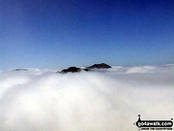
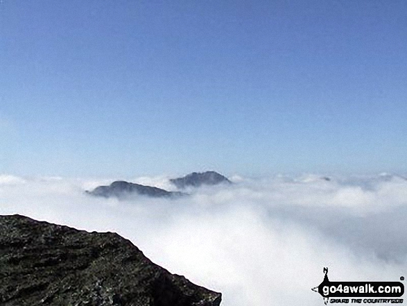
The summits of Ben Vane (left) and Beinn Ime poking up through the clouds during a temperature inversion seen from Ben Vorlich (The Arrochar Alps)
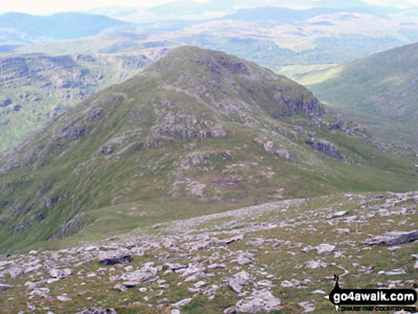
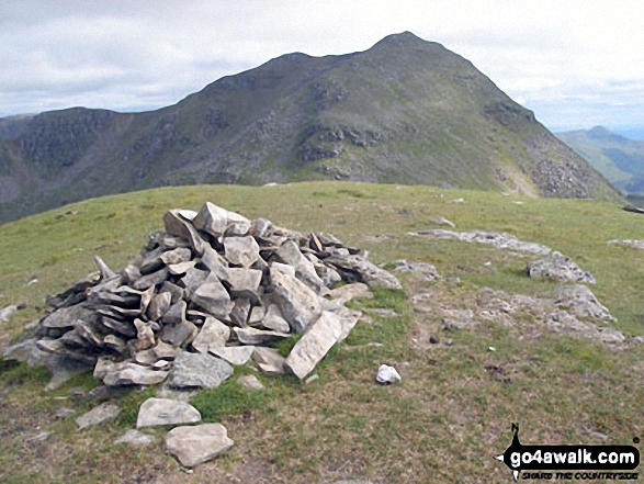
Snow on Ben Narnain (right) and A' Chrois (left) with a distant Ben Lomond prominant between from the summit of Beinn Ime
The summits of Ben Vane (left) and Beinn Ime poking up through the clouds during a temperature inversion seen from Ben Vorlich (The Arrochar Alps)
Send us your photographs and pictures on, of, or from Beinn Ime
If you would like to add your walk photographs and pictures featuring views from, on or of Beinn Ime to this page, please send them as email attachments (configured for any computer) along with your name to:
and we shall do our best to publish them.
(Guide Resolution = 300dpi. At least = 660pixels (wide) x 440 pixels (high).)

You can also submit photos via our Facebook Page.
NB. Please indicate where each photo was taken and whether you wish us to credit your photos with a Username or your First Name/Last Name.
Not familiar with this top?


