Walk The Langdale Pikes
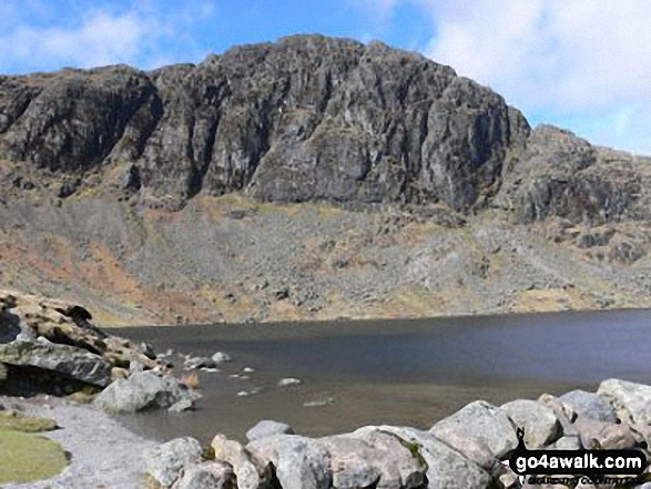 Pavey Ark from Stickle Tarn
Photo: Chris Haselden
The Langdale Pikes comprise a group of 5 mountains to the North West of Great Langdale in The Lake District, Cumbria, England.
These 5 mountains are:
For the best easy to follow walk routes up The Langdale Pikes use these easy yo follow walking maps:
   |
Vital Statistics:
| Length: | 4.5ml (7.5km) | |
| Ascent: | 2,645ft (806m) | |
| Time: | 4½ hrs | |
| Grade: |  | (Moderate) |
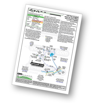
Route Summary:
- Great Langdale, The New Dungeon Ghyll, Great Langdale, Stickle Ghyll, Stickle Tarn, Jack's Rake, The Langdale Pikes, Pavey Ark, Thunacar Knott, Harrison Stickle, Pike of Stickle (Pike O' Stickle), Loft Crag, Mark Gate, The New Dungeon Ghyll, Great Langdale
|
Vital Statistics:
| Length: | 7.25ml (11.5km) | |
| Ascent: | 3,046ft (928m) | |
| Time: | 5.75hrs | |
| Grade: |  | (Moderate) |
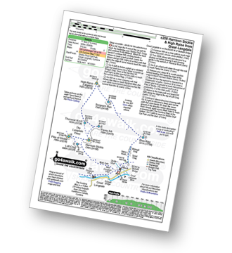
Route Summary:
- Great Langdale, The New Dungeon Ghyll, Stickle Ghyll, Whitegill Crag, Blea Rigg, Sergeant Man, High Raise (Langdale), The Langdale Pikes, Thunacar Knott, Pavey Ark, Harrison Stickle, Pike of Stickle (Pike O' Stickle), Loft Crag, Mark Gate, The New Dungeon Ghyll, Great Langdale
|
Vital Statistics:
| Length: | 8.25ml (13km) | |
| Ascent: | 2,924ft (891m) | |
| Time: | 6 hrs | |
| Grade: | | (Moderate) |
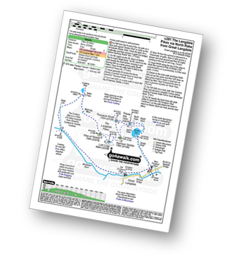
Route Summary:
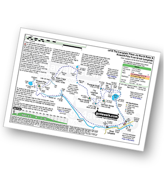
- Great Langdale, The New Dungeon Ghyll, Stickle Ghyll, Stickle Tarn, North Rake, The Langdale Pikes, Pavey Ark, Thunacar Knott, Harrison Stickle, Loft Crag, Pike of Stickle (Pike O' Stickle), Martcrag Moor, Stake Pass, The Cumbria Way, Stake Gill, Mickleden, Mickleden Beck, The New Dungeon Ghyll, Great Langdale
|
Vital Statistics:
| Length: | 10mls (16km) | |
| Ascent: | 3,580ft (1,091m) | |
| Time: | 7.25hrs | |
| Grade: |  | (Hard) |
Route Summary:
- Great Langdale, The New Dungeon Ghyll, Stickle Ghyll, Stickle Tarn, North Rake, The Langdale Pikes, Pavey Ark, Thunacar Knott, Harrison Stickle, Loft Crag, Pike of Stickle (Pike o' Stickle), Martcrag Moor, Stake Pass, Black Crags (Langdale), Little Gill Head, Rossett Pike, Rossett Gill, The Cumbria Way, Mickleden, Mickleden Beck, The New Dungeon Ghyll, Great Langdale
Send us your photographs and pictures on, of, or from The Langdale Pikes
If you would like to add your walk photographs and pictures featuring views from, on or of The Langdale Pikes to this page, please send them as email attachments (configured for any computer) along with your name to:
and we shall do our best to publish them.
(Guide Resolution = 300dpi. At least = 660pixels (wide) x 440 pixels (high).)

You can also submit photos via our Facebook Page.
NB. Please indicate where each photo was taken.

To contribute to go4awalk.com or to contact us about anything at all - see Talk To Us. For help see Help.
go4awalk.com and go4awalk.co.uk are registered trademarks of TMDH Limited.
Copyright © 2000-2025 TMDH Limited. All rights reserved.
Copyright Terms & Conditions Privacy Statement
A - Z Walks Home Log On/Accounts Photo Gallery Walk Ideas and Collections Fell Facts Hill Skills Walking Questions and Answers Your Stories News Competitions Product Reviews/Gear Tests Walking Gear Guides Peaks and Mountains Peak Bagging Find New Walking Friends Camping GPS Waypoints for Walking Contents Walk Search Talk To Us go4awalk.com Help Free Example Walks Newsletter


