
![]()
Holyhead Mountain
220m (722ft)
The Isle of Anglesey and The Llyn (Lleyn) Peninsula, Isle of Anglesey, Wales
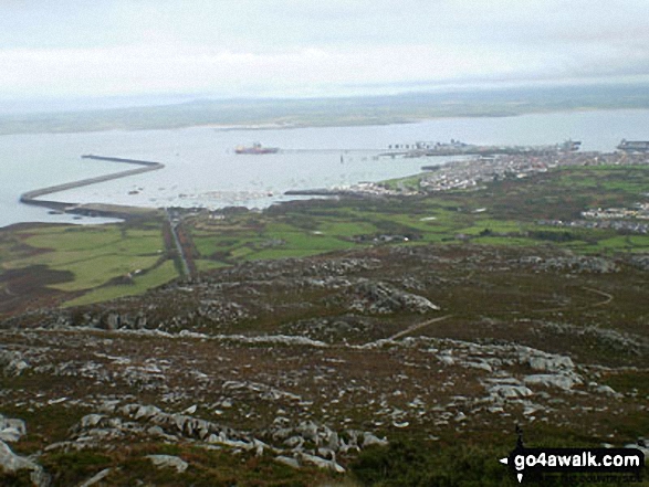
Holyhead Mountain is the highest point on The Isle of Anglesey.
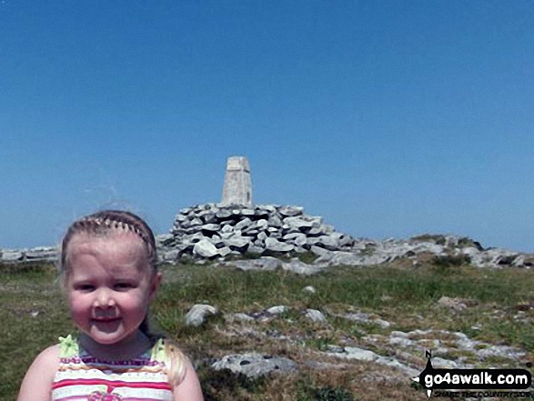
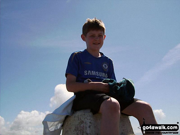
The summit of Holyhead Mountain is marked by an Ordnance Survey Trig Point.
Not familiar with this top?
A go4awalk.com downloadable Peak Bagging Map in PDF format featuring Holyhead Mountain should be available soon.
Free-to-access Interactive Walk Planning Maps:
1:25,000 scale OS Explorer Map (orange/yellow covers):
An Interactive Walk Planning Map for OS Explorer 262 Anglesey West is not currently available
1:50,000 scale OS Landranger Map (pink/magenta covers):
An Interactive Walk Planning Map for OS Landranger 114 Anglesey is not currently available
 Fellow go4awalkers who have already walked, climbed, summited & bagged Holyhead Mountain
Nick Tippins walked up Holyhead Mountain on September 6th, 2019 [with] Fran
Tony Anderton climbed Holyhead Mountain on November 19th, 2022 [from/via/route] N.Stack circular route [with] Trudy [weather] Strong SW wind but dry. - Could see the Isle of Man & Dumfries & Galloway
Mark Smith bagged Holyhead Mountain on August 29th, 2013 [weather] hot & sunny
Tom Mcbeath hiked Holyhead Mountain on January 6th, 2020 [from/via/route] Walked from RSPB Car Park [with] Ursula [weather] Cloudy & windy - Circular walk
Stephen Reader summited Holyhead Mountain on September 4th, 2015 [from/via/route] South Stack [with] Bev and Afia
Andrew Joss conquered Holyhead Mountain on August 20th, 2015 [from/via/route] Holyhead [with] Barbara, Dan and Vicky [weather] Rainy & low cloud
Leon Harvey scaled Holyhead Mountain on August 25th, 2014 [from/via/route] County Park Car Park & coast [with] Solo [weather] Wet & strong winds
Louise Sandwith, Daniel Price, Louis Smith and David Parker have all walked, climbed & bagged Holyhead Mountain.
To add (or remove) your name and experiences on this page - Log On and edit your Personal Mountain Bagging Record
More Photographs & Pictures of views from, on or of Holyhead Mountain
Send us your photographs and pictures on, of, or from Holyhead Mountain
If you would like to add your walk photographs and pictures featuring views from, on or of Holyhead Mountain to this page, please send them as email attachments (configured for any computer) along with your name to:
and we shall do our best to publish them.
(Guide Resolution = 300dpi. At least = 660pixels (wide) x 440 pixels (high).)

You can also submit photos via our Facebook Page.
NB. Please indicate where each photo was taken and whether you wish us to credit your photos with a Username or your First Name/Last Name.
Not familiar with this top?


