
![]()
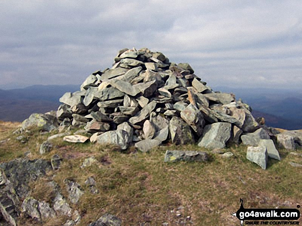
Y Garn (Rhinogs)
629m (2064ft)
The Rhinogs, Snowdonia, Gwynedd, Wales
Tap/mouse over a coloured circle (1-3 easy walks, 4-6 moderate walks, 7-9 hard walks) and click to select.
Y Garn (Rhinogs) means 'The Cairn' in Welsh and is pronounced 'uh-gan'.
You can find Y Garn (Rhinogs) & all the walks that climb it on these unique free-to-access Interactive Walk Planning Maps: (click/TAP to select)
1:25,000 scale OS Explorer Map (the ones with orange/yellow covers):
1:50,000 scale OS Landranger Map (the ones with pink/magenta covers):
See Y Garn (Rhinogs) and the surrounding tops on our free-to-access 'Google Style' Peak Bagging Maps:
See Y Garn (Rhinogs) and the surrounding tops on our downloadable PDF Peak Bagging Map:
   |
|---|
Vital Statistics:
| Length: | 5.5ml (8.5km) |
|---|---|
| Ascent: | 2,032ft (619m) |
| Time: | 4 hrs |
| Grade: |  (Moderate) (Moderate) |
Route Summary:
Ganllwyd - Cwm Camlan - Afon Camlan - Rhaeadr Du - Black Waterfalls - Coed Ganllwyd - Ffridd Bryn-melyn - Nant Las - Bryn Bedwog - Y Garn (Rhinogs) - Bryn Bedwog - Nant Las - Ffridd Bryn-melyn - Coed Ganllwyd - Black Waterfalls - Rhaeadr Du - Afon Camlan - Cwm Camlan - Ganllwyd
 Fellow go4awalkers who have already walked, climbed, summited & bagged Y Garn (Rhinogs)
Christina Lander walked up Y Garn (Rhinogs) on May 27th, 2024 [from/via/route] Ganllwyd - Rhaeadr Du - Y Garn - Ganllwyd [with] Dick [weather] Sunny day/light cloud
Melfyn Parry climbed Y Garn (Rhinogs) on June 1st, 2023 [from/via/route] Started walk from the car park at Ganllwyd as per walk GW162. Followed the route as described to the summit of Y Garn. I did try an alternative route back which involved walking in a NE direction from the summit to join the wall, crossing it wasn't easy but there was a section of wall that had collapsed which allowed me to cross it at a T junction with another wall. Then passing through a gap in the cross wall I was able to follow an awkward path, that seemed to criss cross through gaps along the wall, walking at times through bilberry bushes which meant the path was not the easiest to follow & yet at times was quite good. The wall passed between Fried Gwndwn Uchaf & Craig y Cae eventually coming to a gate near a farmhouse at SH7121524238. At this point it was easy to cross the next field & join the track at SH7136324309. This farm track soon joined a forest track which then met the outgoing route at the hairpin junction SH7170823608, from here I just followed the outward leg back via the waterfalls to the carpark. [with] On my own [weather] Sunny & quite warm all day. - Stunning views in all directions from the summit. You get a great view of the main Rhinog range & down the Mawddach towards Fairbourne & Barmouth. The black waterfalls are well worth spending a few minutes to admire & the scenery up & down the river from the foot bridge is especially pretty. Took 4 hours to complete the walk at a leisurely pace, plenty of time to admire the views & take photos.
Mark Davidson bagged Y Garn (Rhinogs) on September 16th, 2009 [from/via/route] Walk gw162 Y Garn (Rhinogs) from Ganllwyd [with] Alone [weather] Warm & sunny
Donovan Suddell hiked Y Garn (Rhinogs) on May 2nd, 2021 [from/via/route] Ganllwys [with] My wife [weather] Cloudy.
Bleddyn Rhys summited Y Garn (Rhinogs) on April 19th, 2019 [from/via/route] Fynnu o Ganllwyd drwy'r goedwig ac heibio'r hen waith aur. [with] Ar ben fy hyn [weather] Eithriadol o braf. Diwrnod poeth iawn am fis Ebrill, bendigedig! - Llwybrau braf diddorol trwy'r tir National trust coedwig a glanau'r afon. Golygfa wych iawn o'r copa. Hen chwarel aur yn ddiddorol.
Paul Booth, Trevor Williams and Pete Howes have all walked, climbed & bagged Y Garn (Rhinogs).To add (or remove) your name and experiences on this page - Log On and edit your Personal Mountain Bagging Record
More Photographs & Pictures of views from, on or of Y Garn (Rhinogs)
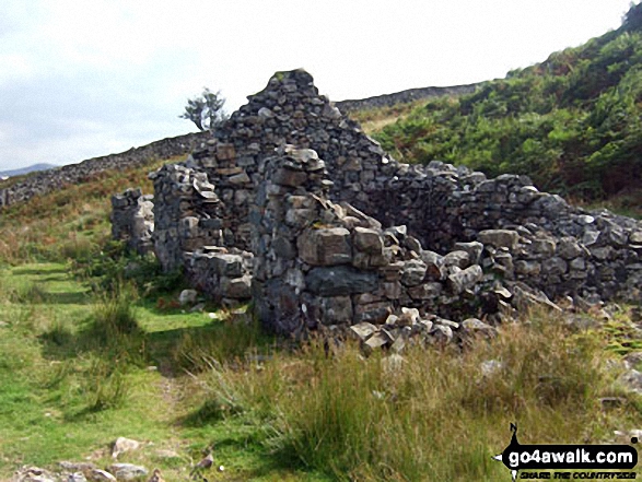
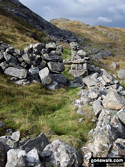
Ruined mine building beneath Bryn Bedwog on the lower slopes of Y Garn (Rhinogs)
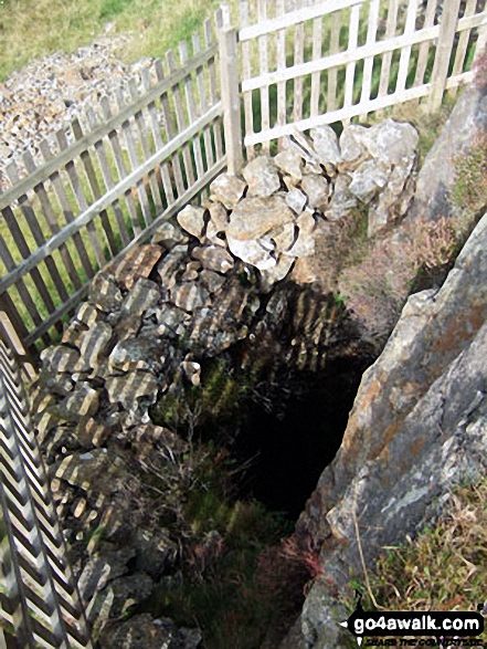
Fenced of mine shaft beneath Bryn Bedwog on the lower slopes of Y Garn (Rhinogs)
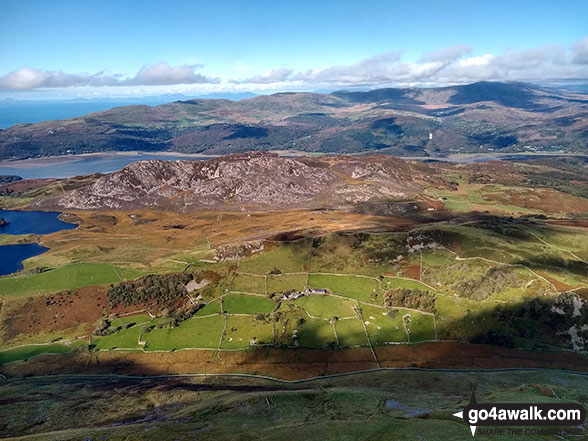
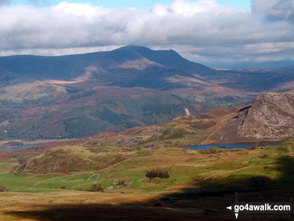
The Mawddach Estuary and the Y Garn (Rhinogs) massiff beyond from the summit of Tyrrau Mawr (Craig-las)
Send us your photographs and pictures on, of, or from Y Garn (Rhinogs)
If you would like to add your walk photographs and pictures featuring views from, on or of Y Garn (Rhinogs) to this page, please send them as email attachments (configured for any computer) along with your name to:
and we shall do our best to publish them.
(Guide Resolution = 300dpi. At least = 660pixels (wide) x 440 pixels (high).)

You can also submit photos via our Facebook Page.
NB. Please indicate where each photo was taken.


