
![]()
Manod Mawr
661m (2169ft)
The Molewyns Area, Snowdonia, Gwynedd, Wales
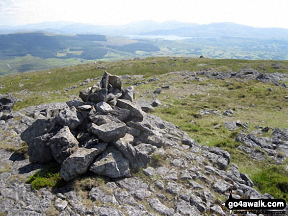
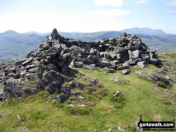
The summit of Manod Mawr is marked by an Ordnance Survey Trig Point.
Not familiar with this top?
   |
|---|
Vital Statistics:
| Length: | 9.5mls (15km) |
|---|---|
| Ascent: | 2,914ft (888m) |
| Time: | 6½ hrs |
| Grade: |  (Hard) (Hard) |
Route Summary:
Blaenau Ffestiniog - Trefeini - Maen-offeren Quarry - Moel Bowydd - Moel Penamnen - Foel-fras (Moel Penamnen) - Cwt-y-bugail Quarry - Manod Mawr (North Top) - Graig-ddu Slate Quarry - Manod Mawr - Nant Dwr-oer - Manod Bach - Nant Dwr-oer - Blaenau Ffestiniog
See Manod Mawr and the surrounding tops on our free-to-access 'Google Style' Peak Bagging Maps:
The Moelwyns area of Snowdonia National Park
Less data - quicker to download
The Whole of Snowdonia National Park
More data - might take a little longer to download
See Manod Mawr and the surrounding tops on our downloadable Peak Bagging Map in PDF format:

NB: Whether you print off a copy or download it to your phone, this PDF Peak Baggers' Map might prove incredibly useful when your are up there on the tops and you cannot get a phone signal.
You can find Manod Mawr & all the walks that climb it on these unique free-to-access Interactive Walk Planning Maps:
1:25,000 scale OS Explorer Map (orange/yellow covers):
1:50,000 scale OS Landranger Map (pink/magenta covers):
 Fellow go4awalkers who have already walked, climbed, summited & bagged Manod Mawr
Stephanie Doyle walked up Manod Mawr on September 1st, 2023 [from/via/route] From campsite [weather] Beautiful - Great views
Daniel Moran climbed Manod Mawr on November 25th, 2024 [from/via/route] Festiniog [with] Frankie chel [weather] decent views made up for the bog - Franke enjoyed his new coat, Circular route with chel & frankie, tough walk in parts especially up moel penamnen, extremely boggy
Christina Lander bagged Manod Mawr on September 1st, 2024 [from/via/route] Blaenau Ffestiniog - Llyn Newydd - Llyn Bowydd - Manod Mawr North top - Manod Mawr - Nant Dwr-oer - Blaenau Ffestiniog [with] Dick [weather] Quite cloudy, a bit foggy on the tops but mostly dry & warm - Long weekend staying in Corris
Donovan Suddell hiked Manod Mawr on August 27th, 2023 [from/via/route] Blaenau Ffestiniog [with] Solo [weather] overcast. Summit was clear
Melfyn Parry summited Manod Mawr on August 22nd, 2022 [from/via/route] Started walk from car park in Blaenau Ffestiniog, headed up through quarry workings to Maen Offeren, at drum house veer left up grassy path to fence. Crossed & headed along spot heights to follow faint path to ridge, turned left & headed to summit of Moel Penamnen. Retraced steps along ridge & continued to summit of Foel Fras. Descent from here following fence to corner of forest before crossing style & continuing along fence to eventually reach summit of Manod Mawr North Top, this path is very boggy & ascent to summit is steep. Descended left from summit to gain main quarry road & turned right. Path passes to right of quarry buildings, follow track & then veer left to gain summit of Manod Mawr. Retraced steps back to track & then turned left following old inclines back to the A470 & then back to car park [with] DS [weather] Started well, drizzle around 10:30, then stopped & then around 11:30 persistent rain stayed with us all day. - From Foel Fras to summit of Manod Mawr North Top is very boggy countryside, can't imagine this would be navigable once the real wet weather sets in over autumn/winter. Probably a walk best completed on a frozen winters' day when the ground would be hard or after a period of dry weather. Definitely gaiter country.
Mark Davidson conquered Manod Mawr on July 12th, 2009 [from/via/route] Walk gw170 Moel Penamnen & Manod Mawr from Blaenau Ffestiniog [with] Alone [weather] Nice & sunny - The route instructions print out for this walk were excellent!
Bleddyn Rhys scaled Manod Mawr on December 31st, 2016 [from/via/route] Manod Mawr o Llan - mewn niwl tew a gwynt! via darn o Sarn Helen a gaer Bryn y Gaer
Robert Taylor-Marriott walked up Manod Mawr on August 7th, 2014 [from/via/route] Route 61: Moelwyns Moel Penamnen. Manod Mawr North Top. Manod Mawr (MPMM). [with] Vince Wetton and Robert Taylor-Marriott. [weather] Sunny, warm, cloudy.
Vince Wetton climbed Manod Mawr on August 7th, 2014 [from/via/route] Gw170 [with] RTM [weather] Bright & Sunny
Gerald Murphy bagged Manod Mawr on March 3rd, 2013 [from/via/route] This description relates to two separate walks. Manod Mawr has two distinct tops sparated by a large slate quarry. I walked Manod Mawr (North Top) (658m) on 27 February, 2013 then, on 3rd March, 2013' Manod Mawr (661m) plus Manod Bach (511m). For Manod Mawr(North Top) I caught a bus (1B) from Blaenau Ffestiniog to the stop before Llan Ffestiniog. The stop is near a layby on the same side as the bus stop. I then took the path from the bus stop leading through some houses away from the layby onto a clear path into Cwm Teigl. I followed the path to Cwt y Bugail slate quarry (still operational at this time). I then took a path to the left towards Llyn Newydd but, at the County Boundary bridge I followed the fence to a ladder stile which led me directly to the cairn. By now I was in thickl fog at the edge of the quarry so I followed the quarry edge to my right & eventually reached Llyn Du Bach. This is not the Llyn du Bach near Gamallt! Now in sunlight, I could see a way back following Afon du Bach to the miners' incline at Bethania district of Blaenau. I descended this to the A470 road back to Blaenau. Not many days later I walked back to Bethania and, across the road from the small Greek Orthodox church, I climbed over an old stile to gain access to the miners' incline. This leads to a col between Manod Mawr & m Manod Bach & to Llyn Manod which lies beneath & between the two hills. I first climbed Manod Mawr before descending & climbing Manod Bach which has a couple of cairns. I returned the way I came. [with] alone (both times) [weather] For North Top - it was foggy & freezing from just below Cwt y Bugail. Even the barbs of the fencing wore long fingers of ice & Llyn du Bach was partially frozen over. For North Top - it was cold but sunny with a light wind only.
To add (or remove) your name and experiences on this page - Log On and edit your Personal Mountain Bagging Record
. . . [see more walk reports]
More Photographs & Pictures of views from, on or of Manod Mawr
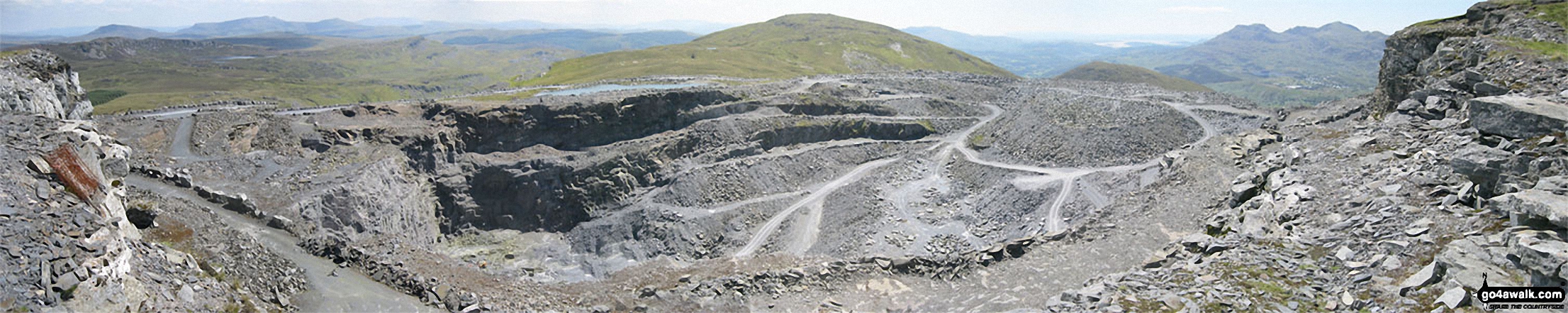
Llyn Du-bach & Maen-offeren Quarry (foreground) with Allt-fawr, Moel Druman, Ysgafel Wen in the distance and Yr Aran, Mount Snowdon (Yr Wyddfa) and Y Lliwedd on the horizon from the summit of Manod Mawr (North Top)
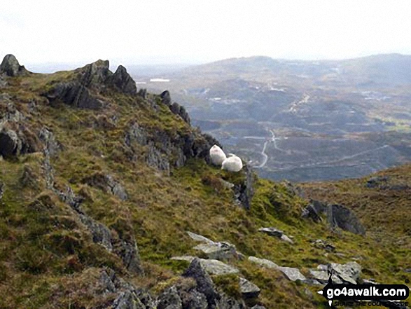
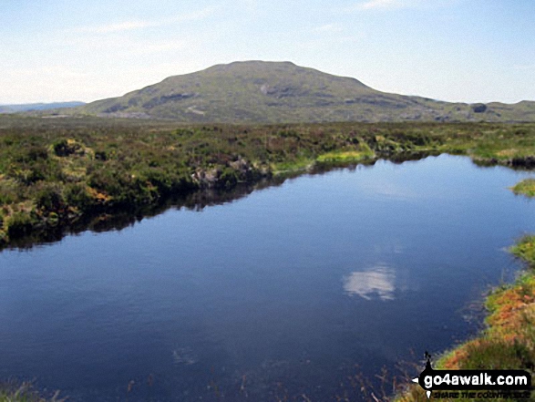
Sheep safely grazing on Allt-fawr (Moelwyns) with Moel Penamnen and Manod Mawr across the valley in the distance
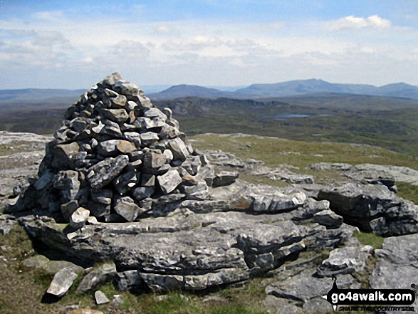
Moelwyn Bach, Craigysgafn, Moelwyn Mawr, Allt-fawr and Moel Druman from Manod Mawr (North Top) summit
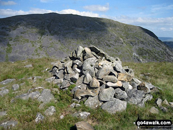
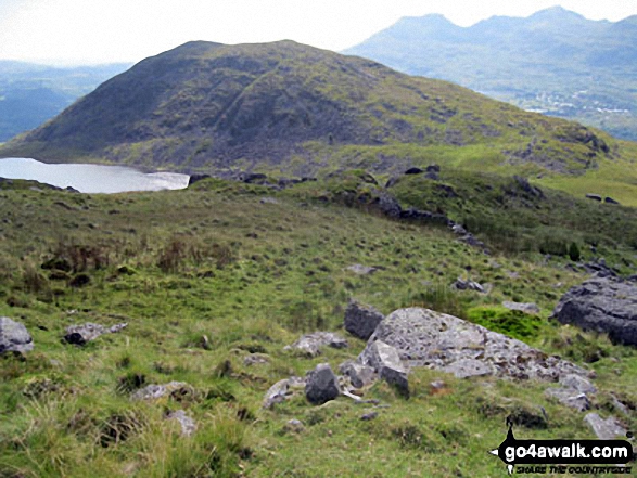
Manod Mawr beyond the huge Graig-ddu Slate Quarry from Manod Mawr (North Top)

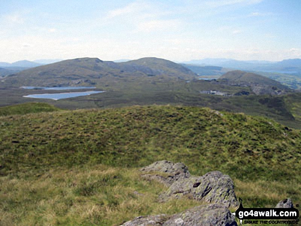
360 degree view from Moel Penamnen summit featuring (from left to right): The Moelwyns - Moelwyn Bach, Craigysgafn & Moelwyn Mawr, Allt-fawr, Moel Druman & Ysgafell Wen, Moel Farlwyd (foreground above/left of blue lake), Yr Aran (pointed peak above Moel Farlwyd), Mount Snowdon (Yr Wyddfa) & Y Lliwedd, The Glyderau - Glyder Fach, Glyder Fawr & Tryfan, Carnedd Moel Siabod, Y Ro Wen, Foel-fras (Moelwyns), Manod Mawr (above two light blue lakes) and The Arenigs - Arenig Fawr & Arenig Fach.
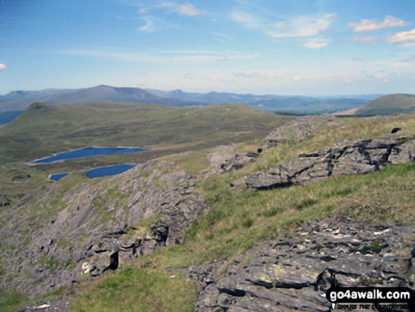
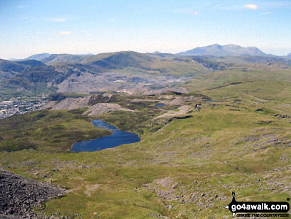
The Carneddau & Carnedd Moel Siabod (on horizon), Moel Penamnen (left) and Llyn Newydd & Llyn Bowydd (mid distance ) from Manod Mawr (North Top)
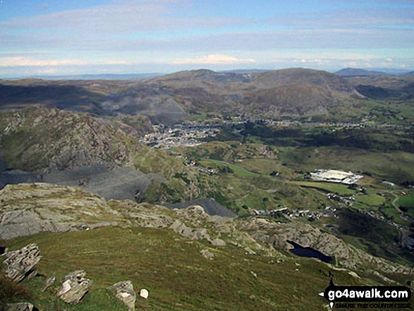
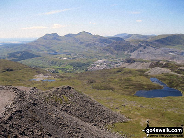
Blaenau Ffestiniog with Manod Mawr beyond from the summit of Moel-yr-hydd
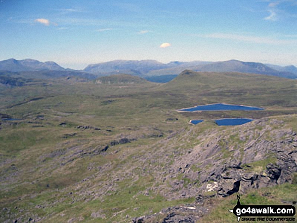
Mount Snowdon (Yr Wyddfa) & Y Lliwedd (left) and The Glyderau - Glyder Fach, Glyder Fawr & Tryfan (centre) and Carnedd Moel Siabod (right) with Moel Penamnen and Llyn Newydd & Llyn Bowydd (mid distance right) from the summit of Manod Mawr (North Top)
Send us your photographs and pictures on, of, or from Manod Mawr
If you would like to add your walk photographs and pictures featuring views from, on or of Manod Mawr to this page, please send them as email attachments (configured for any computer) along with your name to:
and we shall do our best to publish them.
(Guide Resolution = 300dpi. At least = 660pixels (wide) x 440 pixels (high).)

You can also submit photos via our Facebook Page.
NB. Please indicate where each photo was taken and whether you wish us to credit your photos with a Username or your First Name/Last Name.
Not familiar with this top?


