
![]()
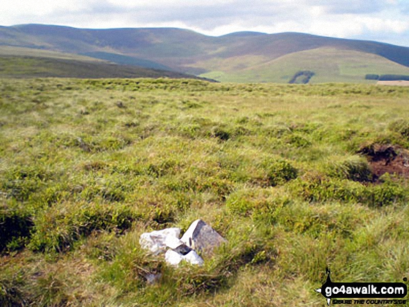
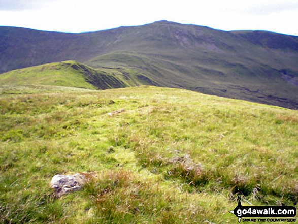
Godor
679m (2229ft)
The Berwyns, Powys, Wales
*Godor is actually just outside of The National Park Boundary
Not familiar with this top?
   |
|---|
Vital Statistics:
| Length: | 9.5ml (15km) |
|---|---|
| Ascent: | 2,632ft (802m) |
| Time: | 6 hrs |
| Grade: |  (Moderate) (Moderate) |
Route Summary:
Tyn-y-ffridd - Cwm Maen Gwynedd - Mynydd Tarw - Foel Wen (South Top) - Foel Wen - Tomle - Bwlch Maen Gwynedd - Craig Berwyn - Cadair Berwyn - Cadair Berwyn (North Top) - Moel Sych - Moel Yr Ewig - Godor (North Top) - Godor - Tyn-y-ffridd
See Godor and the surrounding tops on our free-to-access 'Google Style' Peak Bagging Map:
The Berwyns of Snowdonia National Park
Less data - quicker to download
See Godor and the surrounding tops on our downloadable Peak Bagging Map in PDF format:

NB: Whether you print off a copy or download it to your phone, this PDF Peak Baggers' Map might prove incredibly useful when your are up there on the tops and you cannot get a phone signal.
You can find Godor & all the walks that climb it on these unique free-to-access Interactive Walk Planning Maps:
1:25,000 scale OS Explorer Map (orange/yellow covers):
1:50,000 scale OS Landranger Map (pink/magenta covers):
 Fellow go4awalkers who have already walked, climbed, summited & bagged Godor
Christina Lander walked up Godor on July 28th, 2024 [from/via/route] Bridge over Afon Irwch - Mynydd Tarw - Foel Wen South top - Foel Wen - Tomle - Bwlch Maen Gwynedd - Cadair Bronwen - Cadair Berwyn north top - Cadair Berwyn - Moel yr Ewig - Godor north top - Godor - bridge over Afon Irwch [with] Dick [weather] A beautiful, hot, sunny day - During our holiday staying at Y Gilfach, Bryn Melyn, Llandderfel
Melfyn Parry climbed Godor on June 5th, 2024 [from/via/route] Followed go4awalk route po109 but seemed a shame as I was in the area not to include Cadair Bronwen, a very easy detour without adding much extra distance (about an extra 0.75 miles) but meant that 11 Nuttalls were bagged in 1 day - generally very good guidance & notes, except note B, this suggests summit of Moel yr Ewig is near fence & marked by single rock, you have to turn left over the fence to climb to the top over heather & bilberry bushes & the top is unmarked, return to the fence to continue the route . If you want to do the extra top - from note 5 on the guidance take a half right to continue to the ridge on a well defined path, at the gate, turn right & head for the summit of Cadair Bronwen, then just return to the gate but then head straight up to Craig Berwyn. [with] On my own [weather] Sunny spells & dry. Heading up to Mynydd Tarw reasonably sheltered from wind, however on the top the wind was much stronger & quite cold, 2 layers became 4 very quickly.
Mark Davidson bagged Godor on July 6th, 2006 [from/via/route] Walk po109 Foel Wen & Cadair Berwyn from Tyn-y-fridd [with] Alone [weather] Lovely & sunny
Elaine Grayson hiked Godor on July 15th, 2016 [from/via/route] see cadair berwyn
Robert Taylor-Marriott summited Godor on July 11th, 2013 [from/via/route] Route 52: Mynydd Tarw. Foel Wen (ST). Tomple. Moel yr Ewig. Gogor (NT) (TFMG) Completed 11.07.13+ [with] Vince Wetton and Robert Taylor-Marriott. [weather] Very Sunny :-)
Vince Wetton conquered Godor on July 11th, 2013 [from/via/route] Cadair Berwyn Moel yr Ewig [with] RTM [weather] Beautiful Sunny Day
Donovan Suddell and Richard Penney have both walked, climbed & bagged Godor.
To add (or remove) your name and experiences on this page - Log On and edit your Personal Mountain Bagging Record
More Photographs & Pictures of views from, on or of Godor
Send us your photographs and pictures on, of, or from Godor
If you would like to add your walk photographs and pictures featuring views from, on or of Godor to this page, please send them as email attachments (configured for any computer) along with your name to:
and we shall do our best to publish them.
(Guide Resolution = 300dpi. At least = 660pixels (wide) x 440 pixels (high).)

You can also submit photos via our Facebook Page.
NB. Please indicate where each photo was taken and whether you wish us to credit your photos with a Username or your First Name/Last Name.
Not familiar with this top?


