
![]()
Hollin Hill (Oxenhope Moor)
451m (1480ft)
The South Pennines and The Forest of Bowland, West Yorkshire, England
The summit of Hollin Hill (Oxenhope Moor) is marked by an Ordnance Survey Trig Point.

Got a photo of Hollin Hill (Oxenhope Moor)
Send it in and we'll publish it here.
Not familiar with this top?
   |
|---|
Vital Statistics:
| Length: | 9mls (14.5km) |
|---|---|
| Ascent: | 1,234ft (376m) |
| Time: | 4½ hrs |
| Grade: |  (Moderate) (Moderate) |
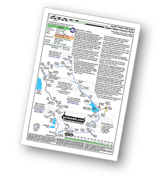
Route Summary:
Ogden Water Country Park - Ogden Water - Great Scar - White Wall End - Thornton Moor - Sawood Moss - Hambleton Top - Little Clough - Great Clough - Nab Hill - Nab Rough - Hollin Hill (Oxenhope Moor) - Old Fly Delph - Withens Head Farm - Cold Edge - Moorlands Farm - Haigh Cote Barn - Moorside - The Calderdale Way - Hough Gate Farm - Hunter Hill - Goose Clough - Stod Fold - Hebble Brook - Ogden Water - Ogden Water Country Park
See Hollin Hill (Oxenhope Moor) and the surrounding tops on our free-to-access 'Google Style' Peak Bagging Map:
See Hollin Hill (Oxenhope Moor) and the surrounding tops on our downloadable Peak Bagging Map in PDF format:

NB: Whether you print off a copy or download it to your phone, this PDF Peak Baggers' Map might prove incredibly useful when your are up there on the tops and you cannot get a phone signal.
Free-to-access Interactive Walk Planning Maps:
1:25,000 scale OS Explorer Map (orange/yellow covers):
1:50,000 scale OS Landranger Map (pink/magenta covers):
An Interactive Walk Planning Map for OS Landranger 104 Leeds & Bradford, Harrogate & Ilkley is not currently available
 Fellow go4awalkers who have already walked, climbed, summited & bagged Hollin Hill (Oxenhope Moor)
Adrian Howard walked up on December 30th, 2016 [from/via/route] From Nab Water Lane up old quarry roads.
Andrew Flynn climbed it on September 12th, 2020 [from/via/route] Wy107 Ogden Water [with] Nicola and George [weather] Nice day. Lovely & sunny
Paul Booth has walked, climbed & bagged Hollin Hill (Oxenhope Moor).
To add (or remove) your name and experiences on this page - Log On and edit your Personal Mountain Bagging Record
Send us your photographs and pictures on, of, or from Hollin Hill (Oxenhope Moor)
If you would like to add your walk photographs and pictures featuring views from, on or of Hollin Hill (Oxenhope Moor) to this page, please send them as email attachments (configured for any computer) along with your name to:
and we shall do our best to publish them.
(Guide Resolution = 300dpi. At least = 660pixels (wide) x 440 pixels (high).)

You can also submit photos via our Facebook Page.
NB. Please indicate where each photo was taken.
Not familiar with this top?


