
![]()
Pikethaw Hill
564m (1851ft)
The Ettrick Hills, The Scottish Borders, The Borders/Dumfries and Galloway, Scotland
Tap/mouse over a coloured circle (1-3 easy walks, 4-6 moderate walks, 7-9 hard walks) and click to select.
Not familiar with this top?
   |
|---|
Vital Statistics:
| Length: | 8.5ml (13.5km) |
|---|---|
| Ascent: | 2,832ft (863m) |
| Time: | 5.75hrs |
| Grade: |  (Moderate) (Moderate) |
Route Summary:
Mosspaul Hotel - Wisp Hill (Teviothead) - Ewenshope Fell - Ewes Doors - Pikethaw Hill - Frodaw Height - Dan's Hags - Upper Hill (Fiddleton Cottage) - Fiddleton Cottage - Bught Knowe - Glenrief Rig - Mosspaul Burn - Mosspaul Hotel
|
|---|
Vital Statistics:
| Length: | 8.75ml (14km) |
|---|---|
| Ascent: | 3,482ft (1,061m) |
| Time: | 7 hrs |
| Grade: |  (Hard) (Hard) |
Route Summary:
Mosspaul Hotel - Wisp Hill (Teviothead) - Ewenshope Fell - Ewes Doors - Pikethaw Hill - Frodaw Height - Dan's Hags - Upper Hill (Fiddleton Cottage) - Fiddleton Cottage - Glenrief Cottage - Castlewink - Ellson Fell - Glenrief Rig - Mosspaul Burn - Mosspaul Hotel
See Pikethaw Hill and the surrounding tops on our free-to-access 'Google Style' Peak Bagging Maps:
The Ettrick Hills area of Scottish Region 28: The Scottish Borders
Less data - quicker to download
Scottish Region 27: The Scottish Borders
Less data - quicker to download
A go4awalk.com downloadable Peak Bagging Map in PDF format featuring Pikethaw Hill should be available soon.
You can find Pikethaw Hill & all the walks that climb it on these unique free-to-access Interactive Walk Planning Maps:
1:25,000 scale OS Explorer Map (orange/yellow covers):
An Interactive Walk Planning Map for OS Explorer 323 Eskdale and Castle o’er Forest is not currently available
1:50,000 scale OS Landranger Map (pink/magenta covers):
 Fellow go4awalkers who have already walked, climbed, summited & bagged Pikethaw Hill
To add (or remove) your name and experiences on this page - Log On and edit your Personal Mountain Bagging Record
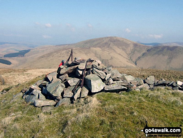
More Photographs & Pictures of views from, on or of Pikethaw Hill
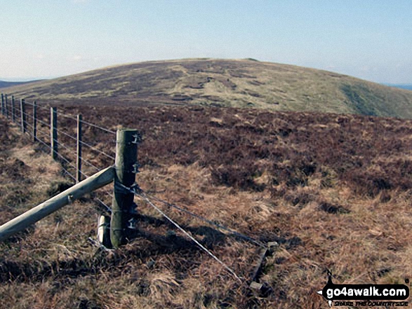
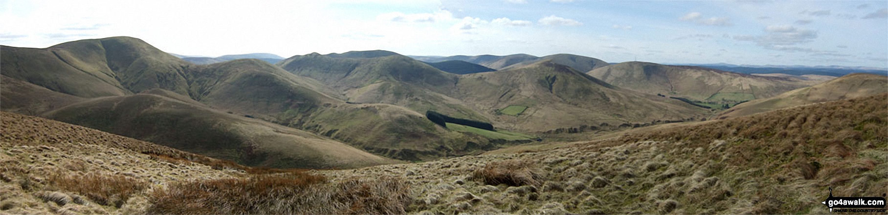
Tudhope Hill, Carlin Tooth (Teviothead), Ellson Fell, Bye Hill, Dan's Hag, Frodshaw Height, Pikethaw Hill, Wisp Hill and Comb Hill (Langhope Height) and The Mosspaul Hotel from Wether Law (Teviothead)
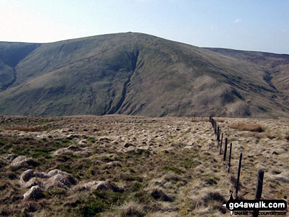
Pikethaw Hill, Ewes Doors, Ewestees Burn and Ewenshop Fell from Bught Knowe on the way to Glenrief Rig
Send us your photographs and pictures on, of, or from Pikethaw Hill
If you would like to add your walk photographs and pictures featuring views from, on or of Pikethaw Hill to this page, please send them as email attachments (configured for any computer) along with your name to:
and we shall do our best to publish them.
(Guide Resolution = 300dpi. At least = 660pixels (wide) x 440 pixels (high).)

You can also submit photos via our Facebook Page.
NB. Please indicate where each photo was taken and whether you wish us to credit your photos with a Username or your First Name/Last Name.
Not familiar with this top?


