
![]()
Hart Fell (Moffat)
808m (2652ft)
The Moffat Hills, The Scottish Borders, The Borders/Dumfries and Galloway, Scotland
Tap/mouse over a coloured circle (1-3 easy walks, 4-6 moderate walks, 7-9 hard walks) and click to select.
Not familiar with this top?
   |
|---|
Vital Statistics:
| Length: | 8.75ml (14km) |
|---|---|
| Ascent: | 3,236ft (986m) |
| Time: | 6½ hrs |
| Grade: |  (Hard) (Hard) |
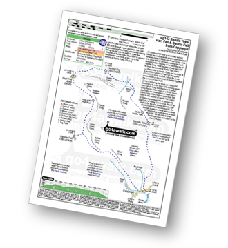
Route Summary:
Capplegill - Blackhope Burn - Saddle Yoke - Under Saddle Yoke - Whirly Gill - Saddle Craigs - Harfell Rig - Hart Fell (Moffat) - Hartfell Craig - Falcon Craig - Upper Comb Craig - Swatte Fell - Nether Comb Craig - Black Craig - Hang Burn - Hang Gill - Capplegill
See Hart Fell (Moffat) and the surrounding tops on our free-to-access 'Google Style' Peak Bagging Maps:
The Moffat Hills area of Scottish Region 28: The Scottish Borders
Less data - quicker to download
Scottish Region 27: The Scottish Borders
Less data - quicker to download
A go4awalk.com downloadable Peak Bagging Map in PDF format featuring Hart Fell (Moffat) should be available soon.
You can find Hart Fell (Moffat) & all the walks that climb it on these unique free-to-access Interactive Walk Planning Maps:
1:25,000 scale OS Explorer Map (orange/yellow covers):
An Interactive Walk Planning Map for OS Explorer 330 Moffat & St Mary’s Loch is not currently available
1:50,000 scale OS Landranger Map (pink/magenta covers):
 Fellow go4awalkers who have already walked, climbed, summited & bagged Hart Fell (Moffat)
Sam Jones walked up Hart Fell (Moffat) on June 29th, 2024 [from/via/route] Via Hart fell Spa from the hall [with] Solo [weather] Mostly sunny - Awesome views not a soul to be seen all day
Mark Davidson climbed Hart Fell on October 10th, 2015 [with] Alone [weather] High white cloud but stayed dry
Iain Taylor bagged Hart Fell on August 19th, 2012 [from/via/route] Nr Moffat (NT 14713 09843)
Trevor Williams has walked, climbed & bagged Hart Fell.
To add (or remove) your name and experiences on this page - Log On and edit your Personal Mountain Bagging Record
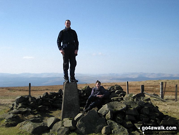
Send us your photographs and pictures on, of, or from Hart Fell (Moffat)
If you would like to add your walk photographs and pictures featuring views from, on or of Hart Fell (Moffat) to this page, please send them as email attachments (configured for any computer) along with your name to:
and we shall do our best to publish them.
(Guide Resolution = 300dpi. At least = 660pixels (wide) x 440 pixels (high).)

You can also submit photos via our Facebook Page.
NB. Please indicate where each photo was taken and whether you wish us to credit your photos with a Username or your First Name/Last Name.
Not familiar with this top?


