
![]()
Beinn a' Chrulaiste
857m (2813ft)
The Glen Coe Mountains, Loch Leven to Connel Bridge, Strath of Orchy and Glen Lochy, Highland, Scotland
Tap/mouse over a coloured circle (1-3 easy walks, 4-6 moderate walks, 7-9 hard walks) and click to select.
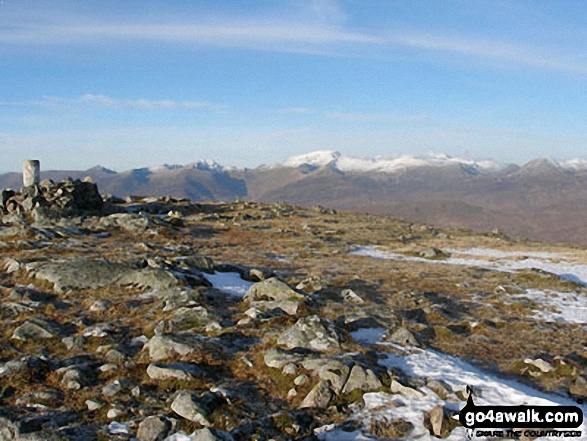
The summit of Beinn a' Chrulaiste is marked by an Ordnance Survey Trig Point.
Not familiar with this top?
   |
|---|
Vital Statistics:
| Length: | 6.5ml (10.5km) |
|---|---|
| Ascent: | 2,227ft (679m) |
| Time: | 4½ hrs |
| Grade: |  (Moderate) (Moderate) |
Route Summary:
Altnafeadh - The Pass of Glen Coe - Stob Beinn a' Chrulaiste - Beinn a' Chrulaiste - The Kings House Hotel - The Old Military Road - The West Highland Way - Altnafeadh - The Pass of Glen Coe.
See Beinn a' Chrulaiste and the surrounding tops on our free-to-access 'Google Style' Peak Bagging Maps:
The Glen Coe Mountains area of Scottish Region 3: Loch Leven to Connel Bridge, Strath of Orchy and Glen Lochy
Less data - quicker to download
Scottish Region 3: Loch Leven to Connel Bridge, Strath of Orchy and Glen Lochy
Less data - quicker to download
See Beinn a' Chrulaiste and the surrounding tops on our downloadable Peak Bagging Map in PDF format:

NB: Whether you print off a copy or download it to your phone, this PDF Peak Baggers' Map might prove incredibly useful when your are up there on the tops and you cannot get a phone signal.
You can find Beinn a' Chrulaiste & all the walks that climb it on these unique free-to-access Interactive Walk Planning Maps:
1:25,000 scale OS Explorer Map (orange/yellow covers):
1:50,000 scale OS Landranger Map (pink/magenta covers):
 Fellow go4awalkers who have already walked, climbed, summited & bagged Beinn a' Chrulaiste
David Buckley walked up Beinn a' Chrulaiste during May, 2015 [with] Julie
Mr M A Blanchard and Trevor Williams have both walked, climbed & bagged Beinn a' Chrulaiste.
To add (or remove) your name and experiences on this page - Log On and edit your Personal Mountain Bagging Record
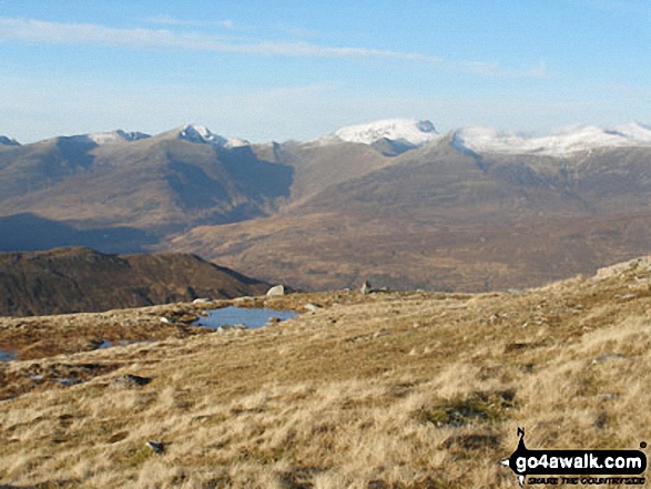
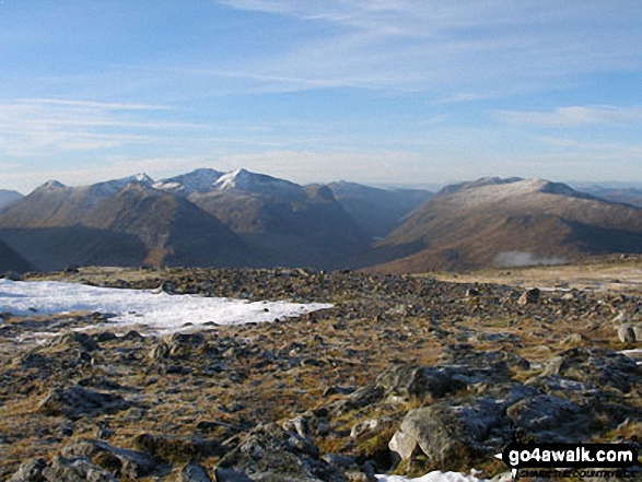
More Photographs & Pictures of views from, on or of Beinn a' Chrulaiste
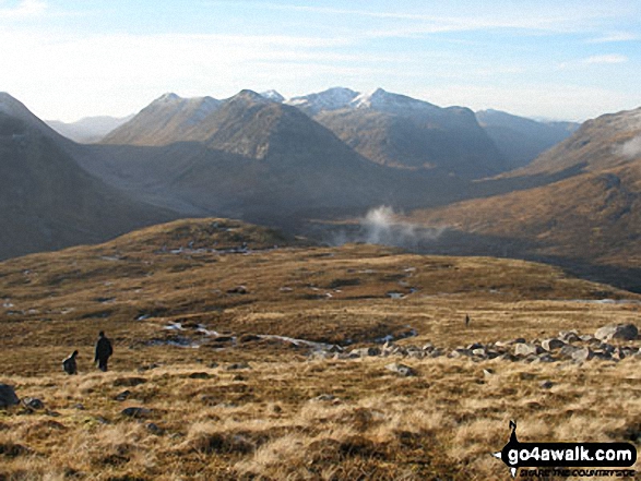
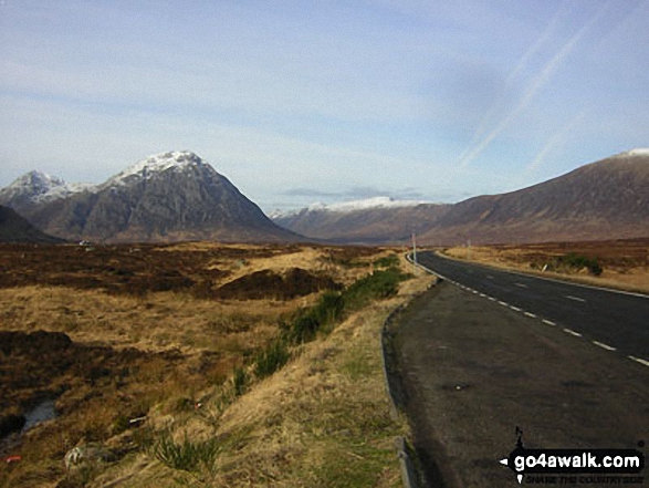
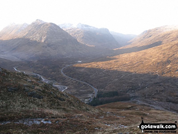
Buachaille Etive Beag and The Three Sisters of Glen Coe (Beinn Fhada, Gearr Aonach & Aonach Dubh) from the lower slopes of Beinn a' Chrulaiste
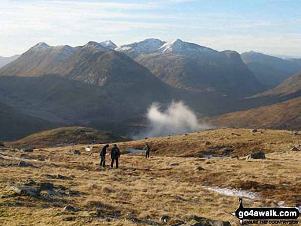
The Three Sisters of Glen Coe (snow capped) and Buachaille Etive Beag (left) from the lower slopes of Beinn a' Chrulaiste
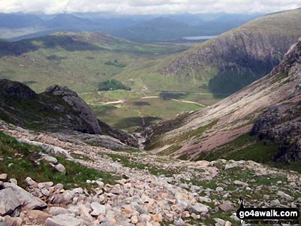
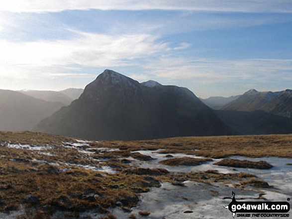
Altnafeadh in The Pass of Glen Coe with Beinn Bheag (left) and Beinn a' Chrulaiste (right) from Coire na Tulaich
Send us your photographs and pictures on, of, or from Beinn a' Chrulaiste
If you would like to add your walk photographs and pictures featuring views from, on or of Beinn a' Chrulaiste to this page, please send them as email attachments (configured for any computer) along with your name to:
and we shall do our best to publish them.
(Guide Resolution = 300dpi. At least = 660pixels (wide) x 440 pixels (high).)

You can also submit photos via our Facebook Page.
NB. Please indicate where each photo was taken and whether you wish us to credit your photos with a Username or your First Name/Last Name.
Not familiar with this top?


