Murdo Icon

Am Bodach (Aonach Eagach)
943m (3095ft)


The Glen Coe Mountains, Loch Leven to Connel Bridge, Strath of Orchy and Glen Lochy, Highland, Scotland


Record Am Bodach (Aonach Eagach) as Bagged, Climbed & Conquered

Murdo Icon

Murdo
No. 343

Walk Am Bodach (Aonach Eagach) walking UK Mountains in Loch Leven to Connel Bridge, Strath of Orchy and Glen Lochy  Highland, Scotland

Am Bodach (Aonach Eagach) Summit

Photo: Iain Macdonald


Not familiar with this top?

How is Am Bodach (Aonach Eagach) classified?

Download 1 easy-to-follow, circular walk that climbs Am Bodach (Aonach Eagach)

See the location of Am Bodach (Aonach Eagach) and the walk on an interactive Google Map

See the location of Am Bodach (Aonach Eagach) on an interactive Google Bagging Map


You can walk to the top of Am Bodach (Aonach Eagach) by using this easy‑to‑follow route map:
Walking Boot Print Icon

Walk h128 Aonach Eagach from The Pass of Glencoe

The finest ridge walk in mainland Britain - but not for the faint hearted

Walk GPS Icon
Walk GPX Icon
Walk PDF Icon

Vital Statistics:

Length: 7.75ml (12.5km)
Ascent:4,270ft (1,301m)
Time:7.25hrs
Grade:Walk Grade 7 Icon (Hard)

See Am Bodach (Aonach Eagach) and the surrounding tops on our free-to-access 'Google Style' Peak Bagging Maps:

Find Google Maps Peak Bagging Map Icon

Scottish Region 3: Loch Leven to Connel Bridge, Strath of Orchy and Glen Lochy

Find Google Maps Peak Bagging Map Icon

The Glen Coe Mountains area of Scottish Region 3: Loch Leven to Connel Bridge, Strath of Orchy and Glen Lochy


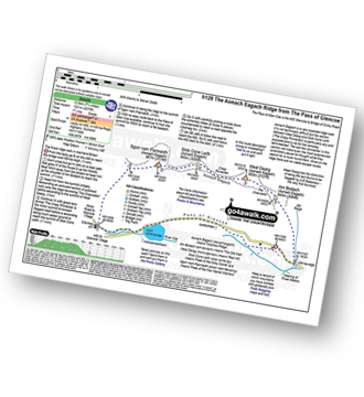
See Am Bodach (Aonach Eagach) and the surrounding tops on our downloadable Peak Bagging Map in PDF format:

Find PDF Peak Bagging Map Icon

The Glen Coe Mountains of Scottish Region 3: Loch Leven to Connel Bridge, Strath of Orchy and Glen Lochy

NB: Whether you print off a copy or download it to your phone, this PDF Peak Baggers' Map might prove incredibly useful when your are up there on the tops and you cannot get a phone signal.


You can find Am Bodach (Aonach Eagach) & all the walks that climb it on these unique free-to-access Interactive Walk Planning Maps:


1:25,000 scale OS Explorer Map (orange/yellow covers):

OS Explorer 384 Glen Coe


1:50,000 scale OS Landranger Map (pink/magenta covers):

OS Landranger 41 Ben Nevis, Fort William & Glen Coe


Other walkers who hiked, climbed, bagged and summited Am Bodach (Aonach Eagach) 
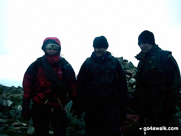
Fellow go4awalkers who have already walked, climbed, summited & bagged Am Bodach (Aonach Eagach)

Louis Smith, Mr M A Blanchard, Ron Blundell and Sharon Houston have all walked, climbed & bagged Am Bodach (Aonach Eagach).

To add (or remove) your name and experiences on this page - Log On and edit your Personal Mountain Bagging Record


Send us your photographs and pictures on, of, or from Am Bodach (Aonach Eagach)

If you would like to add your walk photographs and pictures featuring views from, on or of Am Bodach (Aonach Eagach) to this page, please send them as email attachments (configured for any computer) along with your name to:


and we shall do our best to publish them.

(Guide Resolution = 300dpi. At least = 660pixels (wide) x 440 pixels (high).)

Send us your photographs and pictures on, of, or from Am Bodach (Aonach Eagach) via Facebook

You can also submit photos via our Facebook Page.

NB. Please indicate where each photo was taken.


Not familiar with this top?

How is Am Bodach (Aonach Eagach) classified?

Download 1 easy-to-follow, circular walk that climbs Am Bodach (Aonach Eagach)

See the location of Am Bodach (Aonach Eagach) and the walk on an interactive Google Map

See the location of Am Bodach (Aonach Eagach) on an interactive Google Bagging Map


Do not miss our pick of the Best Walks in Britain


Follow go4awalk.com on Twitter Follow go4awalk.com on Facebook


Home


Find new Friends to go walking with

Walk all 214 Wainwrights in just 59 Walks. Download GPS Waypoints - Great Walks you must not miss!

Walk The Yorkshire Three Peaks Challenge Walk - All the Latest Route Information, GPS Waypoints and Split Times to keep you on Schedule

Walk The British Three Peaks Challenge Walk - All the Latest Route Information and GPS Waypoints

See our pick of The Best Walks in The Lake District - Great Walks you must not miss!

Walk our pick of the Best Lake District Ridge Walks - Great Walks you must not miss!

Walk our pick of the Best Lake District Walks to do in the rain - Great Walks you must not miss!

Walk our pick of The Best Walks in Snowdonia - Great Walks you must not miss!

Walk our pick of The Best Ridge Walks in Wales - Walks you must not miss!

Walk our pick of The Best Walks in The Brecon Beacons - Great Walks you must not miss!

Walk our pick of The Best Walks in The Yorkshire Dales - Walks you must not miss!

Walk our pick of The Best Walks in The Peak District - Walks you must not miss!

Walk our pick of The Best Walks in The Forest of Bowland - Walks you must not miss!

Walk our pick of The Best Walks in Shropshire - Walks you must not miss!

Walk our pick of The Best Walks in Cheshire - Walks you must not miss!

Walk our pick of The Best Walks in Lancashire - Walks you must not miss!

Not sure where to walk next? Try Peak Bagging - Great Walks you must not miss!

Not sure where to walk next? Walk part of a National Trail - Great Walks you must not miss!

Walks with Downloadable and Uploadable GPS Waypoint Data

Walking Kit and Gear Tested by Walkers

Full Site Search
Do not miss our pick of the Best Walks in Britain