
![]()
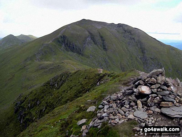
Beinn Ghlas (Breadalbane)
1103m (3620ft)
The Ben Lawers Area, The River Tay to Rannoch Moor, Perth and Kinross, Scotland
Tap/mouse over a coloured circle (1-3 easy walks, 4-6 moderate walks, 7-9 hard walks) and click to select.
Not familiar with this top?
See Beinn Ghlas (Breadalbane) and the surrounding tops on our free-to-access 'Google Style' Peak Bagging Maps:
The Ben Lawers Area area of Scottish Region 2: The River Tay to Rannoch Moor
Less data - quicker to download
Scottish Region 2: The River Tay to Rannoch Moor
Less data - quicker to download
A go4awalk.com downloadable Peak Bagging Map in PDF format featuring Beinn Ghlas (Breadalbane) should be available soon.
Free-to-access Interactive Walk Planning Maps:
1:25,000 scale OS Explorer Map (orange/yellow covers):
An Interactive Walk Planning Map for OS Explorer OL48 Ben Lawers & Glen Lyon is not currently available
1:50,000 scale OS Landranger Map (pink/magenta covers):
An Interactive Walk Planning Map for OS Landranger 51 Loch Tay & Glen Dochart is not currently available
 Fellow go4awalkers who have already walked, climbed, summited & bagged Beinn Ghlas (Breadalbane)
Mark Davidson walked up Beinn Ghlas (Breadalbane) on October 6th, 2021 [from/via/route] Parking area at north end of Lochan na Lairige [with] JS & MC [weather] Nice & sunny & not too cold
John Currie climbed Beinn Ghlas (Breadalbane) on July 8th, 2017 [from/via/route] From Ben Lawers - reached top at 12:02 [with] Barry Colman [weather] Clear - Artemis Great Kindrochit Quadrathlon
Frances Ipson bagged Beinn Ghlas (Breadalbane) on August 12th, 2012 [from/via/route] Ben Lawers car park [with] stan and stella [weather] cloudy, misty on top, no view.
Simon Lewis hiked Beinn Ghlas (Breadalbane) on August 11th, 2012 [with] Sharron
John Herbert has summited Beinn Ghlas (Breadalbane) [from/via/route] Ben Lawers visitor centre - enroute to Ben Lawers [with] Muriel [weather] Cloudy & windy - Did this enroute to Ben Lawers - date unknown as it was a few years ago - will repeat soon & update data
Patrick Rogozinski, Louise Sandwith, Grant Mclean, Mr M A Blanchard, Ron Blundell, Simon Duerden, Phyllis Mcgibbon, Paul Booth, Trevor Williams, John Cuthbert, Geert Gritter and Adam Shewry have all walked, climbed & bagged Beinn Ghlas (Breadalbane).
To add (or remove) your name and experiences on this page - Log On and edit your Personal Mountain Bagging Record
More Photographs & Pictures of views from, on or of Beinn Ghlas (Breadalbane)
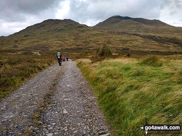
Meall Corranaich (left) and Beinn Ghlas (Breadalbane) from the track south of Meall nan Tarmachan
Send us your photographs and pictures on, of, or from Beinn Ghlas (Breadalbane)
If you would like to add your walk photographs and pictures featuring views from, on or of Beinn Ghlas (Breadalbane) to this page, please send them as email attachments (configured for any computer) along with your name to:
and we shall do our best to publish them.
(Guide Resolution = 300dpi. At least = 660pixels (wide) x 440 pixels (high).)

You can also submit photos via our Facebook Page.
NB. Please indicate where each photo was taken and whether you wish us to credit your photos with a Username or your First Name/Last Name.
Not familiar with this top?


