
![]()
Y Gamriw
604m (1982ft)
The South Western Area, The Cambrian Mountains, Powys, Wales
Tap/mouse over a coloured circle (1-3 easy walks, 4-6 moderate walks, 7-9 hard walks) and click to select.
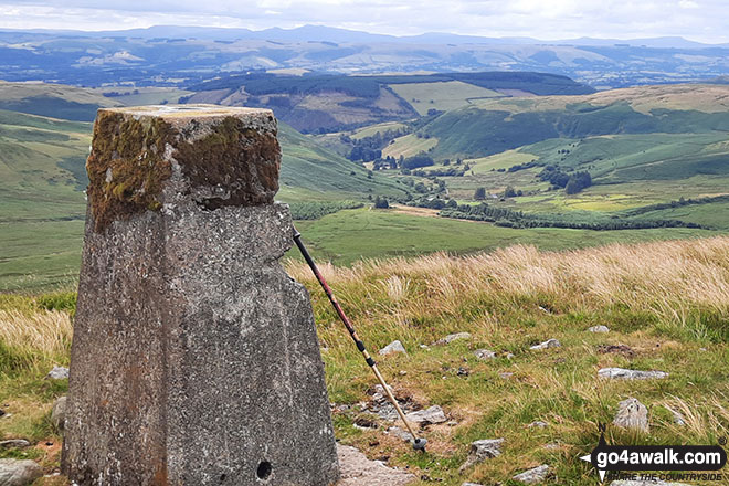
The summit of Y Gamriw is marked by an Ordnance Survey Trig Point.
Not familiar with this top?
See Y Gamriw and the surrounding tops on our free-to-access 'Google Style' Peak Bagging Maps:
The South Western AreaThe South Western Area of Mynyddoedd Cambria (The Cambrian Mountains)
Less data - quicker to download
Mynyddoedd Cambria (The Cambrian Mountains)
Less data - quicker to download
A go4awalk.com downloadable Peak Bagging Map in PDF format featuring Y Gamriw should be available soon.
Free-to-access Interactive Walk Planning Maps:
1:25,000 scale OS Explorer Map (orange/yellow covers):
An Interactive Walk Planning Map for OS Explorer 200 Llandrindod Wells & Elan Valley is not currently available
1:50,000 scale OS Landranger Map (pink/magenta covers):
An Interactive Walk Planning Map for OS Landranger 147 Elan Valley & Builth Wells is not currently available
 Fellow go4awalkers who have already walked, climbed, summited & bagged Y Gamriw
Emily Reason walked up Y Gamriw on May 21st, 2022 [from/via/route] From Doldowlod. Cross the Wye at Llanwrthwl Bridge, bear R at the church, then follow the road marked "To Pen-Rhos only". Follow the road until it turns into a track on NT land. Look to the R for the path that leads up the SE side of Y Gamriw - the connecting footpath isn't obvious so just strike out when you're close. From the top of that path, head NE to the first (& highest) cairn, then to the trig point, & to the 2nd, 3rd & 4th cairns - roughly in a row heading NNE. Take a bearing at the trig point as the 2nd cairn dips out of view along the path. A very faint path can be seen & avoids the worst of the marshy ground (there was decent rain the day before). The same path leads down to the marked footpath descending into the farmyard at Dol-Lago, & then it's a good level path back to Llanwrthwl. Not a soul in sight, except sheep! [weather] Overcast.
To add (or remove) your name and experiences on this page - Log On and edit your Personal Mountain Bagging Record
More Photographs & Pictures of views from, on or of Y Gamriw
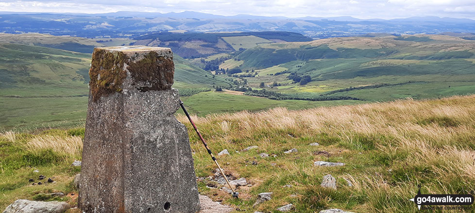
The trig point on the summit of Y Gamriw looking south towards the Brecon Beacons
Send us your photographs and pictures on, of, or from Y Gamriw
If you would like to add your walk photographs and pictures featuring views from, on or of Y Gamriw to this page, please send them as email attachments (configured for any computer) along with your name to:
and we shall do our best to publish them.
(Guide Resolution = 300dpi. At least = 660pixels (wide) x 440 pixels (high).)

You can also submit photos via our Facebook Page.
NB. Please indicate where each photo was taken and whether you wish us to credit your photos with a Username or your First Name/Last Name.
Not familiar with this top?


