
![]()
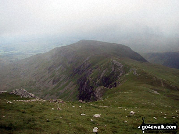
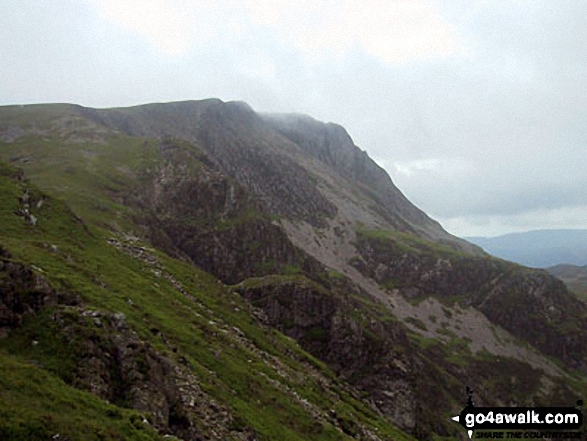
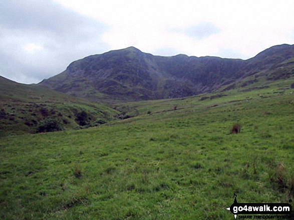
Gau Graig
683m (2242ft)
The Cadair Idris Area, Snowdonia, Gwynedd, Wales
Tap/mouse over a coloured circle (1-3 easy walks, 4-6 moderate walks, 7-9 hard walks) and click to select.
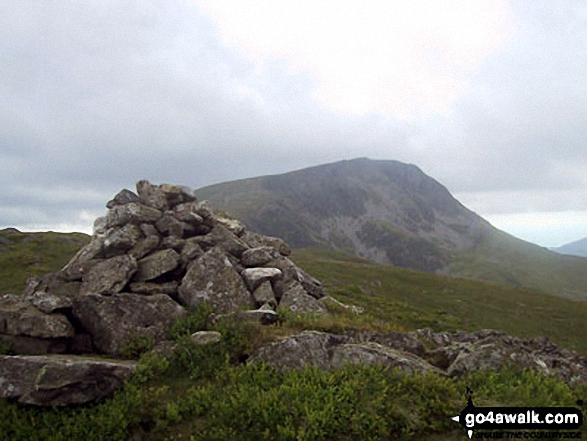
Gau Graig was deleted from Mountain (Hewitt) status in May, 2015 after a survey found the 'prominence' to be only 25.4m
Not familiar with this top?
   |
|---|
Vital Statistics:
| Length: | 11.25ml (18.5km) |
|---|---|
| Ascent: | 3,558ft (1,084m) |
| Time: | 7.75hrs |
| Grade: |  (Hard) (Hard) |
Route Summary:
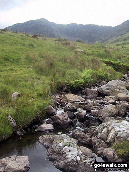
Llyn Gwernan - The Pony Path - Rhiw Gwerdydd - Cyfrwy - Cadair Idris (Penygadair) - Mynydd Moel - Gau Graig - Bwlch-coch - Pandy Gader - Afon Arran - Rhydwen - Llyn Gwernan
|
|---|
Vital Statistics:
| Length: | 10.5ml (17km) |
|---|---|
| Ascent: | 4,060ft (1,237m) |
| Time: | 8 hrs |
| Grade: |  (Hard) (Hard) |
Route Summary:
Minffordd Hotel - Afon Faw - Ystrad-gwyn - Nant Cadair - The Minffordd Path - Llyn Cau - Craig Lwyd - Craig Cwm Amarch - Craig Cau - Cadair Idris (Penygadair) - Cyfrwy - Cadair Idris (Penygadair) - Mynydd Moel - Gau Graig - Mynydd Gwerngraig - A487 - Nant Yr Allt-ioen - Cwm Rhwyddfor - Bwlch Llyn Bach - Minffordd.
See Gau Graig and the surrounding tops on our free-to-access 'Google Style' Peak Bagging Maps:
The Cadair Idris area of Snowdonia National Park
Less data - quicker to download
The Whole of Snowdonia National Park
More data - might take a little longer to download
See Gau Graig and the surrounding tops on our downloadable Peak Bagging Map in PDF format:

NB: Whether you print off a copy or download it to your phone, this PDF Peak Baggers' Map might prove incredibly useful when your are up there on the tops and you cannot get a phone signal.
You can find Gau Graig & all the walks that climb it on these unique free-to-access Interactive Walk Planning Maps:
1:25,000 scale OS Explorer Map (orange/yellow covers):
1:50,000 scale OS Landranger Map (pink/magenta covers):
 Fellow go4awalkers who have already walked, climbed, summited & bagged Gau Graig
Melfyn Parry walked up Gau Graig on October 13th, 2022 [from/via/route] Started walk from car park at SH732115 & followed well signposted path over the river & past the visitor centre before ascending through woodland up steep stone steps. Path continues steeply upwards & then forks to the right at SH721123 to Llyn Can which is well worth a visit. Retrace steps & then fork right to rejoin Minffordd path at SH720123. Path continues steeply upwards to gain the summit of Craig Cwm Amarch. From here path is well defined to head towards Cadair Idris. Turned left at SH708127 to join Pony Path which descends gradually & follows edge of cliffs to then rise slowly to summit of Cyfrwy. From here retrace steps to then continue on Pony Path to summit of Cadair Idris. From here the route to Mynydd Moel is visible & an easy walk. From here there is a steep descent before following a fence line to where it joins another fence coming from the right, cross over stile & follow path to corner of fence & pop over tp reach cairns at summit of Gau Graig. From here head in a southerly direction to reach fence at SH744138, path here is very steep in places before levelling out & path turns right at corner of fence at SH751140 & then descends almost back to A487 before turning sharp right & continues down to finish the walk at the lay by at SH753135. Approx total distance is 12.6Km & took nearly 6 hours. [with] On my own [weather] A sunny, dry day & pleasantly warm at times, got a bit chilly on the summit of Cadair Idris & warmed up again on descent. Hardly any breeze. - An really enjoyable walk with stunning views. Straight forward route, challenging ascents as path in parts are quite steep.
Paul Wilcox climbed Gau Graig on July 31st, 2020 [from/via/route] GW103 from the summit of Cadair Idris, Mynnydd Moel [with] Howard K [weather] Beautiful sunny day - great visibility - Navigation really tough when you leave Gau Graig - not clear at all. Faint path at time & difficult terrain. Bit of a guess after the final ladder stile.
Mark Davidson bagged Gau Graig on June 12th, 2004 [with] Martin [weather] Dry but low cloud - did get some good views though
Christina Lander hiked Gau Graig on June 3rd, 2015 [from/via/route] Minffordd - Craig Cwm Amarch - Cadair Idris - Mynydd Moel - Gau Graig - Cwm Rhwyddfor - Minffordd [with] Dick [weather] Perfect sunny day - Another great day on Cadair Idris, one of my favourite mountains
Richard Penney summited Gau Graig on February 25th, 2013 [from/via/route] Cadair Idris circuit [with] Solo [weather] Ice, mist etc
Linda Mckeogh, Paul Booth, Trevor Williams, Stephen Millington, David Price and Stephen Hobdell have all walked, climbed & bagged Gau Graig.
To add (or remove) your name and experiences on this page - Log On and edit your Personal Mountain Bagging Record
More Photographs & Pictures of views from, on or of Gau Graig
Send us your photographs and pictures on, of, or from Gau Graig
If you would like to add your walk photographs and pictures featuring views from, on or of Gau Graig to this page, please send them as email attachments (configured for any computer) along with your name to:
and we shall do our best to publish them.
(Guide Resolution = 300dpi. At least = 660pixels (wide) x 440 pixels (high).)

You can also submit photos via our Facebook Page.
NB. Please indicate where each photo was taken and whether you wish us to credit your photos with a Username or your First Name/Last Name.
Not familiar with this top?


